
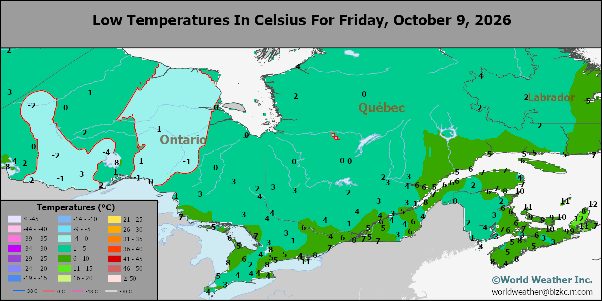
SE Canada Min
This content is for members only
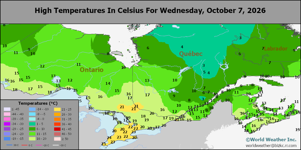
SE Canada Max
This content is for members only
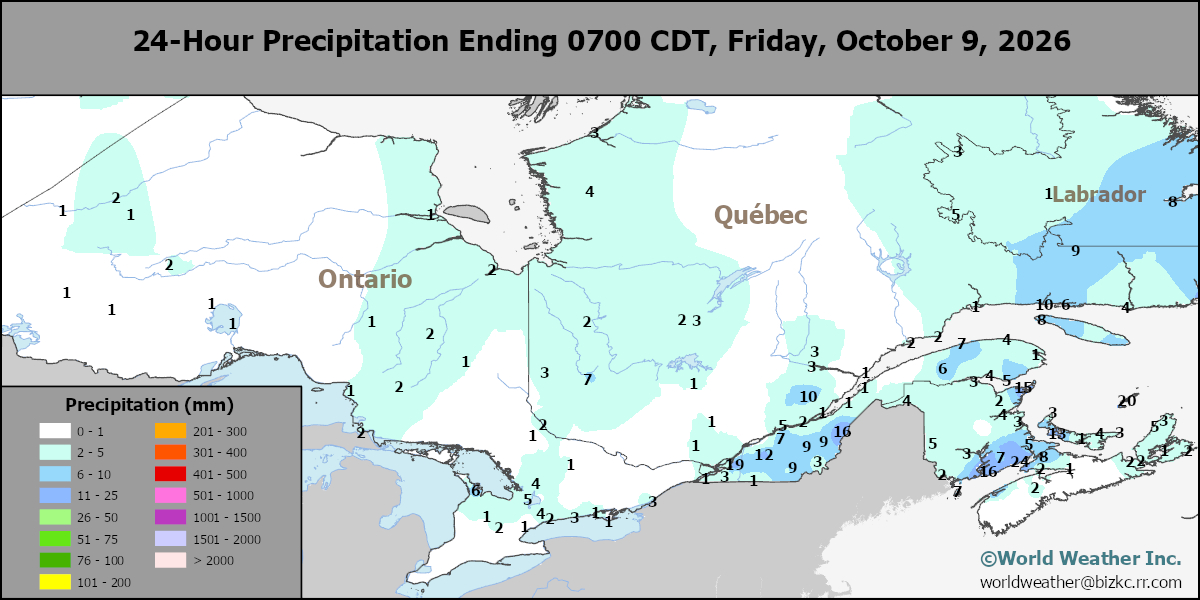
SE Canada Rainfall
This content is for members only
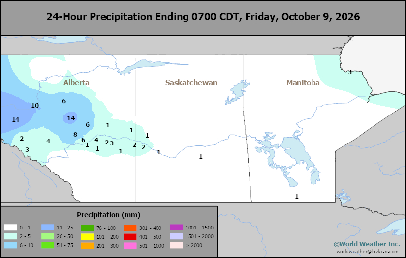
Prairies Rainfall
This content is for members only
Prairies Max Temperature
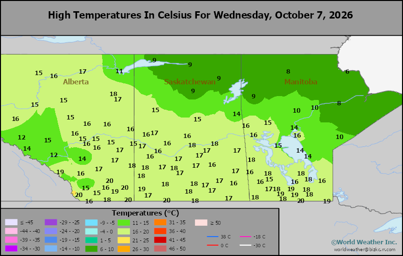
This content is for members only
Prairies Min Temperature
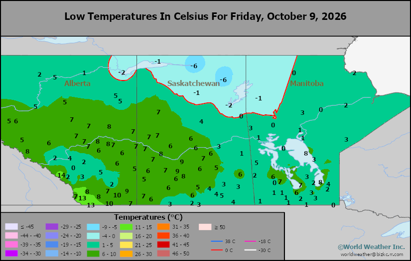
This content is for members only
Canada Rainfall
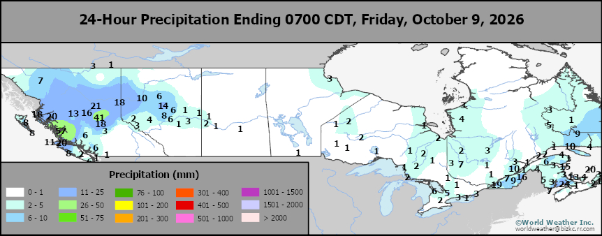
This content is for members only
Venezuela Rainfall
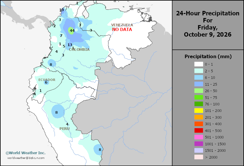
This content is for members only
Mexico Min Temperature
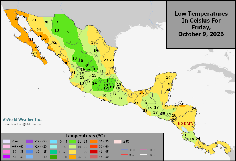
This content is for members only
Mexico Max Temperature
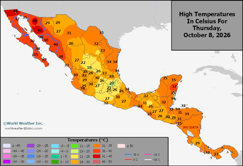
This content is for members only
Mexico Rainfall
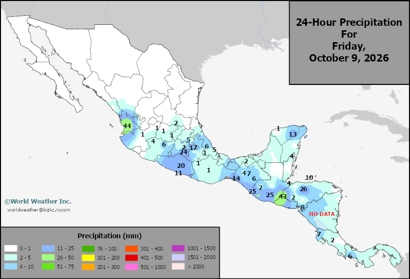
This content is for members only
Argentina Min Temperature
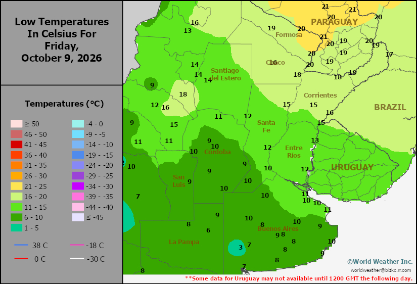
This content is for members only
Argentina Max Temperature
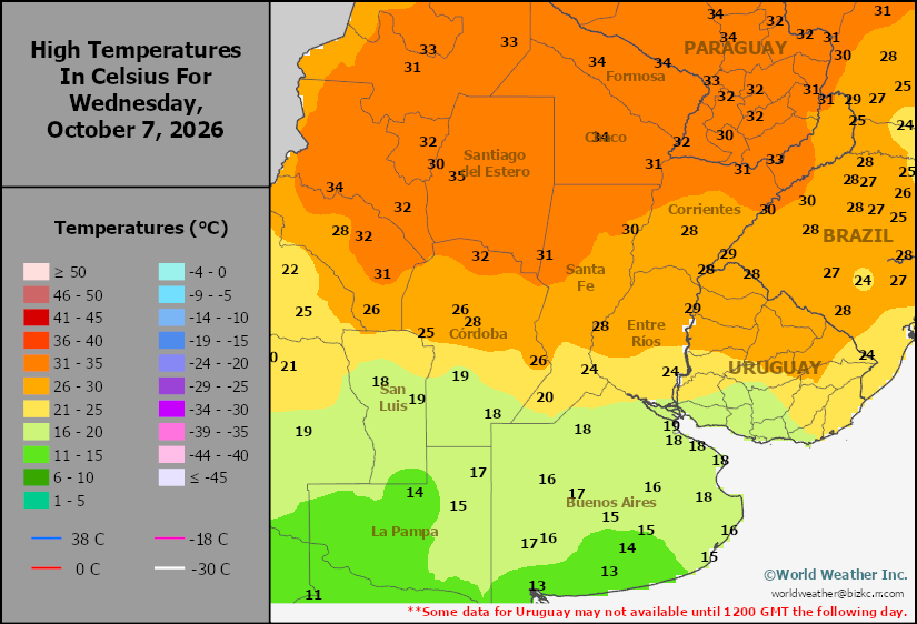
This content is for members only
Argentina Rainfall
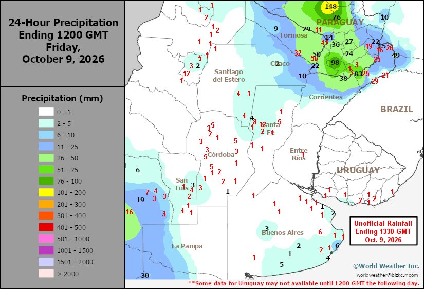
This content is for members only
Brazil Min Temperature
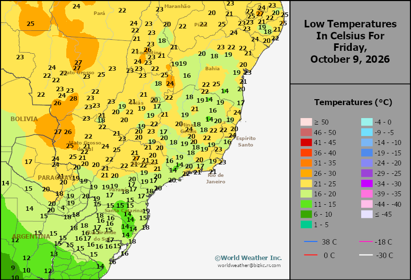
This content is for members only
Brazil Max Temperature
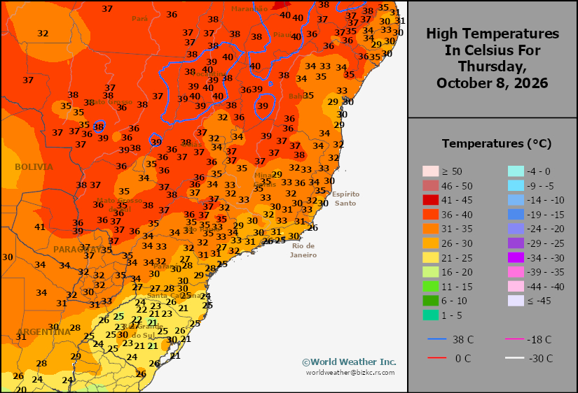
This content is for members only
Brazil Rainfall
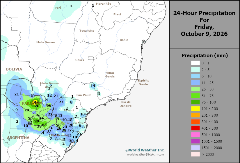
This content is for members only
Philippines Min
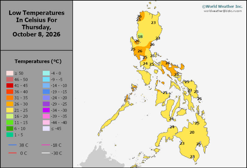
This content is for members only
Philippines Max
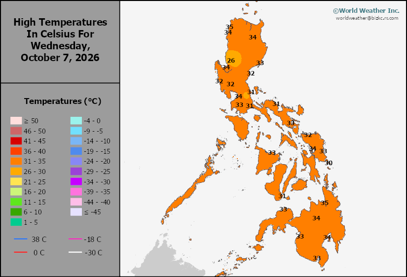
This content is for members only
Philippines Rain
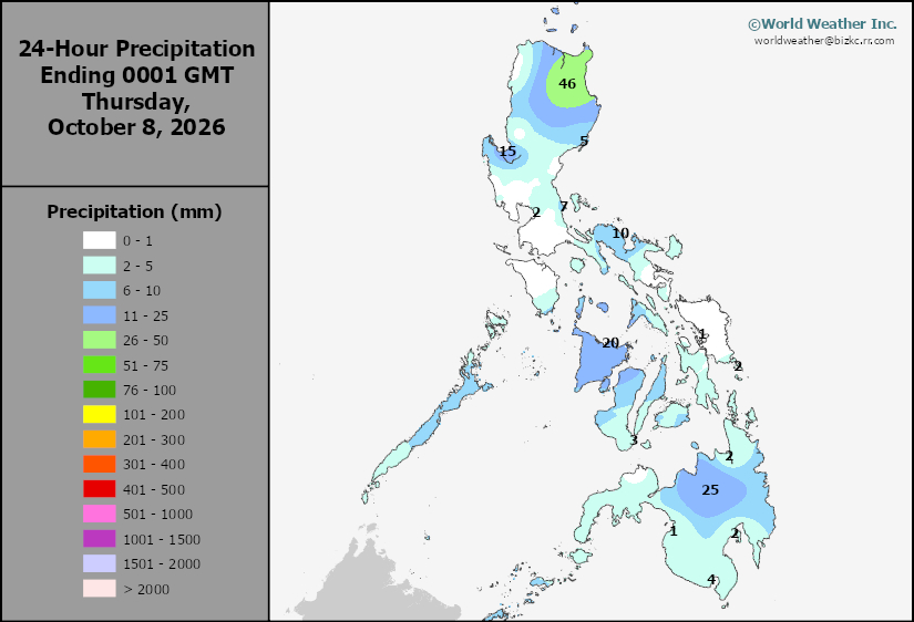
This content is for members only
Southeast North Rain
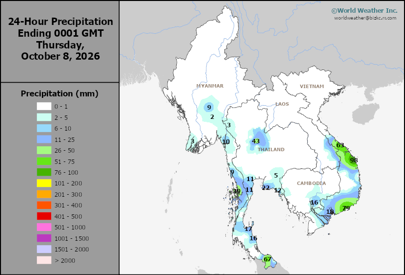
This content is for members only
Southeast North Min
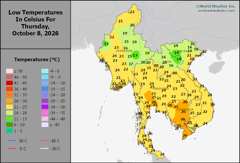
This content is for members only
Southeast North Max
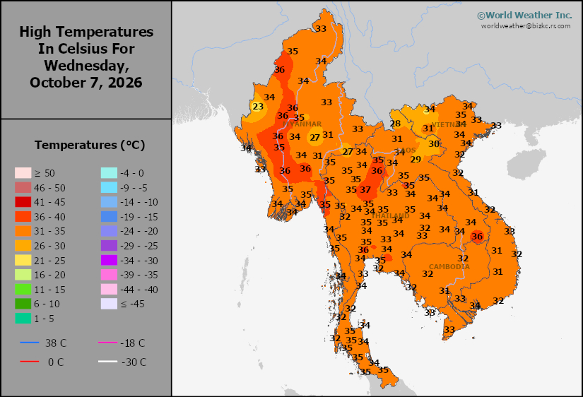
This content is for members only
Southeast Min
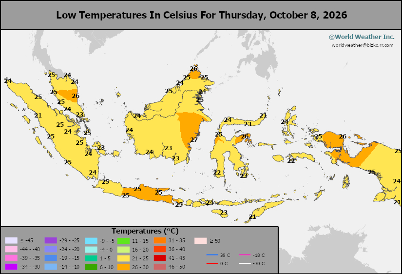
This content is for members only
Southeast Max
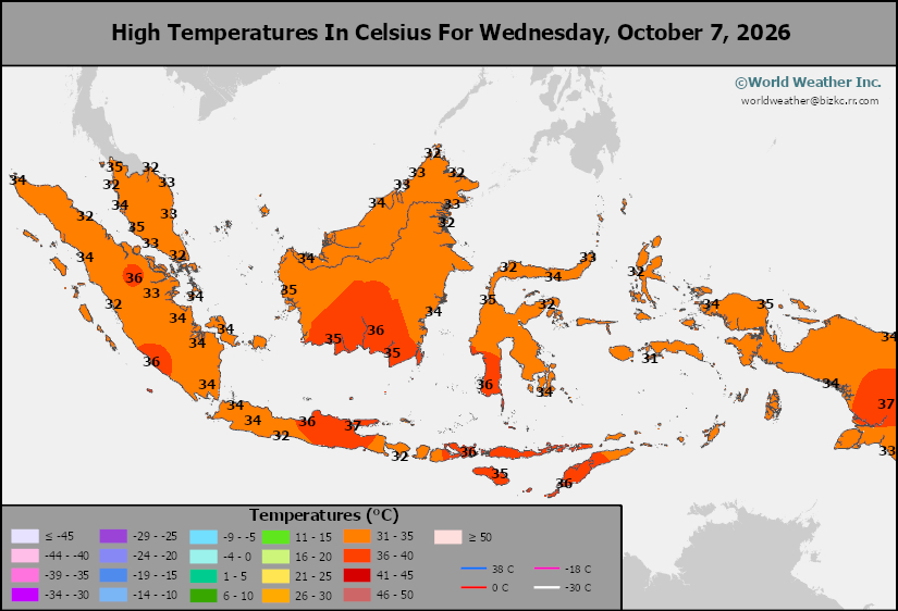
This content is for members only
Southeast Rain
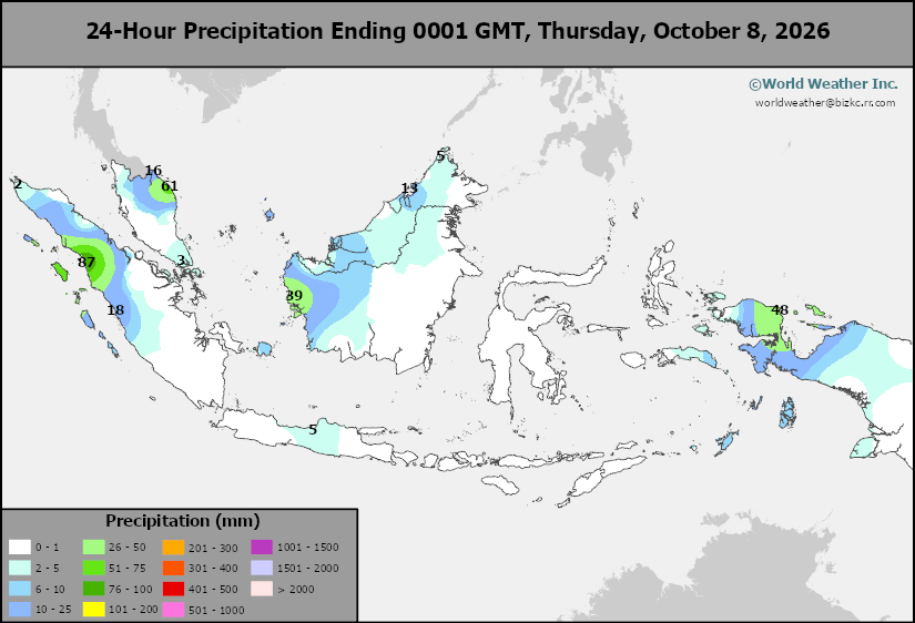
This content is for members only
West Africa Rain
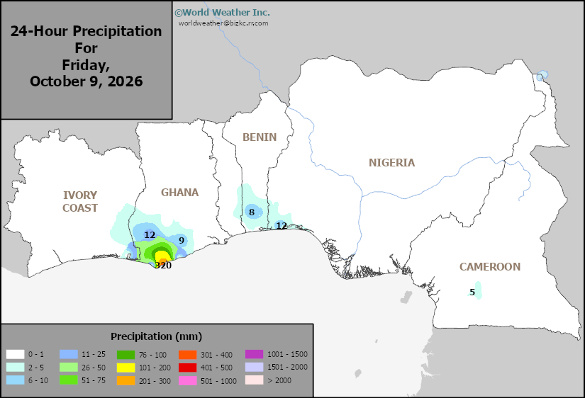
This content is for members only
Max Temperature
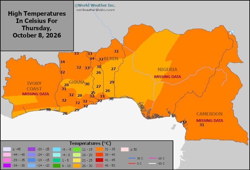
This content is for members only
Min Temperature
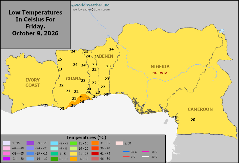
This content is for members only
North Africa Rain
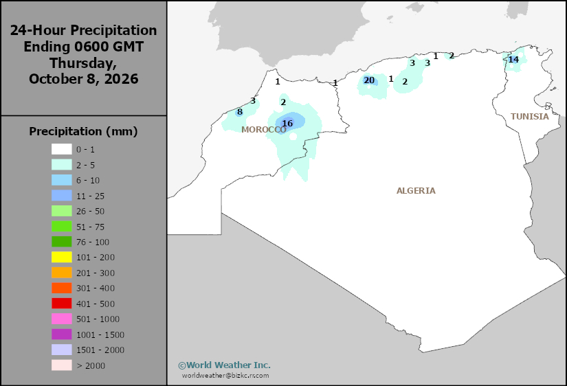
This content is for members only
Max Temperature
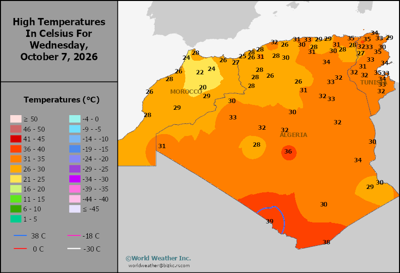
This content is for members only
Min Temperature
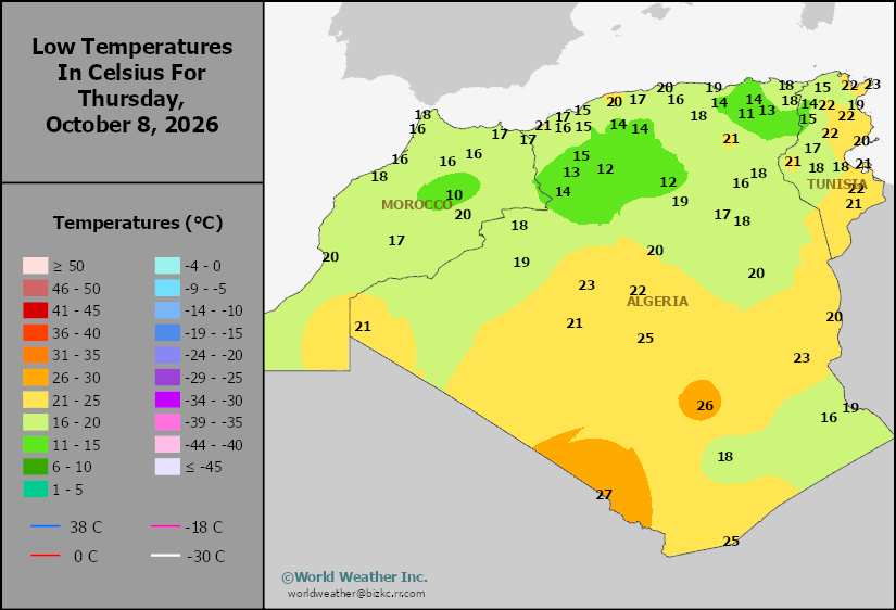
This content is for members only
Min Temperature
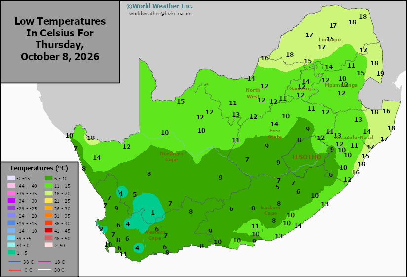
This content is for members only
Max Temperature
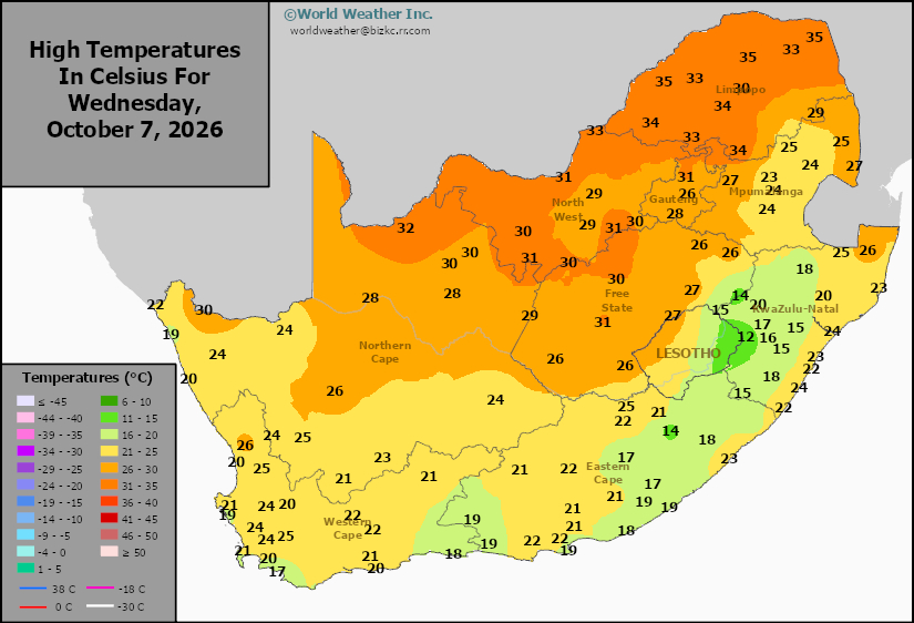
This content is for members only
South Africa Rain
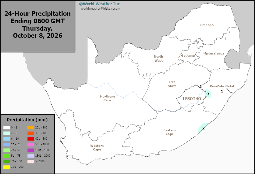
This content is for members only
Hard Red Wheat Tmin
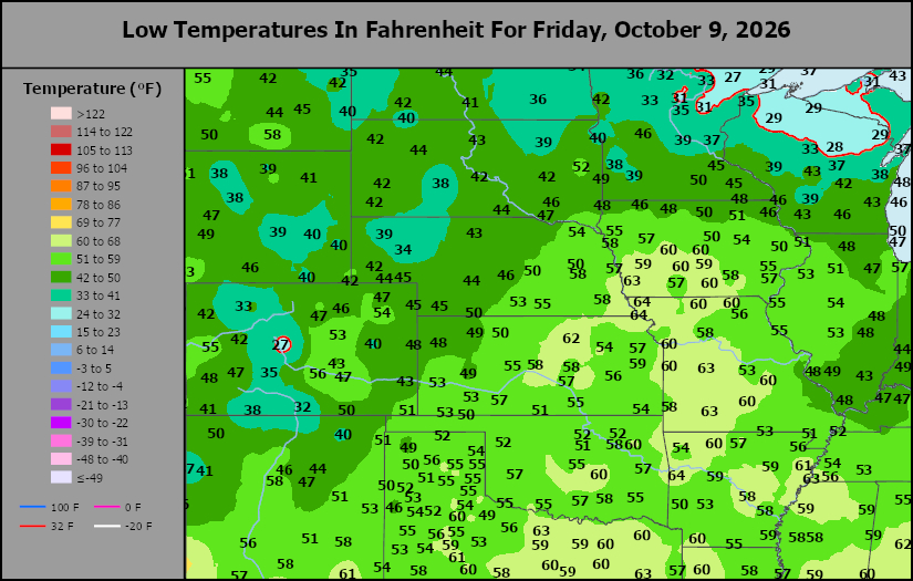
This content is for members only
Northeast Tmin
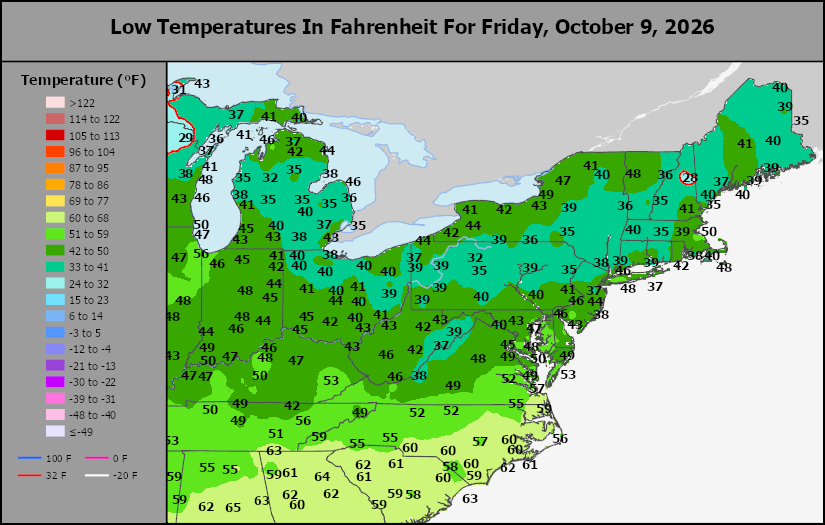
This content is for members only
Southwest Tmin
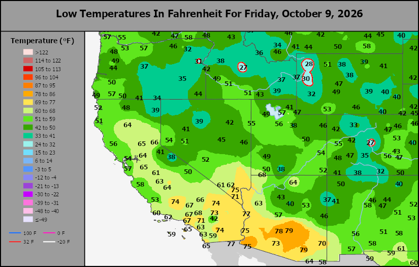
This content is for members only
Northwest Tmin
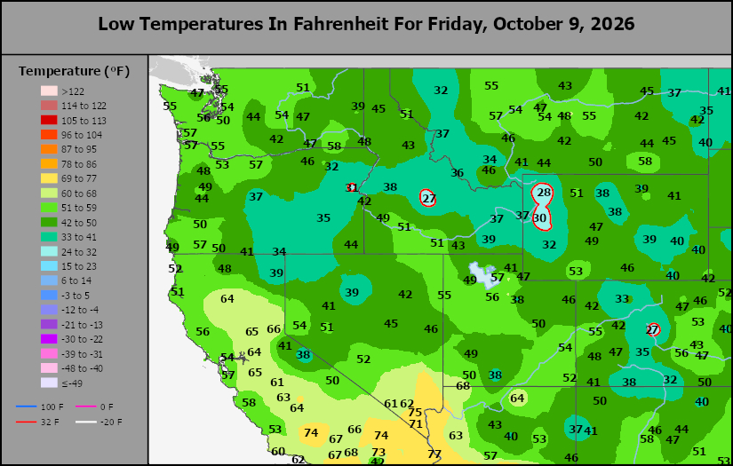
This content is for members only
South Plains Tmin
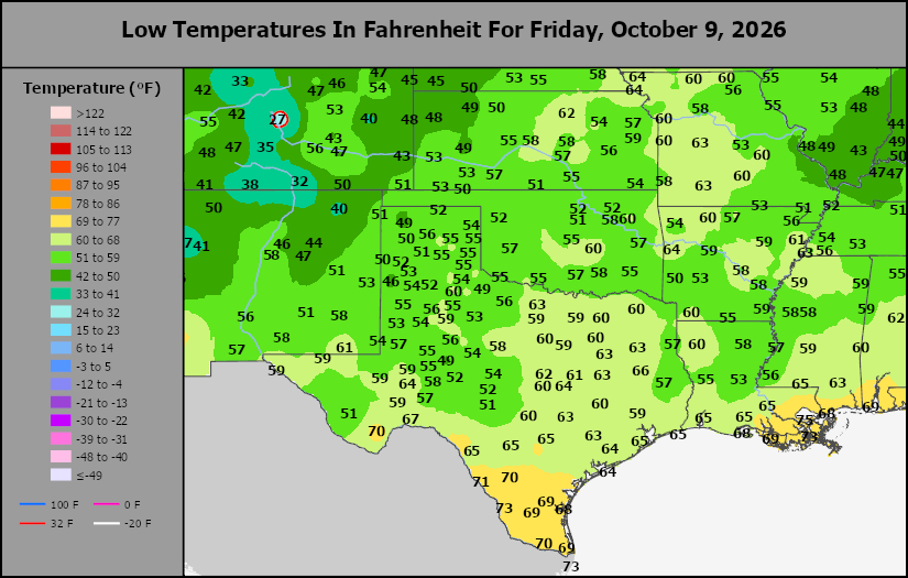
This content is for members only
Delta/SE U.S. Tmin
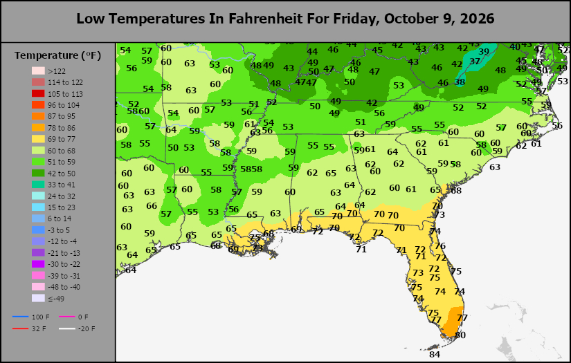
This content is for members only
Corn Belt Tmin
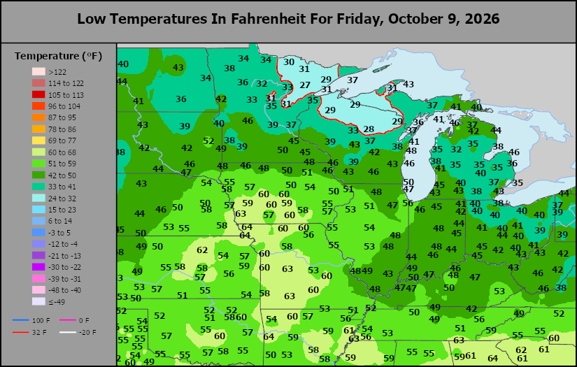
This content is for members only
US Min
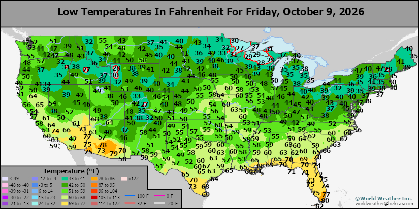
This content is for members only
North Plains Tmin
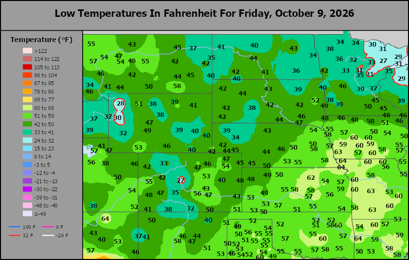
This content is for members only
Hard Red Wheat Tmax
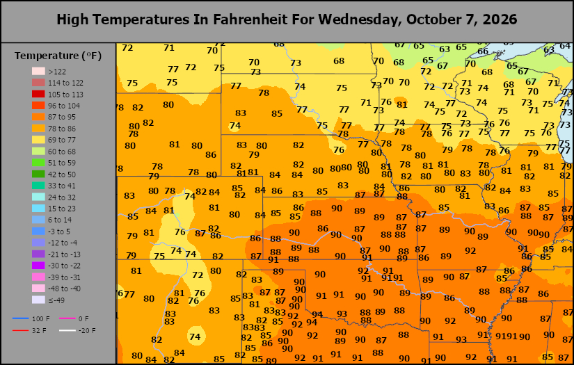
This content is for members only
Northeast Tmax
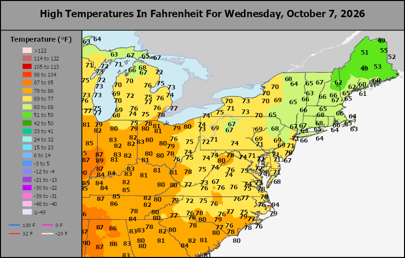
This content is for members only
Southwest Tmax
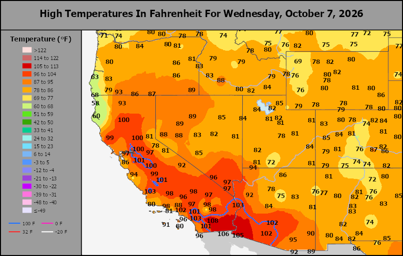
This content is for members only
Northwest Tmax
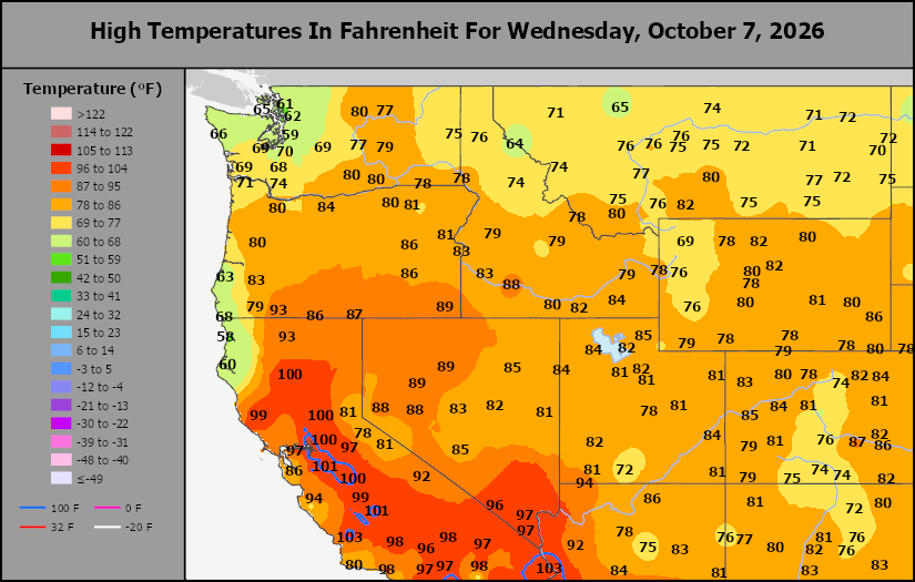
This content is for members only
South Plains Tmax
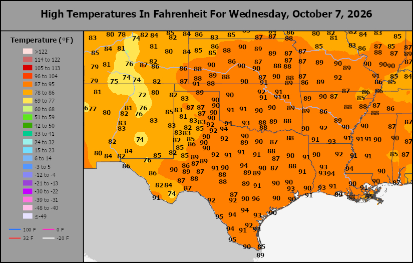
This content is for members only
Delta/SE U.S. Tmax
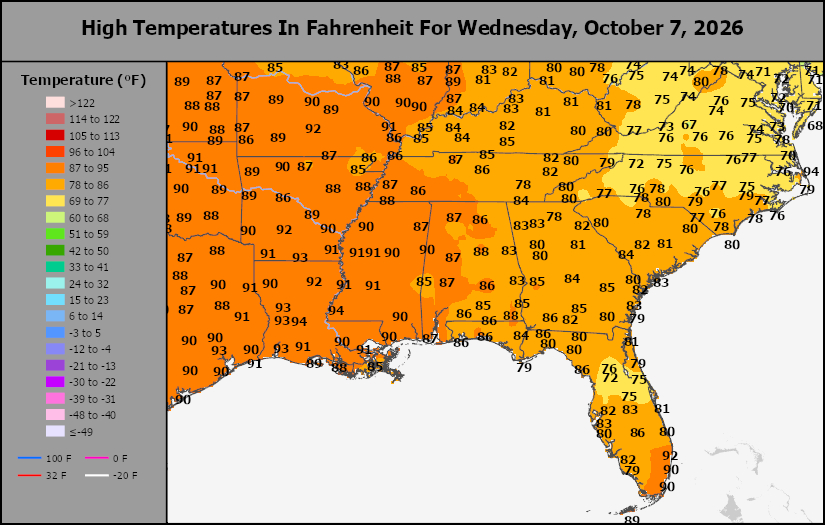
This content is for members only
Corn Belt Tmax
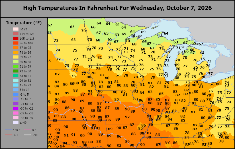
This content is for members only
North Plains Tmax
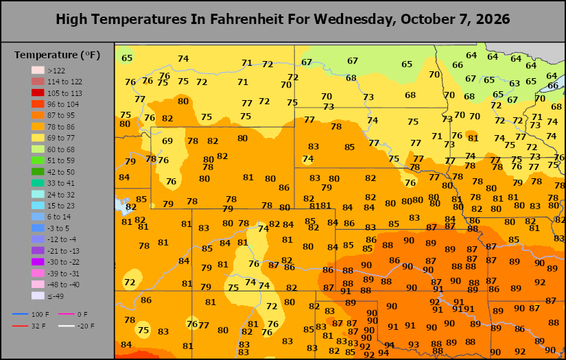
This content is for members only
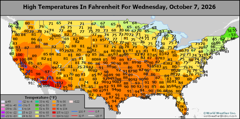
US Max
This content is for members only
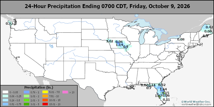
US Rain
This content is for members only
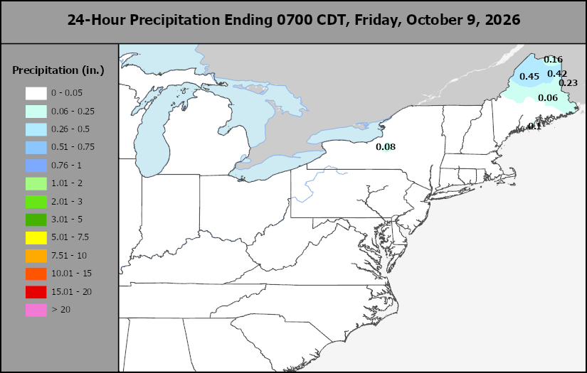
Northeast Daily Rain
This content is for members only
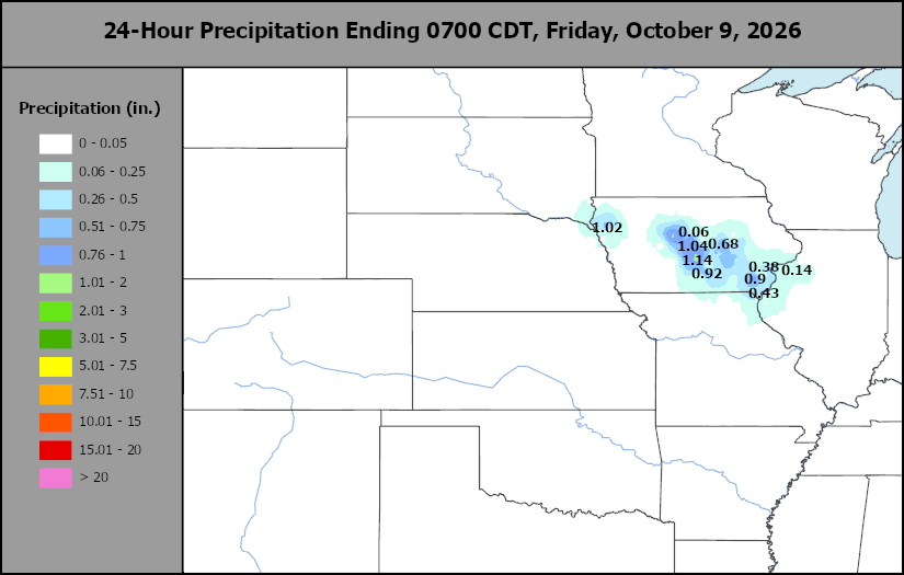
Hard Red Wheat Daily Rain
This content is for members only
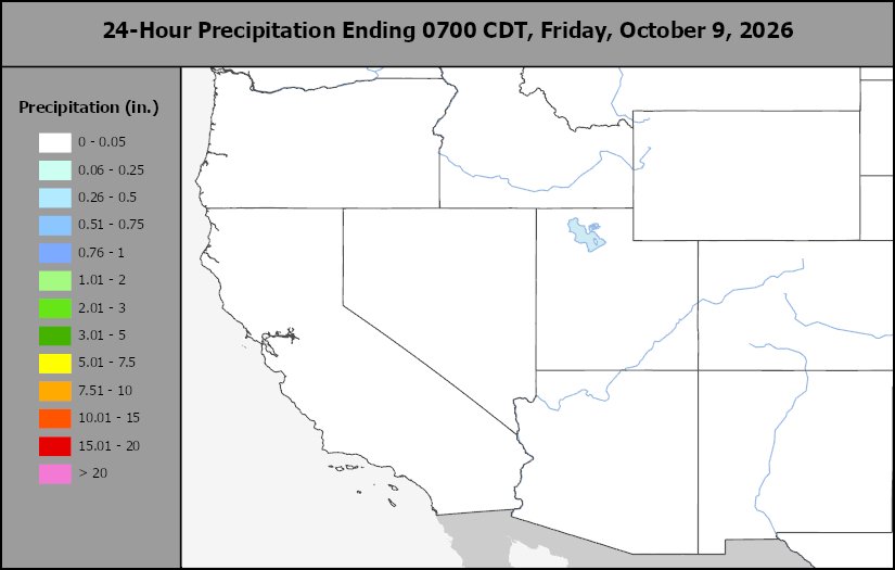
Southwest Daily Rain
This content is for members only
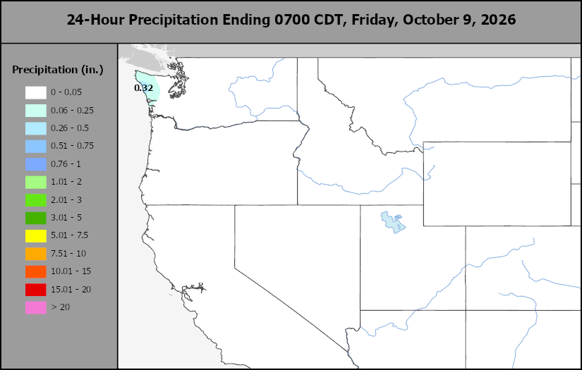
Northwest Daily Rain
This content is for members only
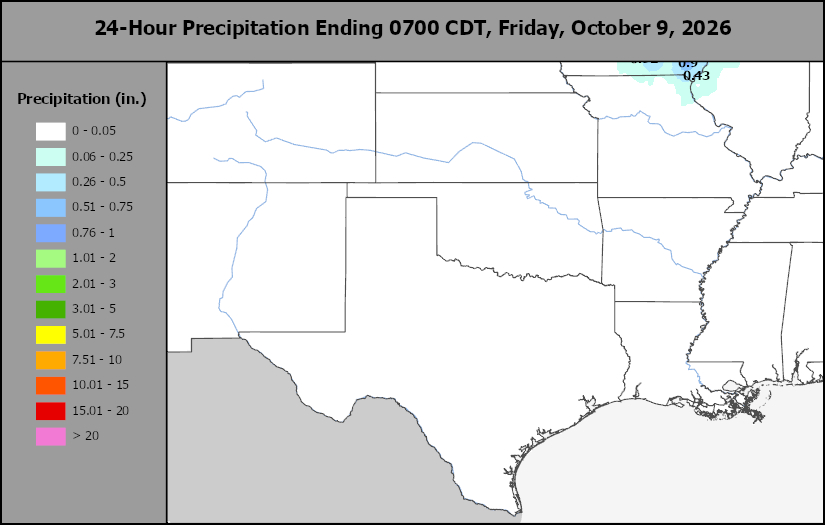
South Plains Daily Rain
This content is for members only
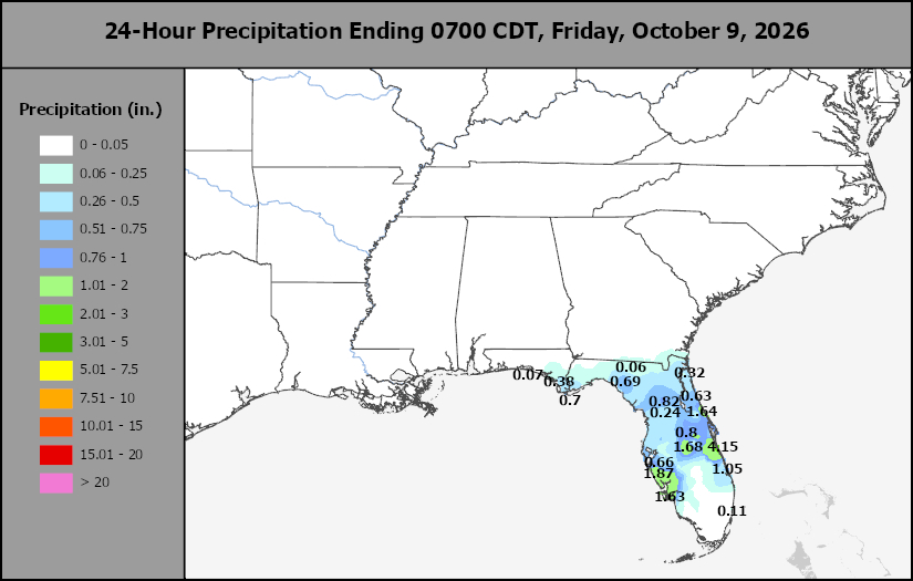
Delta/SE U.S. Daily Rain
This content is for members only
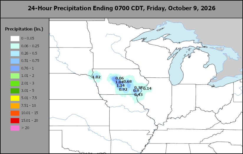
Corn Belt Daily Rain
This content is for members only
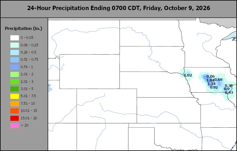
North Plains Daily Rain
This content is for members only
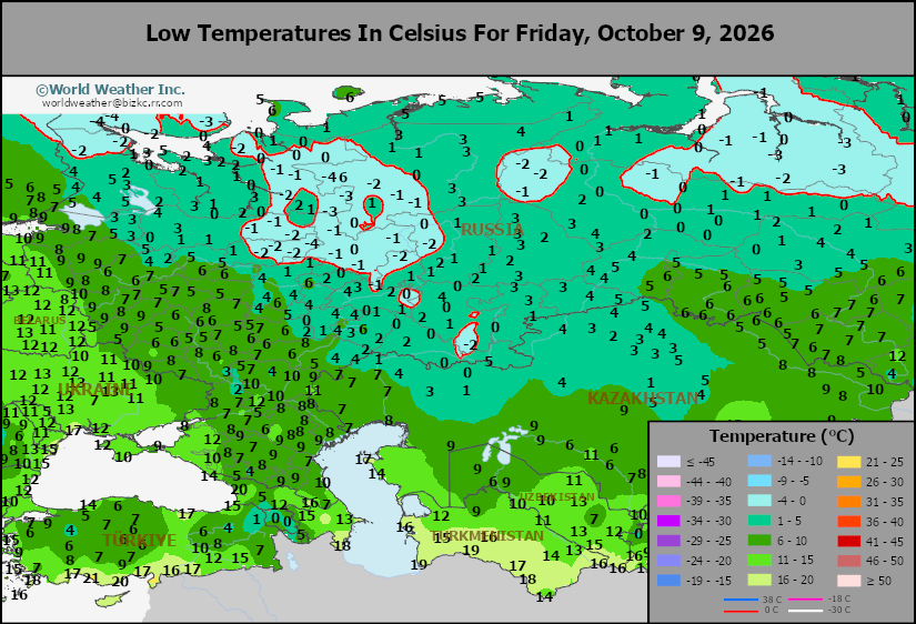
Low Temperature
This content is for members only
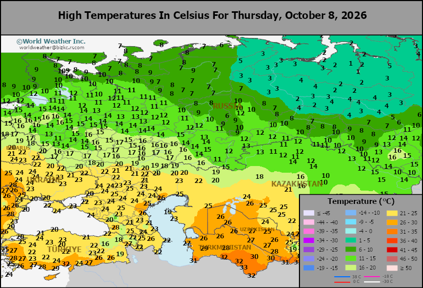
High Temperature
This content is for members only
CIS Rainfall
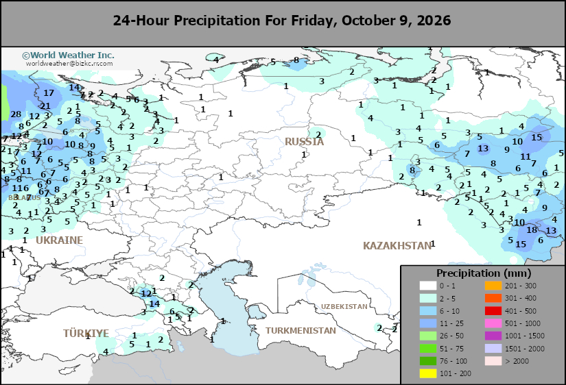
This content is for members only
Low Temperature
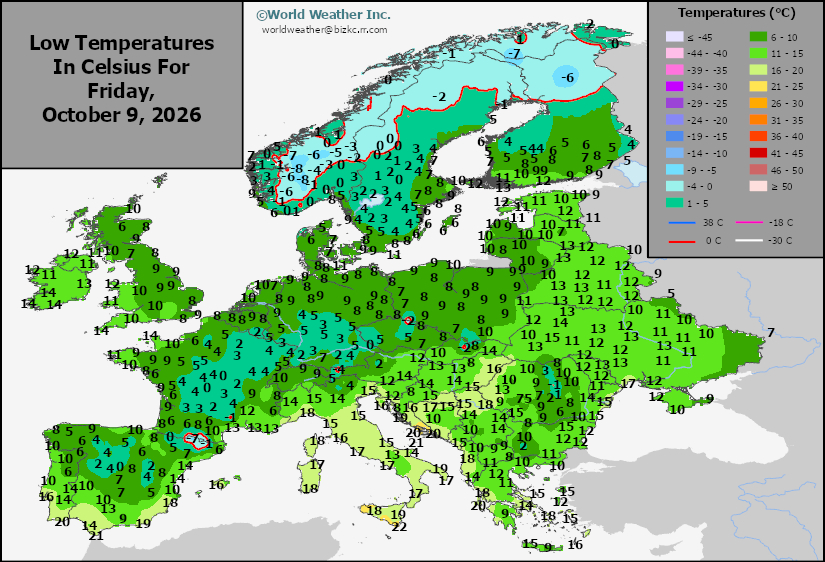
This content is for members only
High Temperature
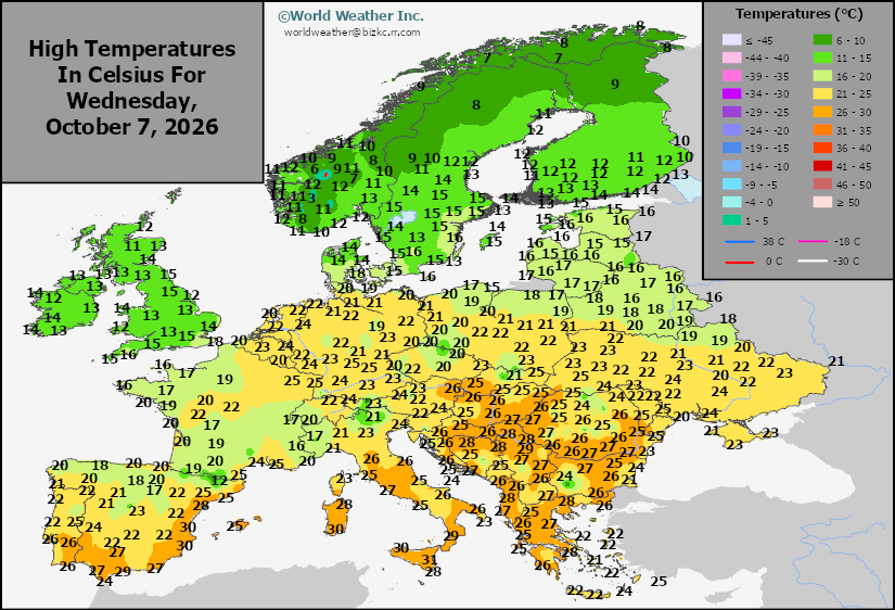
This content is for members only
Europe Rainfall
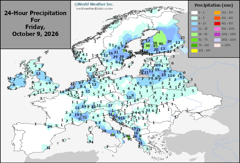
This content is for members only
Low Temperature
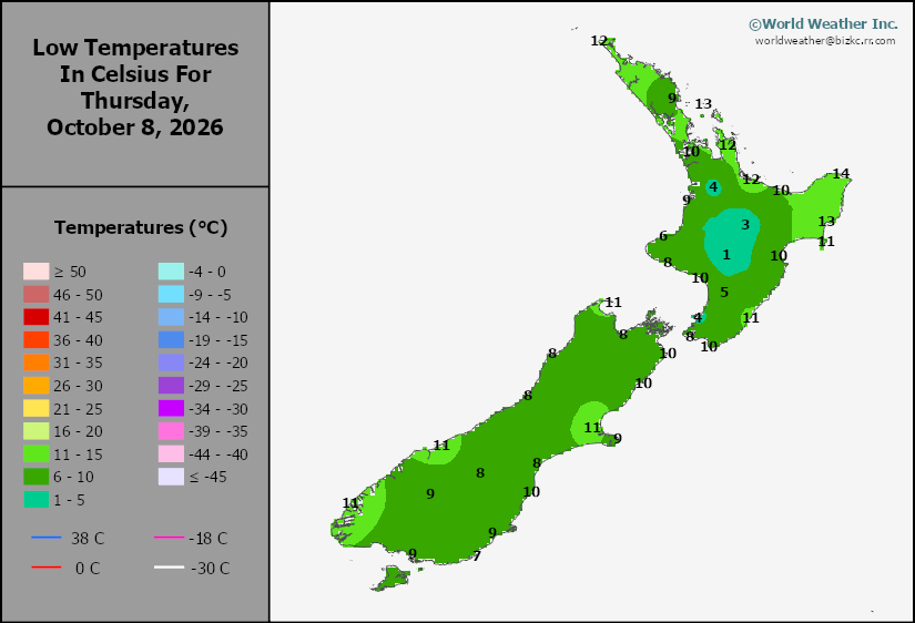
This content is for members only
High Temperature
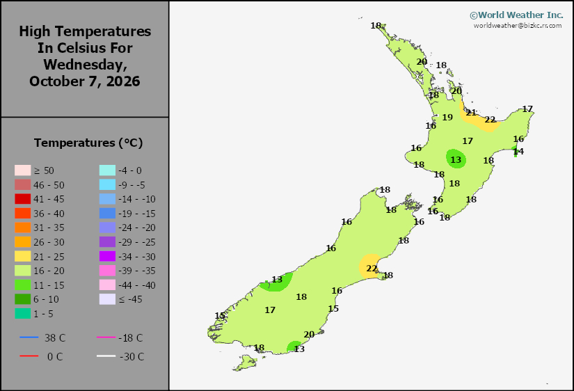
This content is for members only
New Zealand Rainfall
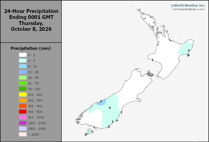
This content is for members only
Low Temperature
This content is for members only
High Temperature
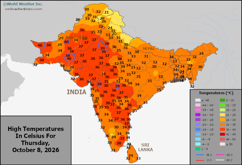
This content is for members only
India Rainfall
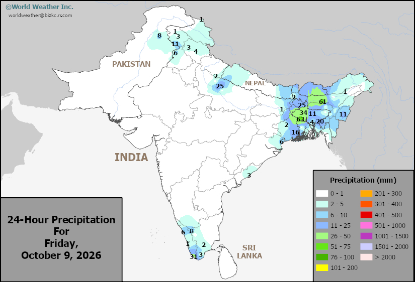
This content is for members only
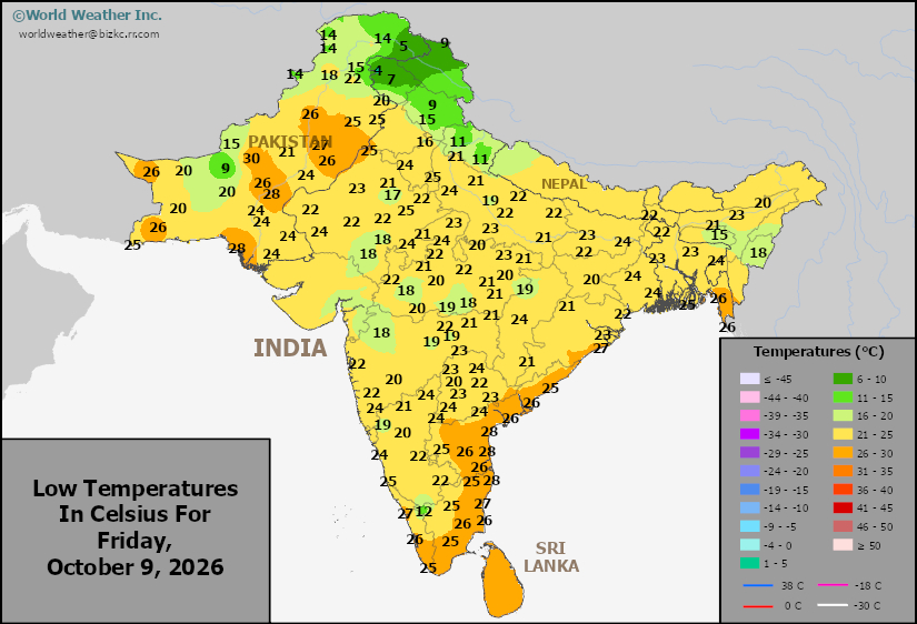
Low Temperature
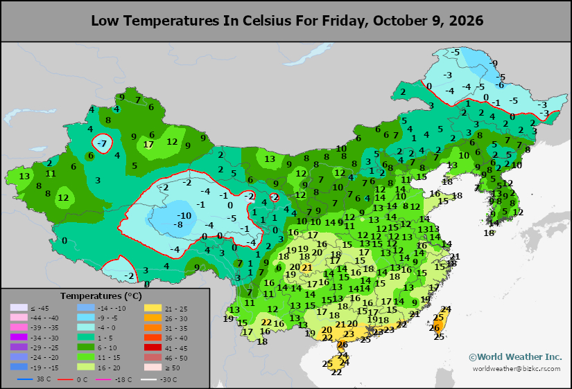
This content is for members only
Japan Rainfall
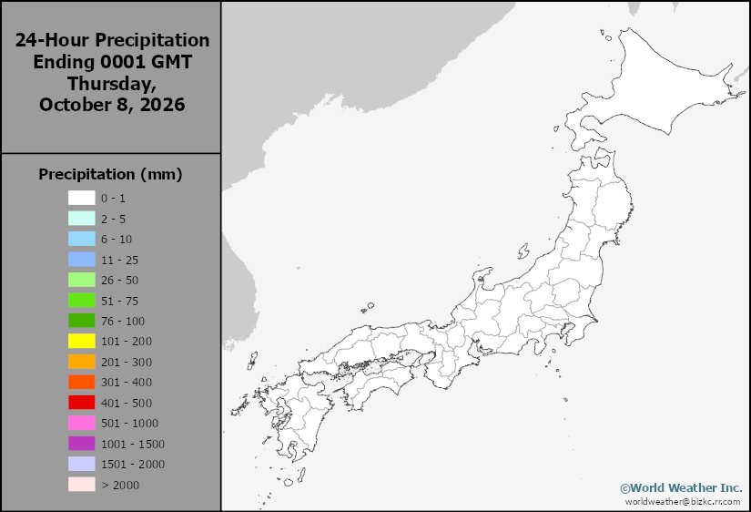
This content is for members only
Low Temperature
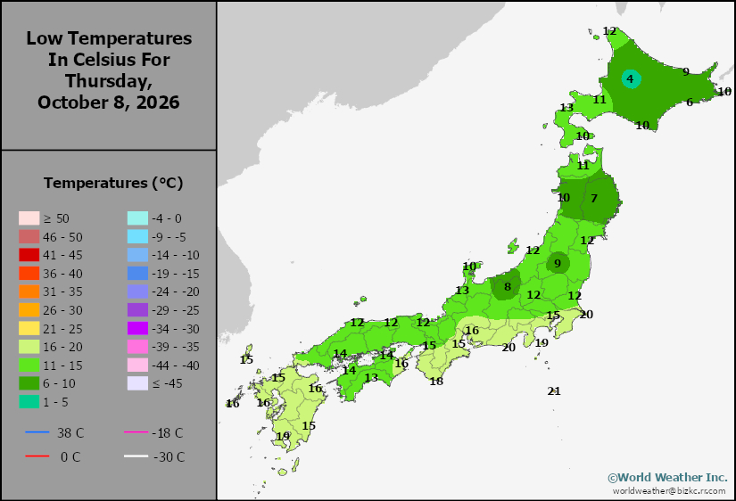
This content is for members only
High Temperature
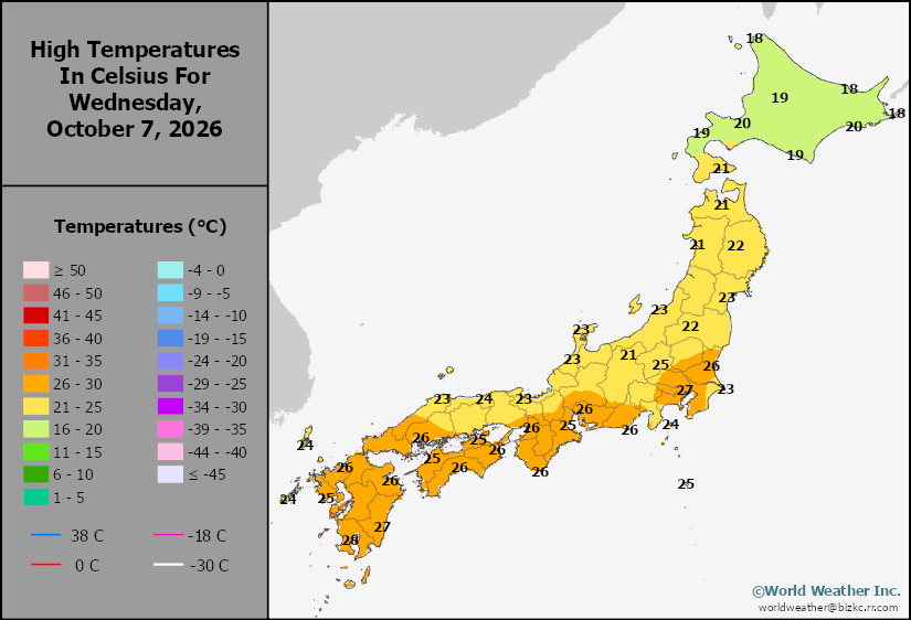
This content is for members only
High Temperature
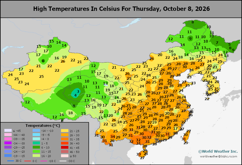
This content is for members only
China Rainfall
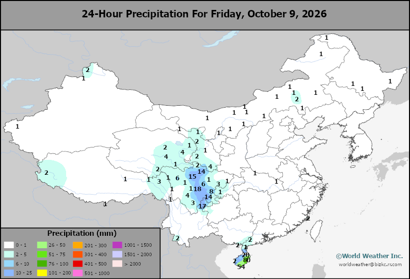
This content is for members only
Low Temperature
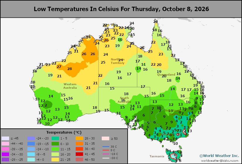
This content is for members only
High Temperature
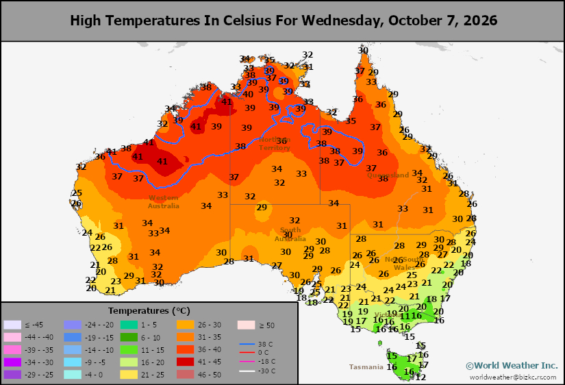
This content is for members only
Austrailia Rainfall
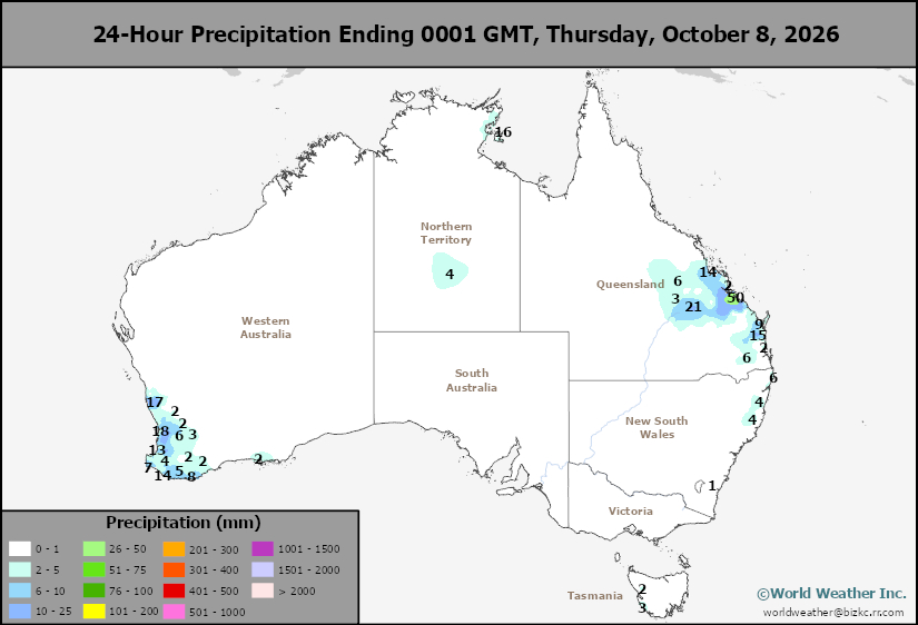
This content is for members only
Burkina Faso, Mali Cotton See Mixed Impact From Late Season Rain
Kansas City, October 8 (World Weather, Inc.) – Much greater than normal rain occurred during the past 10 days in key cotton areas across Burkina Faso and Mali where some cotton may have been discolored while concerns increased over boll rot as well. However, a significant portion of the crop was planted late this year due to the late start of the rainy season and that portion of the crop likely saw some benefit from the rain with improved conditions for cotton development and yields. Looking ahead, an improving trend for cotton maturation and harvesting will occur during the next two weeks after southwestern Mali into western Burkina Faso receives additional rain into this weekend.
Canada’s Prairies To See Harvest Impacts From Winter Weather
Kansas City, October 9 (World Weather Inc.) – After a few weeks of good or at least improving harvest conditions, weather is again expected to turn wetter and cooler for the Prairies through the end of next week. Disturbances will promote waves of precipitation with varying amounts of snow accumulating in portions of Alberta and Saskatchewan. Parts of northwestern Alberta could receive upwards of a foot of snow today into Saturday. While the harvest advanced swiftly in recent days due to drier and warmer weather, producers are still behind usual harvest pace. Additional delays are expected and portions of western Alberta may not be able to wrap up the harvest due to the snow – at least for a while. Drier and warmer weather will return later this month and may be enough to improve late-season harvest conditions for some. Minor production losses will be possible if producers are not able to finish the harvest in areas that see the greatest amount of snow during the next few days.
Central, Eastern N. America Cold Surge Likely Late Next Week
Kansas City, October 9 (World Weather Inc.) – Cooling in the higher latitudes of the Northern Hemisphere has become a little more notable in recent weeks, but most areas not experiencing any seriously cold anomalies, yet. Changes are expected briefly next week that should induce a southward shift in some colder than usual air through central and eastern parts of North America. The surge may not be unusual for this time of year, but with it being the first such event of the season it may come as a shock to most living things. Frost and freezes will impact a large part of central and eastern Canada with some of the same expected from the northeastern U.S. Plains through the northern Midwest to Ontario and Quebec, Canada and the U.S. Great Lakes region and northeastern states.
Venezuela/Colombia Min Temps
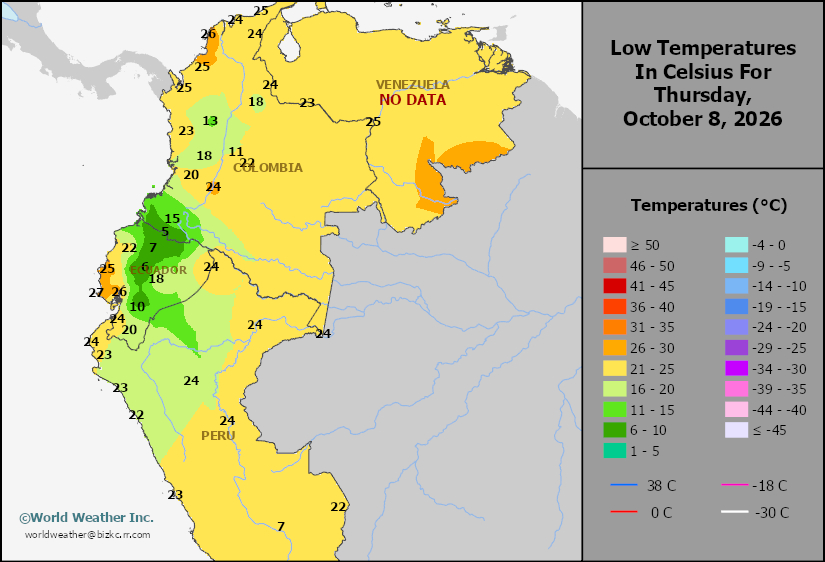
This content is for members only
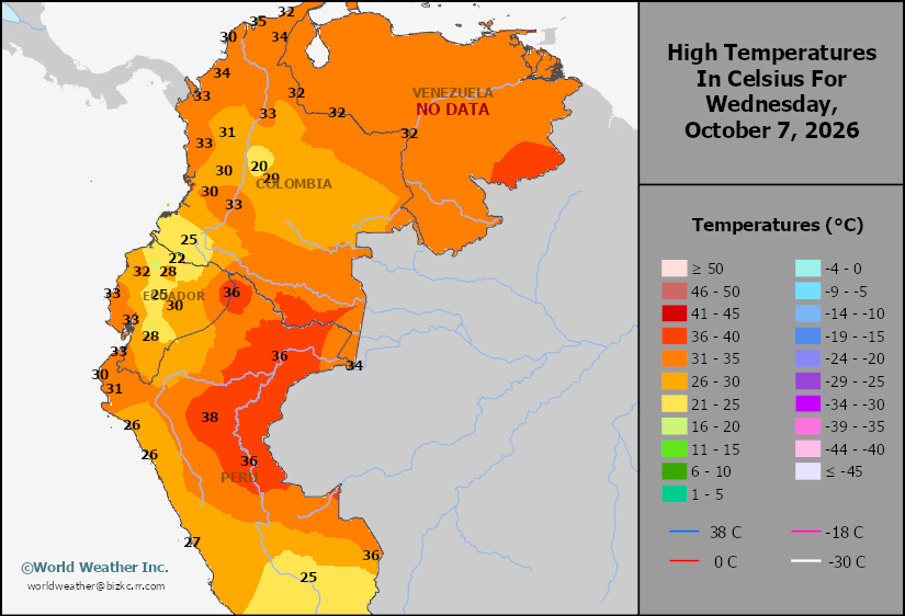
Venezuela/Colombia Max Temps
This content is for members only
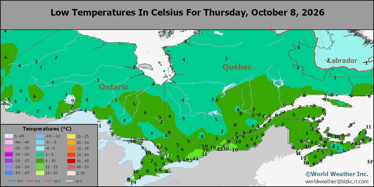
SE Canada Min
This content is for members only
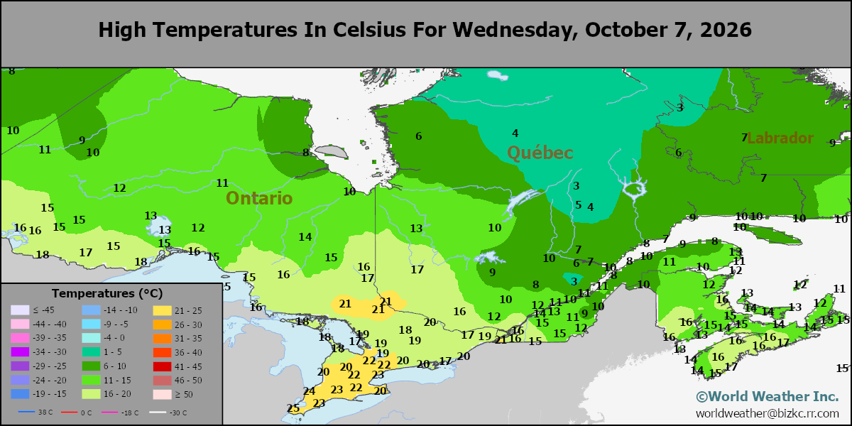
SE Canada Max
This content is for members only
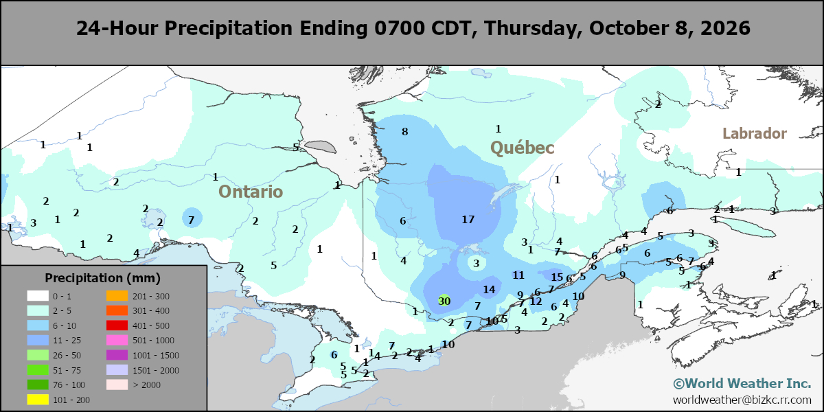
SE Canada Rainfall
This content is for members only
Prairies Rainfall
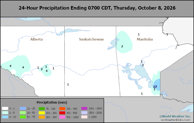
This content is for members only
Prairies Max Temperature
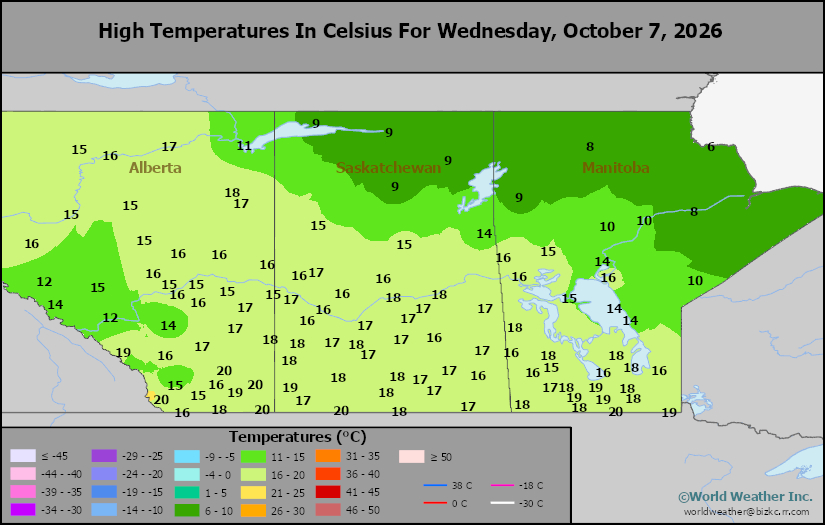
This content is for members only
Prairies Min Temperature
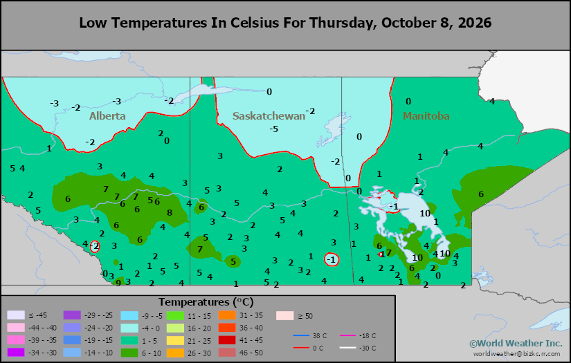
This content is for members only
Canada Rainfall
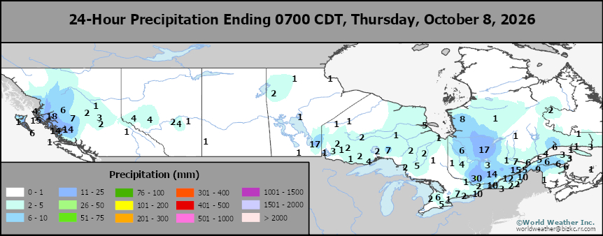
This content is for members only
Venezuela Rainfall
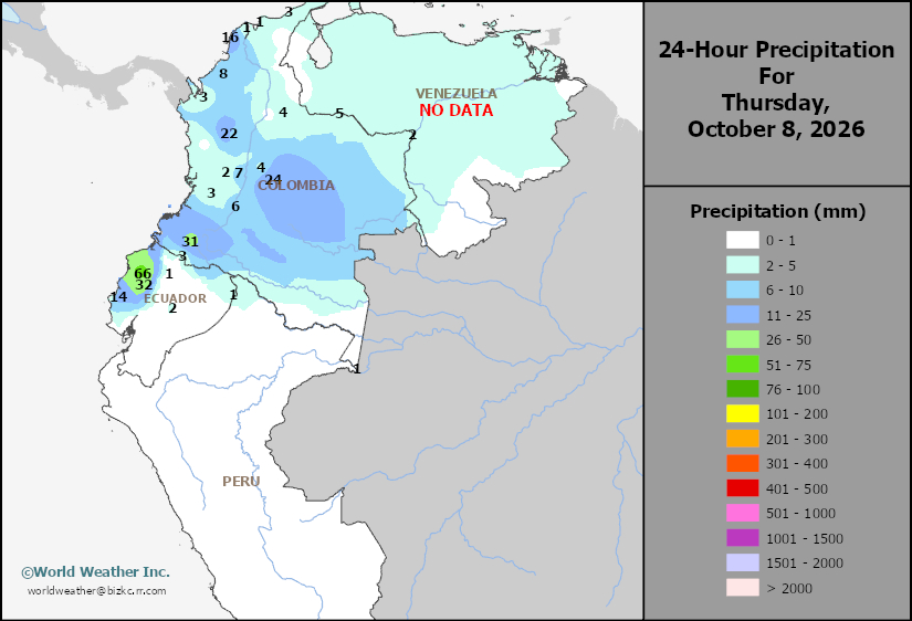
This content is for members only
Mexico Min Temperature
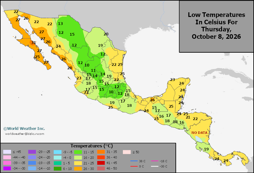
This content is for members only
Mexico Max Temperature
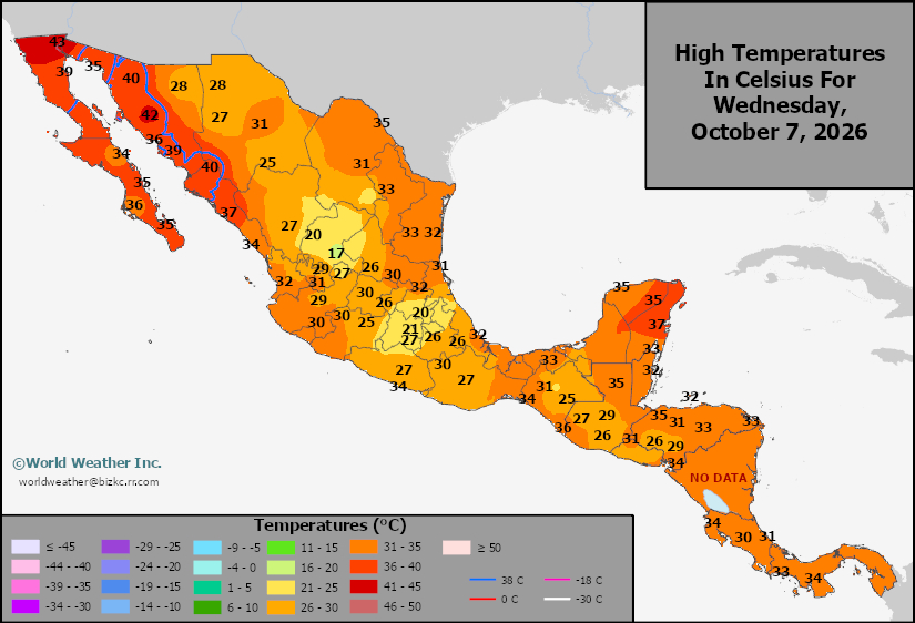
This content is for members only
Mexico Rainfall
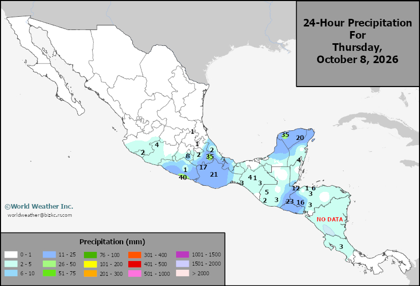
This content is for members only
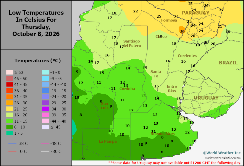
Argentina Min Temperature
This content is for members only