
Subsoil Moisture
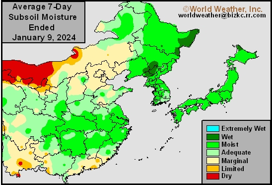
This content is for members only
Topsoil Moisture
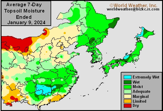
This content is for members only
Subsoil Moisture
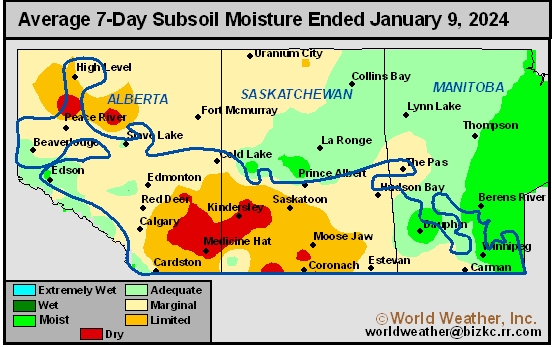
This content is for members only
Topsoil Moisture
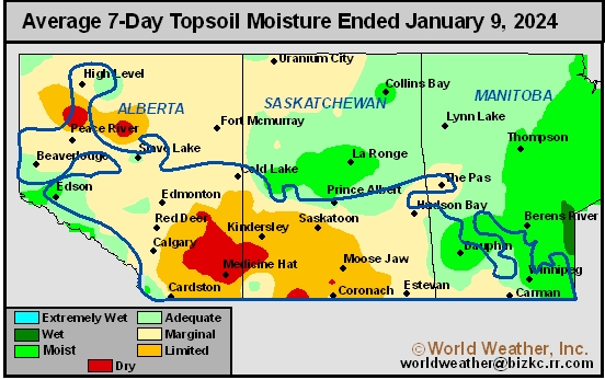
This content is for members only
Subsoil Moisture

This content is for members only
Topsoil Moisture

This content is for members only
Subsoil Moisture
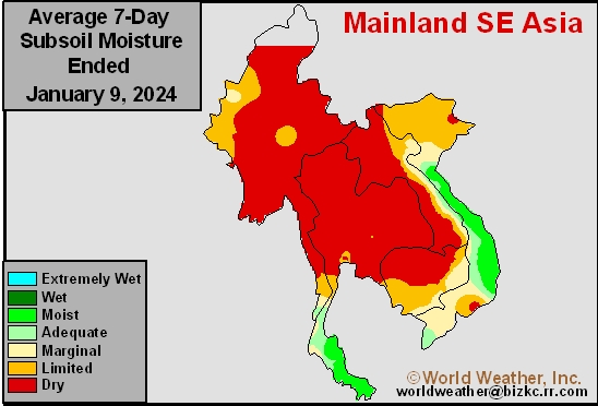
This content is for members only
Topsoil Moisture
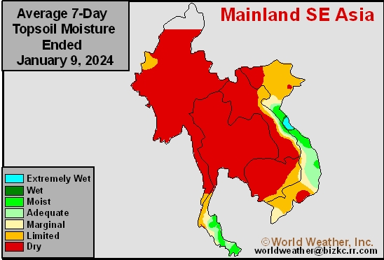
This content is for members only
Subsoil Moisture
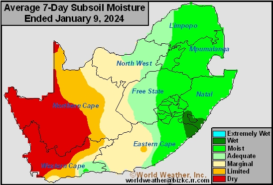
This content is for members only
Topsoil Moisture
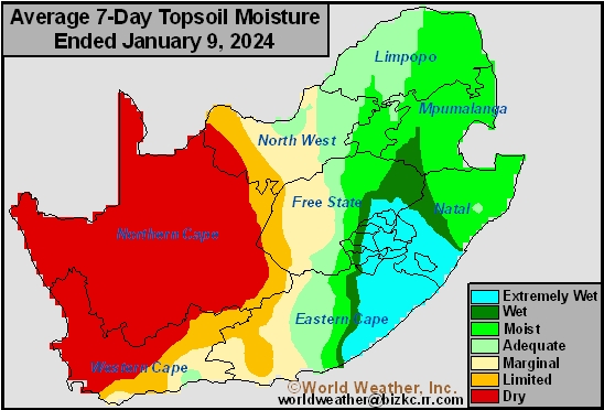
This content is for members only
Subsoil Moisture
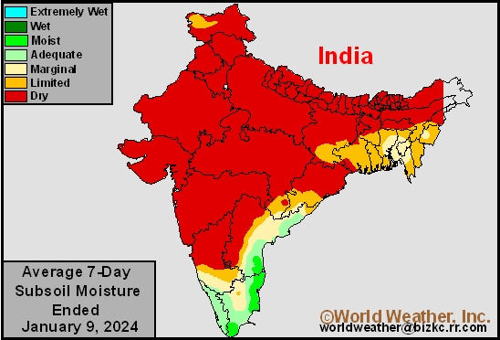
This content is for members only
Topsoil Moisture
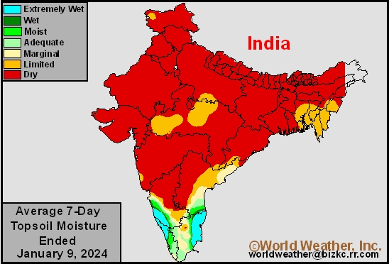
This content is for members only
Subsoil Moisture
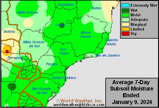
This content is for members only
Topsoil Moisture
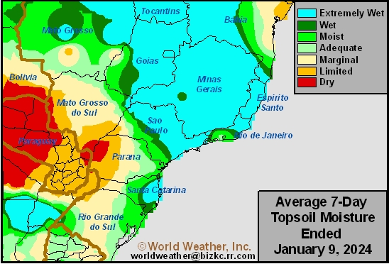
This content is for members only
Subsoil Moisture
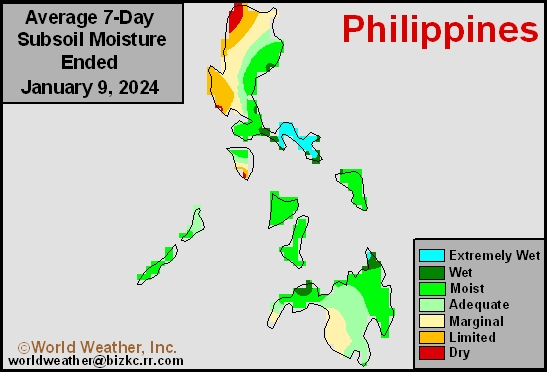
This content is for members only
Topsoil Moisture
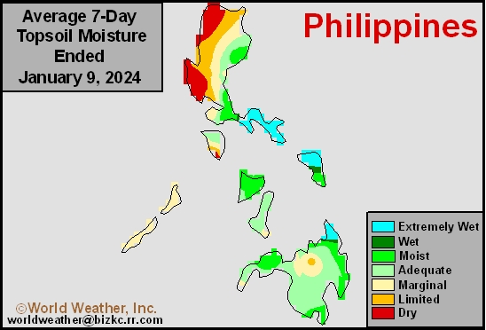
This content is for members only
Subsoil Moisture
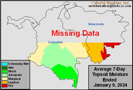
This content is for members only
Topsoil Moisture
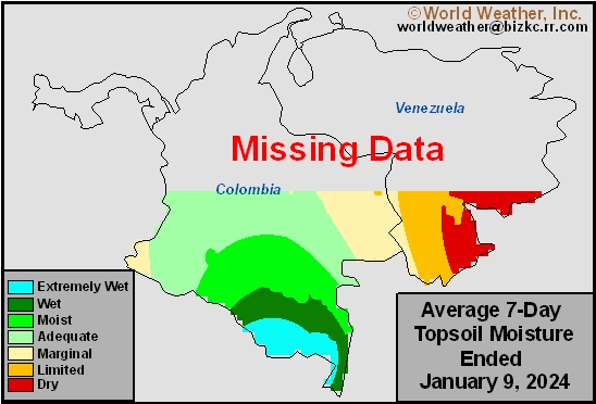
This content is for members only
Subsoil Moisture
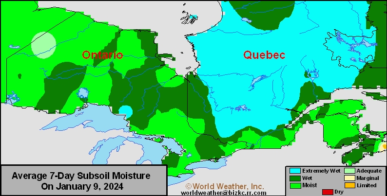
This content is for members only
Topsoil Moisture
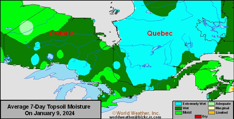
This content is for members only
Subsoil Moisture
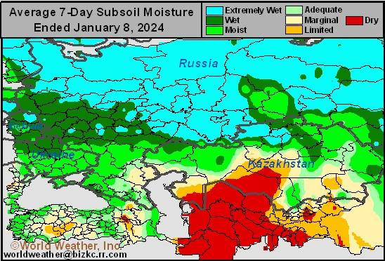
This content is for members only
Topsoil Moisture
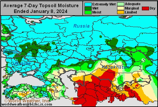
This content is for members only
Subsoil Moisture

This content is for members only
Topsoil Moisture

This content is for members only
Topsoil Moisture
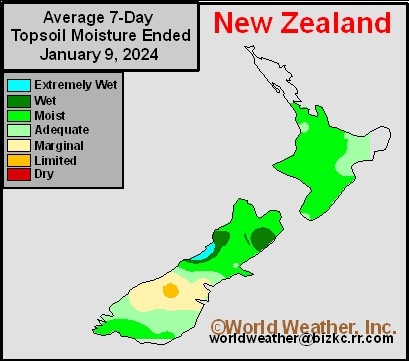
This content is for members only
Subsoil Moisture
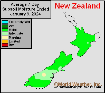
This content is for members only
Subsoil Moisture
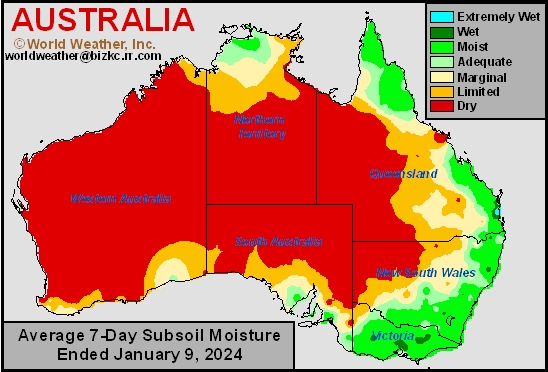
This content is for members only
Topsoil Moisture
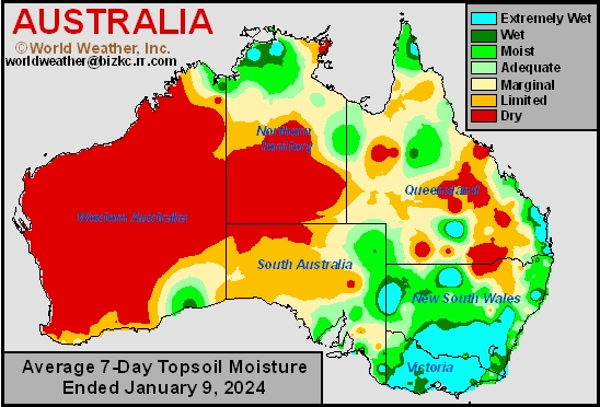
This content is for members only
Recent Rain Improves Topsoil Moisture Across Argentina
Kansas City, January 9 (World Weather Inc.) – Recent rainfall in the primary crop growing region of Argentina has greatly improved topsoil conditions in the past week, with various crop areas in central Argentina now seeing surplus soil conditions. More rain is expected in the next 7-days, mainly in the same areas that received rain previously. Soil moisture is expected to continue improving in many parts of the country, though areas like Cordoba, San Luis, northern Santa Fe, and Corrientes may be at risk of some flooding due to already saturated topsoil. The moisture should mostly be welcome and good for long term crop development.
Brazil Soybean Conditions Will Remain Favorable This Week
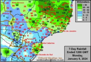
Kansas City, January 9 (World Weather Inc.) – The previously dry areas in northeastern and center-west Brazil received enough rain in recent weeks to raise soil moisture to the benefit of summer crop development. The improved moisture profile has helped support more aggressive establishment and growth for the soybeans, first-season corn, rice, cotton, and other crops. Production potentials for Brazil are still expected to be lower than early estimates due to the poor planting conditions in October and November for Mato Grosso and neighboring locations. However, a large crop will still be possible due to the influx of rain in recent weeks. Brazil’s main production areas will have several opportunities for rain this week that will maintain generally favorable conditions for the crops. Western Parana and immediate neighboring areas may otherwise need to see a slight uptick in rain later this month to support ideal long-term crop conditions.
U.S. Will Be Impacted By Winter Storms; Arctic Air This Week
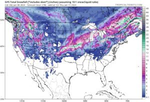
Kansas City, January 8 (World Weather Inc.) – Two winter storms and an Arctic surge will impact central United States this week. The first winter storm is already under way in central U.S. Plains and will advance from there to the Great Lakes region tonight and Tuesday. Heavy snow accumulations are slated from portions of Kansas, eastern Nebraska, and northern Missouri into Iowa, northern Illinois, southern Wisconsin, and portions of Michigan. Travel will likely become hazardous and livestock stress is expected. Another winter storm is expected late Thursday into this weekend with significant snow accumulations possible in portions of the Midwest and neighboring areas. Travel delays and livestock stress are expected with little potential for winter crop damage.
Northern Hemisphere Cold Surge Overview, Forecast
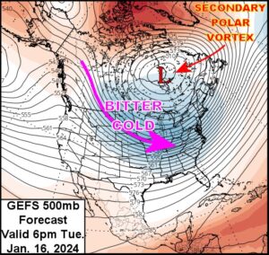
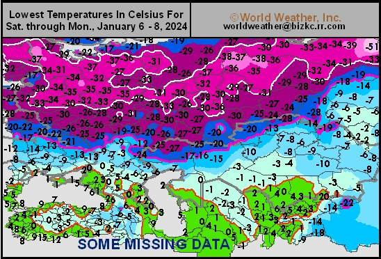
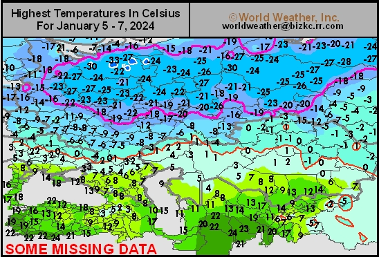
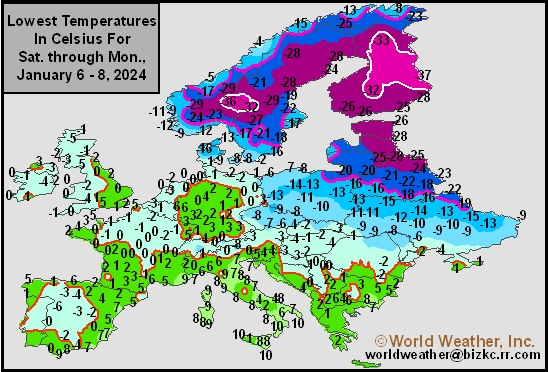
Kansas City, January 8 (World Weather Inc.) – Stratospheric warming advertised at the end of December for January has verified well. Such events are known for displacing the polar vortex, sometimes stretching the vortex out and occasionally splitting the vortex into two vortices. In all cases, cold air aloft is pressured to the surface in the Northern Hemisphere and then spreads to the lower latitudes. The cold surge over Russia and northeastern Europe that has been ongoing for the past week is directly related to the stratospheric warming event and the displacement of the polar vortex. A secondary polar vortex will develop briefly over eastern Canada this weekend into early next week to bring cold weather to North America, but it is not likely to persist like the cold that is projected for northwestern Russia, Scandinavia and some neighboring areas of northeastern Europe.
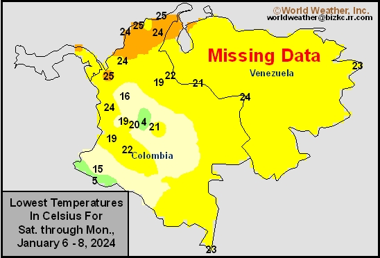
Venezuela/Colombia Min Temps
This content is for members only
Venezuela/Colombia Max Temps
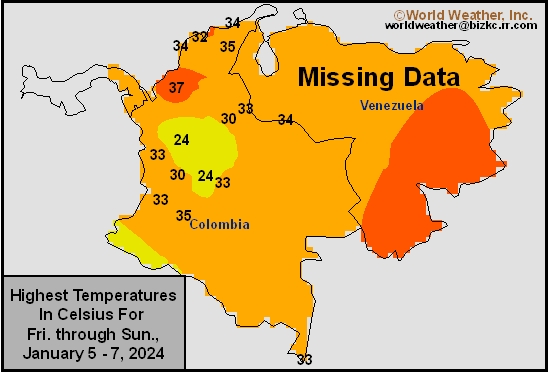
This content is for members only
SE Canada Min
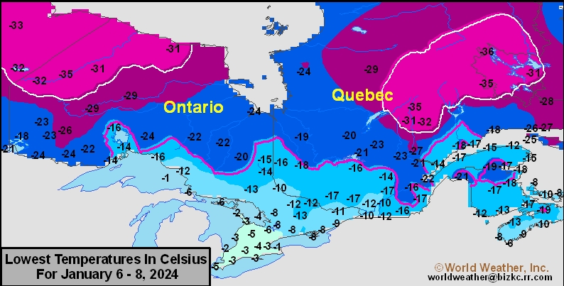
This content is for members only
SE Canada Max
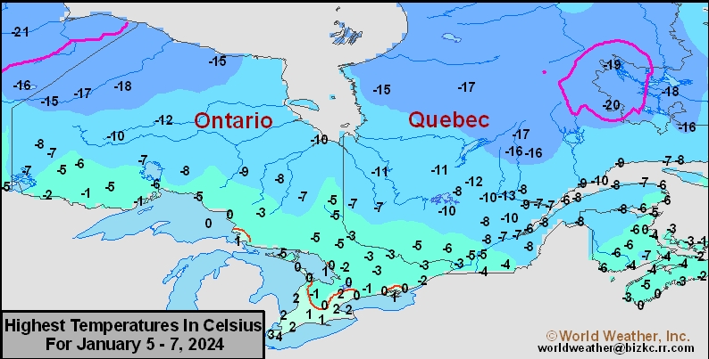
This content is for members only
SE Canada Rainfall
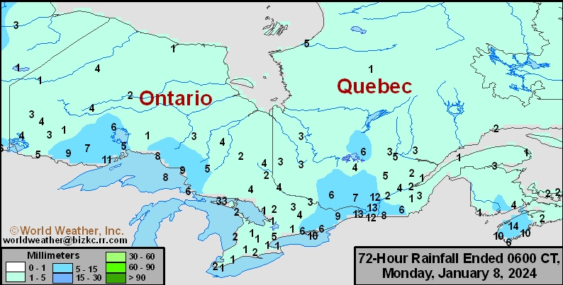
This content is for members only
Prairies Rainfall

This content is for members only
Prairies Max Temperature

This content is for members only
Prairies Min Temperature

This content is for members only
Canada Rainfall

This content is for members only
Venezuela Rainfall
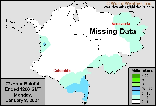
This content is for members only
Mexico Min Temperature
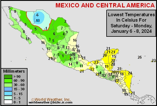
This content is for members only
Mexico Max Temperature
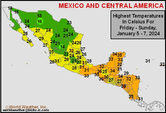
This content is for members only
Mexico Rainfall
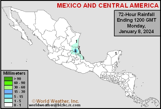
This content is for members only
Argentina Min Temperature
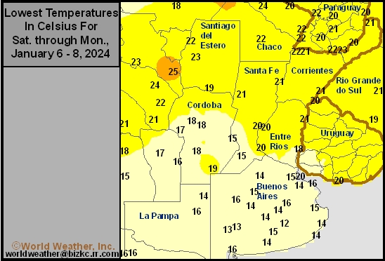
This content is for members only
Argentina Max Temperature
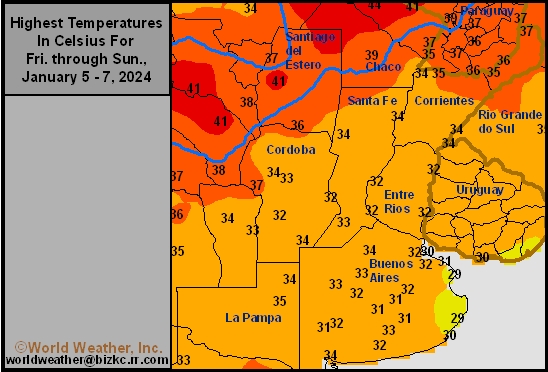
This content is for members only
Argentina Rainfall
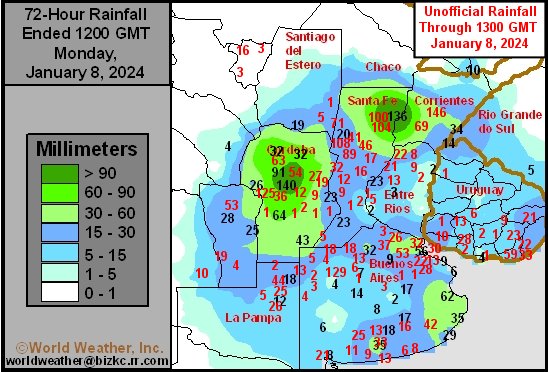
This content is for members only
Brazil Min Temperature
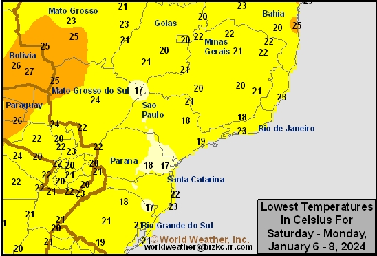
This content is for members only
Brazil Max Temperature
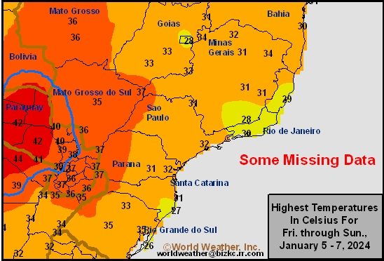
This content is for members only
Brazil Rainfall
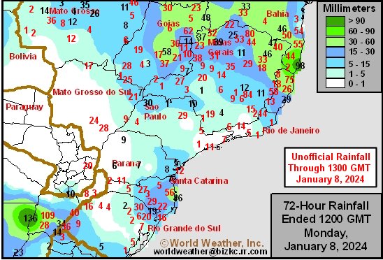
This content is for members only
Philippines Min
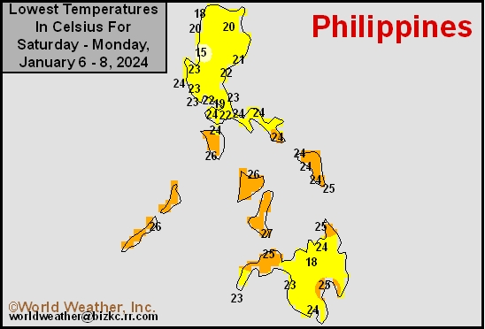
This content is for members only
Philippines Max
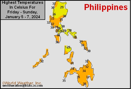
This content is for members only
Philippines Rain
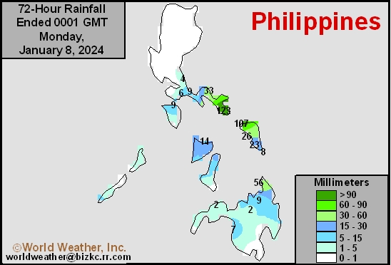
This content is for members only
Southeast North Rain
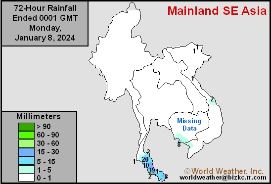
This content is for members only
Southeast North Min
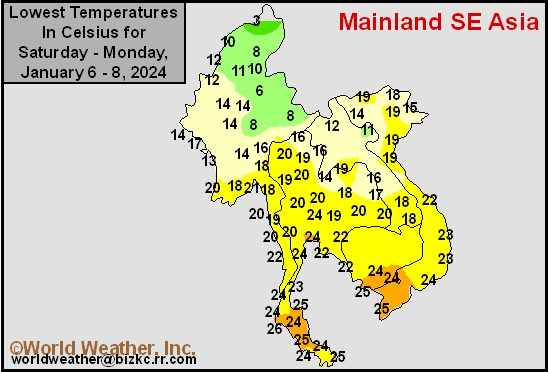
This content is for members only
Southeast North Max
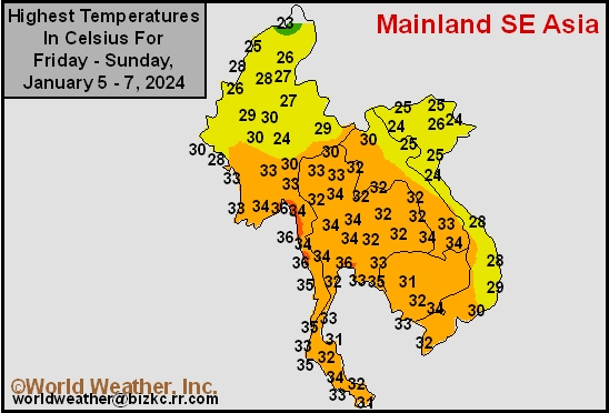
This content is for members only
Southeast Min
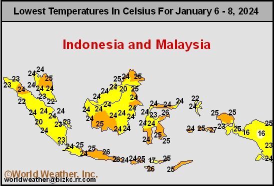
This content is for members only
Southeast Max
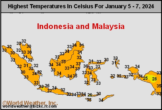
This content is for members only
Southeast Rain
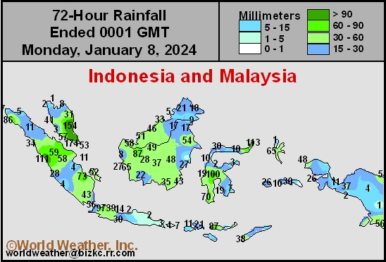
This content is for members only
West Africa Rain
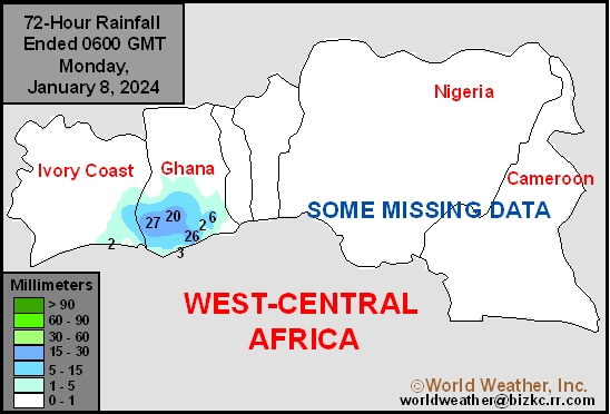
This content is for members only
Max Temperature
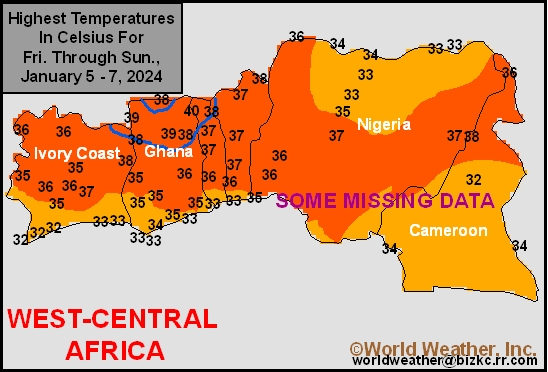
This content is for members only
Min Temperature
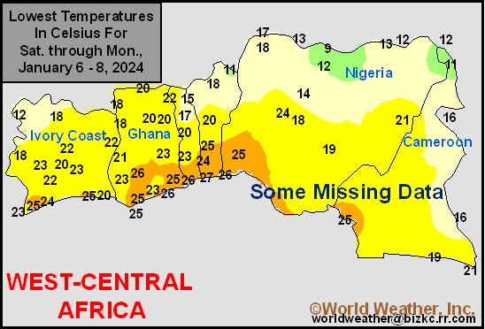
This content is for members only
North Africa Rain
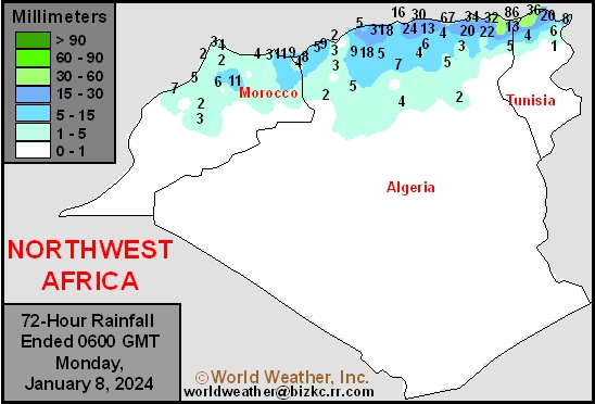
This content is for members only
Max Temperature
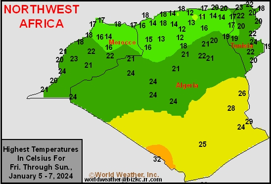
This content is for members only
Min Temperature
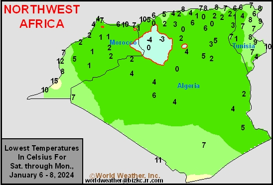
This content is for members only
Min Temperature
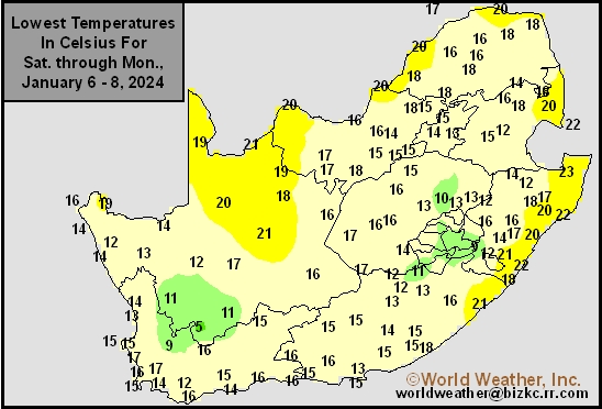
This content is for members only
Max Temperature
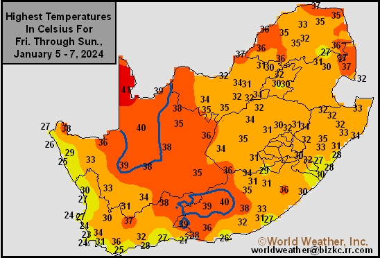
This content is for members only
South Africa Rain
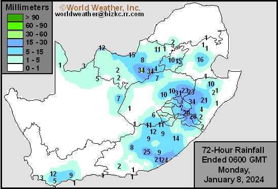
This content is for members only
Hard Red Wheat Tmin
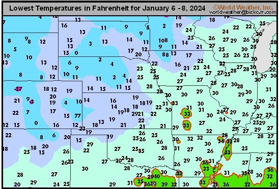
This content is for members only
Northeast Tmin
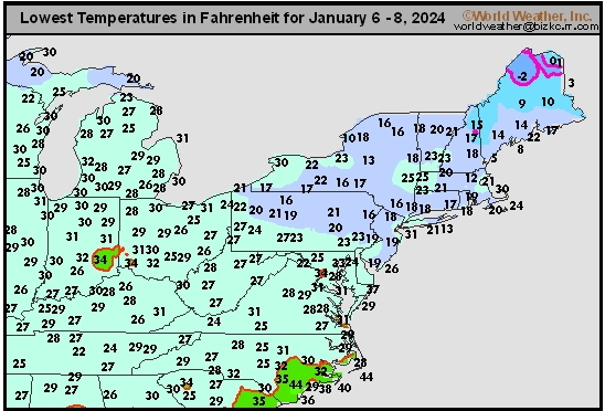
This content is for members only
Southwest Tmin
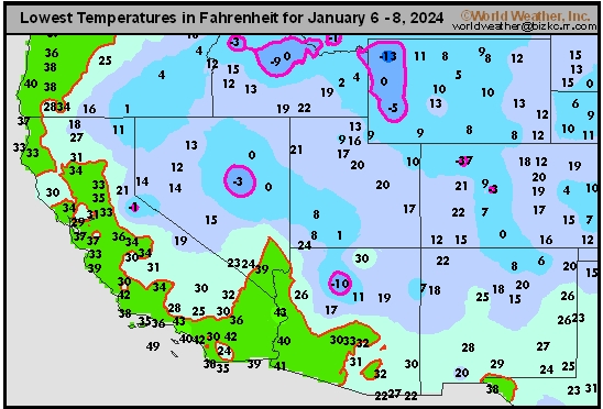
This content is for members only
Northwest Tmin
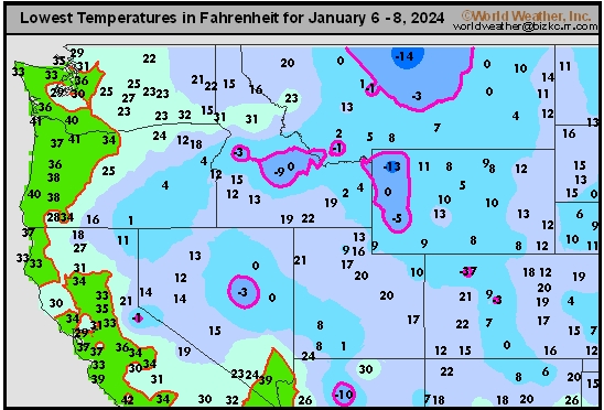
This content is for members only
South Plains Tmin
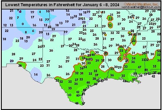
This content is for members only
Delta/SE U.S. Tmin
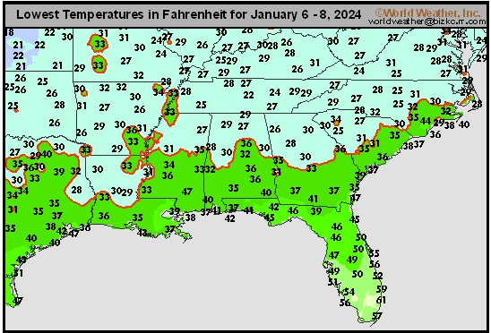
This content is for members only
Corn Belt Tmin
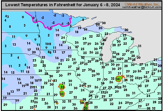
This content is for members only
US Min

This content is for members only
North Plains Tmin
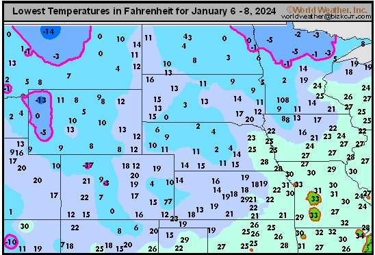
This content is for members only
Hard Red Wheat Tmax
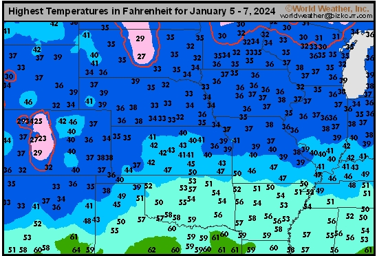
This content is for members only
Northeast Tmax
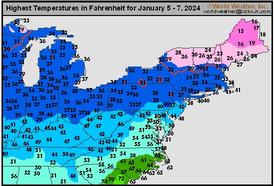
This content is for members only
Southwest Tmax
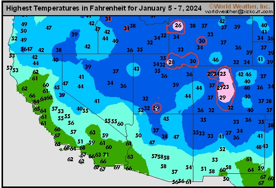
This content is for members only
Northwest Tmax
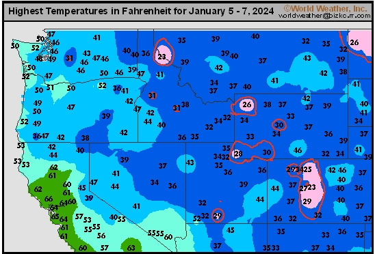
This content is for members only
South Plains Tmax
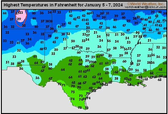
This content is for members only
Delta/SE U.S. Tmax
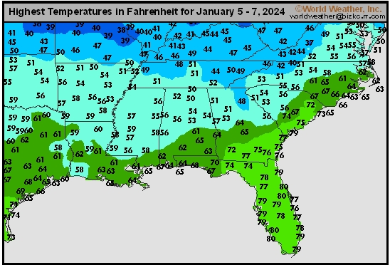
This content is for members only
Corn Belt Tmax
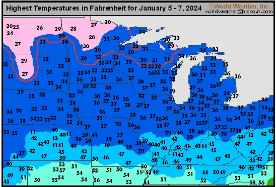
This content is for members only
North Plains Tmax
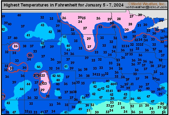
This content is for members only
US Max

This content is for members only
US Rain

This content is for members only
Northeast Daily Rain
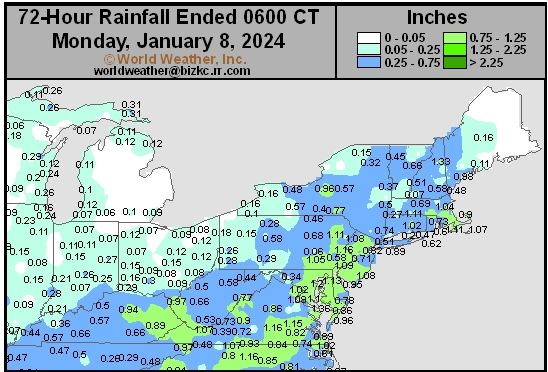
This content is for members only
Hard Red Wheat Daily Rain
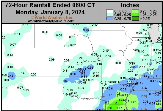
This content is for members only
Southwest Daily Rain
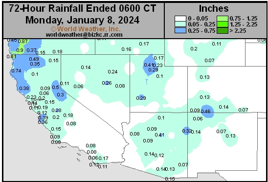
This content is for members only
Northwest Daily Rain
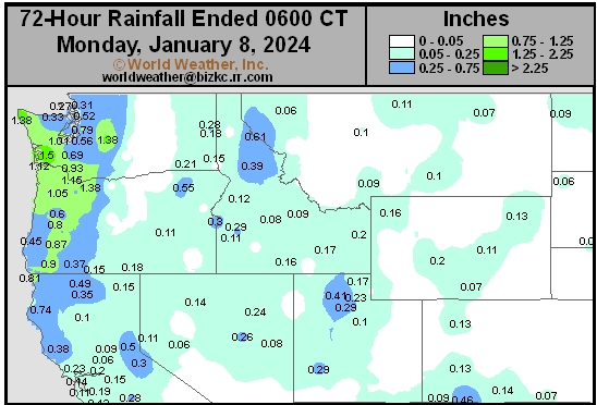
This content is for members only
South Plains Daily Rain
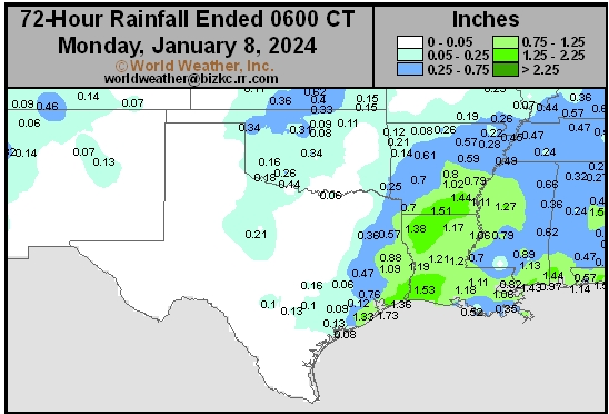
This content is for members only
Delta/SE U.S. Daily Rain
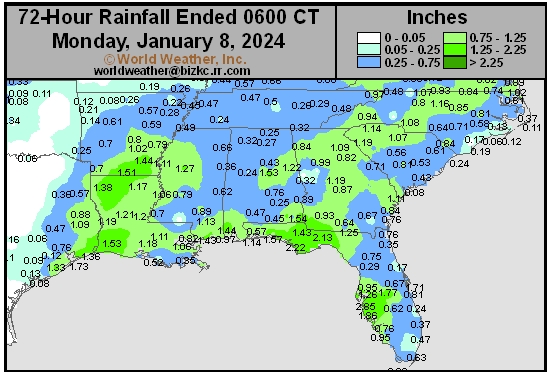
This content is for members only
Corn Belt Daily Rain
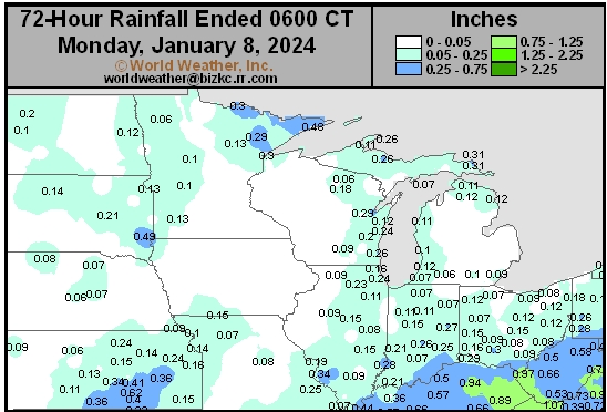
This content is for members only
North Plains Daily Rain
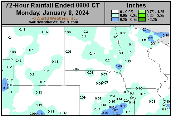
This content is for members only
Low Temperature
This content is for members only
High Temperature
This content is for members only
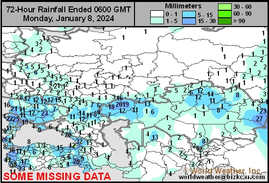
CIS Rainfall
This content is for members only
Low Temperature
This content is for members only