
Northwest Daily Rain
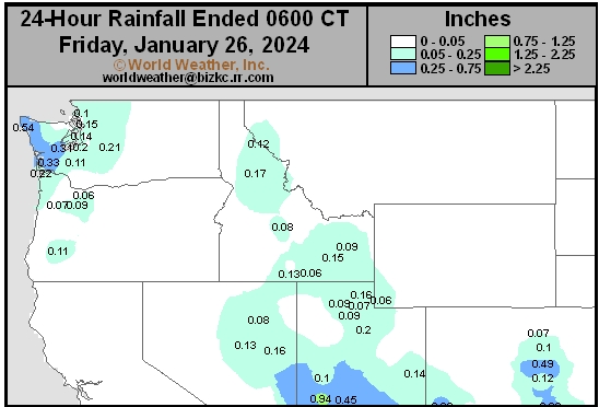
This content is for members only
South Plains Daily Rain
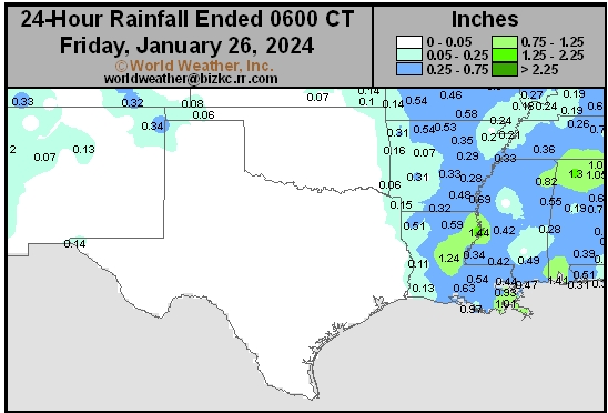
This content is for members only
Delta/SE U.S. Daily Rain
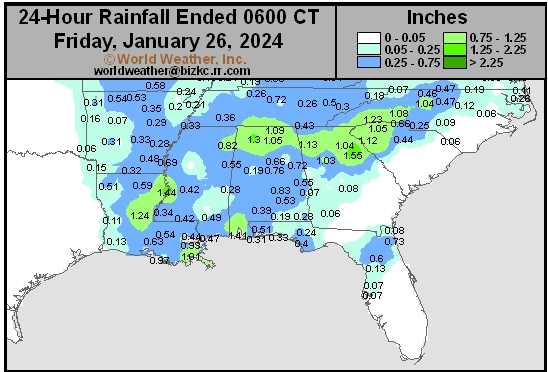
This content is for members only
Corn Belt Daily Rain
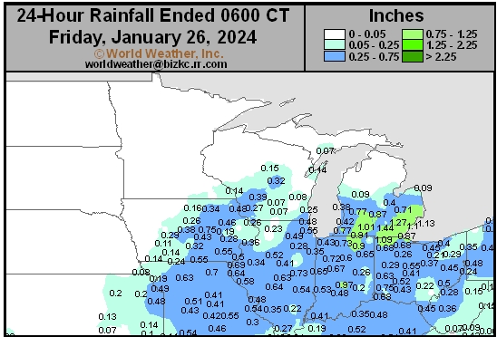
This content is for members only
North Plains Daily Rain
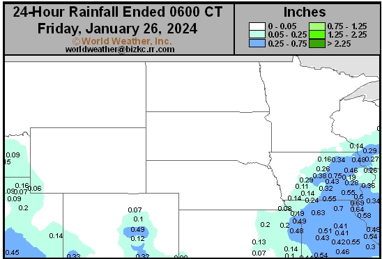
This content is for members only
Low Temperature
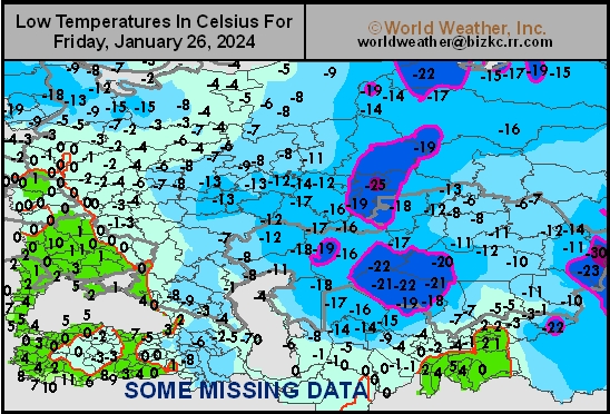
This content is for members only
High Temperature
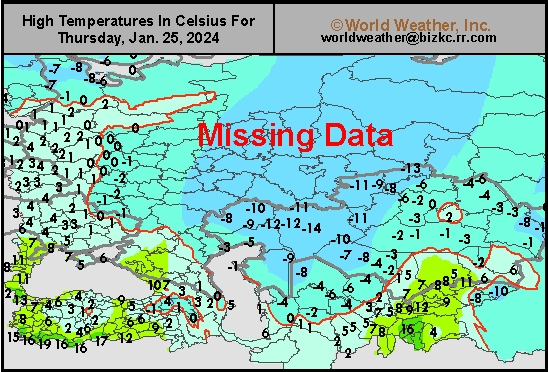
This content is for members only
CIS Rainfall
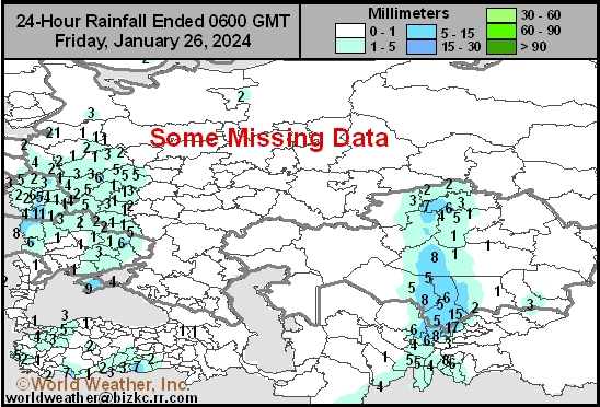
This content is for members only
Low Temperature
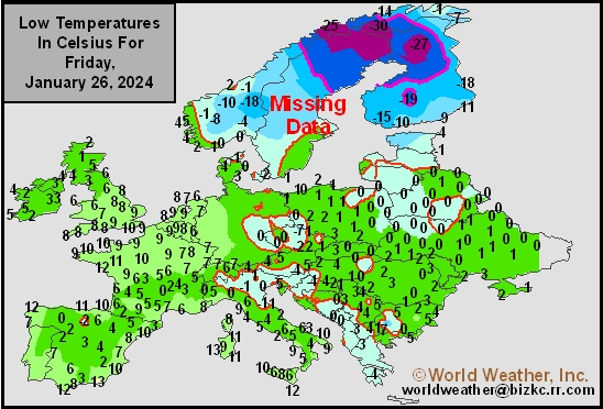
This content is for members only
High Temperature
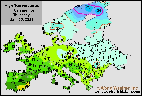
This content is for members only
Europe Rainfall
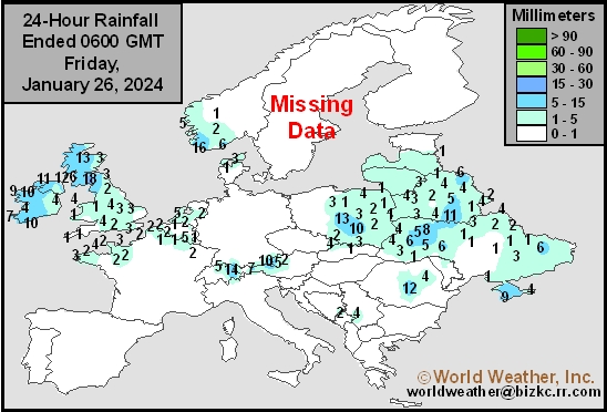
This content is for members only
Low Temperature
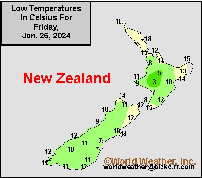
This content is for members only
High Temperature
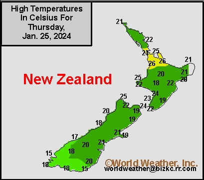
This content is for members only
New Zealand Rainfall
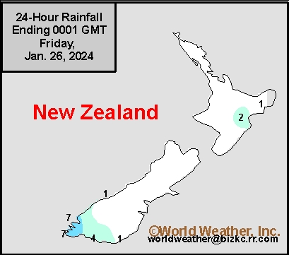
This content is for members only
Low Temperature
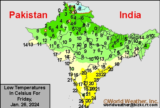
This content is for members only
High Temperature
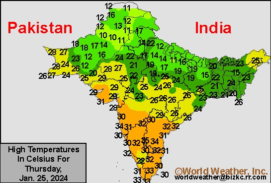
This content is for members only
India Rainfall
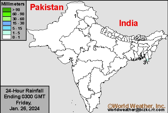
This content is for members only
Low Temperature
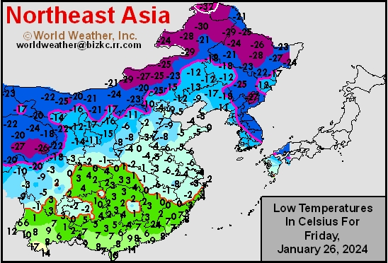
This content is for members only
Japan Rainfall
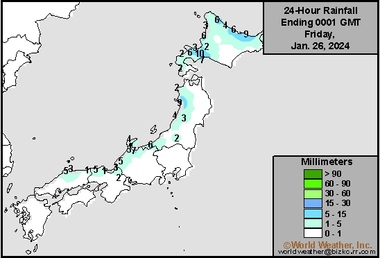
This content is for members only
Low Temperature
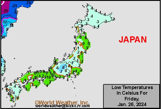
This content is for members only
High Temperature
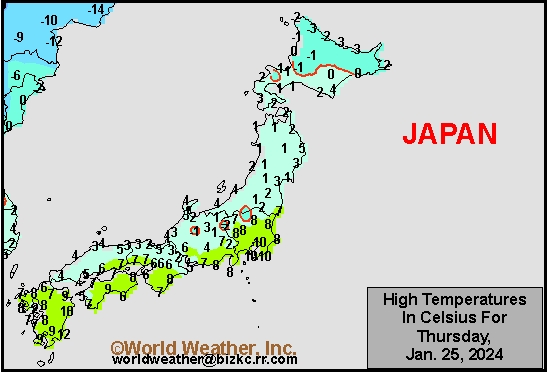
This content is for members only
High Temperature
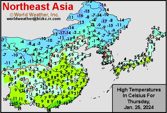
This content is for members only
China Rainfall
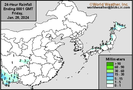
This content is for members only
Low Temperature
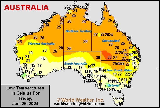
This content is for members only
High Temperature
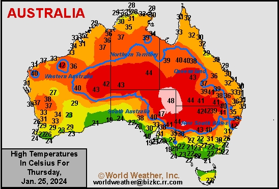
This content is for members only
Australia Rainfall
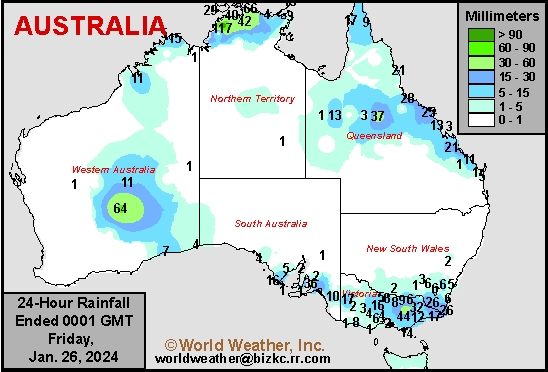
This content is for members only
Subsoil Moisture

This content is for members only
Topsoil Moisture

This content is for members only
Subsoil Moisture
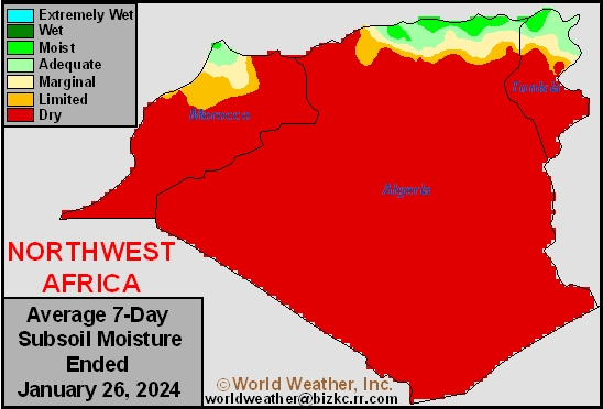
This content is for members only
Topsoil Moisture
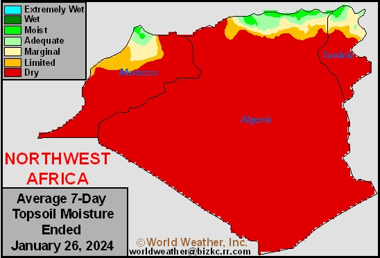
This content is for members only
Subsoil Moisture
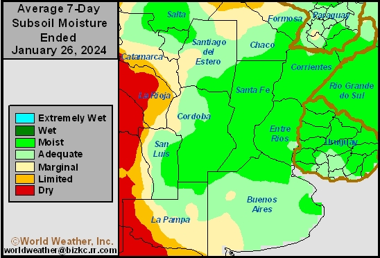
This content is for members only
Topsoil Moisture
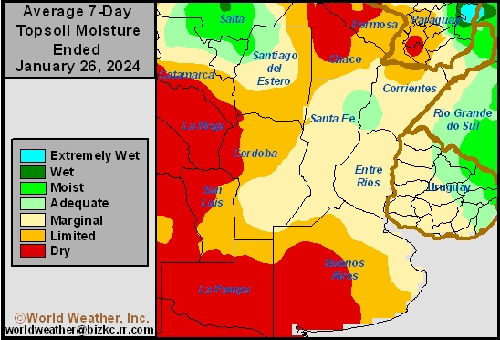
This content is for members only
Subsoil Moisture
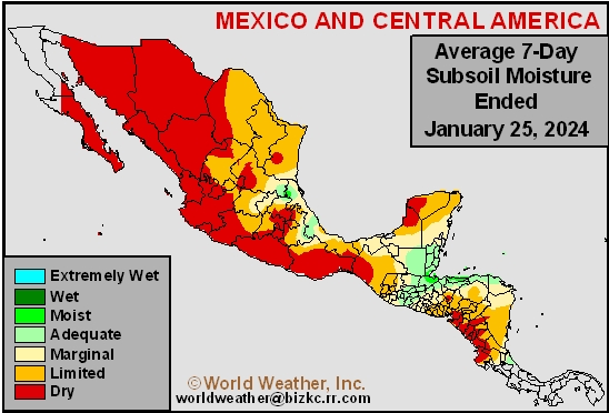
This content is for members only
Topsoil Moisture
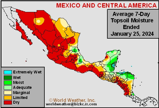
This content is for members only
Subsoil Moisture
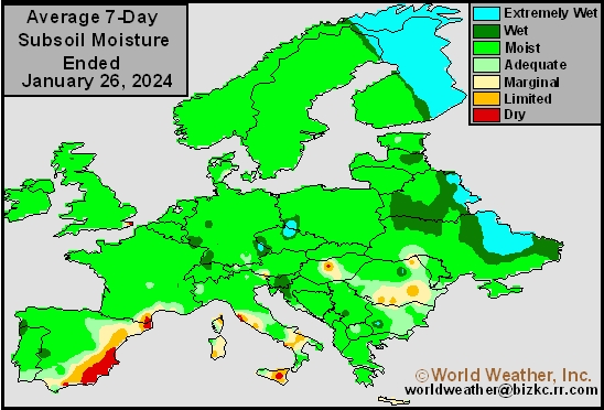
This content is for members only
Topsoil Moisture
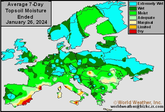
This content is for members only
Subsoil Moisture
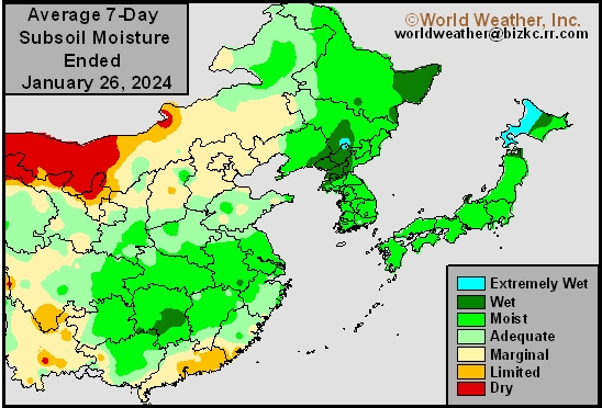
This content is for members only
Topsoil Moisture
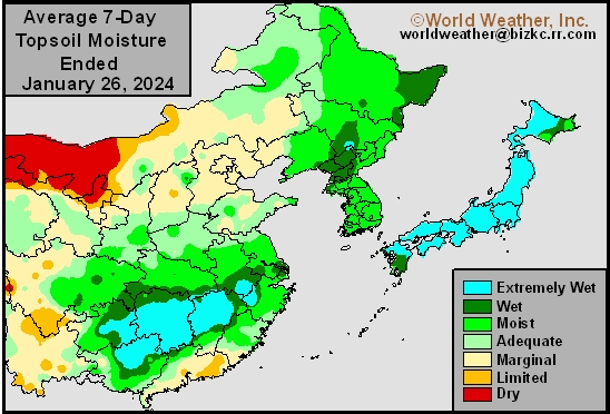
This content is for members only
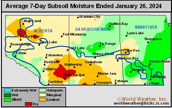
Subsoil Moisture
This content is for members only
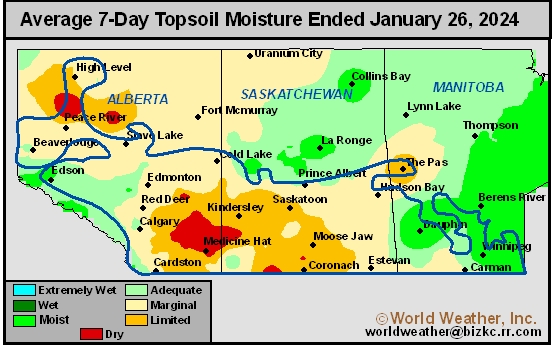
Topsoil Moisture
This content is for members only
Subsoil Moisture

This content is for members only
Topsoil Moisture

This content is for members only
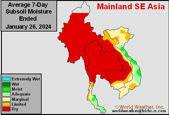
Subsoil Moisture
This content is for members only
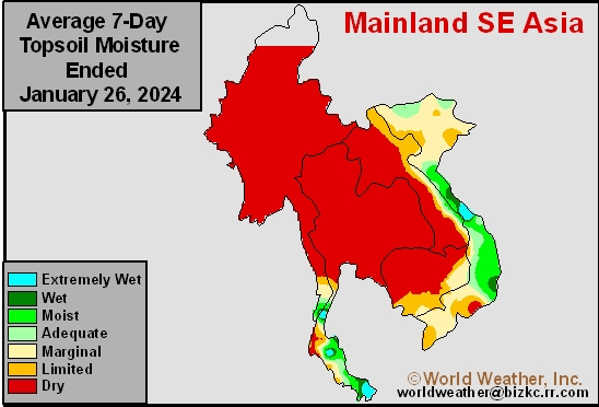
Topsoil Moisture
This content is for members only
Subsoil Moisture
This content is for members only
Topsoil Moisture
This content is for members only
Subsoil Moisture
This content is for members only
Topsoil Moisture
This content is for members only
Subsoil Moisture
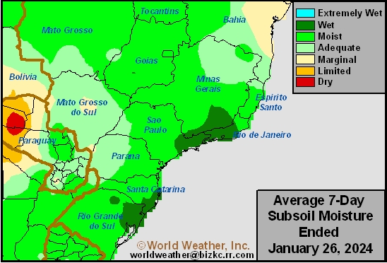
This content is for members only
Topsoil Moisture
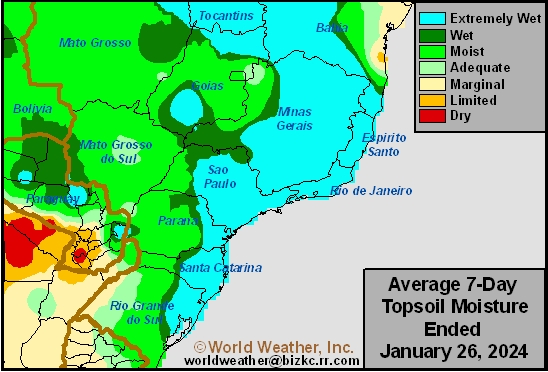
This content is for members only
Subsoil Moisture
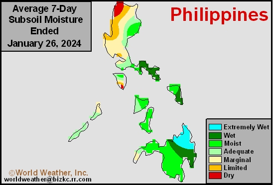
This content is for members only
Topsoil Moisture
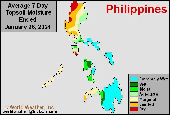
This content is for members only
Subsoil Moisture
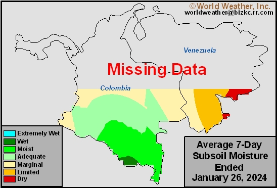
This content is for members only
Topsoil Moisture
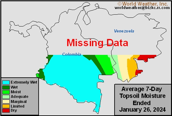
This content is for members only
Subsoil Moisture
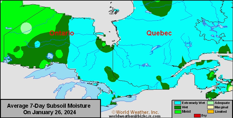
This content is for members only
Topsoil Moisture
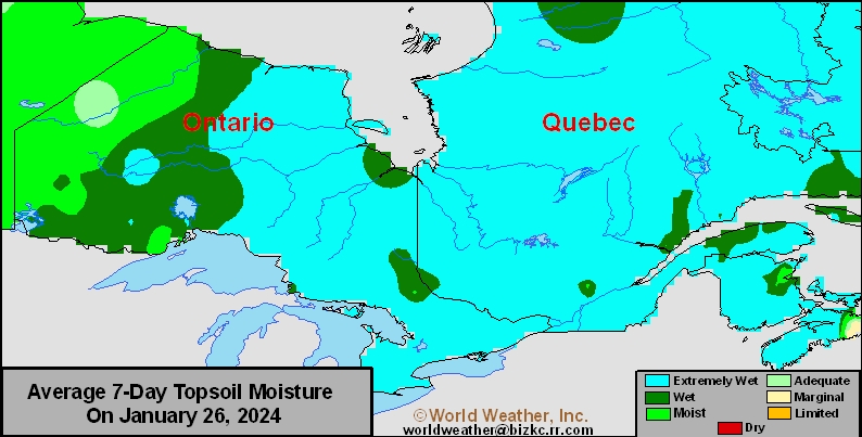
This content is for members only
Subsoil Moisture
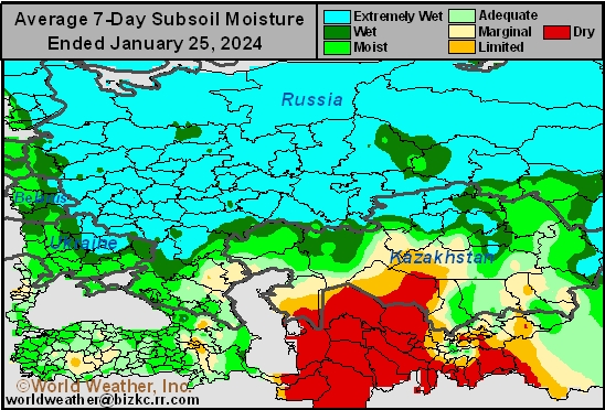
This content is for members only
Topsoil Moisture
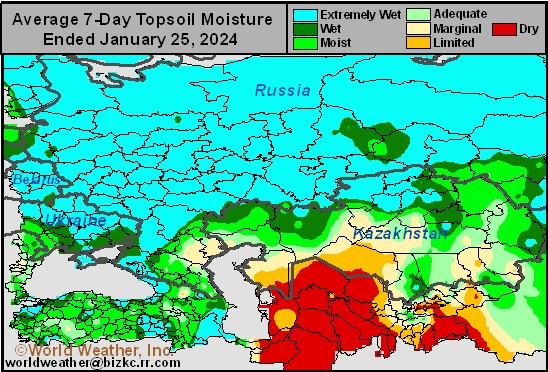
This content is for members only
Subsoil Moisture

This content is for members only
Topsoil Moisture

This content is for members only
Topsoil Moisture
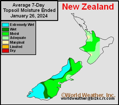
This content is for members only
Subsoil Moisture
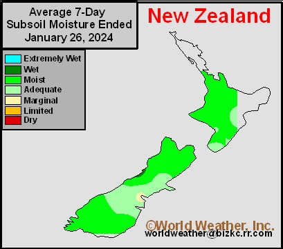
This content is for members only
Subsoil Moisture
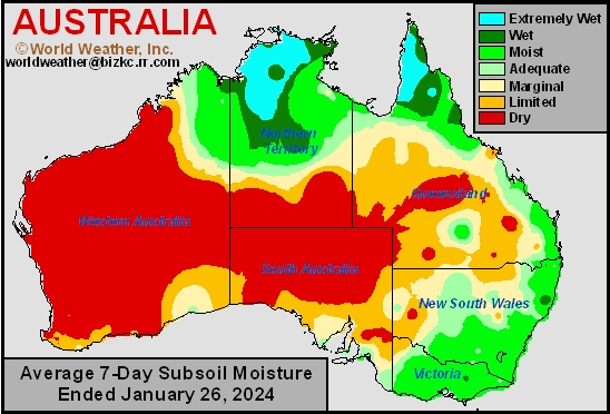
This content is for members only
Topsoil Moisture
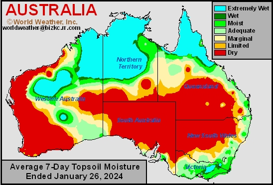
This content is for members only
India In Growing Need Of Rain As Reproduction Nears
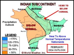
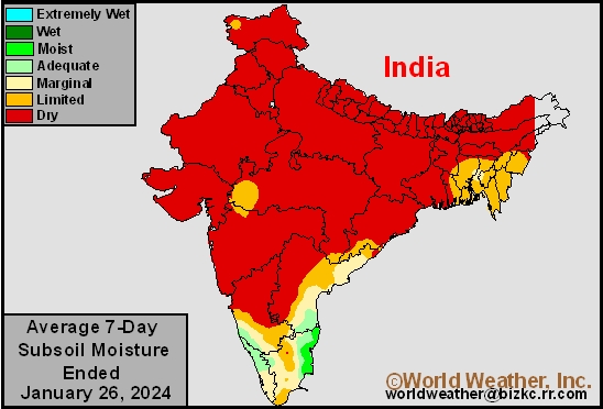
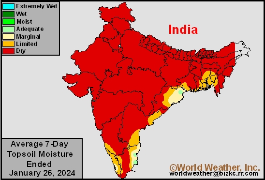
Kansas City, January 26 (World Weather Inc.) – Western and northern India have trended much drier than normal in recent months and is in need of rain. Winter grains, oilseeds, pulses, and other crops must have a good moisture source either from irrigation or timely rain to yield well and that may not be the case right now. Dryland crops may have developed unevenly or poorly and production potential may be lower than normal this season without a significant improvement in rainfall during the next few weeks. Irrigated crops have grown under more favorable conditions, though there is still need timely rain. Many areas in central, southern, and eastern India have also dried down this month and are in a growing need of rain. Below average precipitation will persist for much of the country in the next week to ten days and possibly during much of February during reproduction.
Western U.S. Snowpack Update; Greater Snowfall Needed
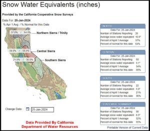
Kansas City, January 25 (World Weather Inc.) – Snow water equivalent levels are below average across much of the western U.S. mountain ranges. Reservoir levels in California are presently near historical normal levels, though reservoirs in the Pacific Northwest are skewing low, particularly in the Yakima Valley. In the next 7-days, between 1.00 and 2.50 inches of moisture will accumulate around the Sierra Nevada, 2.50 to 4.00 inches in the Washington Cascades and 0.30 to 0.90 inch in much of the Northern Rocky Mountains. While these amounts will be welcome, more precipitation will be needed in coming weeks to either replenish or maintain reservoir levels in anticipation of spring planting in late March.
South Africa Summer Crop Areas Drying Down
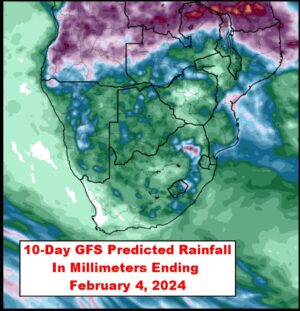
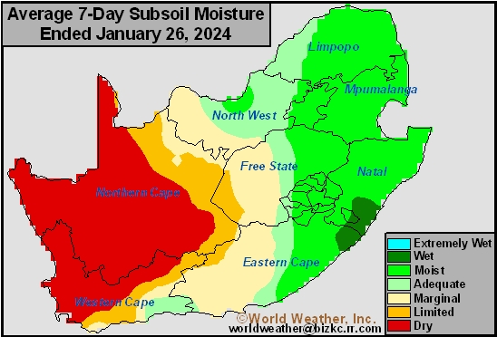
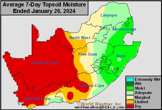
Kansas City, January 25 (World Weather Inc.) – Many areas in Free State and North West lost a significant amount of soil moisture during the past week due to a lack of rain and gradual warming trend. Deep-rooted crops were still able to draw moisture from subsoil levels, though the need for timely rain is increasing. The region will only have a few opportunities for spotty rain during the coming week with warm daytime temperatures resulting in additional aggressive drying. Development rates may slow and crops may be stressed in the driest fields. The need for timely rain will be high during the first half of February to ensure favorable yield potentials. Eastern South Africa has ample moisture and will see a good mix of rain and sunshine during the coming week to support crops favorably.
Queensland, Australia Crops To Benefit From Cyclone Kirrily
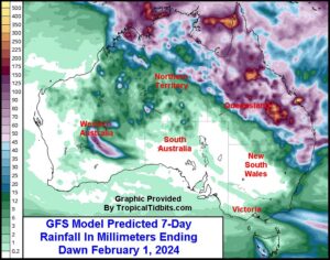
Kansas City, January 25 (World Weather Inc.) – Tropical Cyclone Kirrily made landfall over northeastern Queensland, Australia earlier today with some damaging wind speeds and heavy rainfall. Power outages were noted with some stressful conditions were suspected to livestock and sugarcane. The center of the disturbance will slowly meander across Queensland in coming days before eventually making its way into Northern Territory and potentially northern Western Australia later this weekend and next week. The storm’s convection, though, will spread across a large section of Queensland and northeastern New South Wales bringing welcome moisture to key sorghum, cotton and other important crop areas. Rainfall will significantly bolster soil moisture and may promote flash flooding in some of central Queensland’s agricultural region. Minor damage is expected away from the coast where landfall takes place while most of the impact will be beneficial and welcome with unirrigated crop benefiting most significantly.
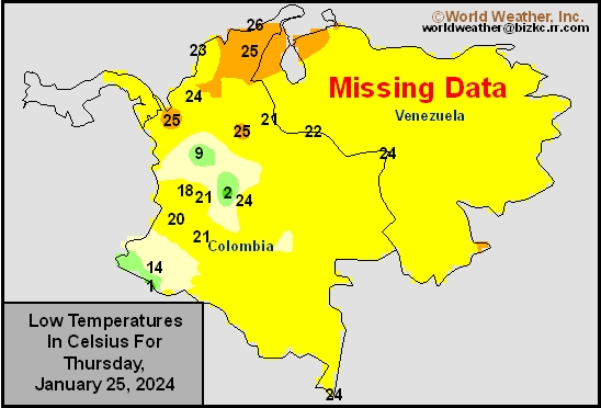
Venezuela/Colombia Min Temps
This content is for members only
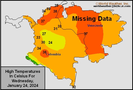
Venezuela/Colombia Max Temps
This content is for members only
SE Canada Min
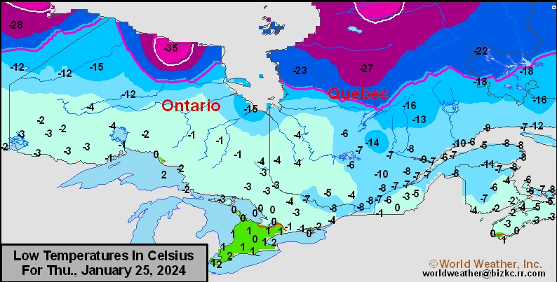
This content is for members only
SE Canada Max
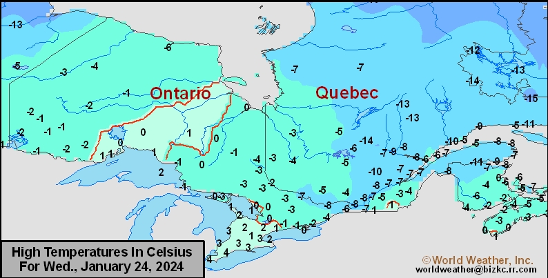
This content is for members only
SE Canada Rainfall
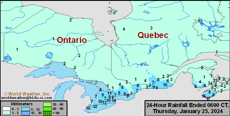
This content is for members only
Prairies Rainfall

This content is for members only
Prairies Max Temperature

This content is for members only
Prairies Min Temperature

This content is for members only
Canada Rainfall

This content is for members only
Venezuela Rainfall
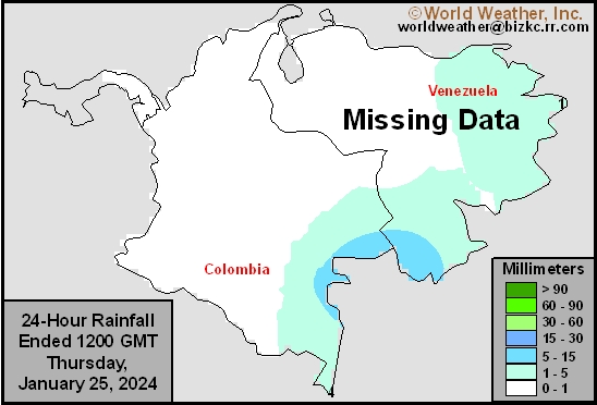
This content is for members only
Mexico Min Temperature
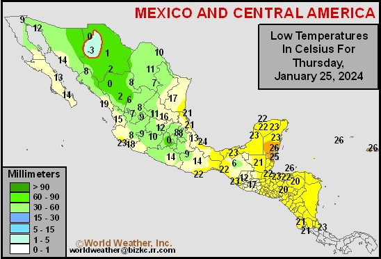
This content is for members only
Mexico Max Temperature
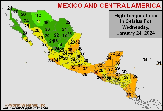
This content is for members only
Mexico Rainfall
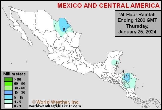
This content is for members only
Argentina Min Temperature
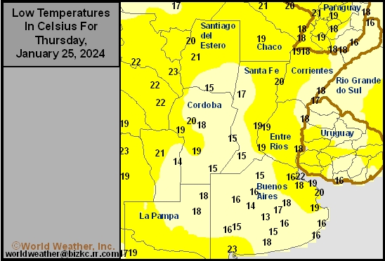
This content is for members only
Argentina Max Temperature
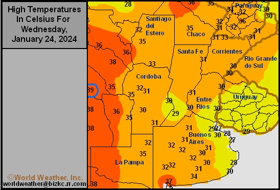
This content is for members only
Argentina Rainfall
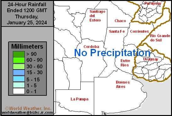
This content is for members only
Brazil Min Temperature
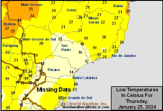
This content is for members only
Brazil Max Temperature
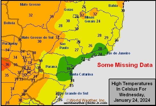
This content is for members only
Brazil Rainfall
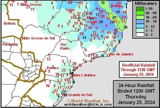
This content is for members only
Philippines Min
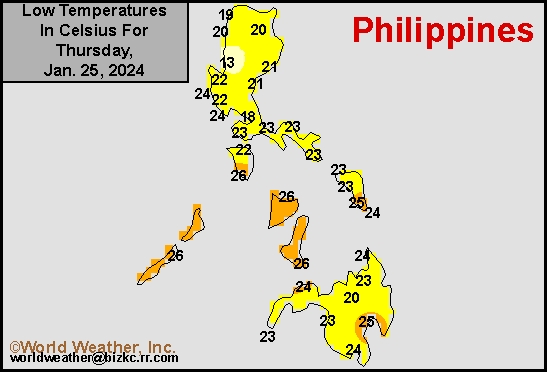
This content is for members only
Philippines Max
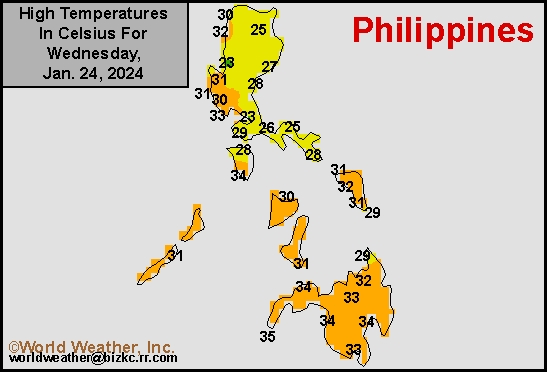
This content is for members only
Philippines Rain
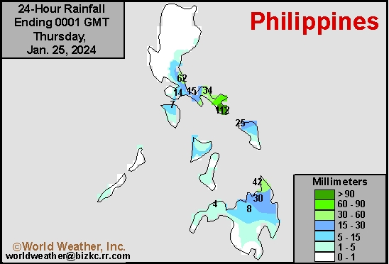
This content is for members only
Southeast North Rain
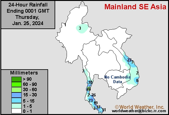
This content is for members only
Southeast North Min
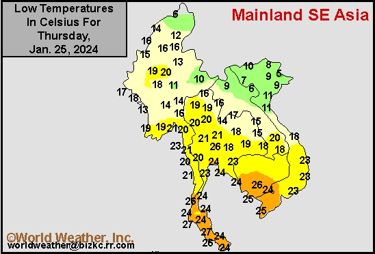
This content is for members only
Southeast North Max
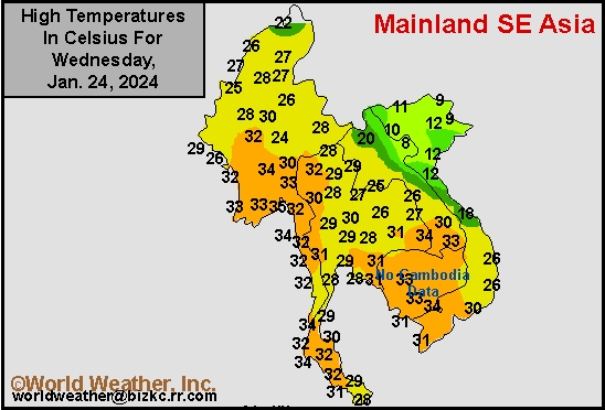
This content is for members only
Southeast Min
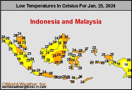
This content is for members only
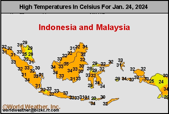
Southeast Max
This content is for members only
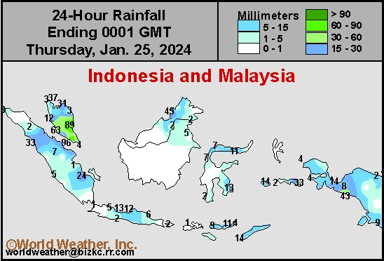
Southeast Rain
This content is for members only
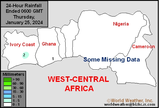
West Africa Rain
This content is for members only
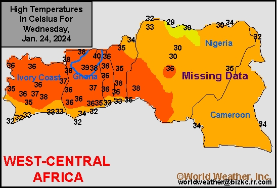
Max Temperature
This content is for members only
Min Temperature
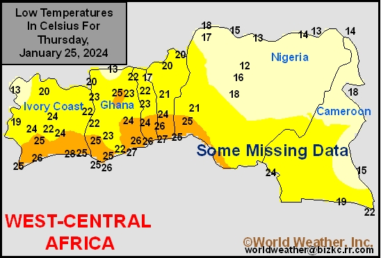
This content is for members only
North Africa Rain
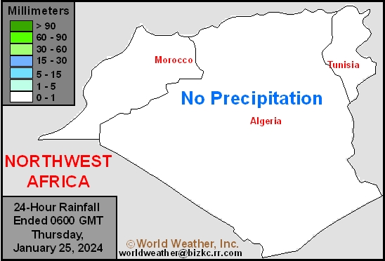
This content is for members only