
Max Temperature
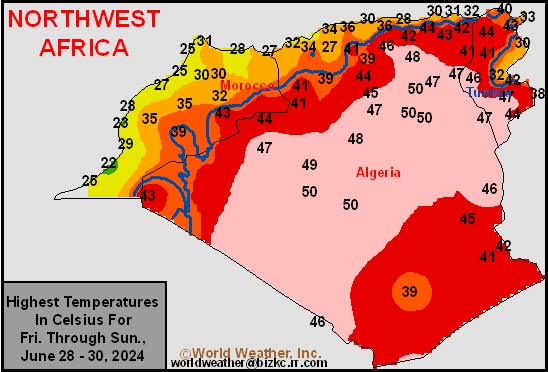
This content is for members only
Min Temperature
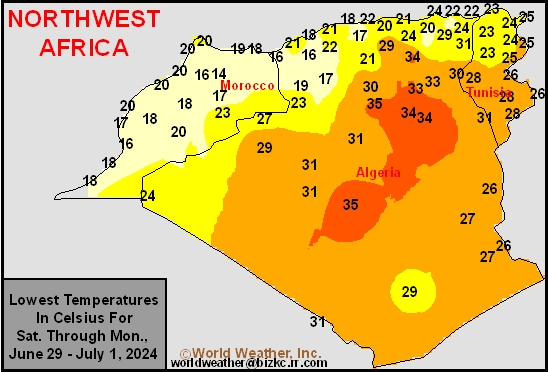
This content is for members only
Min Temperature
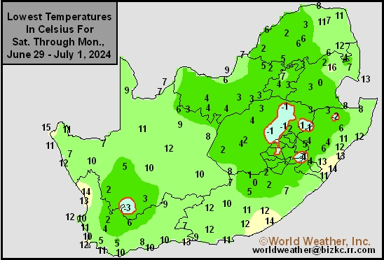
This content is for members only
Max Temperature
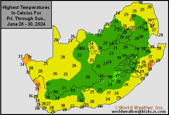
This content is for members only
South Africa Rain
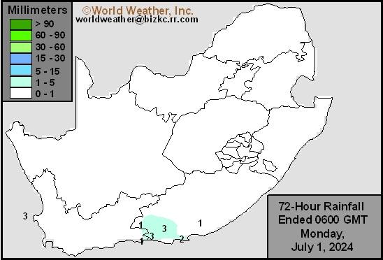
This content is for members only
Hard Red Wheat Tmin
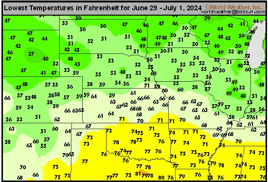
This content is for members only
Northeast Tmin
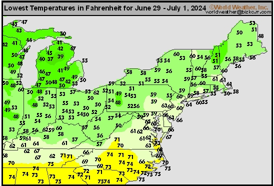
This content is for members only
Southwest Tmin
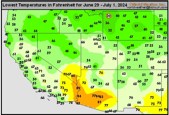
This content is for members only
Northwest Tmin
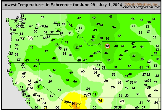
This content is for members only
South Plains Tmin
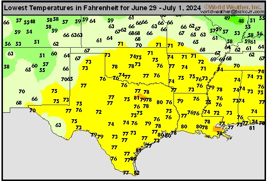
This content is for members only
Delta/SE U.S. Tmin
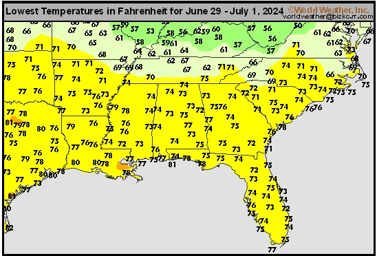
This content is for members only
Corn Belt Tmin
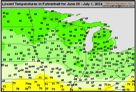
This content is for members only
US Min

This content is for members only
North Plains Tmin
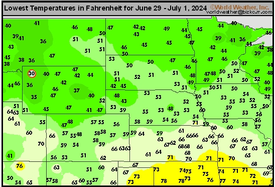
This content is for members only
Hard Red Wheat Tmax
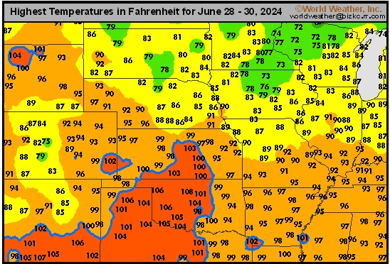
This content is for members only
Northeast Tmax
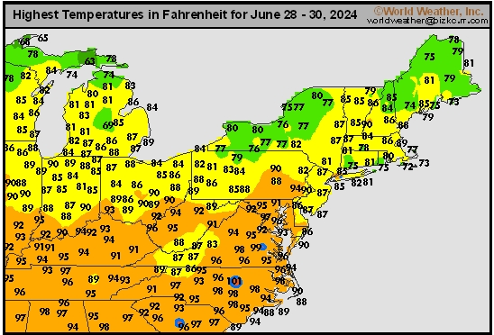
This content is for members only
Southwest Tmax
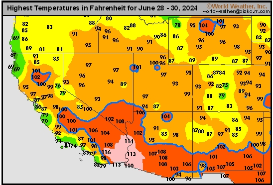
This content is for members only
Northwest Tmax
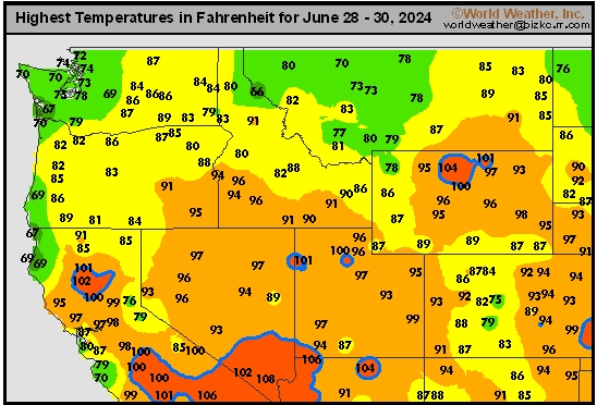
This content is for members only
South Plains Tmax
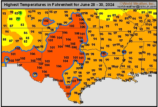
This content is for members only
Delta/SE U.S. Tmax
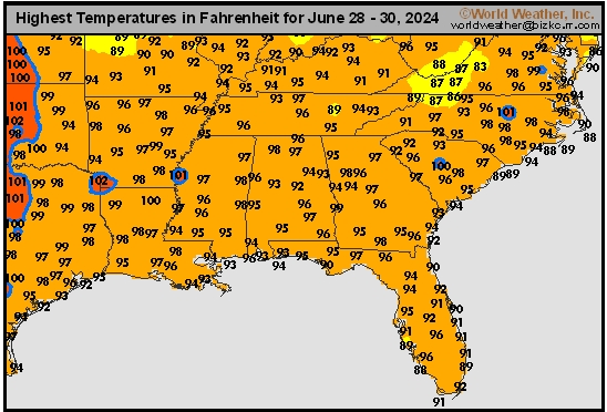
This content is for members only
Corn Belt Tmax
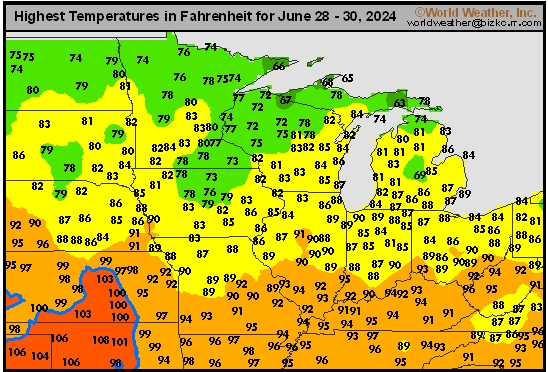
This content is for members only
North Plains Tmax
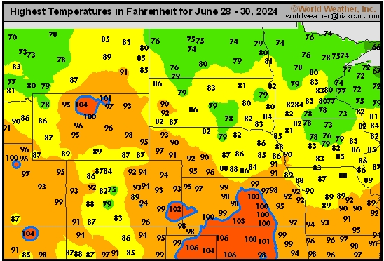
This content is for members only
US Max

This content is for members only
US Rain

This content is for members only
Northeast Daily Rain
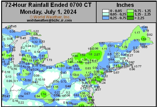
This content is for members only
Hard Red Wheat Daily Rain
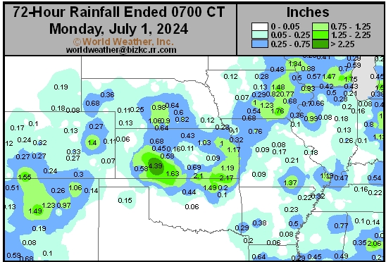
This content is for members only
Southwest Daily Rain
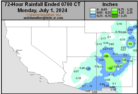
This content is for members only
Northwest Daily Rain
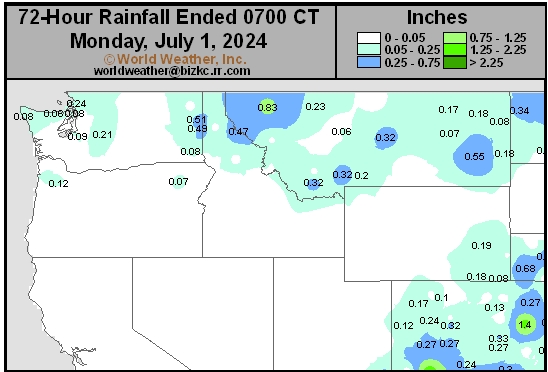
This content is for members only
South Plains Daily Rain
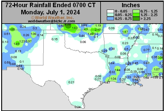
This content is for members only
Delta/SE U.S. Daily Rain
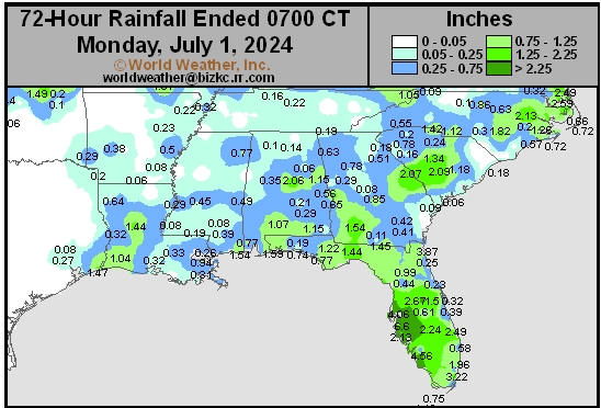
This content is for members only
Corn Belt Daily Rain
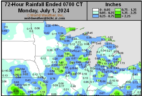
This content is for members only
North Plains Daily Rain
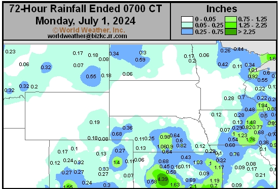
This content is for members only
Low Temperature
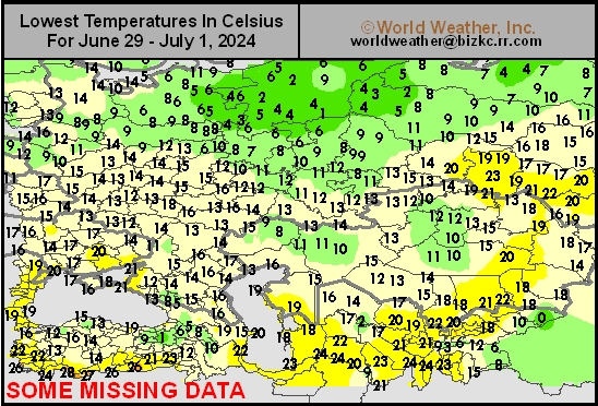
This content is for members only
High Temperature
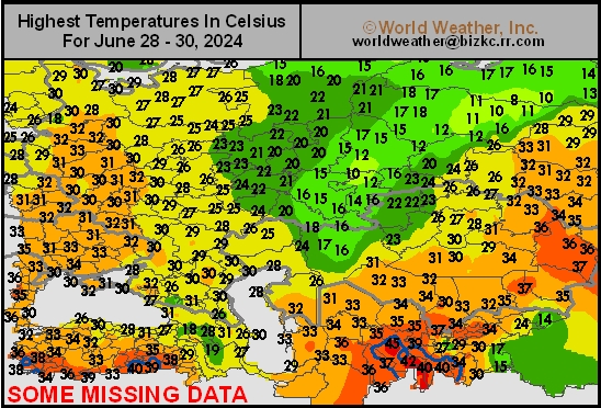
This content is for members only
CIS Rainfall
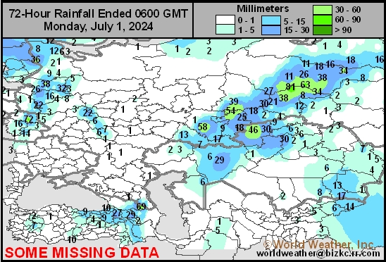
This content is for members only
Low Temperature
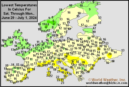
This content is for members only
High Temperature
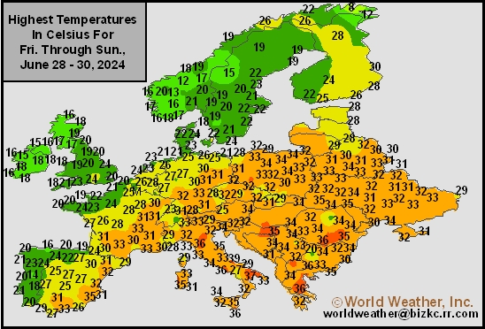
This content is for members only
Europe Rainfall
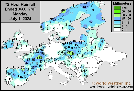
This content is for members only
Low Temperature
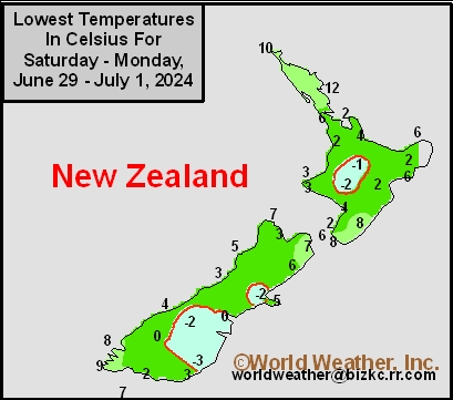
This content is for members only
High Temperature
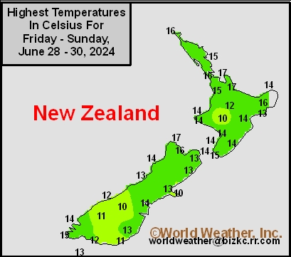
This content is for members only
New Zealand Rainfall
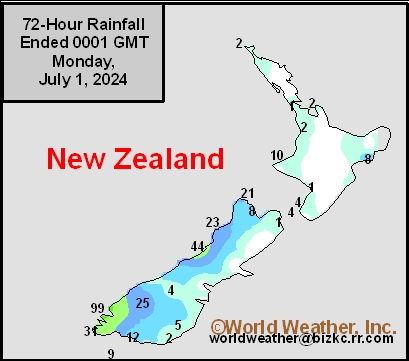
This content is for members only
Low Temperature
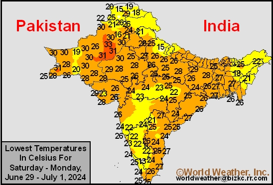
This content is for members only
High Temperature
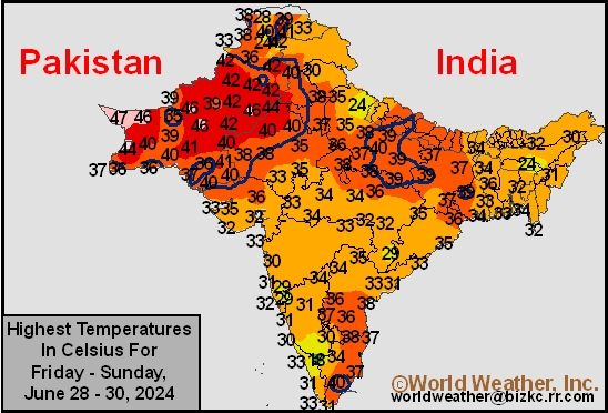
This content is for members only
India Rainfall
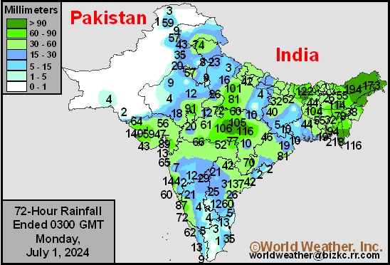
This content is for members only
Low Temperature
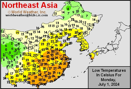
This content is for members only
Japan Rainfall
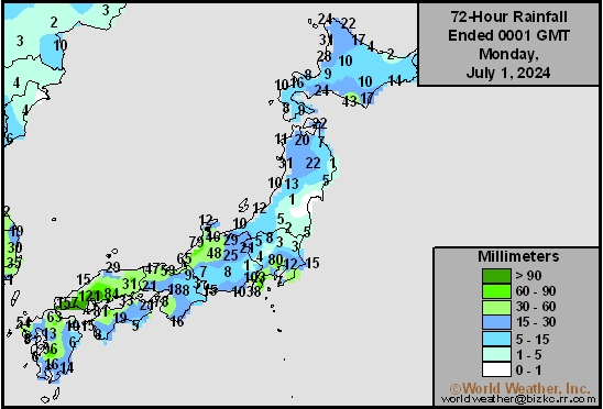
This content is for members only
Low Temperature
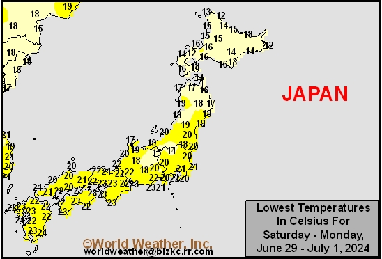
This content is for members only
High Temperature
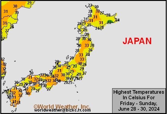
This content is for members only
High Temperature
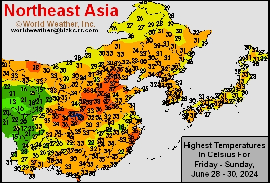
This content is for members only
China Rainfall
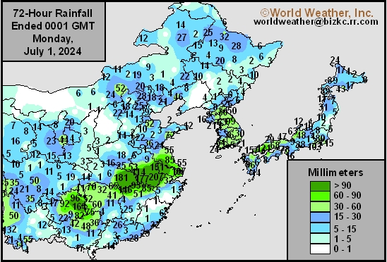
This content is for members only
Low Temperature
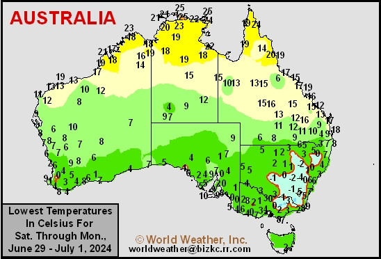
This content is for members only
High Temperature
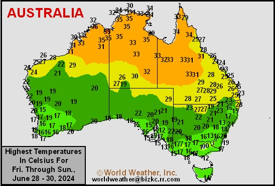
This content is for members only
Australia Rainfall
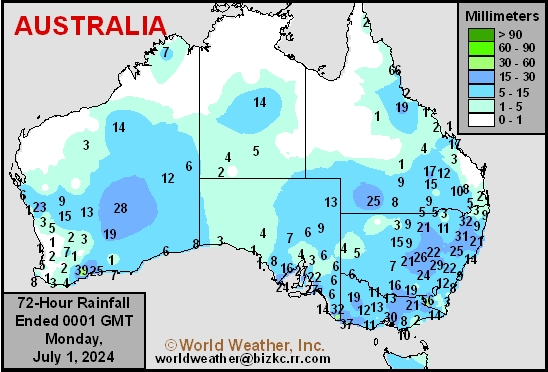
This content is for members only
Tropical Depression Three Forms In Bay Of Campeche
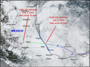
Kansas City, June 30 (World Weather Inc.) – Tropical Depression Three has formed in the Bay of Campeche this afternoon. The system is expected to be become a tropical storm prior to landfall in east-central Mexico tonight. The storm will produce heavy rain throughout eastern Mexico with some local flooding likely as well. Very little wind damage is expected, but flooding may be enhanced late this week and weekend when Hurricane Beryl impacts a part of eastern Mexico.
Warm U.S. July Weather To Allow Dryness To Expand
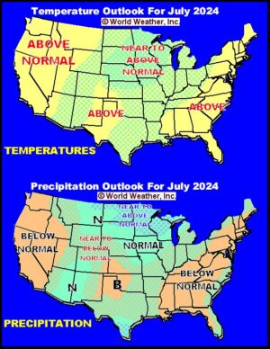
Kansas City, June 30 (World Weather Inc.) – Recent rain in the U.S. Midwest has crop conditions rated favorably in many areas, although it is too wet in the upper Midwest. Pockets of drought have managed to pop up across portions of the northwestern U.S. and in a part of the lower eastern Midwest and interior southeastern states recently while it is persisting in the central and southwestern Plains. Weather in July is expected to be warm enough to stimulate quick drying in many areas and that, according to the U.S. National Weather Service and NOAA, may lead to expanding drought. World Weather, Inc. anticipates additional wet weather in the north-central U.S. and near to below normal precipitation in many other areas.
Mexico’s Monsoon Will Continue To Chip Away At Drought
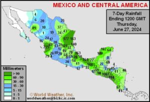
Kansas City, June 28 (World Weather Inc.) – Two tropical disturbances moving through eastern Mexico brought significant drought relief in the past week while the monsoonal weather pattern was just beginning to kick in. Another tropical system may impact the same region in this coming week while monsoon flow begins to improve in other parts of Mexico. That should bring opportunities for rain across the nation’s driest areas in the west and north and start improving summer crop production potentials for 2024.
Canadian Prairies Crop Prospects Relatively Good

Kansas City, June 28 (World Weather Inc.) – Frequent rainfall continued during the past week for much of the Canadian Prairies. A strong storm system moved across the region Thursday and continues to do so today promoting varying amounts of rain. Another storm system occurred last weekend that brought hail and strong wind speeds to portions of Saskatchewan as well. While these systems promoted some damaging conditions, overall production potentials remain generally favorable for the Prairies. Ample moisture continues to support good early-season development for many areas, although there are a few areas that are too wet and a few that are still dealing with some dryness. Another concern has been degree day accumulations which are below average and that could impact crop maturity rates and raise the potential for damage if early season frosts become an issue. Additional waves of rain and mild weather are expected into early July.
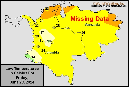
Venezuela/Colombia Min Temps
This content is for members only
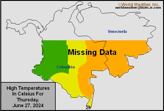
Venezuela/Colombia Max Temps
This content is for members only
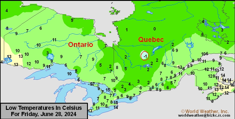
SE Canada Min
This content is for members only
SE Canada Max
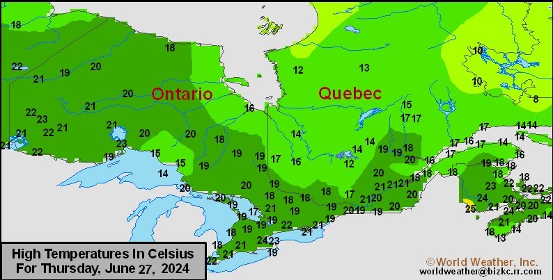
This content is for members only
SE Canada Rainfall
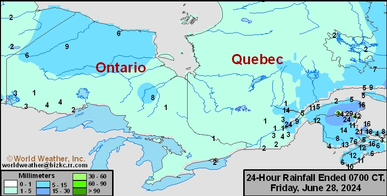
This content is for members only
Prairies Rainfall

This content is for members only
Prairies Max Temperature

This content is for members only
Prairies Min Temperature

This content is for members only
Canada Rainfall

This content is for members only
Venezuela Rainfall
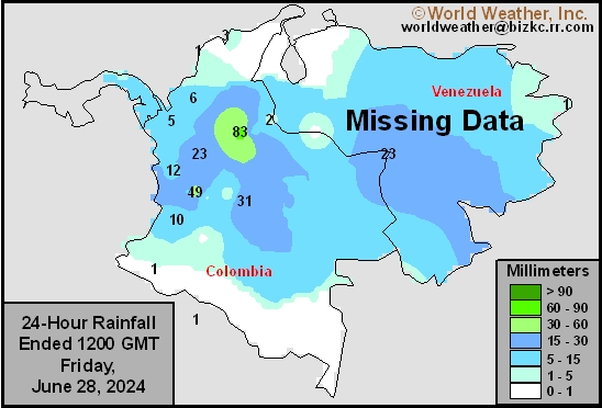
This content is for members only
Mexico Min Temperature
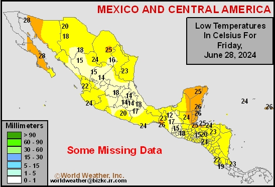
This content is for members only
Mexico Max Temperature
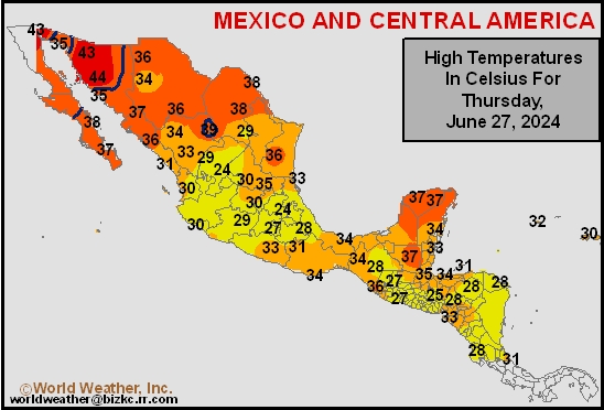
This content is for members only
Mexico Rainfall
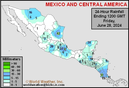
This content is for members only
Argentina Min Temperature
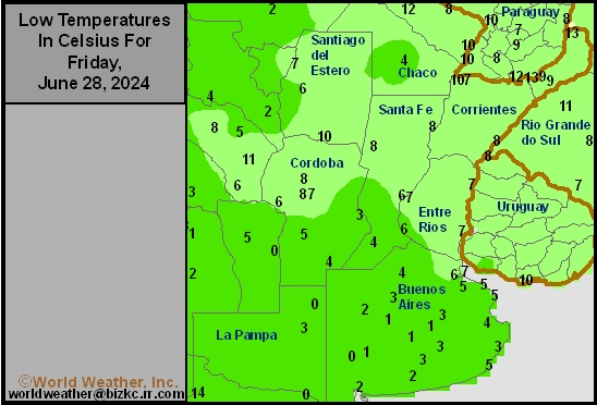
This content is for members only
Argentina Max Temperature
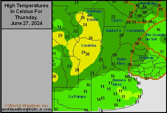
This content is for members only
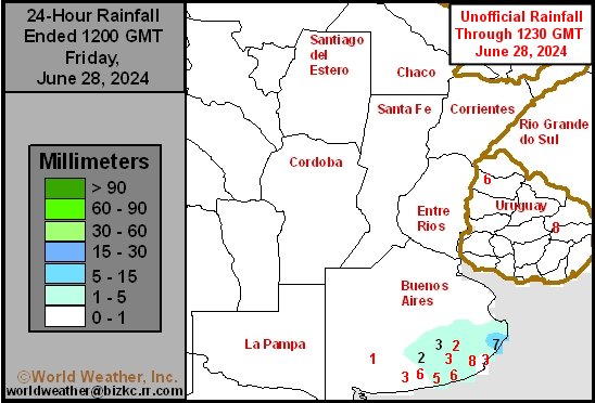
Argentina Rainfall
This content is for members only
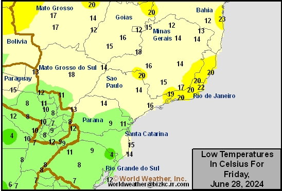
Brazil Min Temperature
This content is for members only
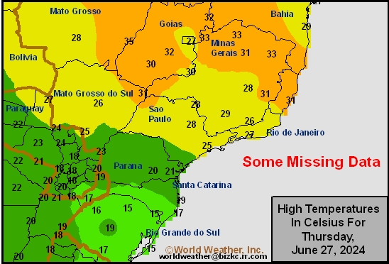
Brazil Max Temperature
This content is for members only
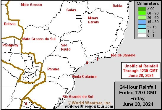
Brazil Rainfall
This content is for members only
Philippines Min
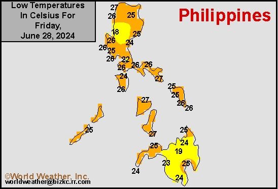
This content is for members only
Philippines Max
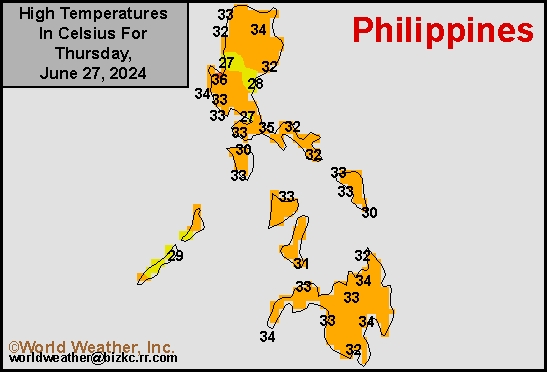
This content is for members only
Philippines Rain
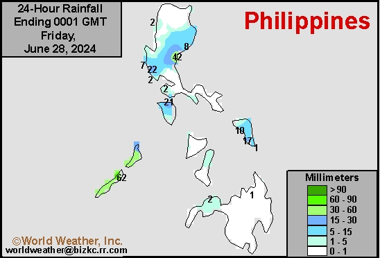
This content is for members only
Southeast North Rain
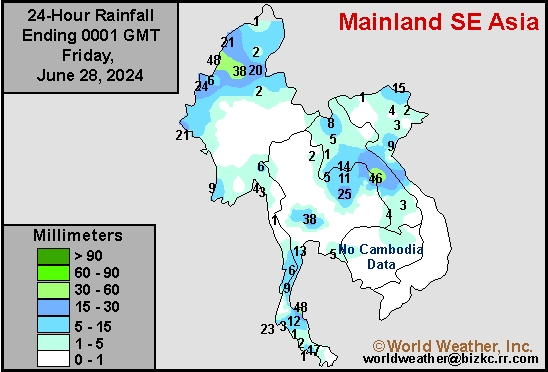
This content is for members only
Southeast North Min
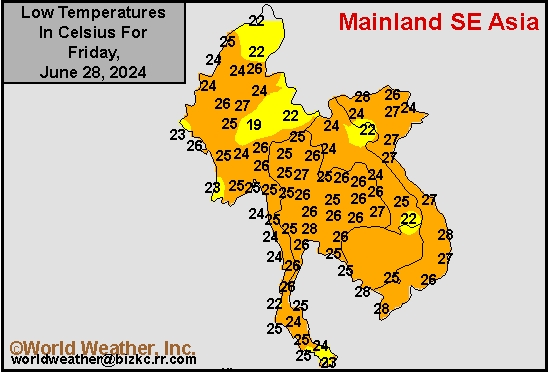
This content is for members only
Southeast North Max
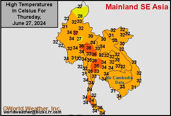
This content is for members only
Southeast Min
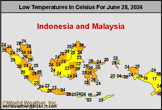
This content is for members only
Southeast Max
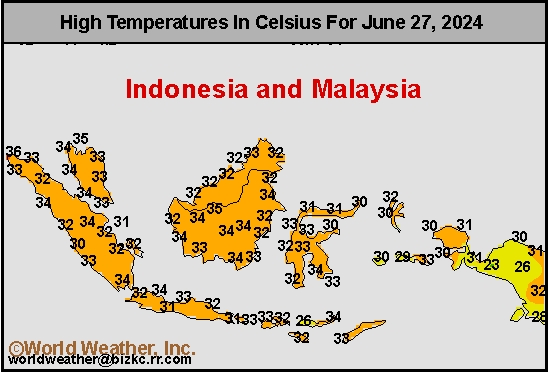
This content is for members only
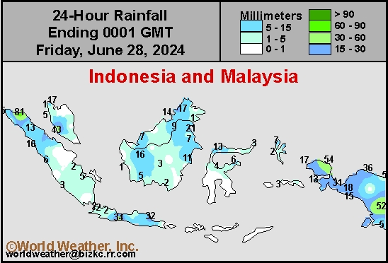
Southeast Rain
This content is for members only
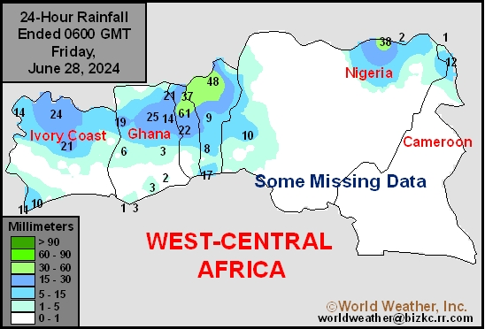
West Africa Rain
This content is for members only
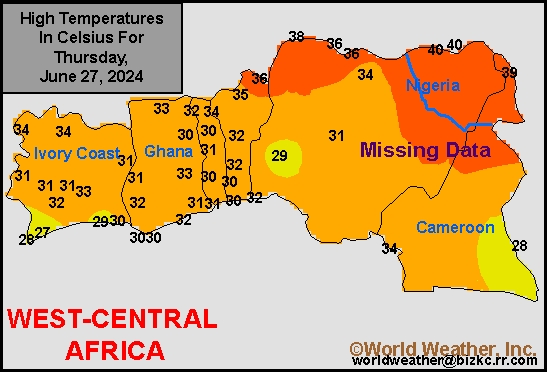
Max Temperature
This content is for members only
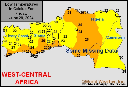
Min Temperature
This content is for members only
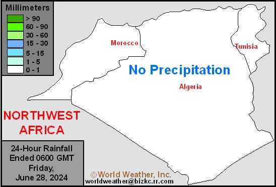
North Africa Rain
This content is for members only
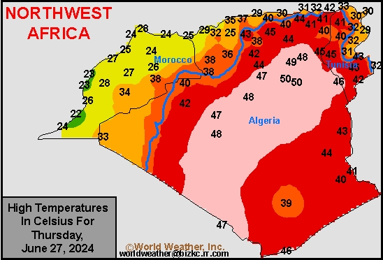
Max Temperature
This content is for members only
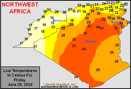
Min Temperature
This content is for members only
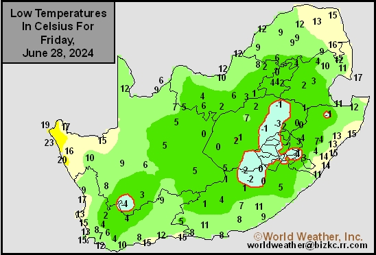
Min Temperature
This content is for members only
Max Temperature
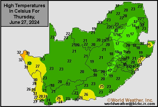
This content is for members only
South Africa Rain
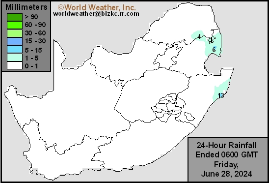
This content is for members only
Hard Red Wheat Tmin
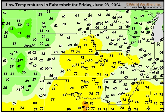
This content is for members only
Northeast Tmin
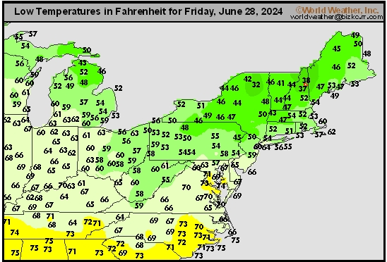
This content is for members only
Southwest Tmin
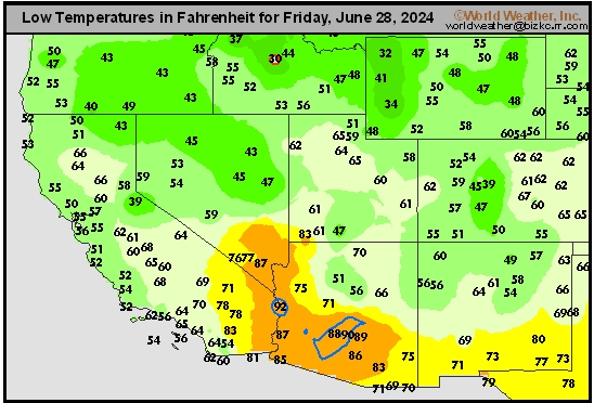
This content is for members only
Northwest Tmin
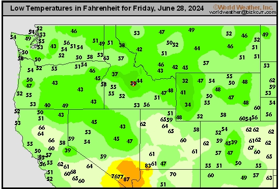
This content is for members only
South Plains Tmin
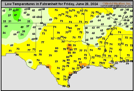
This content is for members only
Delta/SE U.S. Tmin
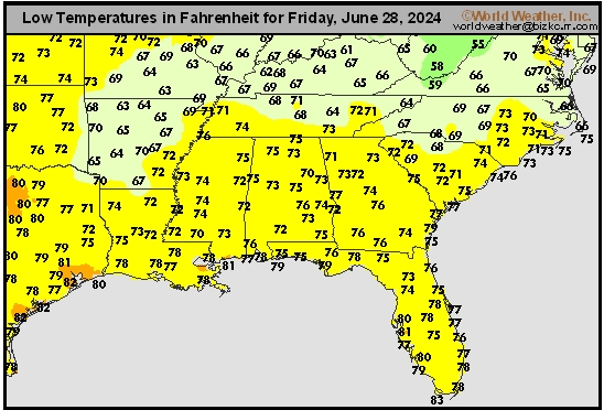
This content is for members only