
Philippines Rain
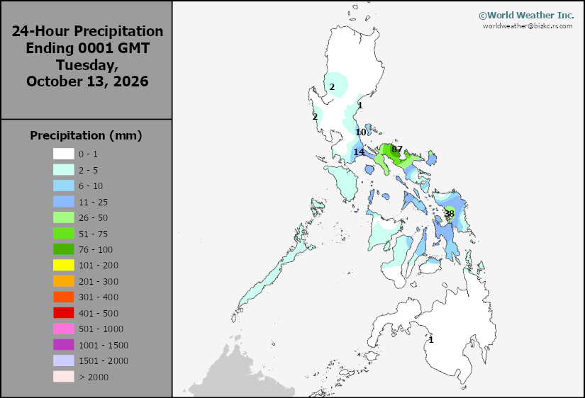
This content is for members only
Southeast North Rain
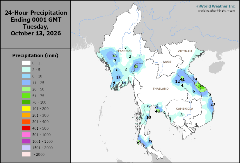
This content is for members only
Southeast North Min
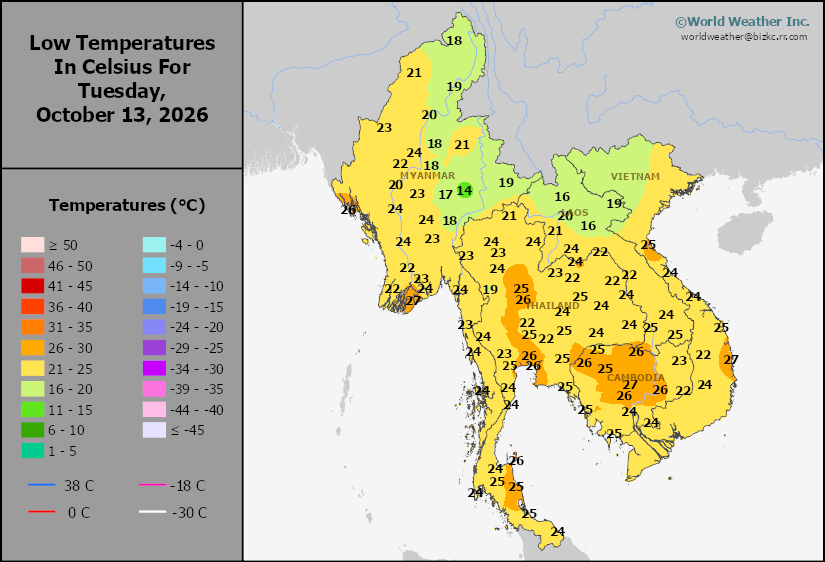
This content is for members only
Southeast North Max
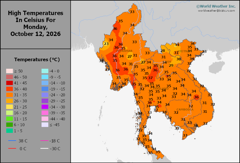
This content is for members only
Southeast Min
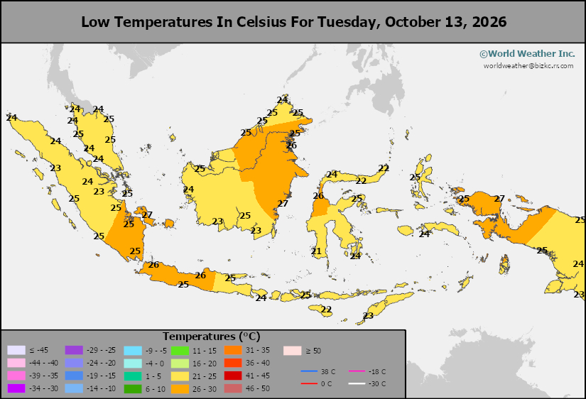
This content is for members only
Southeast Max
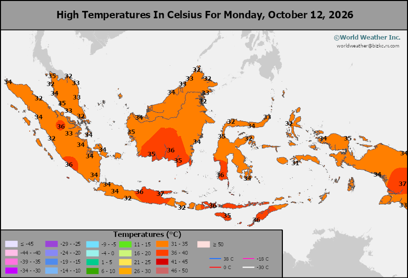
This content is for members only
Southeast Rain
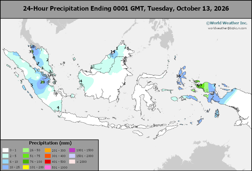
This content is for members only
West Africa Rain
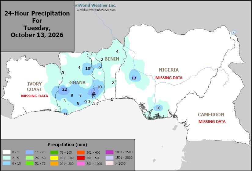
This content is for members only
Max Temperature
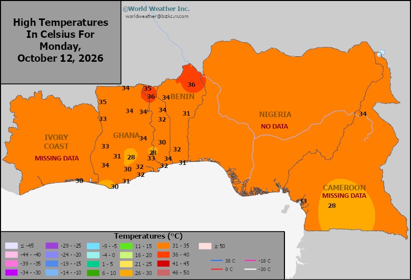
This content is for members only
Min Temperature
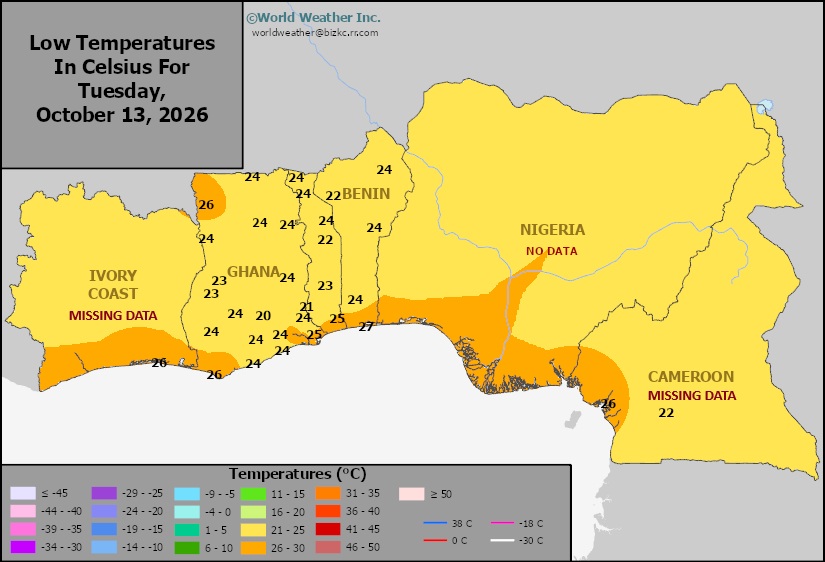
This content is for members only
North Africa Rain
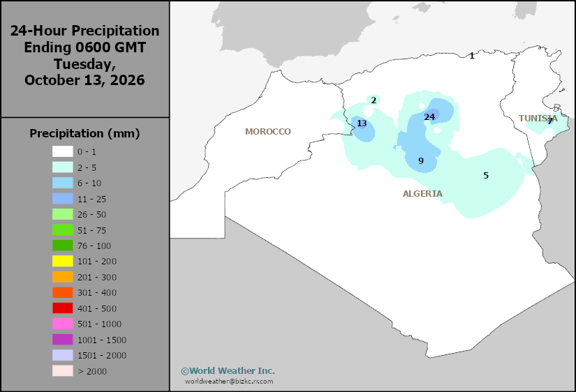
This content is for members only
Max Temperature
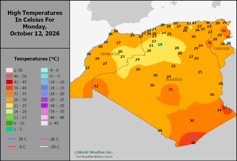
This content is for members only
Min Temperature
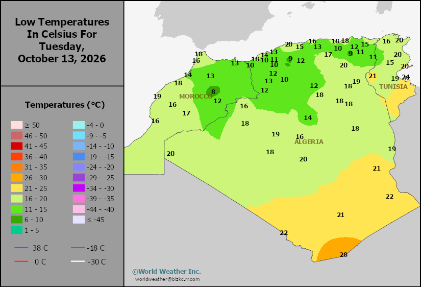
This content is for members only
Min Temperature
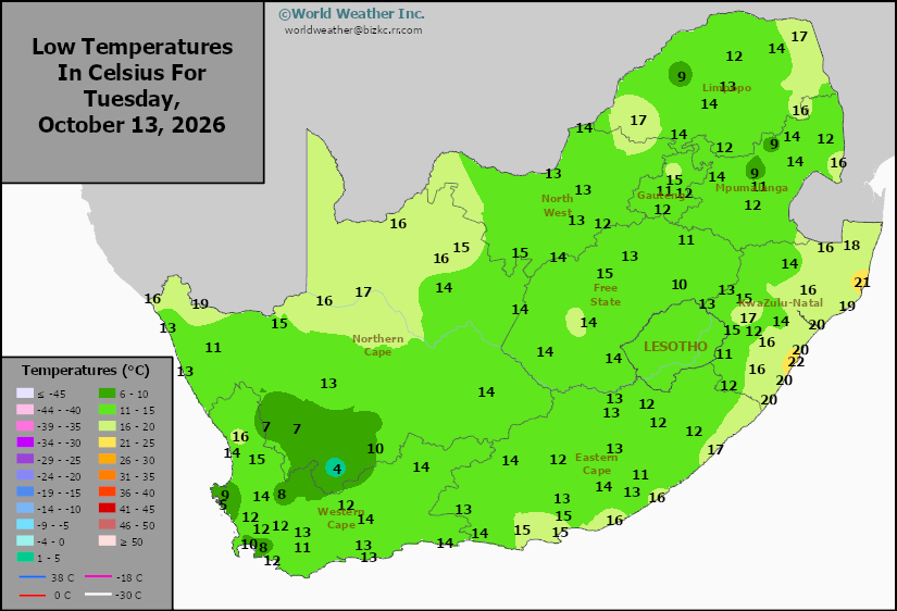
This content is for members only
Max Temperature
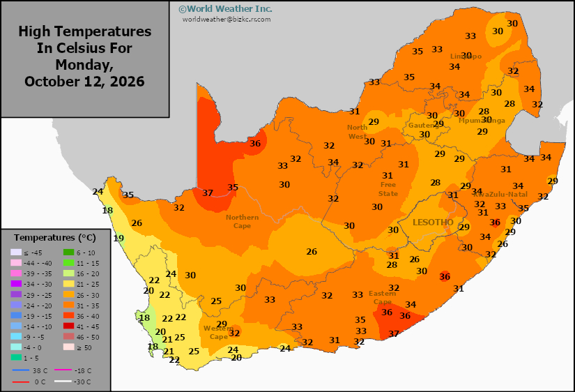
This content is for members only
South Africa Rain
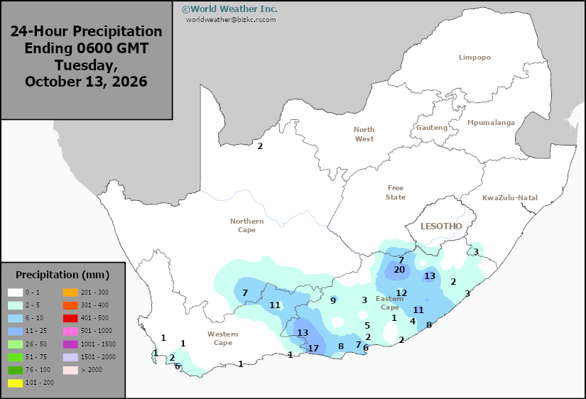
This content is for members only
Hard Red Wheat Tmin
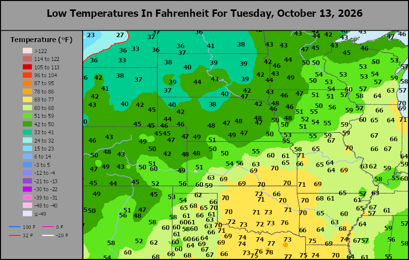
This content is for members only
Northeast Tmin
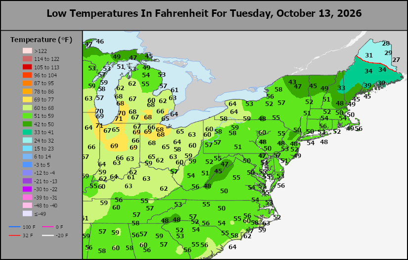
This content is for members only
Southwest Tmin
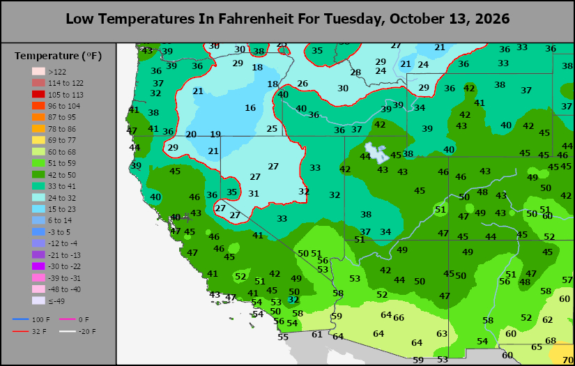
This content is for members only
Northwest Tmin
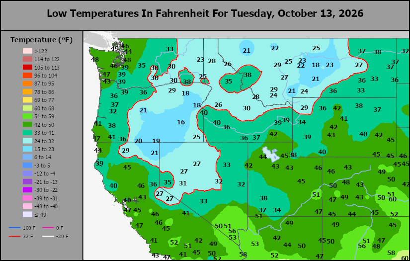
This content is for members only
South Plains Tmin
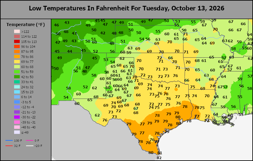
This content is for members only
Delta/SE U.S. Tmin
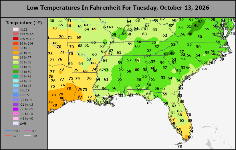
This content is for members only
Corn Belt Tmin
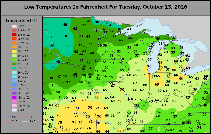
This content is for members only
US Min
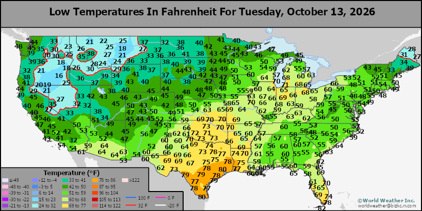
This content is for members only
North Plains Tmin
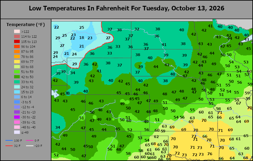
This content is for members only
Hard Red Wheat Tmax
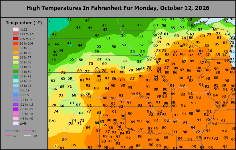
This content is for members only
Northeast Tmax
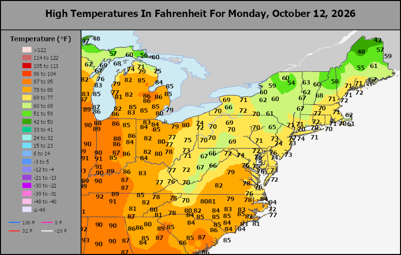
This content is for members only
Southwest Tmax
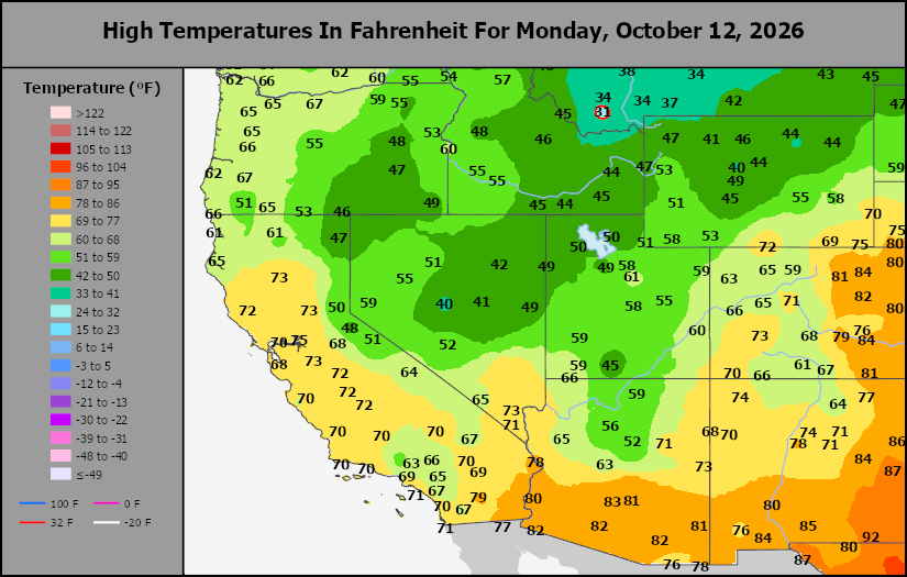
This content is for members only
Northwest Tmax
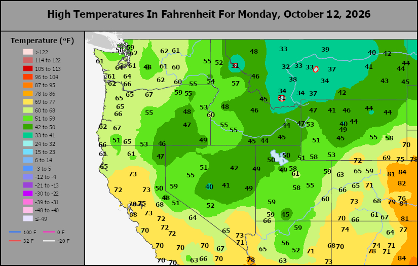
This content is for members only
South Plains Tmax
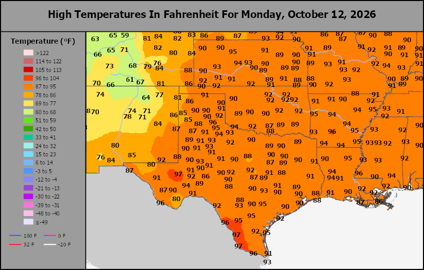
This content is for members only
Delta/SE U.S. Tmax
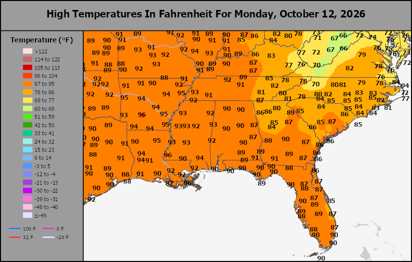
This content is for members only
Corn Belt Tmax
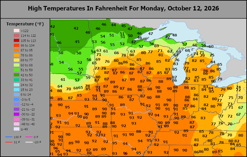
This content is for members only
North Plains Tmax
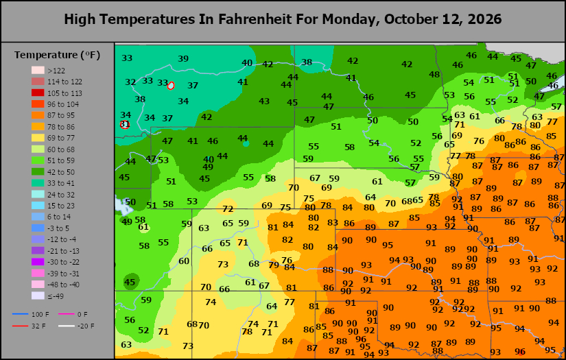
This content is for members only
US Max
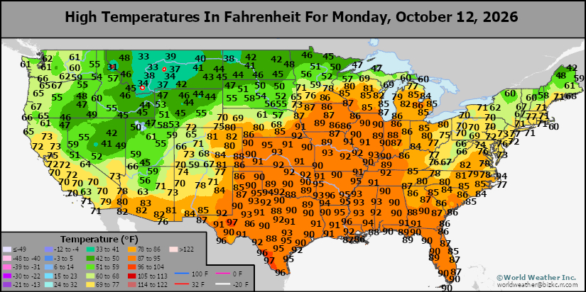
This content is for members only
US Rain
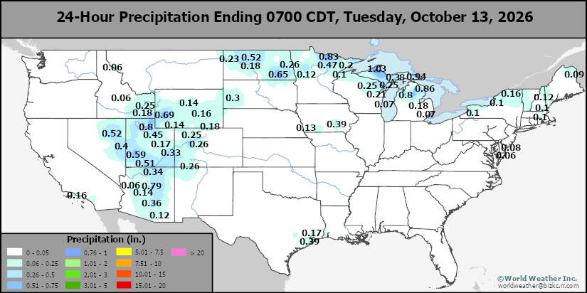
This content is for members only
Northeast Daily Rain
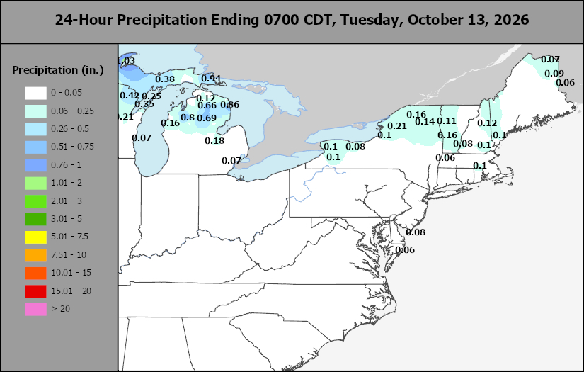
This content is for members only
Hard Red Wheat Daily Rain
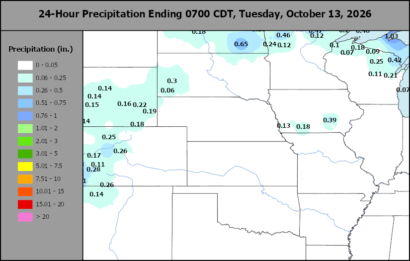
This content is for members only
Southwest Daily Rain
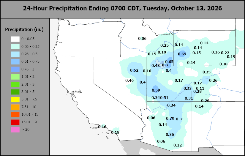
This content is for members only
Northwest Daily Rain
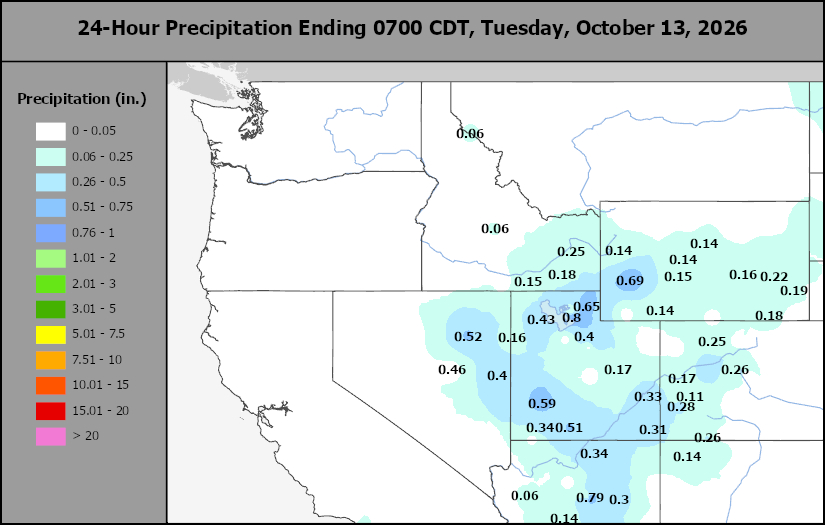
This content is for members only
South Plains Daily Rain
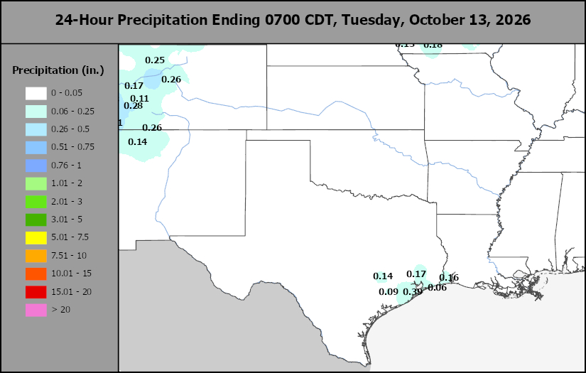
This content is for members only
Delta/SE U.S. Daily Rain
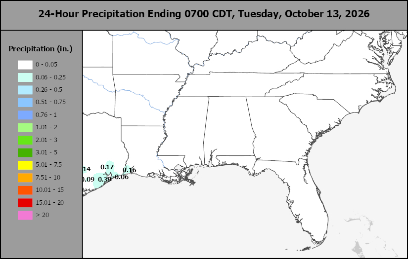
This content is for members only
Corn Belt Daily Rain
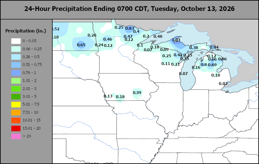
This content is for members only
North Plains Daily Rain
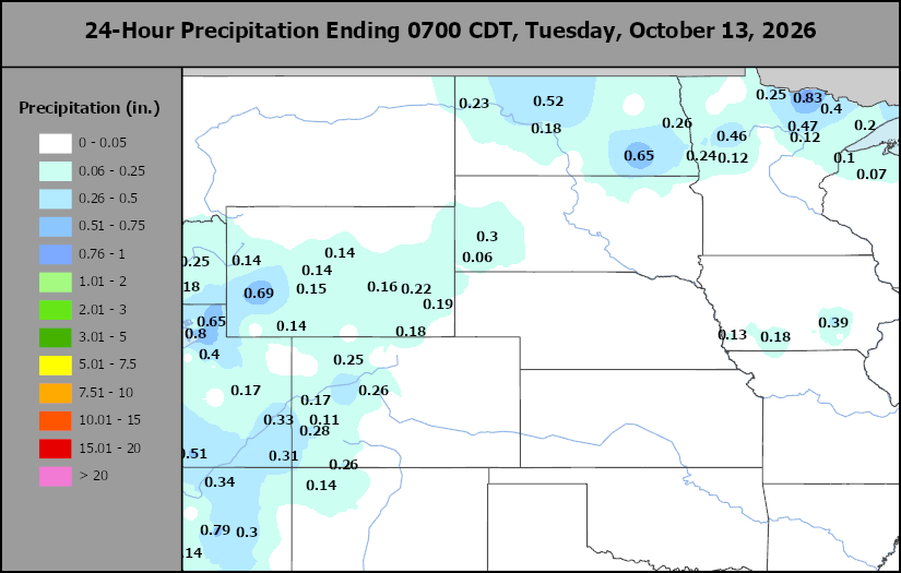
This content is for members only
Low Temperature
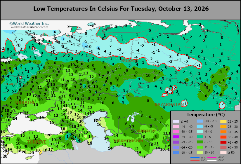
This content is for members only
High Temperature
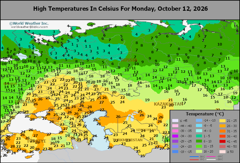
This content is for members only
CIS Rainfall
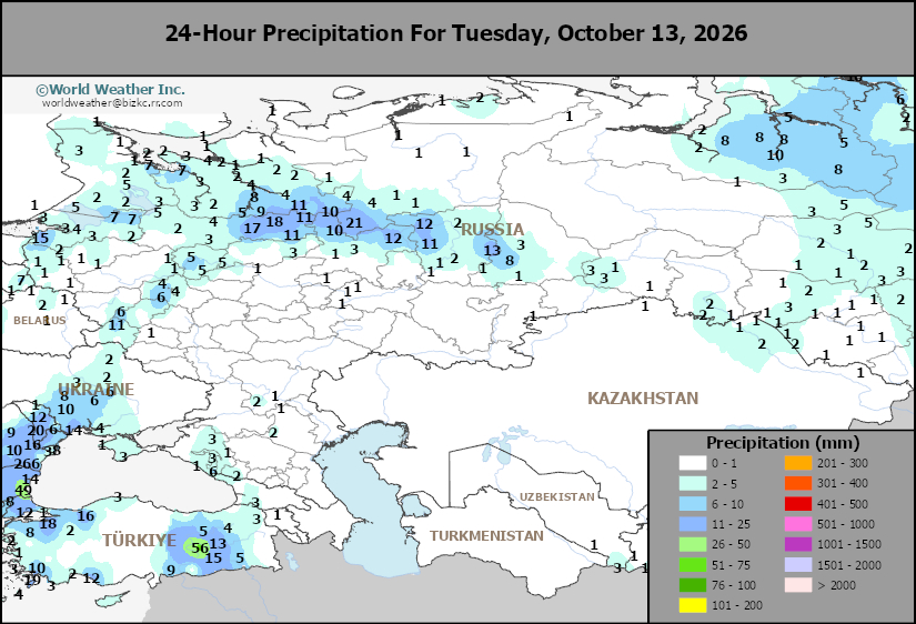
This content is for members only
Low Temperature
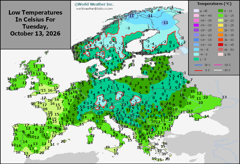
This content is for members only
High Temperature
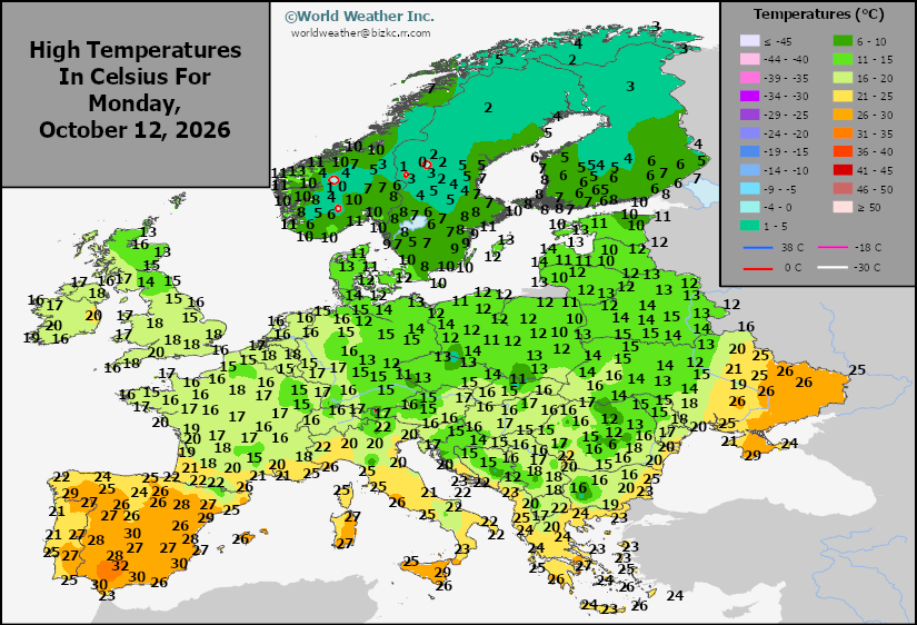
This content is for members only
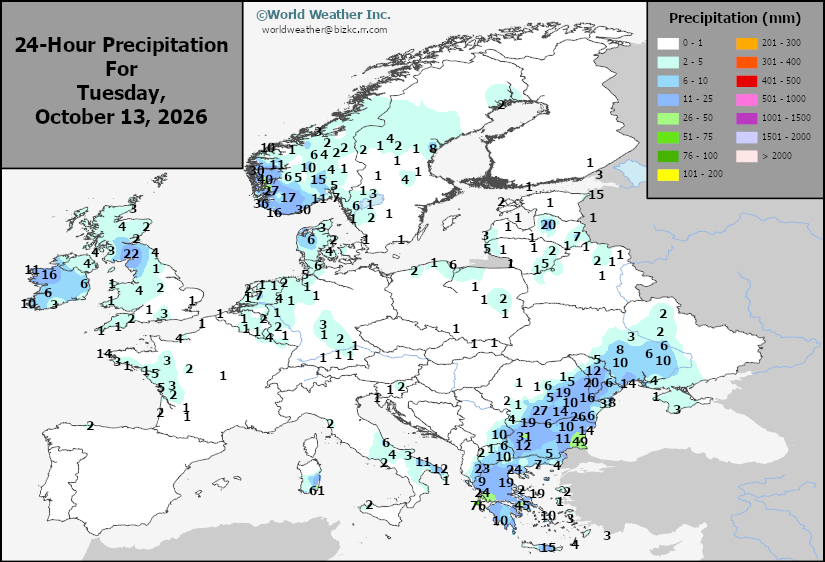
Europe Rainfall
This content is for members only
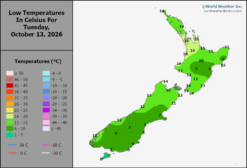
Low Temperature
This content is for members only
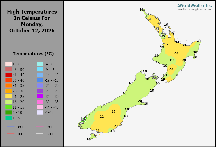
High Temperature
This content is for members only
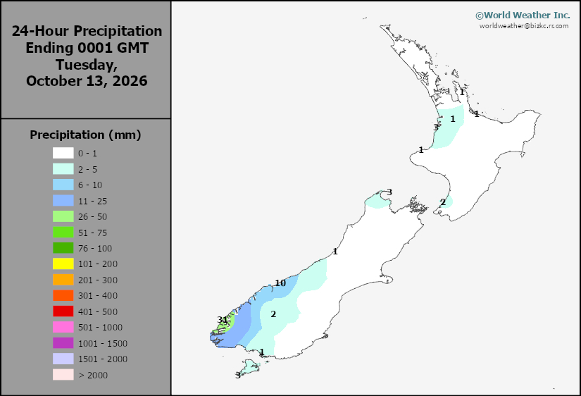
New Zealand Rainfall
This content is for members only
Low Temperature
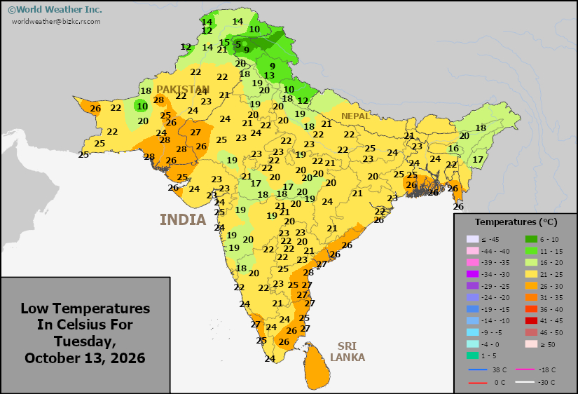
This content is for members only
High Temperature
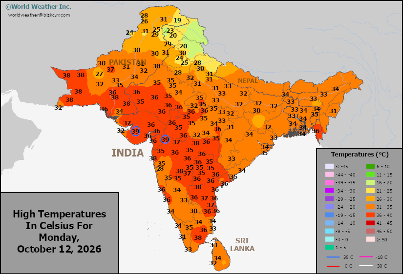
This content is for members only
India Rainfall
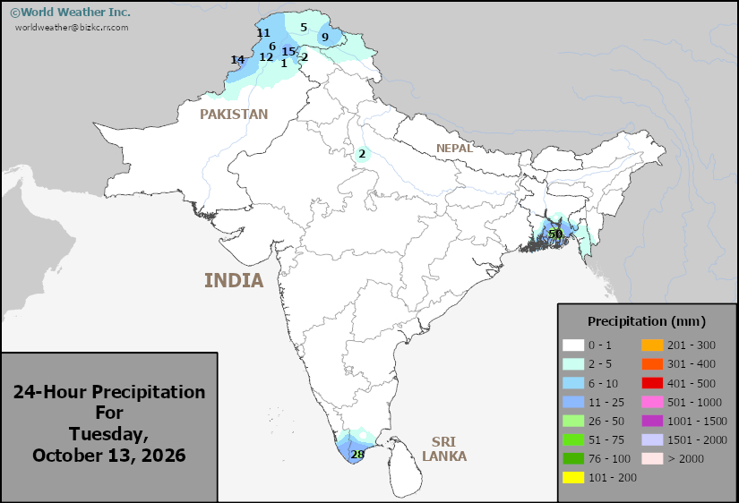
This content is for members only
Low Temperature
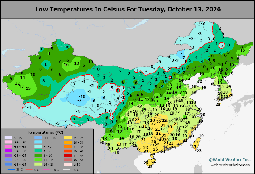
This content is for members only
Japan Rainfall
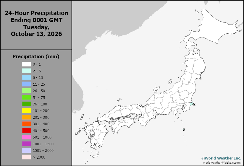
This content is for members only
Low Temperature
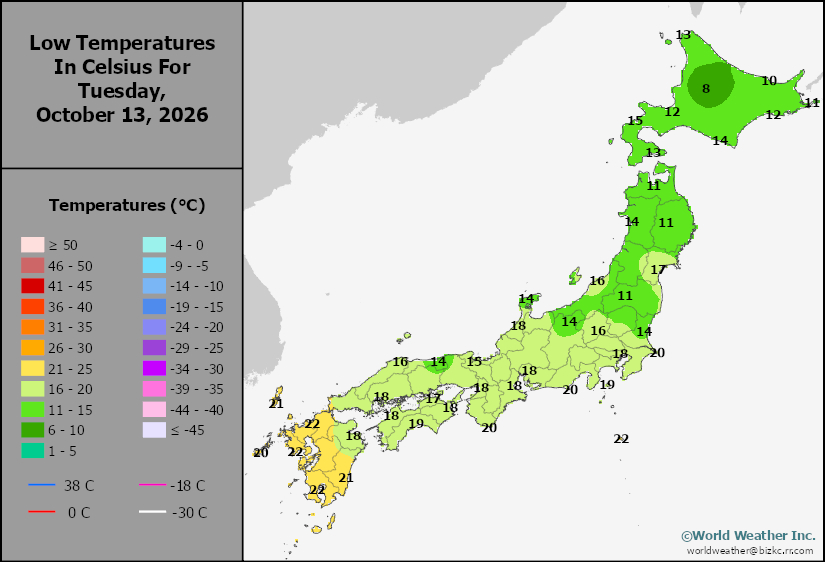
This content is for members only
High Temperature
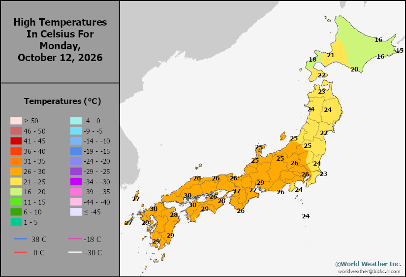
This content is for members only
High Temperature
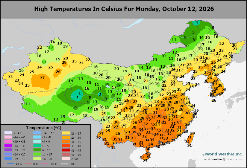
This content is for members only
China Rainfall
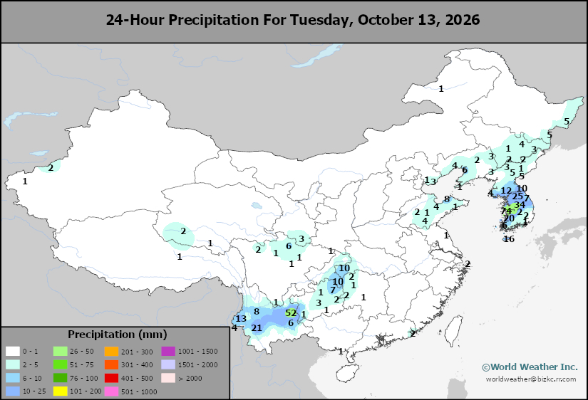
This content is for members only
Low Temperature
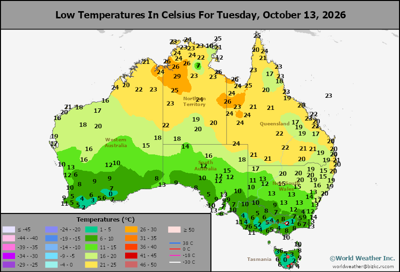
This content is for members only
High Temperature
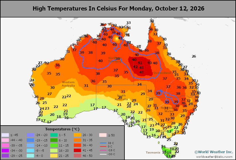
This content is for members only
Austrailia Rainfall
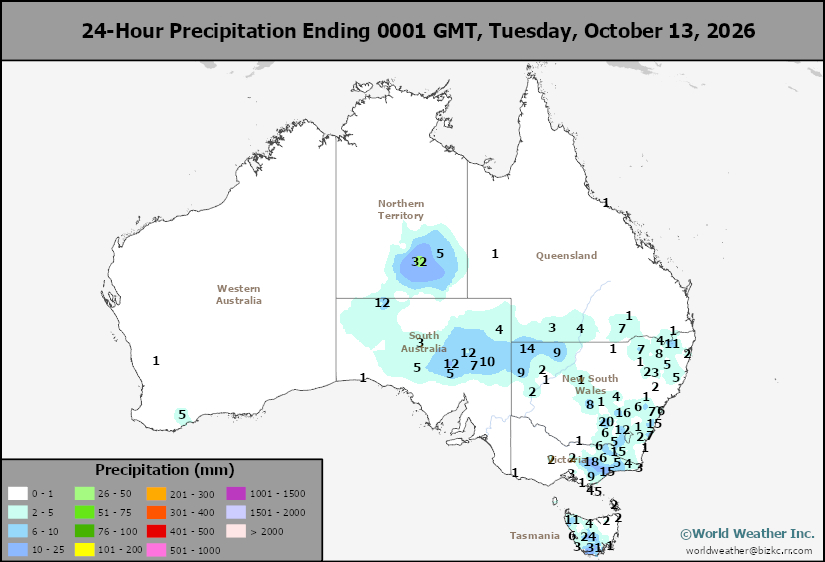
This content is for members only
Weekly Citrus Weather For Tuesday, October 13, 2026
Kansas City, October 13 (World Weather Inc.) – Florida’s citrus region received significant amounts of rain during the past week. With more rain on the way during the coming week, the ground will remain saturated in much of the main citrus areas. Late-season development conditions will remain favorable. Mexico’s citrus areas also saw waves of rain during the past week with heavy rain noted in Veracruz and immediate neighboring areas. Precipitation in the coming week will be enough to maintain aggressive citrus growth. Brazil’s citrus areas will also see a good mix of rain and sunshine during the coming week that will be welcome for fruit setting and general development.
U.S. Midwest Corn, Soybean Harvest Will Be Impacted By Rain
Kansas City, October 13 (World Weather Inc.) – Harvest conditions were relatively favorable for much of the U.S. Midwest during the past ten days. Dry weather or limited precipitation combined with periods of warmer than usual weather helped producers get into the fields aggressively after several locations were wetter than usual in September. Several weeks of good weather are still needed to wrap up the harvest under favorable conditions. Harvest prospects will deteriorate later today into Thursday as remnant moisture from Hurricane Simon begins to stream into the region from Mexico and the southern Plains at the same time as a cold front. Rain will spread across a large section of the Corn and Soybean Belt and will likely slow or delay the harvest. Drier weather will evolve over the weekend and early next week, though the wettest areas may need a day or two of drier weather before producers are able to re-enter the fields. Quality impacts should be minimal. There will be more rain coming into the region next week as well.
NOAA ENSO Model Falsely Suggests El Nino Has Peaked
Kansas City, October 13 (World Weather Inc.) – The U.S. National Oceanic and Atmospheric Administration’s (NOAA) ENSO forecast model (CFSv2) has been suggesting in recent model runs that this year’s very strong to “super” El Nino may have peaked recently and is expected to weaken through the winter. This prediction is not supported by Ocean surface or subsurface temperature anomalies, nor is there much support in other parameters to suggest the event has peaked and will be weakening over the next few weeks. The Australia Bureau of Meteorology has its own ENSO model and it suggests the El Nino event will be peaking in November or early December, not now. The Australian Bureau of Meteorology suggested that there is not much reason to anticipate any sustainable weakening for another several weeks.
Subsoil Moisture
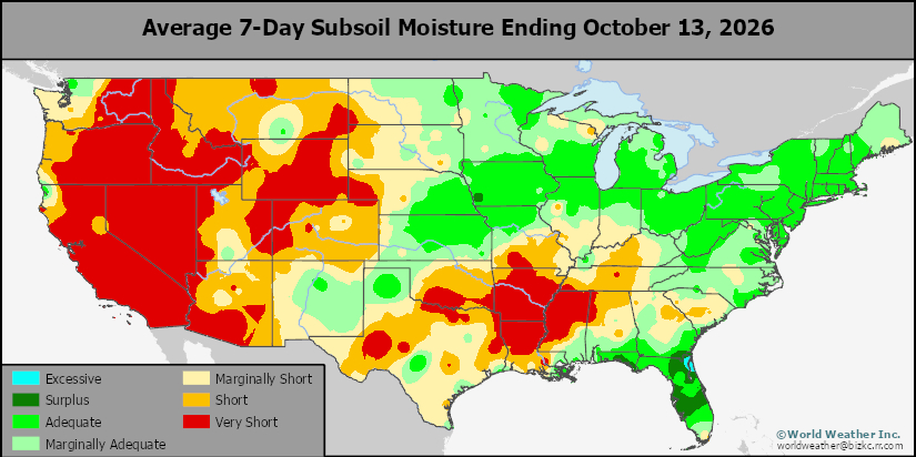
This content is for members only
Topsoil Moisture
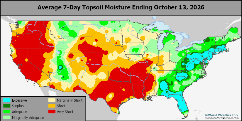
This content is for members only
Subsoil Moisture
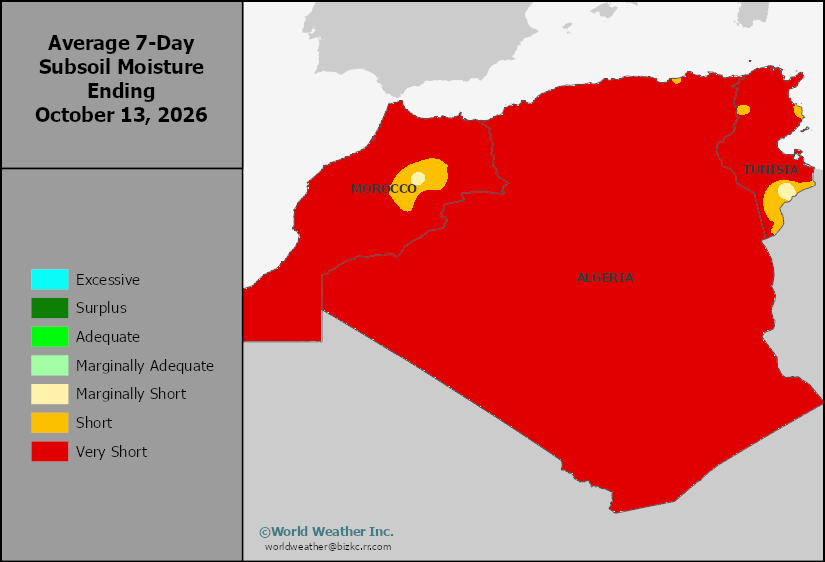
This content is for members only
Topsoil Moisture
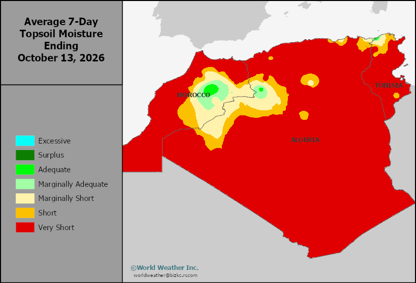
This content is for members only
Subsoil Moisture
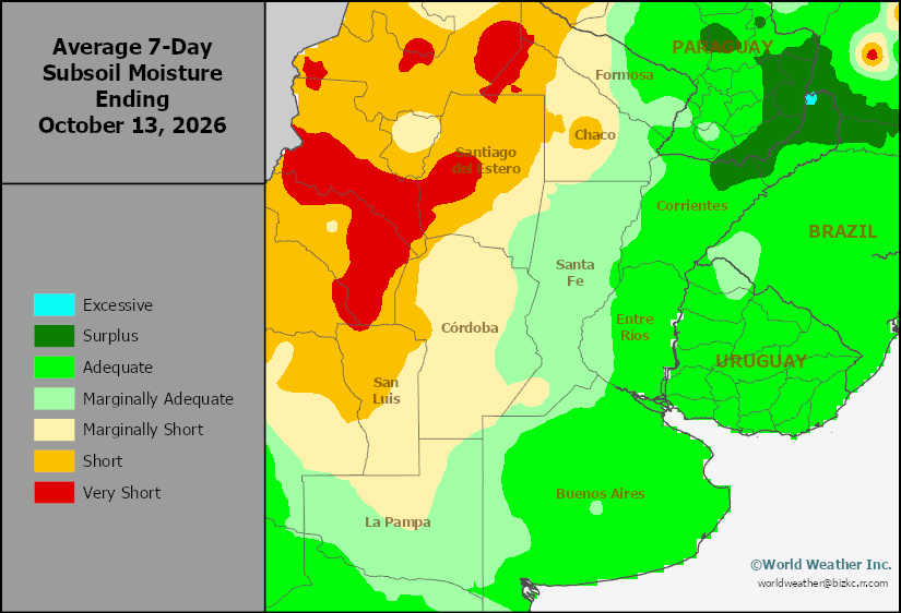
This content is for members only
Topsoil Moisture
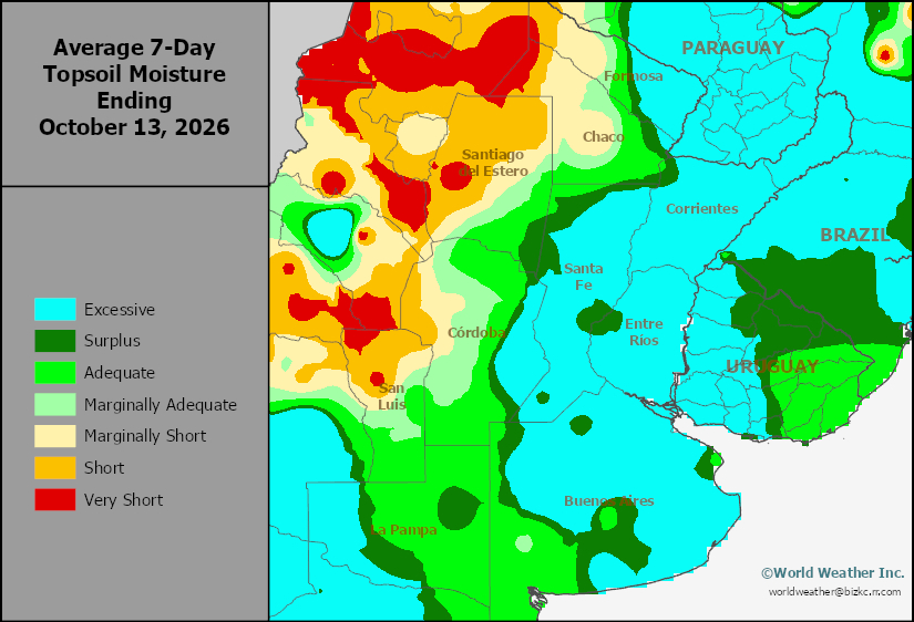
This content is for members only
Subsoil Moisture
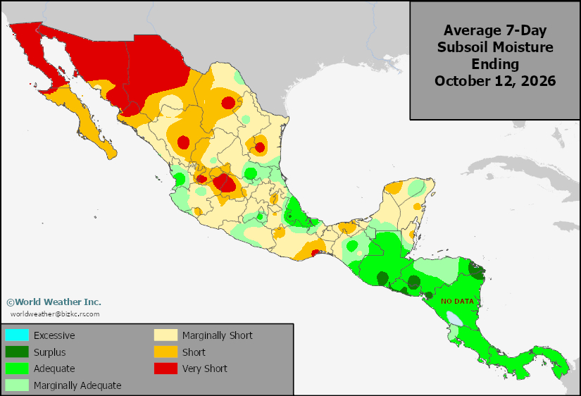
This content is for members only
Topsoil Moisture
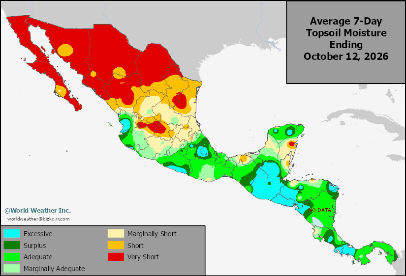
This content is for members only
Subsoil Moisture
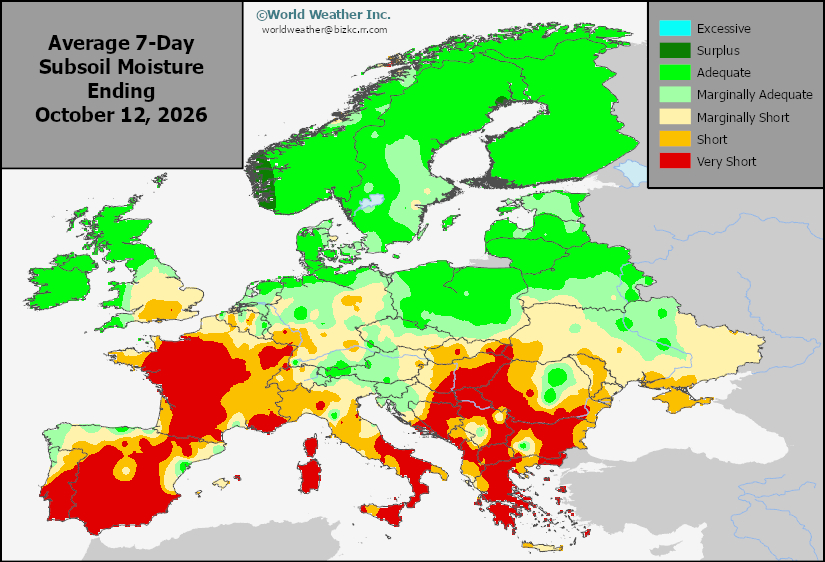
This content is for members only
Topsoil Moisture
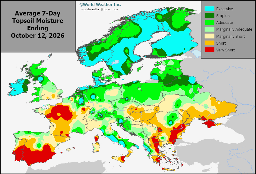
This content is for members only
Subsoil Moisture
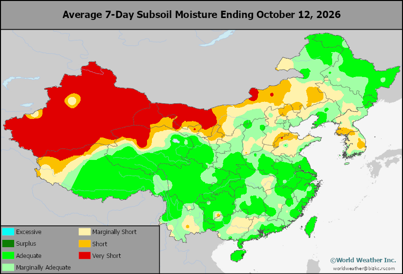
This content is for members only
Topsoil Moisture
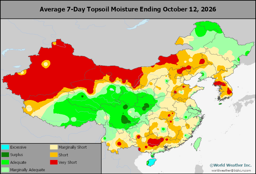
This content is for members only
Subsoil Moisture
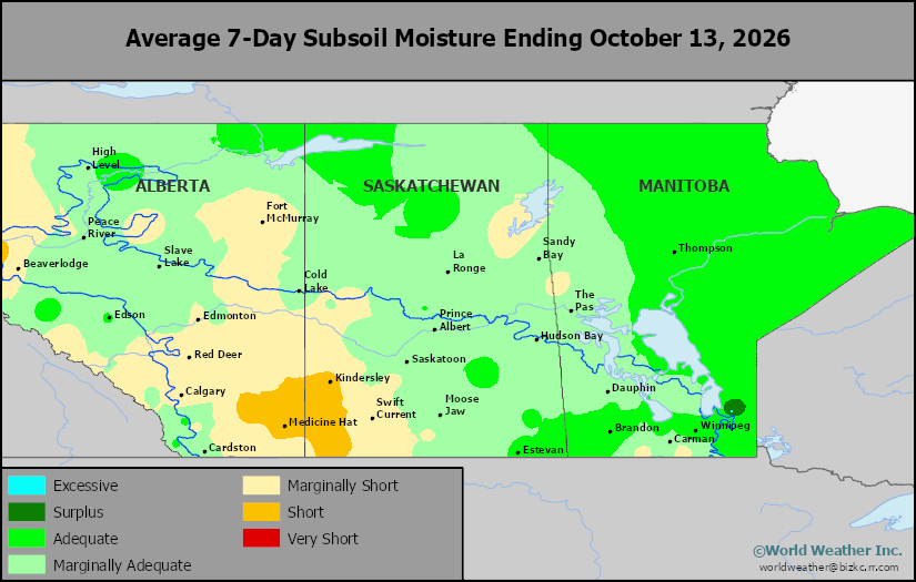
This content is for members only
Topsoil Moisture
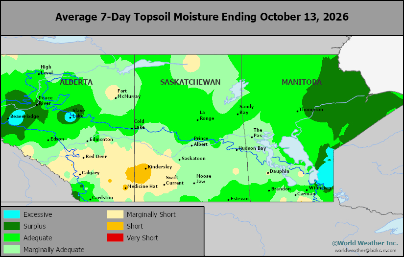
This content is for members only
Subsoil Moisture
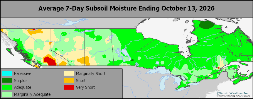
This content is for members only
Topsoil Moisture
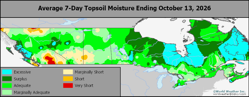
This content is for members only
Subsoil Moisture
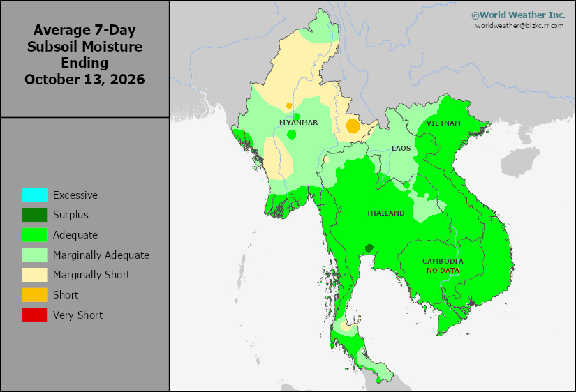
This content is for members only
Topsoil Moisture
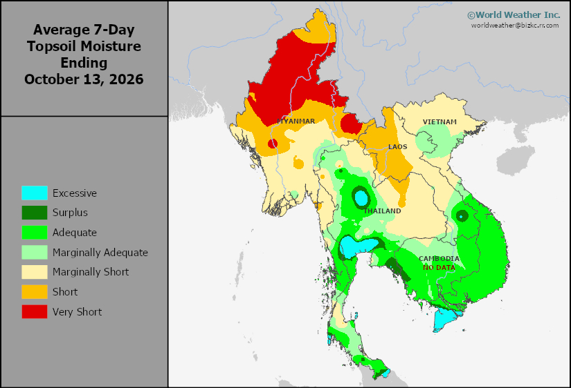
This content is for members only
Subsoil Moisture
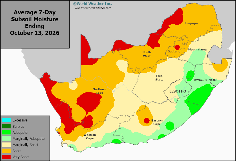
This content is for members only
Topsoil Moisture
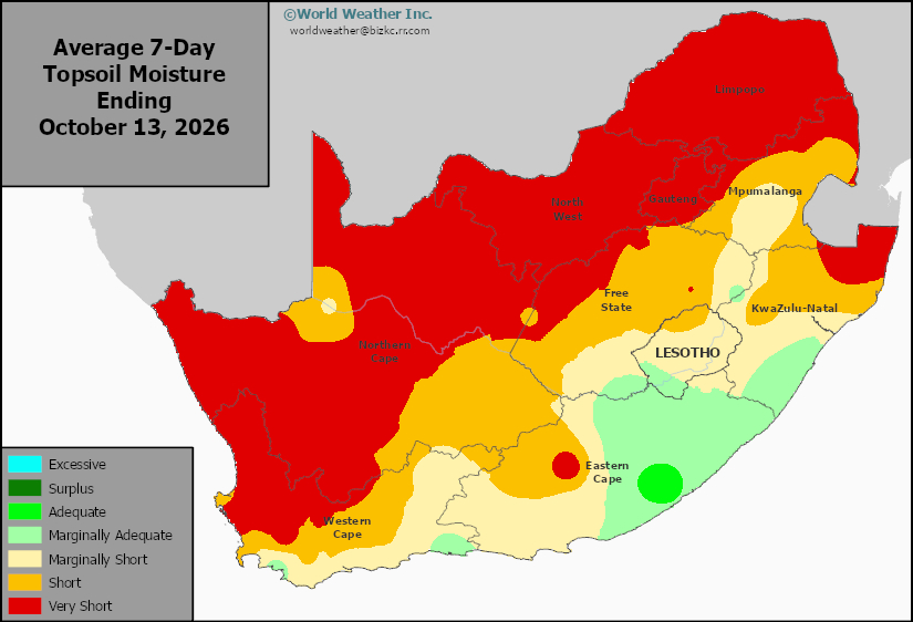
This content is for members only
Subsoil Moisture
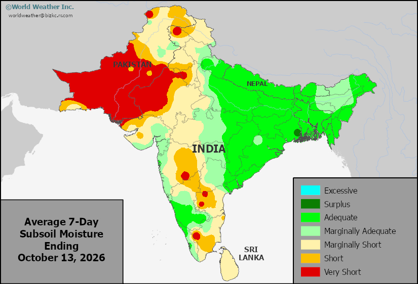
This content is for members only
Topsoil Moisture
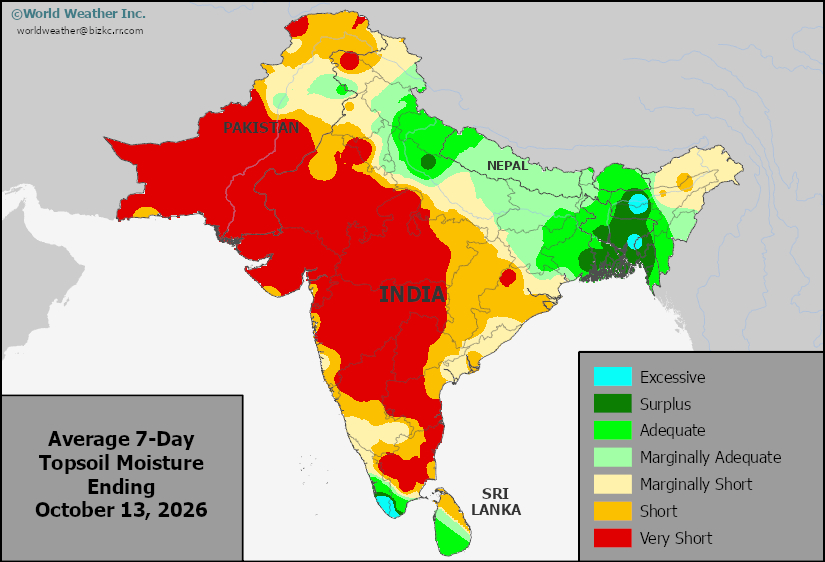
This content is for members only
Subsoil Moisture
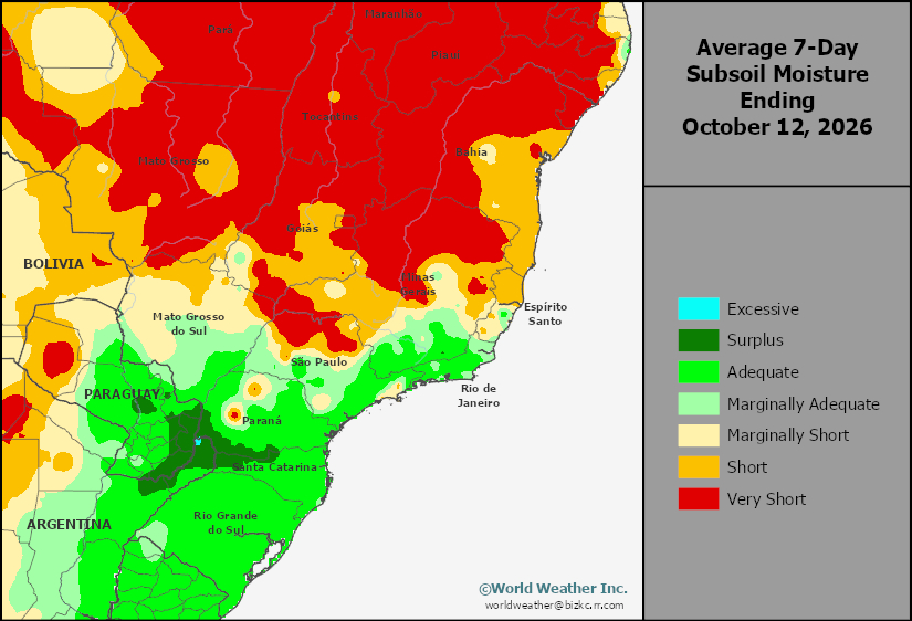
This content is for members only
Topsoil Moisture
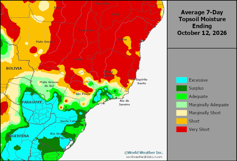
This content is for members only
Subsoil Moisture
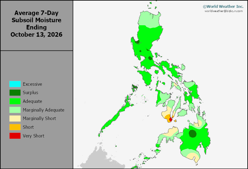
This content is for members only
Topsoil Moisture
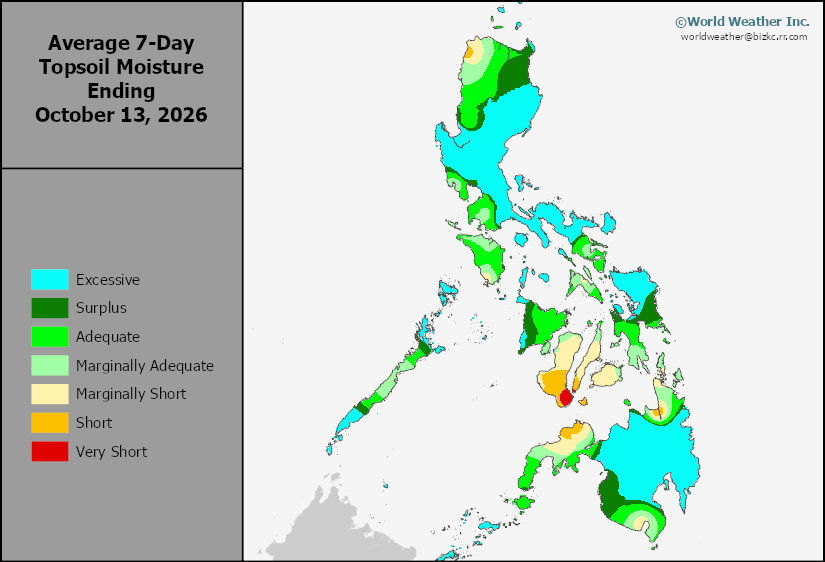
This content is for members only
Subsoil Moisture
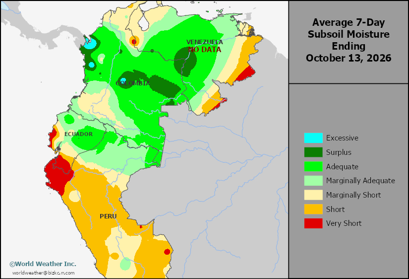
This content is for members only
Topsoil Moisture
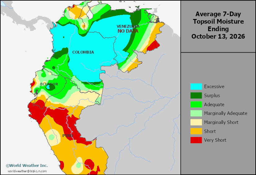
This content is for members only
Subsoil Moisture
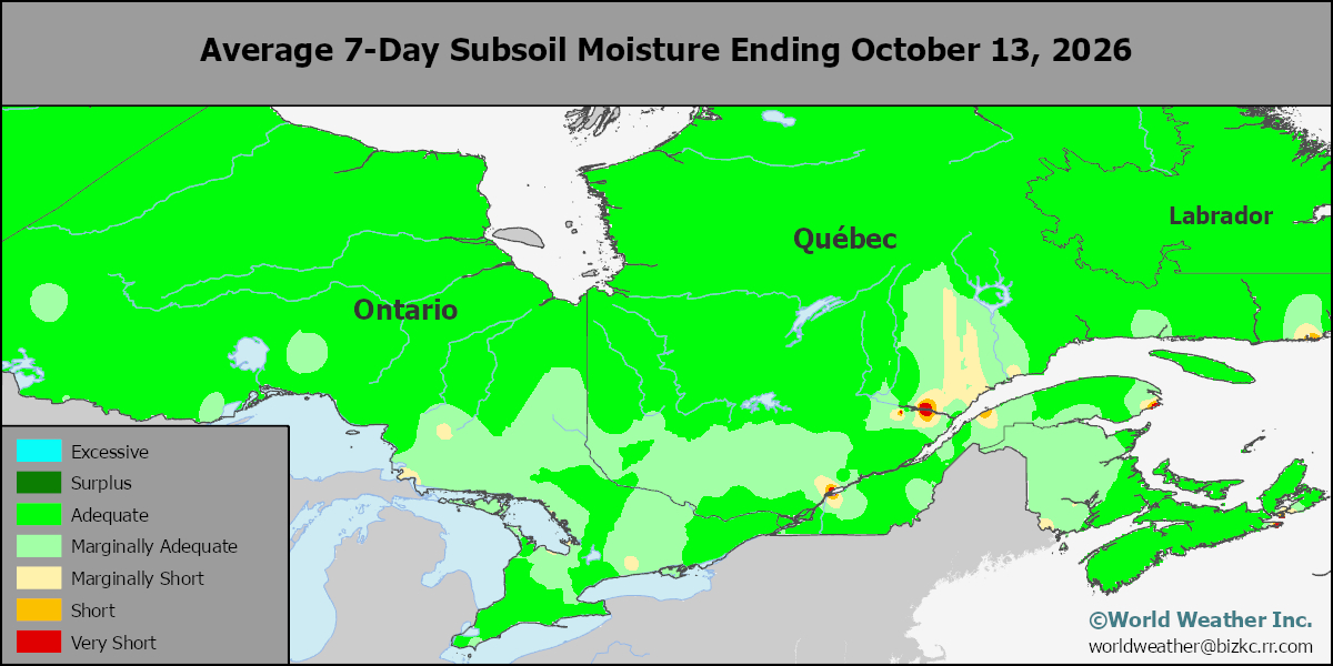
This content is for members only
Topsoil Moisture
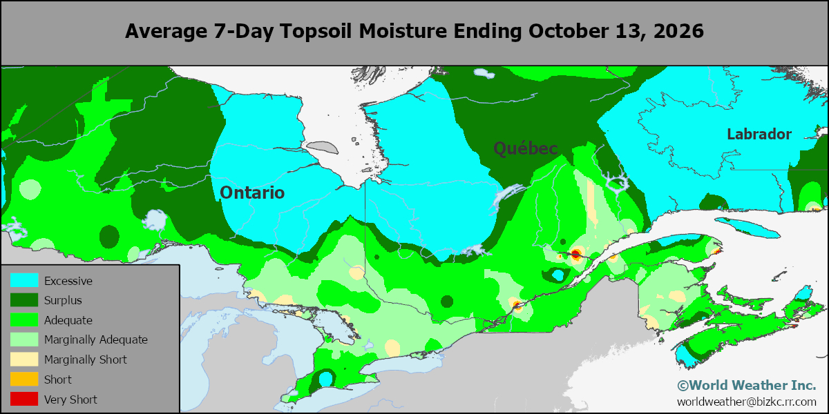
This content is for members only
Subsoil Moisture
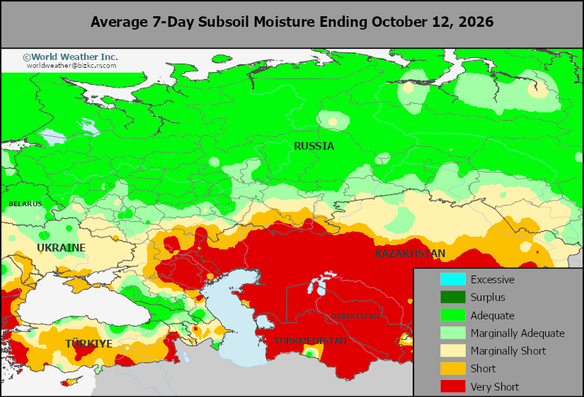
This content is for members only
Topsoil Moisture
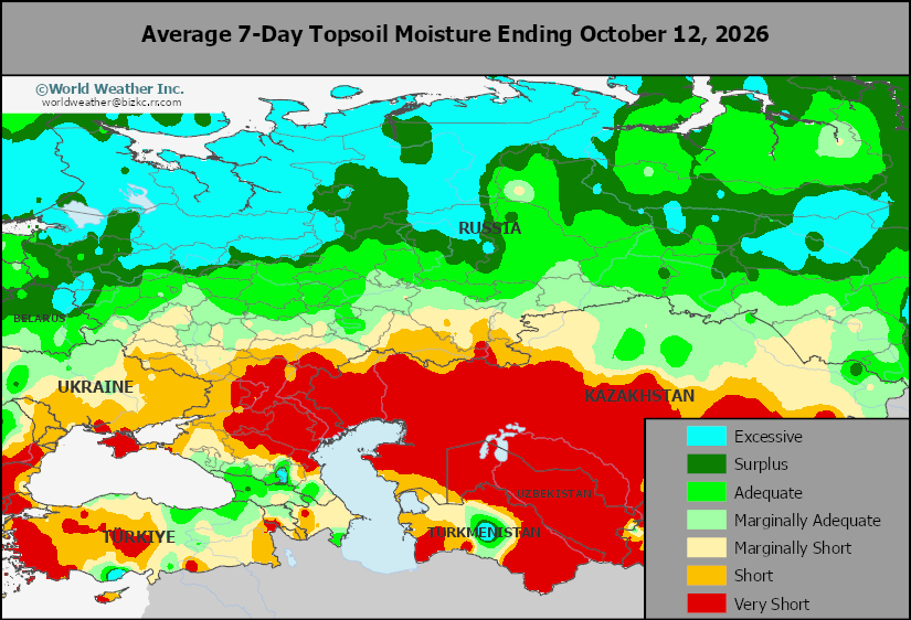
This content is for members only
Subsoil Moisture
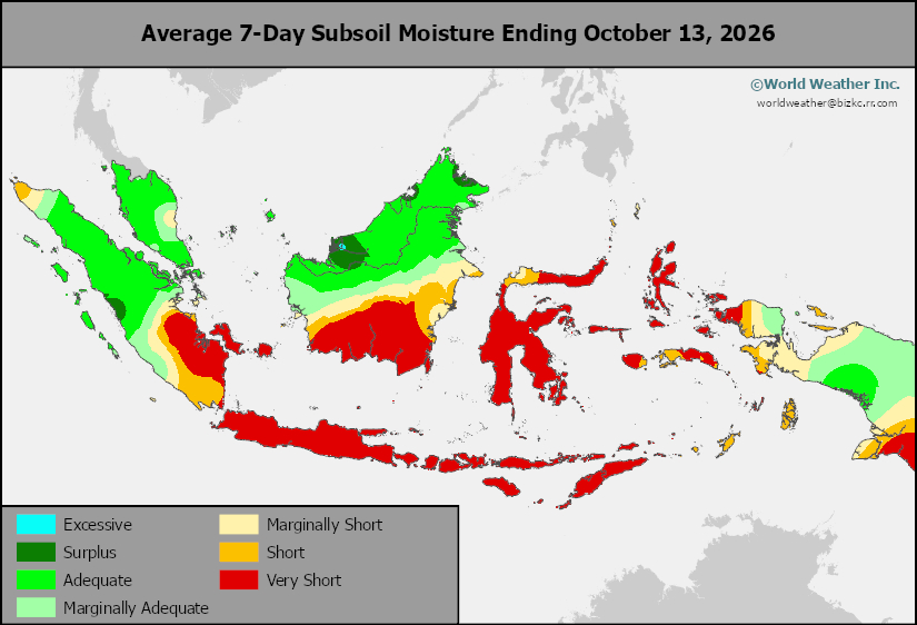
This content is for members only