
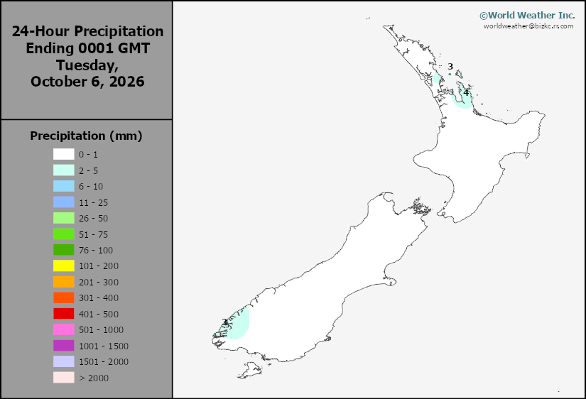
New Zealand Rainfall
This content is for members only
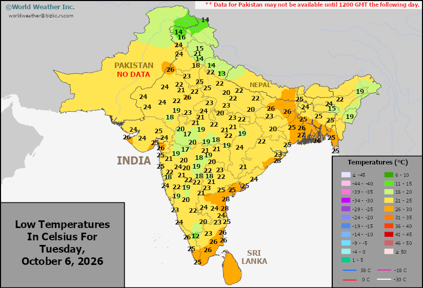
Low Temperature
This content is for members only
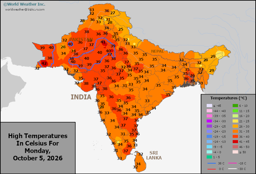
High Temperature
This content is for members only
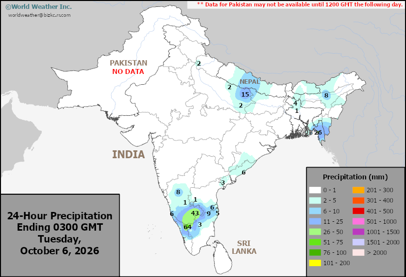
India Rainfall
This content is for members only
Low Temperature
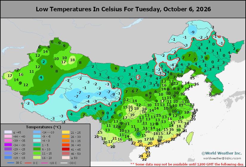
This content is for members only
Japan Rainfall
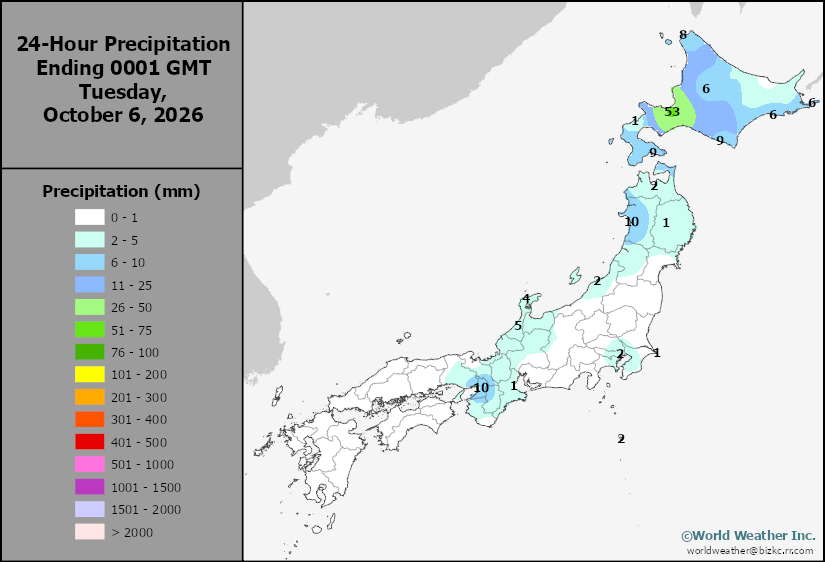
This content is for members only
Low Temperature
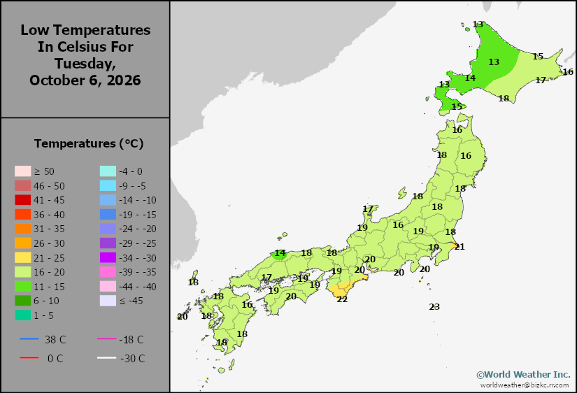
This content is for members only
High Temperature
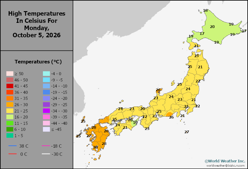
This content is for members only
High Temperature
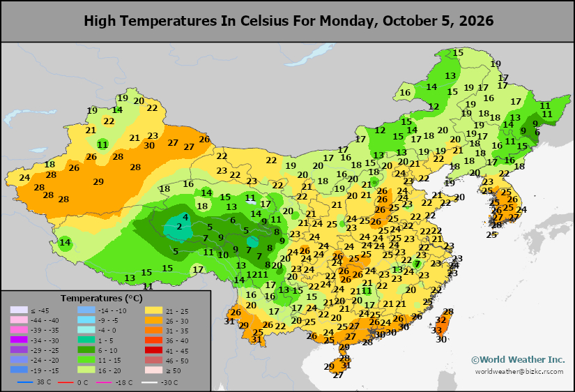
This content is for members only
China Rainfall
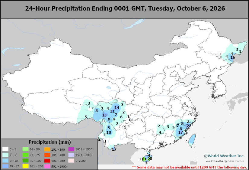
This content is for members only
Low Temperature
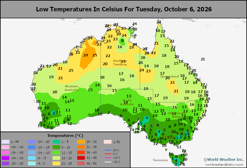
This content is for members only
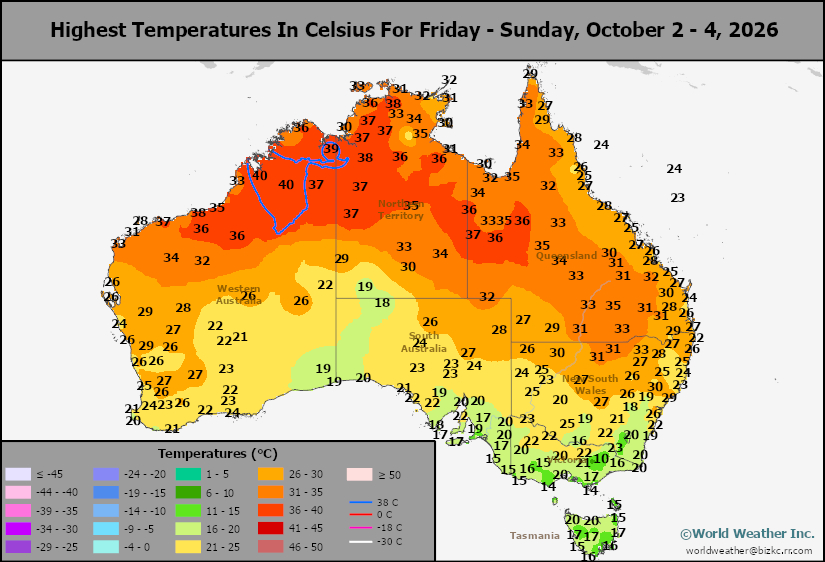
High Temperature
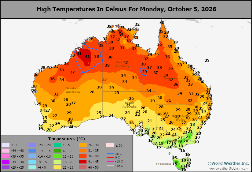
This content is for members only
Austrailia Rainfall
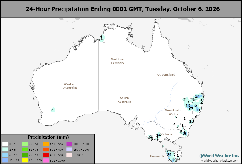
This content is for members only
Southeast U.S. Cotton, Peanut and Soybean Rain Piles Up
Kansas City, October 6 (World Weather Inc.) – Heavy rain has fallen again overnight in the southeastern corner of the United States where summer crop harvesting is on hold and there is some concern over the quality of cotton in particular. Drier weather is now expected for a few days, but a developing tropical cyclone in the western Gulf of America may move toward the Delta with landfall possible this weekend. Some of the heavy rain associated with this storm will impact these already soggy areas in Georgia, northern Florida and Alabama; however, the developing tropical cyclone should impact the Delta more directly than the southeastern states possibly sparing the already wettest areas from additional impact from excessive rain.
U.S. Delta, Southeast May See Harvest Impacts This Weekend
Kansas City, October 5 (World Weather Inc.) – A slow-moving frontal boundary will promote rain for portions of southern Georgia, northern Florida, and immediate neighboring areas during the next few days. Other locations in the U.S. southeast and Delta will see favorable harvest conditions through Friday. During this time, a disturbance will slowly form over the western Gulf of America. This disturbance could slowly meander toward the U.S. southeast and promote erratic rainfall for portions of the Delta and southeastern states’ main production areas this weekend and early next week. Some cotton quality declines will be possible if the rain verifies. Other crops will experience harvest delays and may be a minor quality issue for soybeans and peanuts.
Canadian Prairies Harvest May Be Impacted By Rain, Snow
Kansas City, October 5 (World Weather Inc.) – Harvest conditions across the Canadian Prairies improved during the past week as warmer and drier weather took hold across the region. The short period of drier and warmer weather allowed for significant drying and more aggressive harvesting and general fieldwork. Overall harvest progress remains behind the usual pace due to the wet weather earlier in the autumn and there is a pressing need for a continuation in the warm and dry bias. Short-term harvest conditions will remain favorable through mid-week despite some light and erratic rain. A stronger disturbance is set to advance over the Prairies late Thursday into Saturday that will promote more widespread precipitation. Accumulating snow is likely in portions of Alberta and northeastern British Columbia, which could once again slow or delay the harvest. Conditions will once again improve for the harvest toward mid-October as drier and warmer biased weather gradually returns.
Venezuela/Colombia Min Temps
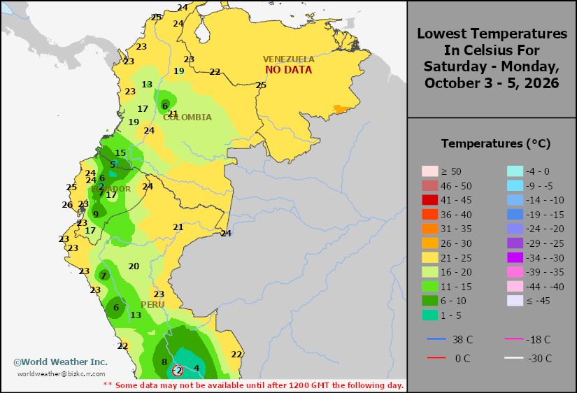
This content is for members only
Venezuela/Colombia Max Temps
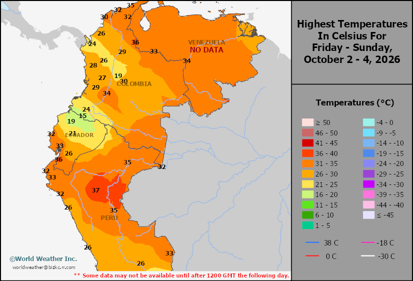
This content is for members only
SE Canada Min
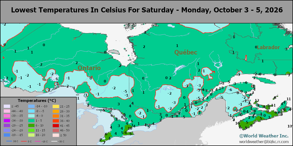
This content is for members only
SE Canada Max
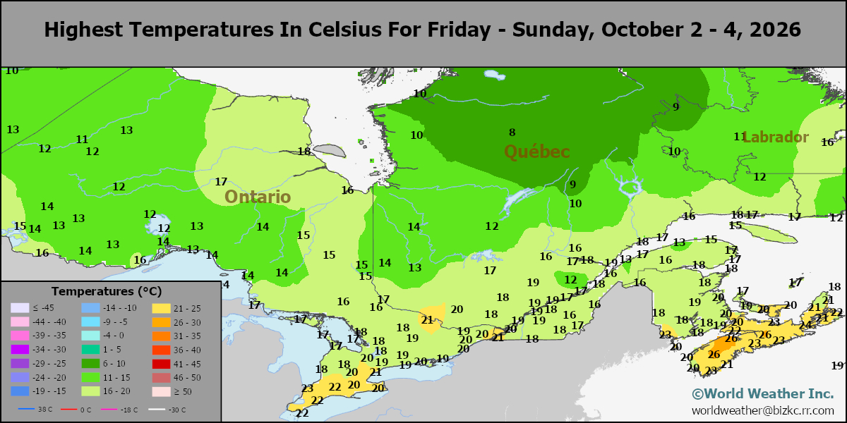
This content is for members only
SE Canada Rainfall
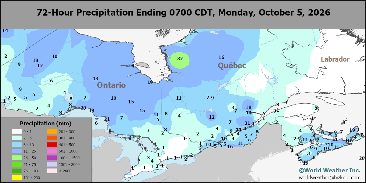
This content is for members only
Prairies Rainfall
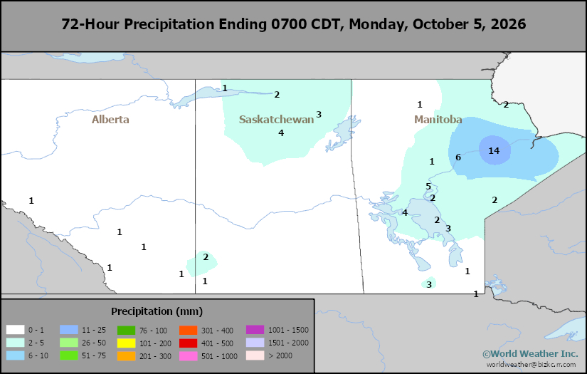
This content is for members only
Prairies Max Temperature
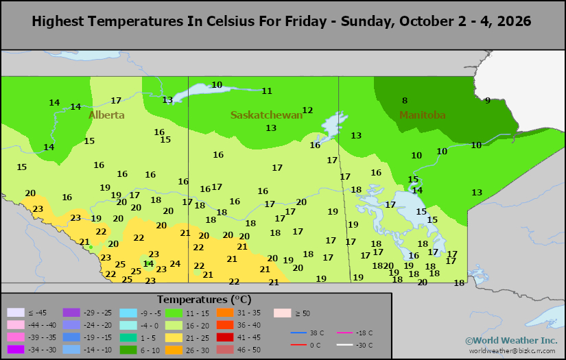
This content is for members only
Prairies Min Temperature
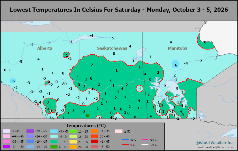
This content is for members only
Canada Rainfall
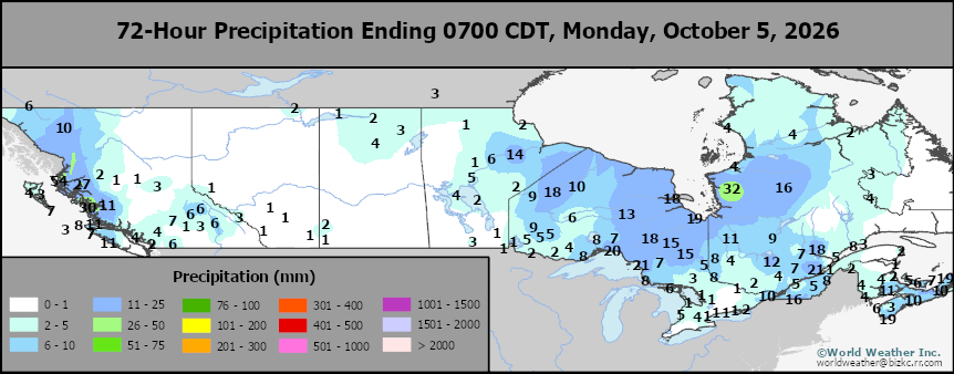
This content is for members only
Venezuela Rainfall
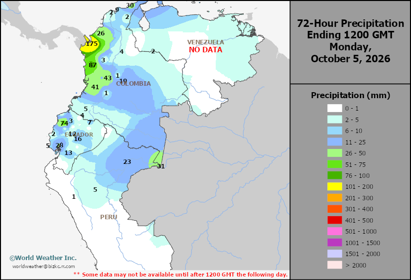
This content is for members only
Mexico Min Temperature
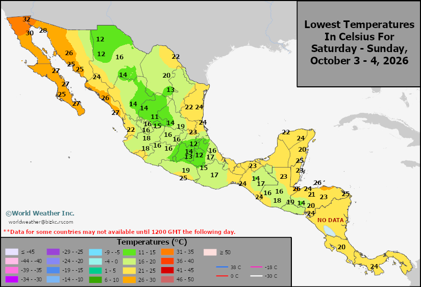
This content is for members only
Mexico Max Temperature
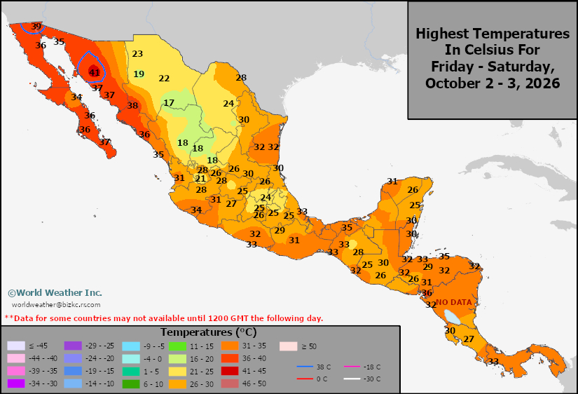
This content is for members only
Mexico Rainfall
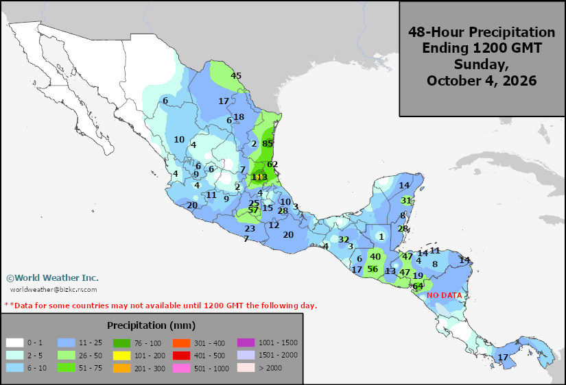
This content is for members only
Argentina Min Temperature
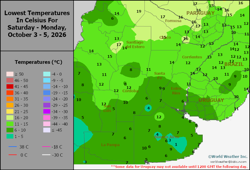
This content is for members only
Argentina Max Temperature
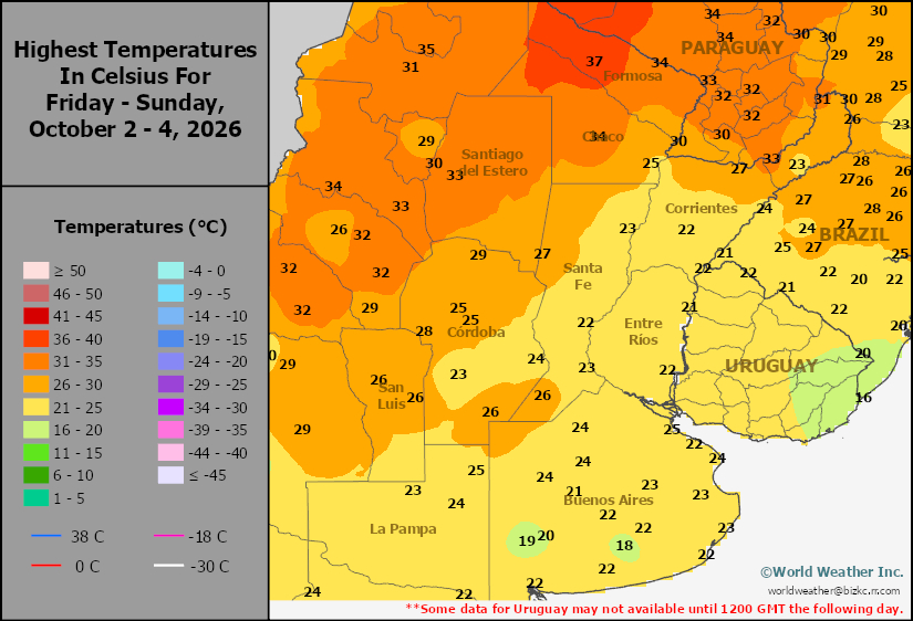
This content is for members only
Argentina Rainfall
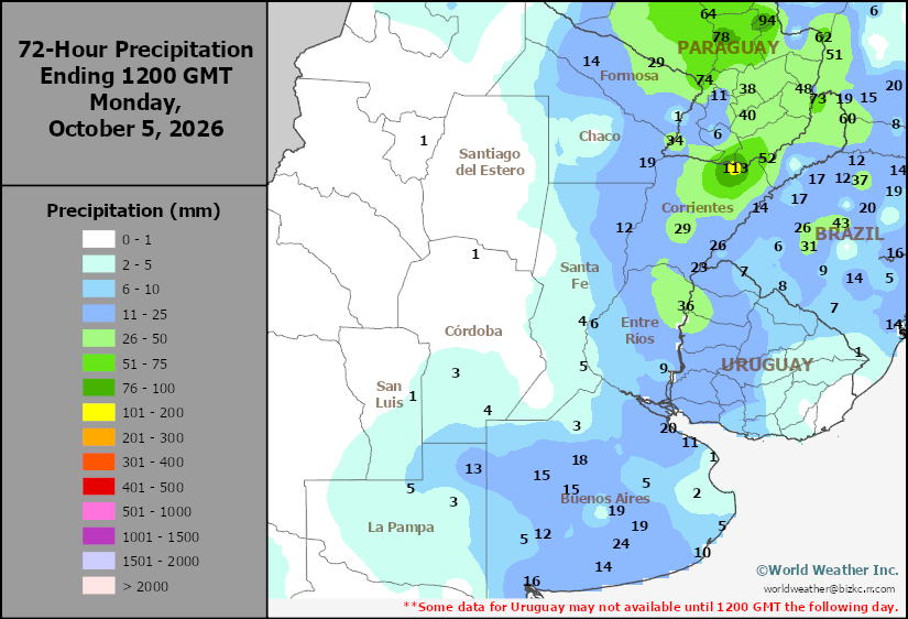
This content is for members only
Brazil Min Temperature
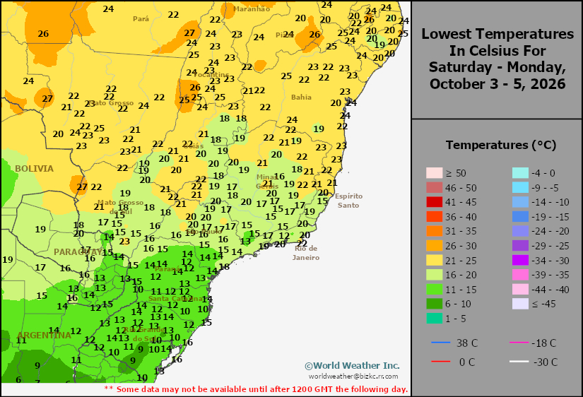
This content is for members only
Brazil Max Temperature
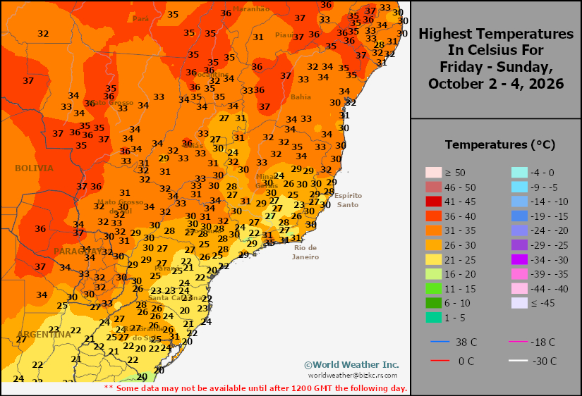
This content is for members only
Brazil Rainfall
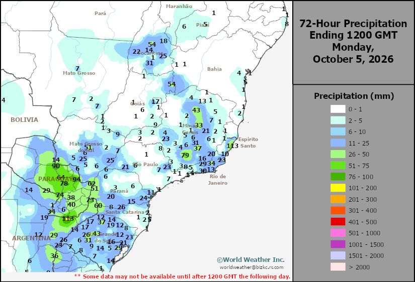
This content is for members only
Philippines Min
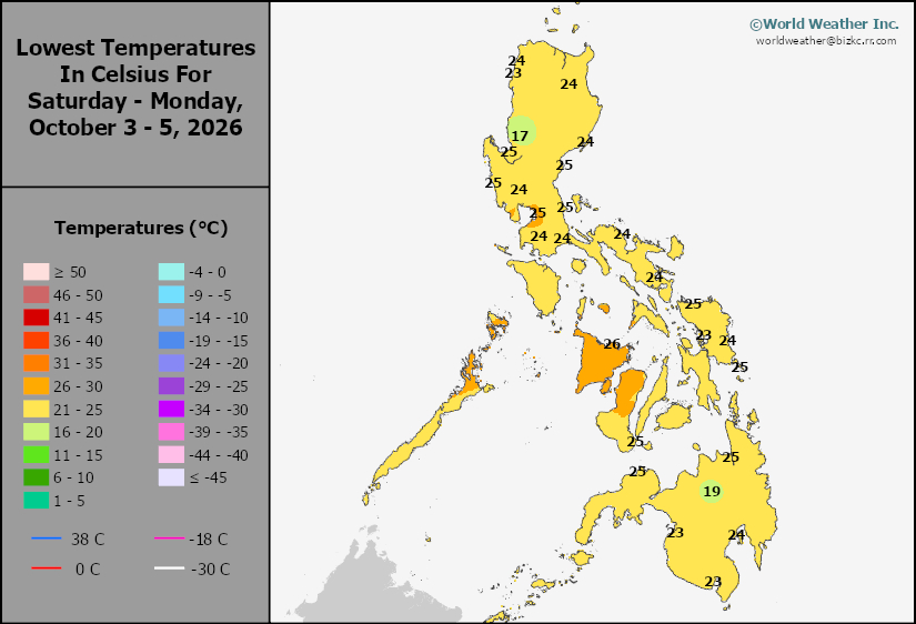
This content is for members only
Philippines Max
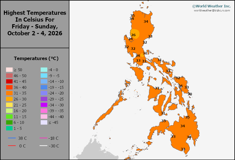
This content is for members only
Philippines Rain
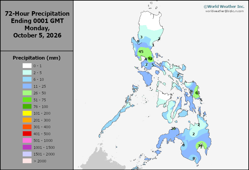
This content is for members only
Southeast North Rain
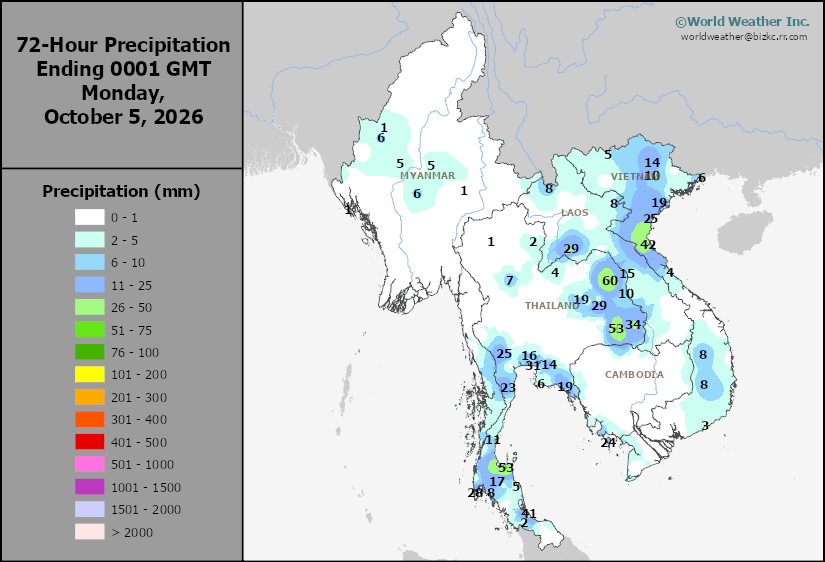
This content is for members only
Southeast North Min
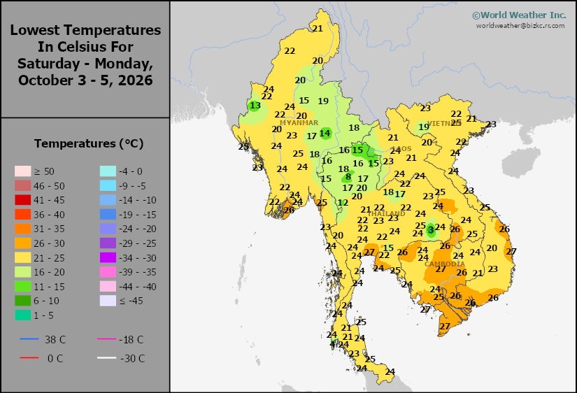
This content is for members only
Southeast North Max
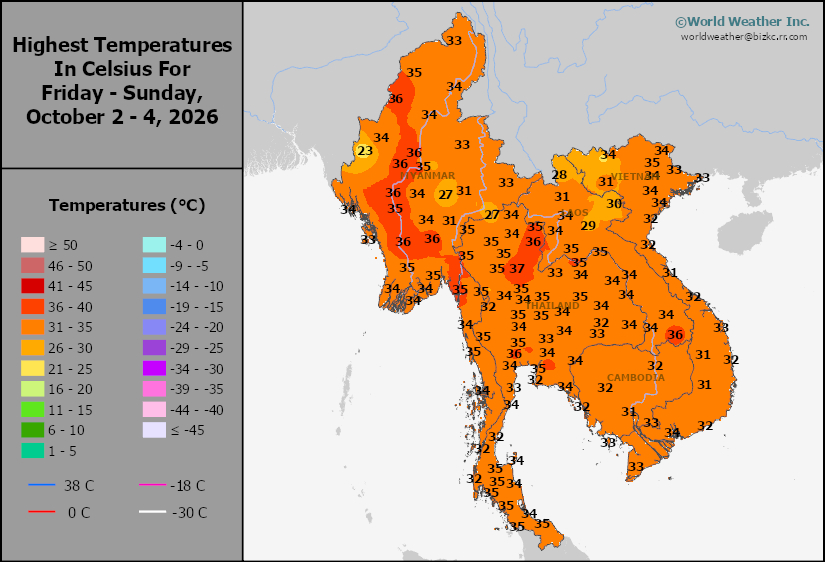
This content is for members only
Southeast Min
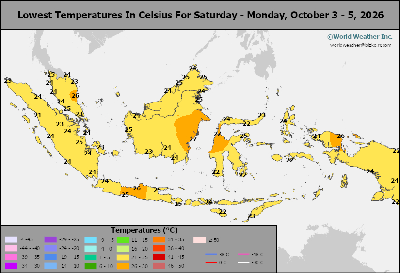
This content is for members only
Southeast Max
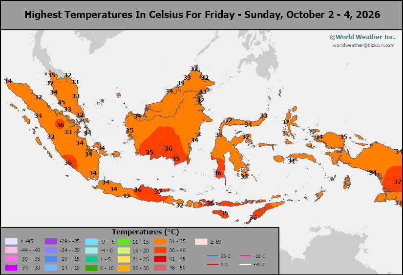
This content is for members only
Southeast Rain
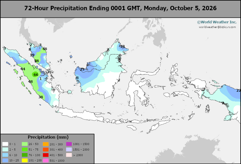
This content is for members only
West Africa Rain
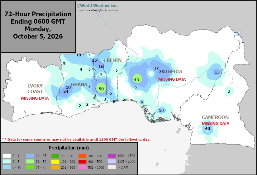
This content is for members only
Max Temperature
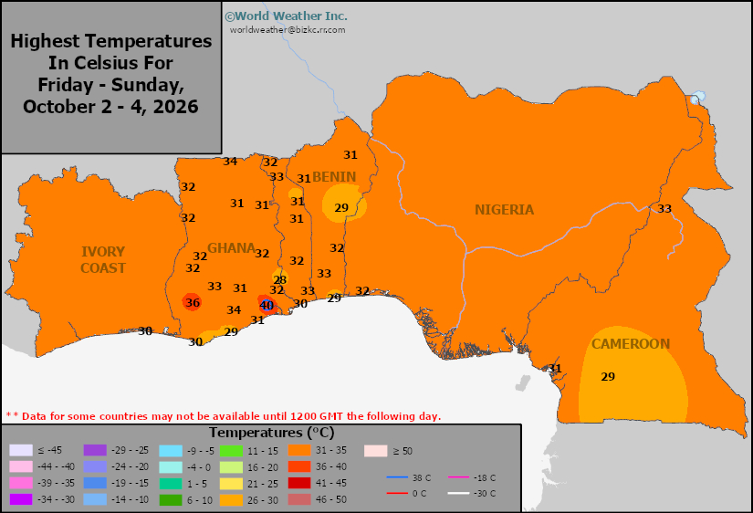
This content is for members only
Min Temperature
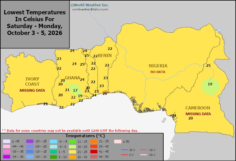
This content is for members only
North Africa Rain
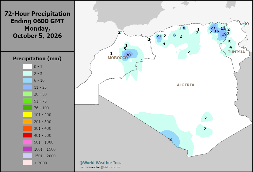
This content is for members only
Max Temperature
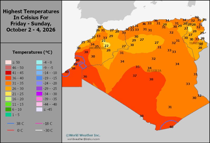
This content is for members only
Min Temperature
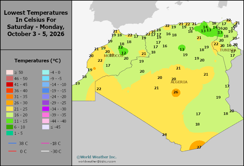
This content is for members only
Min Temperature
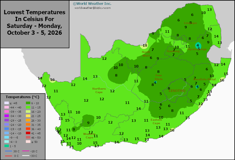
This content is for members only
Max Temperature
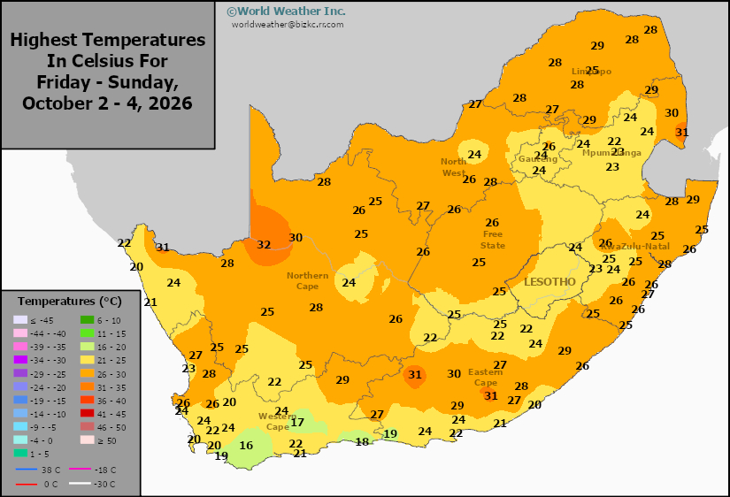
This content is for members only
South Africa Rain
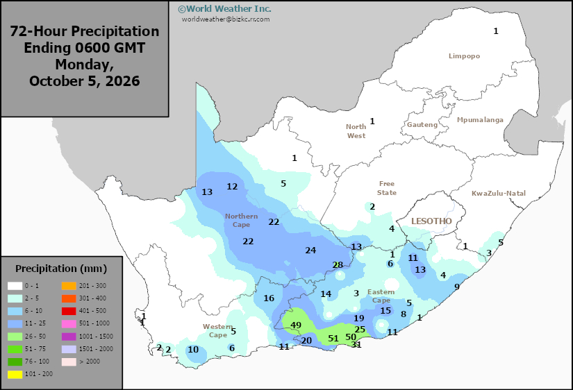
This content is for members only
Hard Red Wheat Tmin
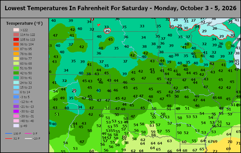
This content is for members only
Northeast Tmin
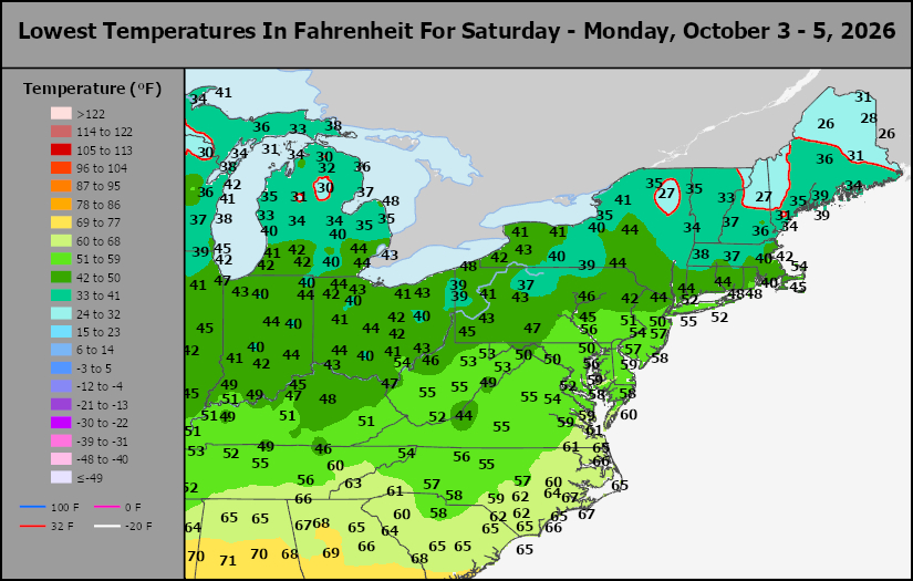
This content is for members only
Southwest Tmin
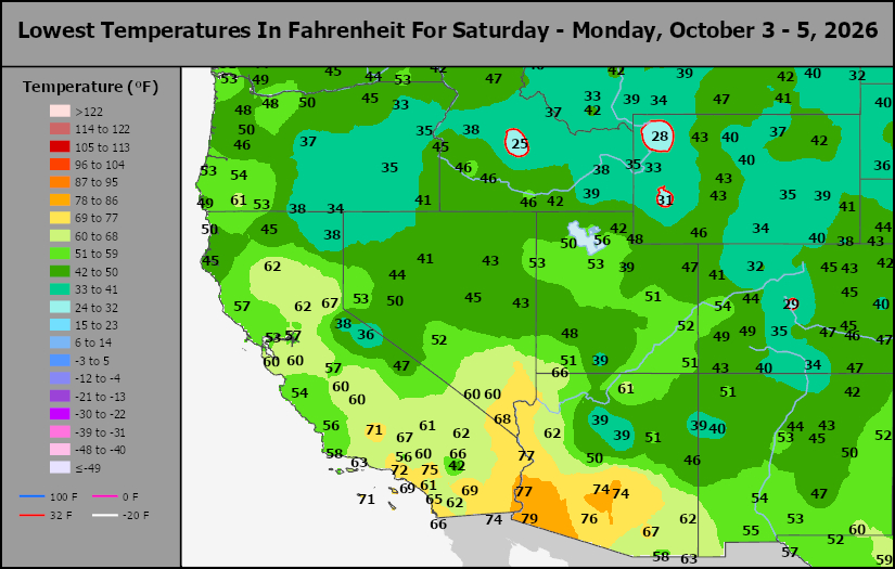
This content is for members only
Northwest Tmin
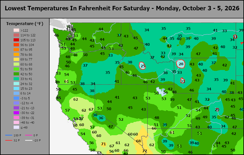
This content is for members only
South Plains Tmin
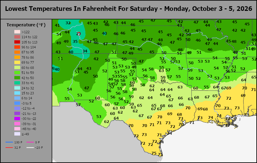
This content is for members only
Delta/SE U.S. Tmin
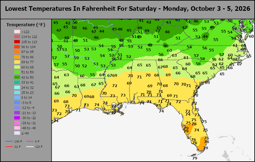
This content is for members only
Corn Belt Tmin
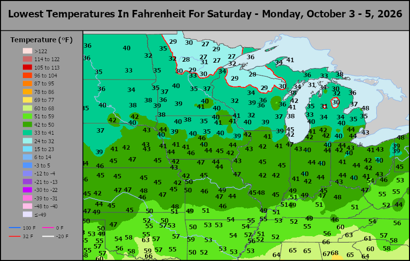
This content is for members only
US Min
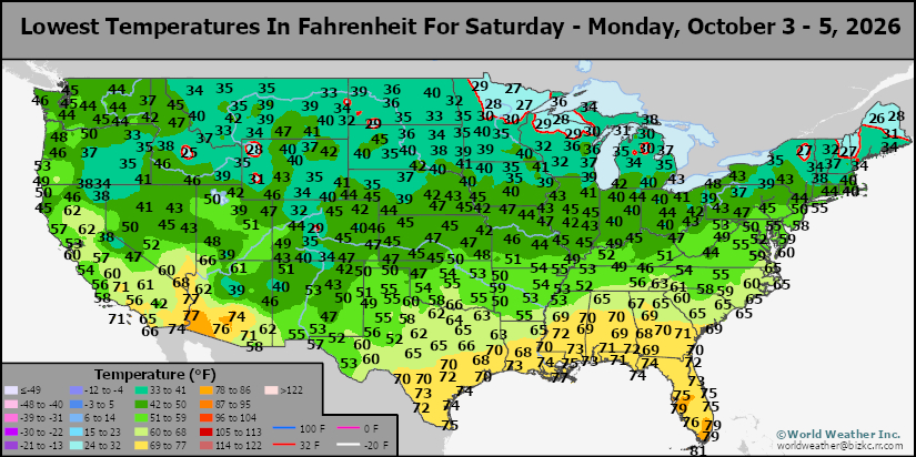
This content is for members only
North Plains Tmin
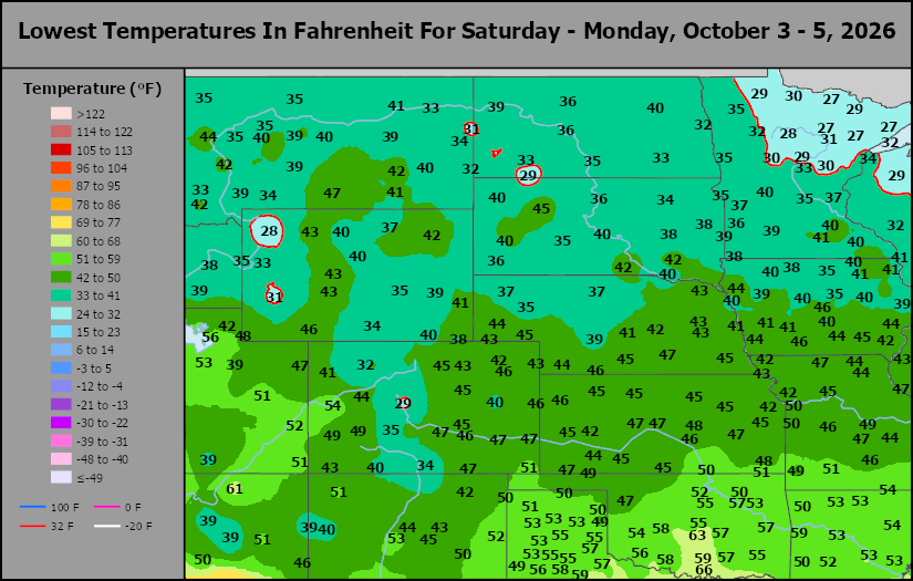
This content is for members only
Hard Red Wheat Tmax
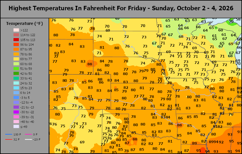
This content is for members only
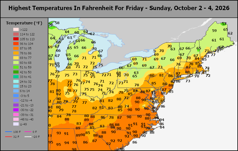
Northeast Tmax
This content is for members only
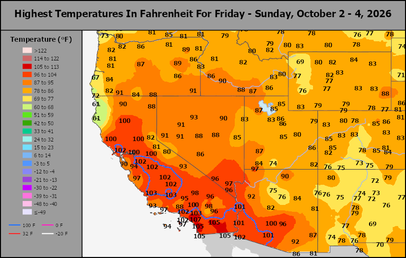
Southwest Tmax
This content is for members only
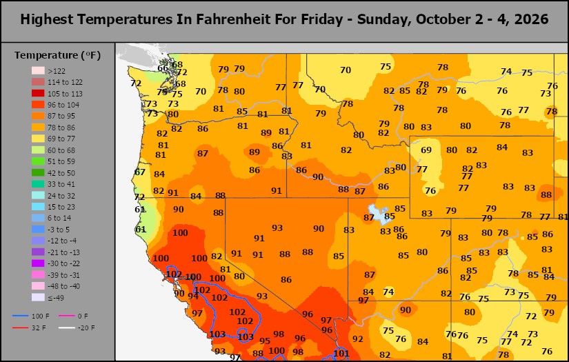
Northwest Tmax
This content is for members only
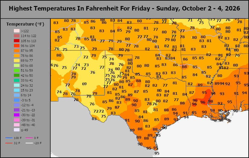
South Plains Tmax
This content is for members only
Delta/SE U.S. Tmax
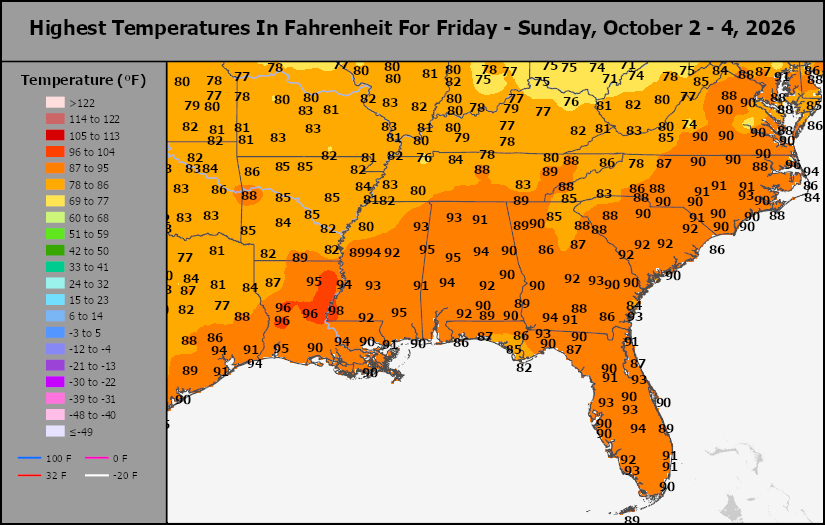
This content is for members only
Corn Belt Tmax
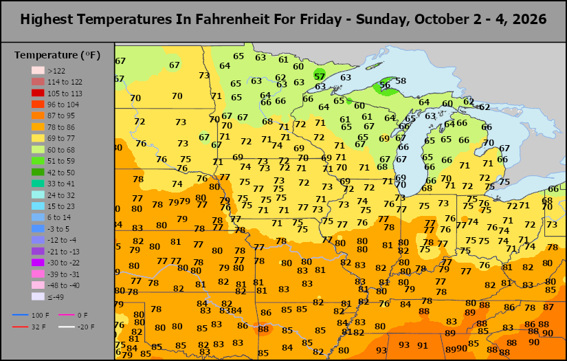
This content is for members only
North Plains Tmax
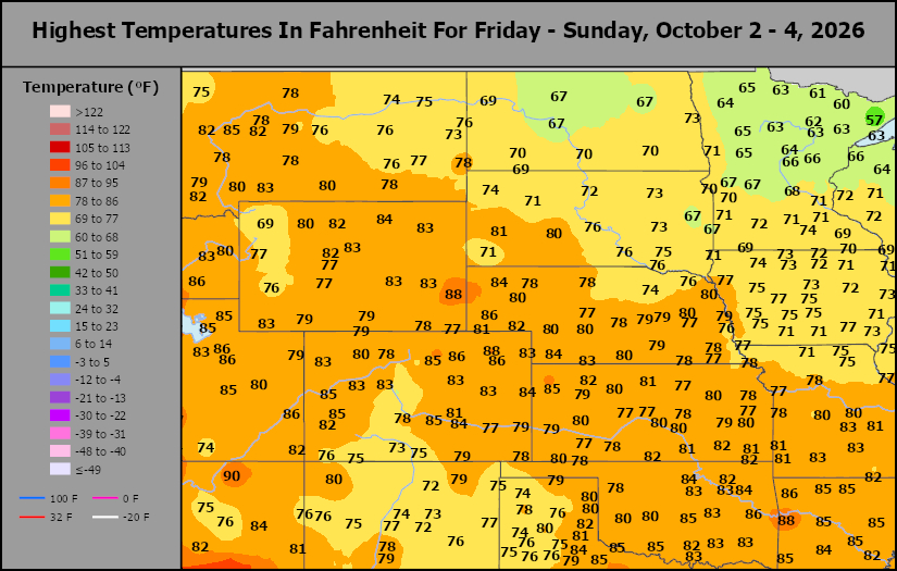
This content is for members only
US Max
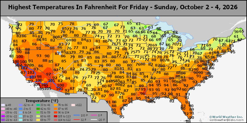
This content is for members only
US Rain
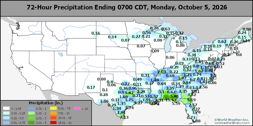
This content is for members only
Northeast Daily Rain
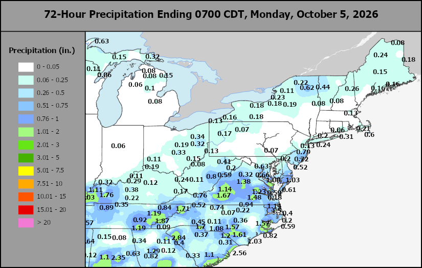
This content is for members only
Hard Red Wheat Daily Rain
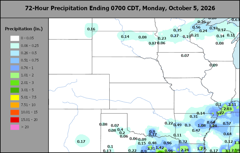
This content is for members only
Southwest Daily Rain
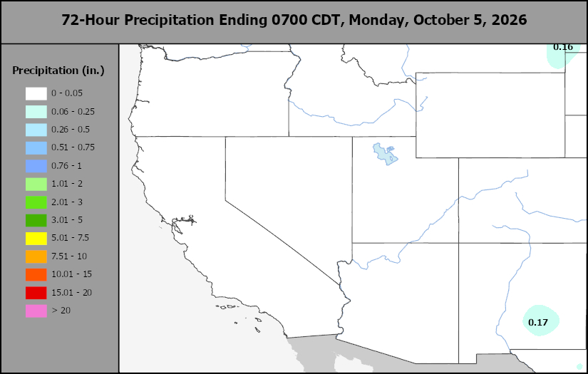
This content is for members only
Northwest Daily Rain
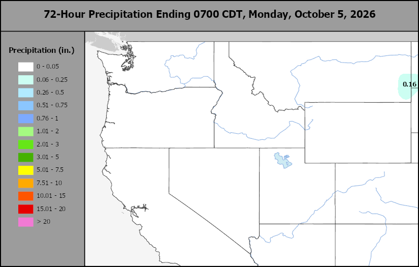
This content is for members only
South Plains Daily Rain
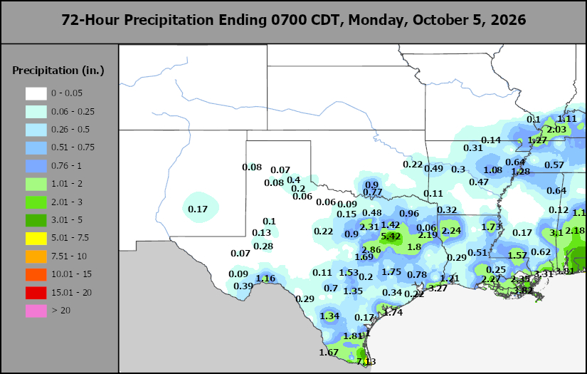
This content is for members only
Delta/SE U.S. Daily Rain
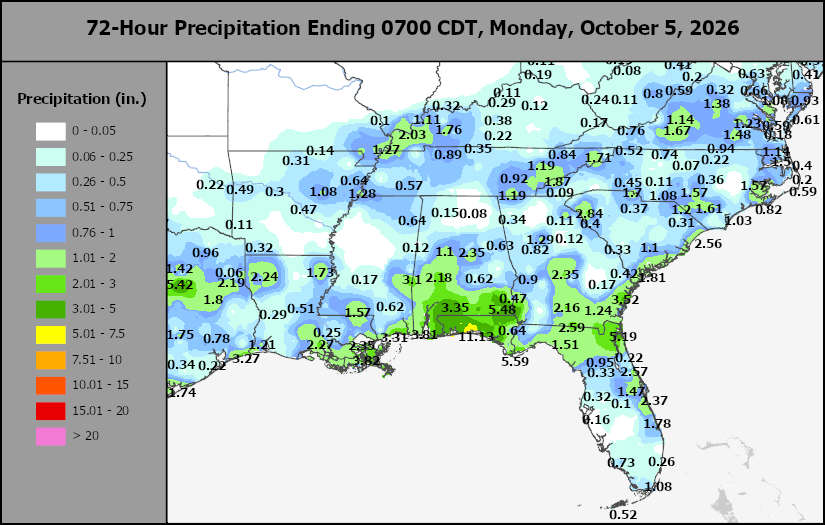
This content is for members only
Corn Belt Daily Rain
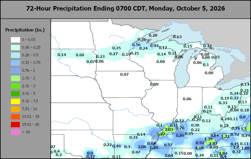
This content is for members only
North Plains Daily Rain
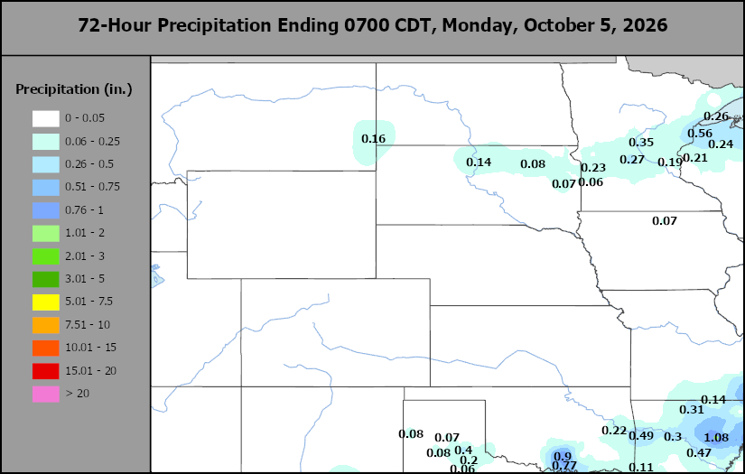
This content is for members only
Low Temperature
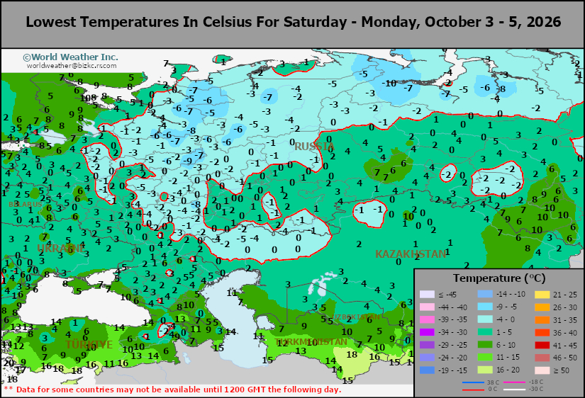
This content is for members only
High Temperature
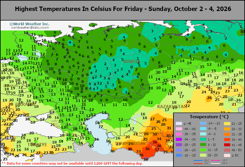
This content is for members only
CIS Rainfall
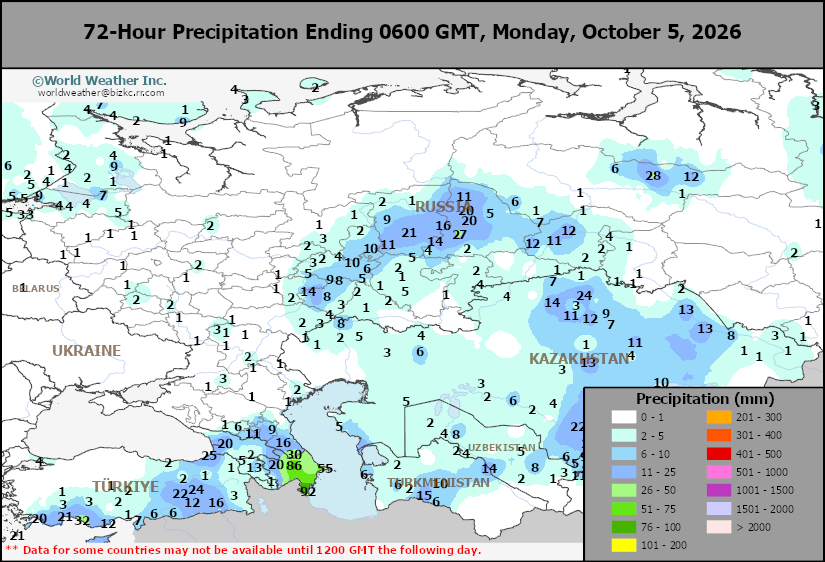
This content is for members only
Low Temperature
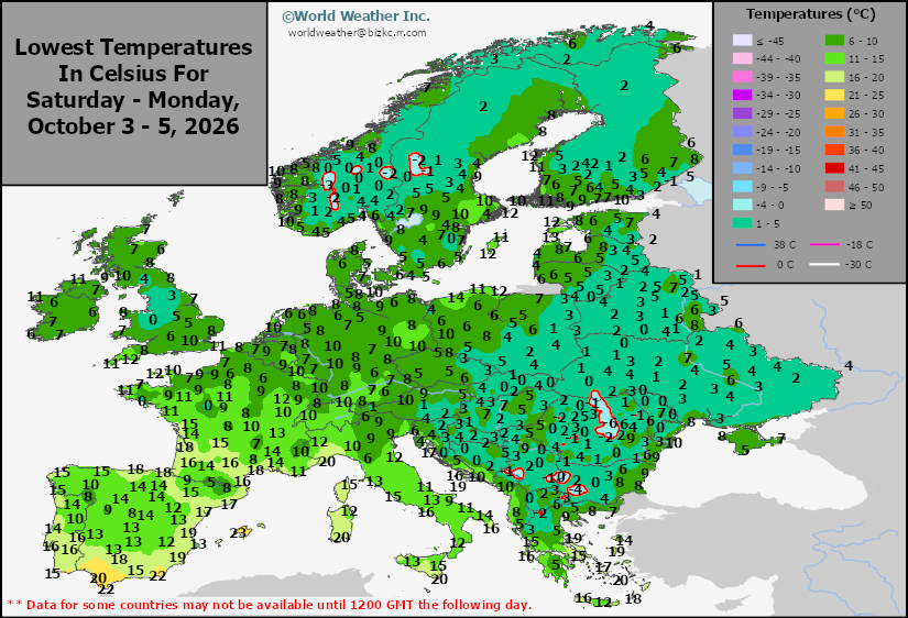
This content is for members only
High Temperature
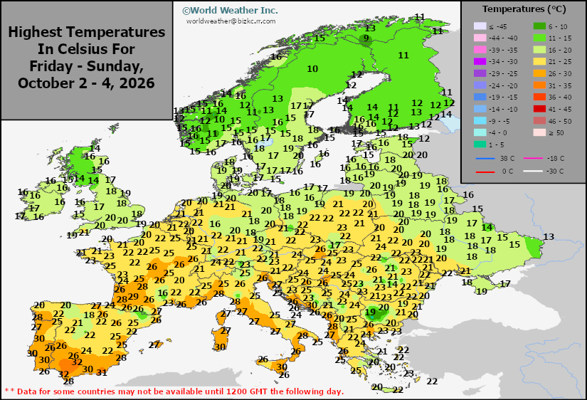
This content is for members only
Europe Rainfall
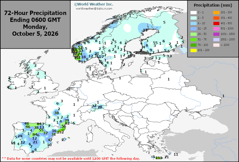
This content is for members only
Low Temperature
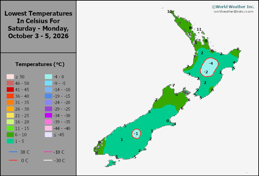
This content is for members only
High Temperature
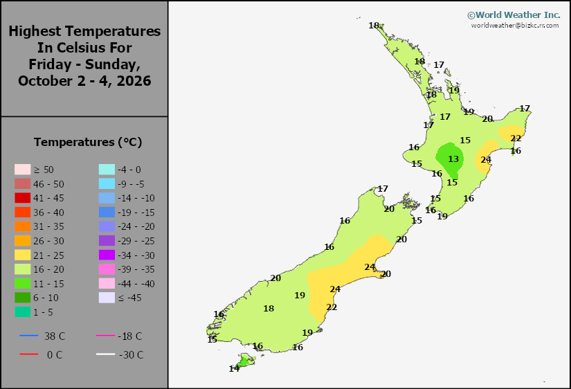
This content is for members only
New Zealand Rainfall
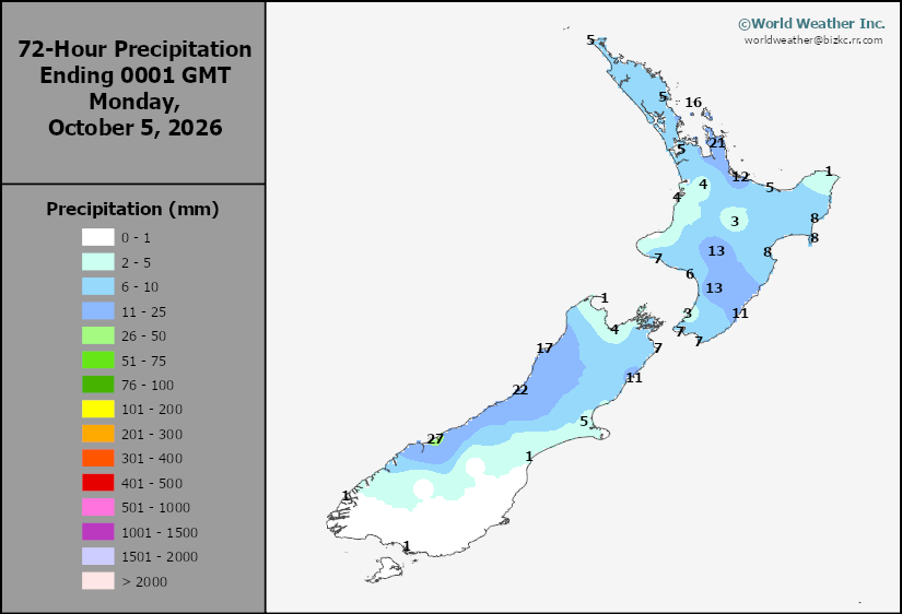
This content is for members only
Low Temperature
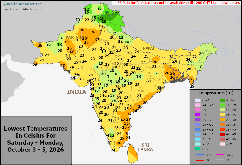
This content is for members only
High Temperature
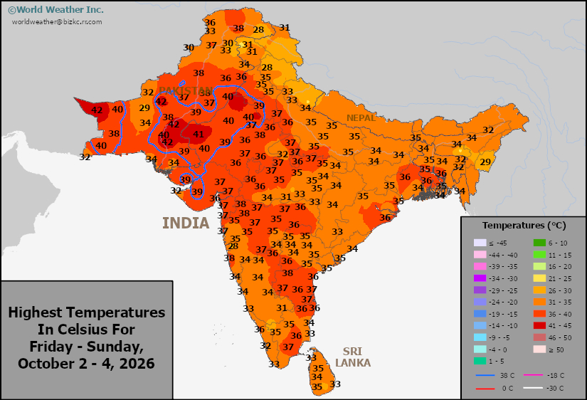
This content is for members only
India Rainfall
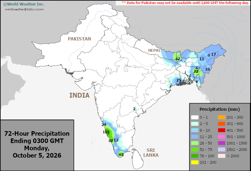
This content is for members only
Low Temperature
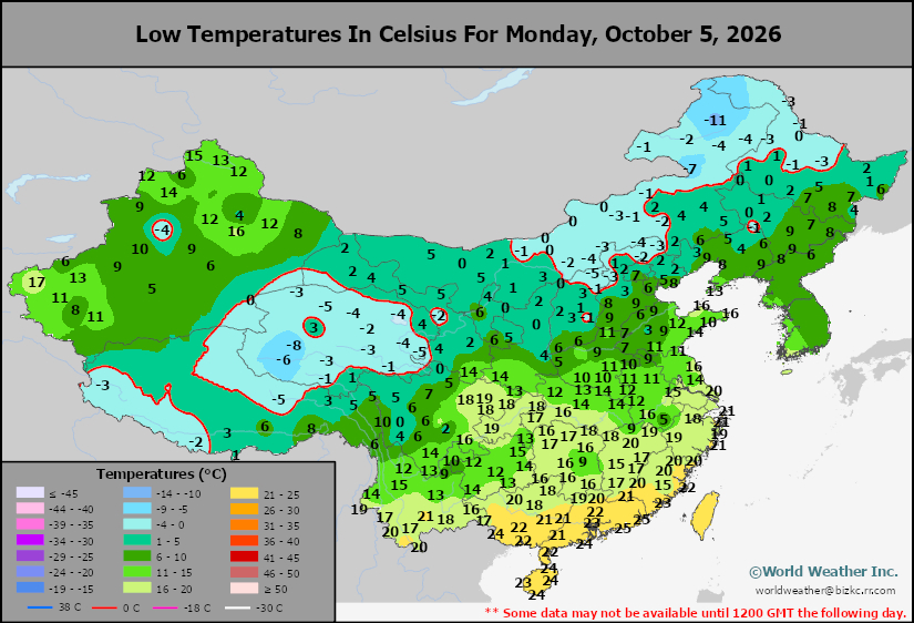
This content is for members only
Japan Rainfall
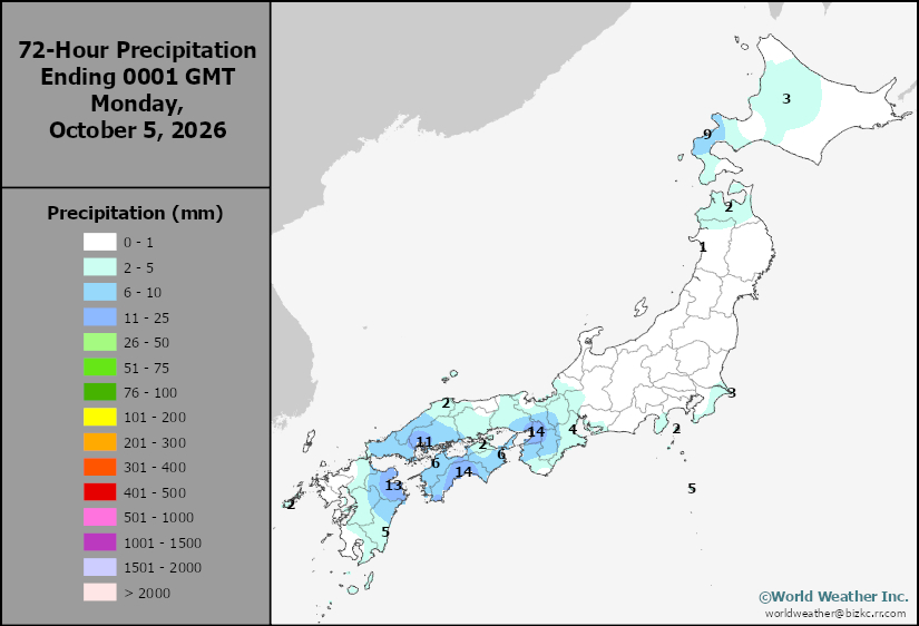
This content is for members only
Low Temperature
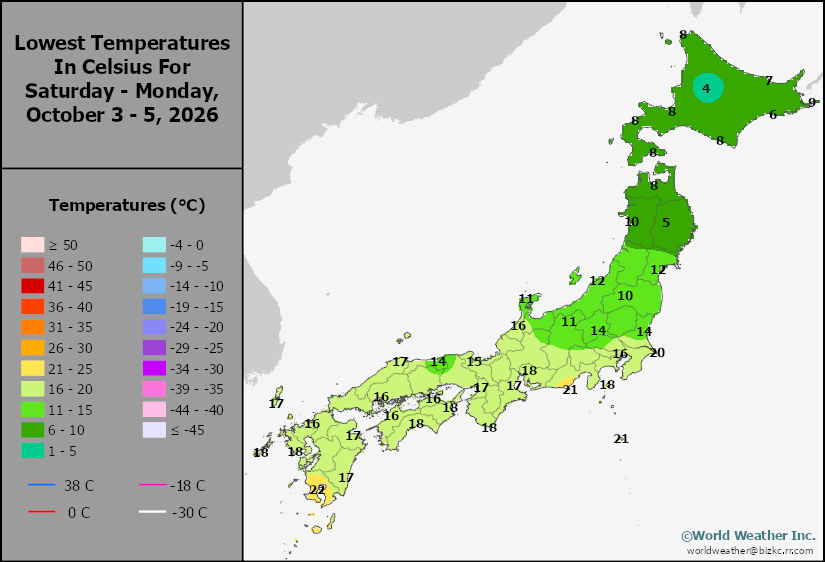
This content is for members only
High Temperature
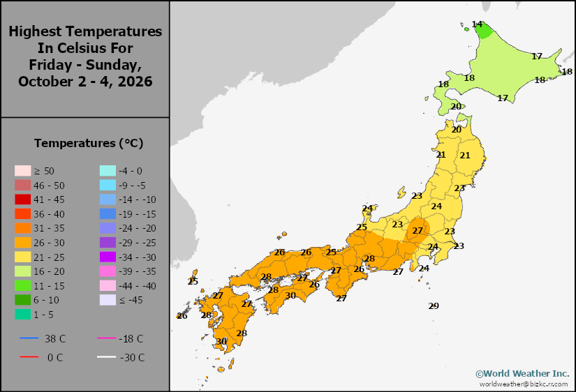
This content is for members only
High Temperature
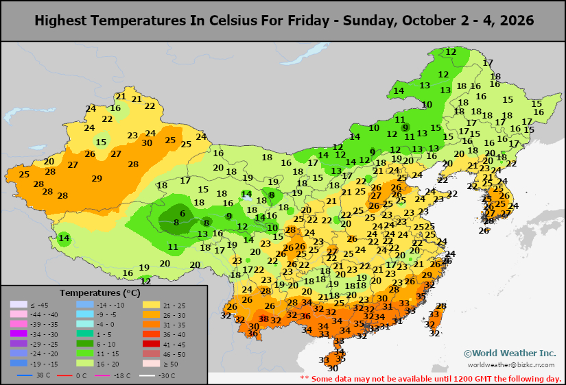
This content is for members only
China Rainfall
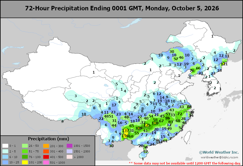
This content is for members only
Low Temperature
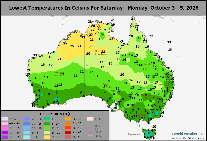
This content is for members only
High Temperature
This content is for members only