
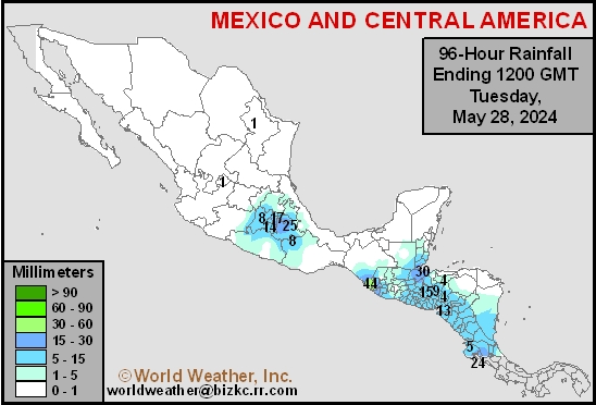
Mexico Rainfall
This content is for members only
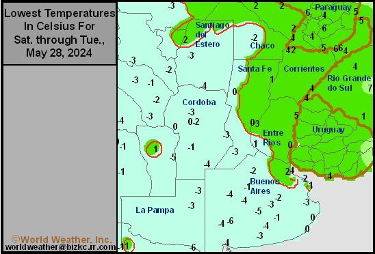
Argentina Min Temperature
This content is for members only
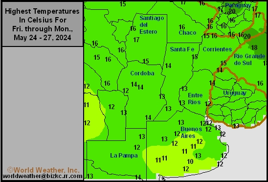
Argentina Max Temperature
This content is for members only
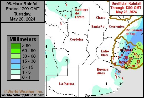
Argentina Rainfall
This content is for members only
Brazil Min Temperature
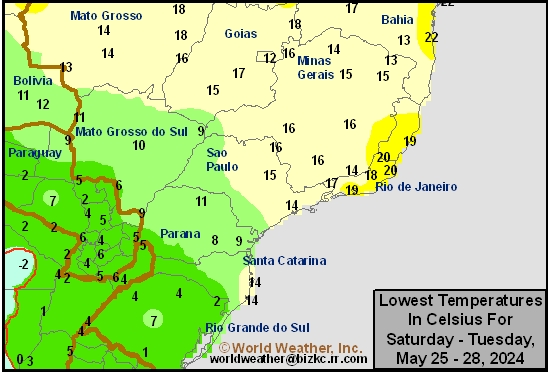
This content is for members only
Brazil Max Temperature
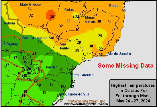
This content is for members only
Brazil Rainfall
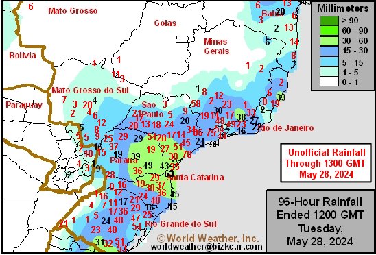
This content is for members only
Philippines Min
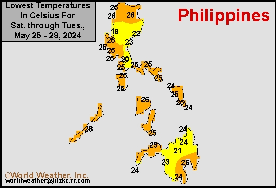
This content is for members only
Philippines Max
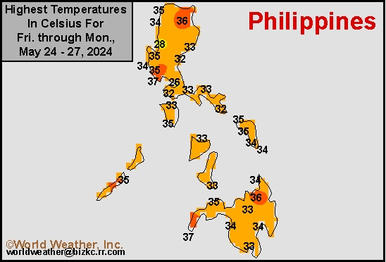
This content is for members only
Philippines Rain
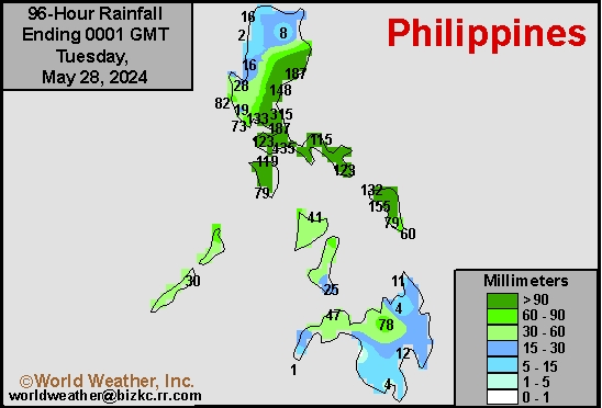
This content is for members only
Southeast North Rain
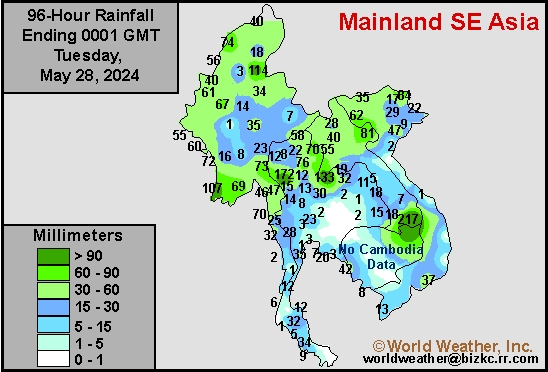
This content is for members only
Southeast North Min
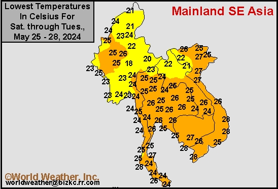
This content is for members only
Southeast North Max
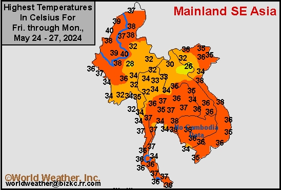
This content is for members only
Southeast Min
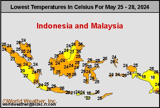
This content is for members only
Southeast Max
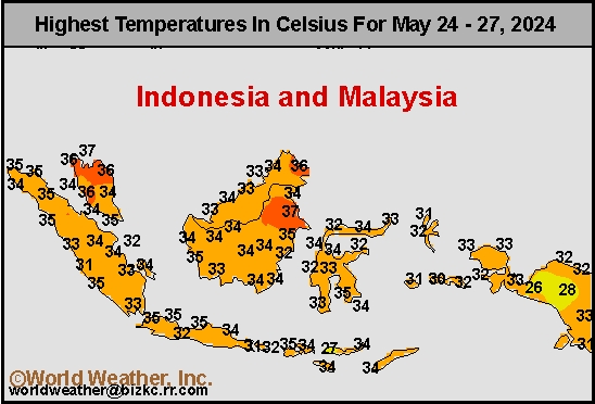
This content is for members only
Southeast Rain
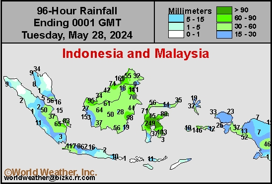
This content is for members only
West Africa Rain
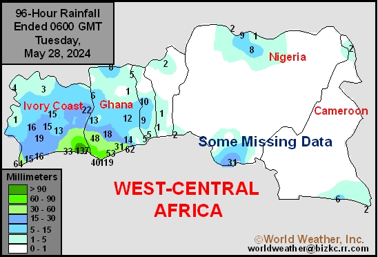
This content is for members only
Max Temperature
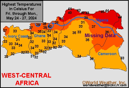
This content is for members only
Min Temperature
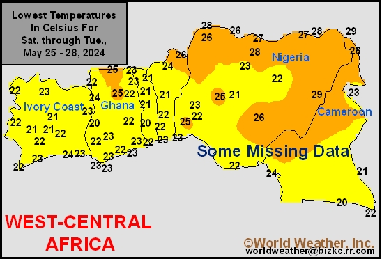
This content is for members only
North Africa Rain
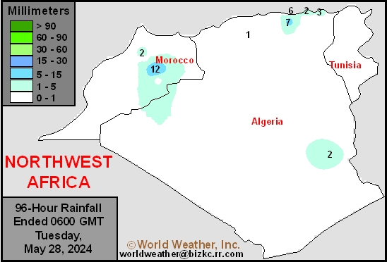
This content is for members only
Max Temperature
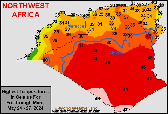
This content is for members only
Min Temperature
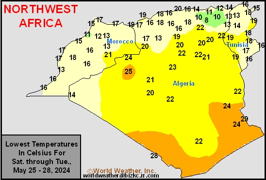
This content is for members only
Min Temperature
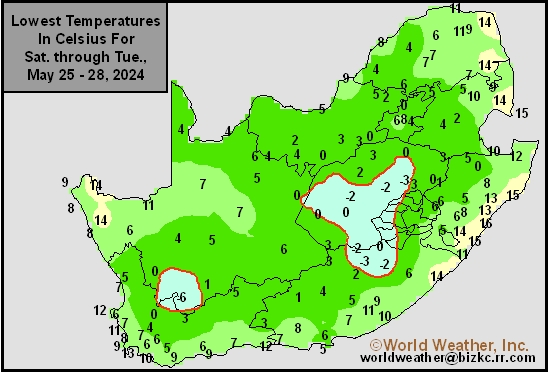
This content is for members only
Max Temperature
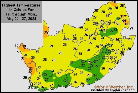
This content is for members only
South Africa Rain
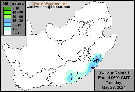
This content is for members only
Hard Red Wheat Tmin
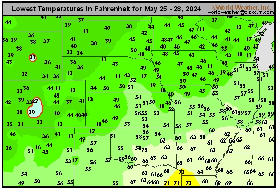
This content is for members only
Northeast Tmin
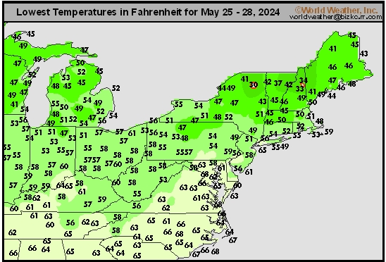
This content is for members only
Southwest Tmin
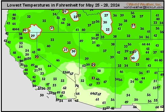
This content is for members only
Northwest Tmin
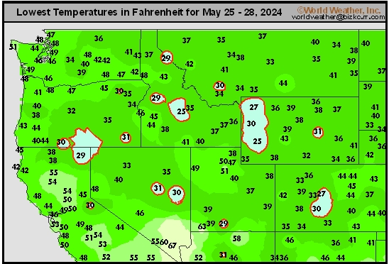
This content is for members only
South Plains Tmin
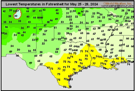
This content is for members only
Delta/SE U.S. Tmin
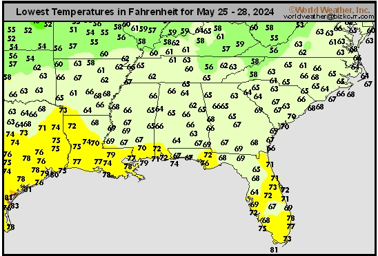
This content is for members only
Corn Belt Tmin
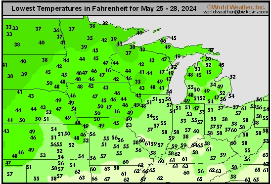
This content is for members only
US Min

This content is for members only
North Plains Tmin
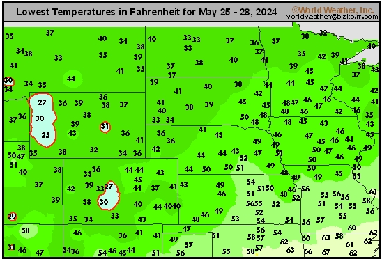
This content is for members only
Hard Red Wheat Tmax
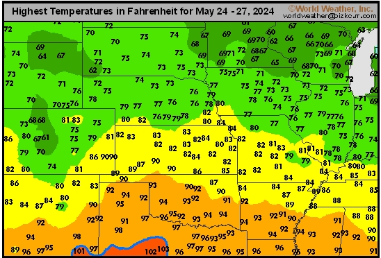
This content is for members only
Northeast Tmax
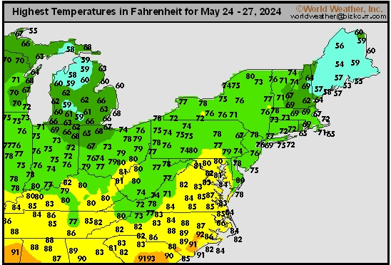
This content is for members only
Southwest Tmax
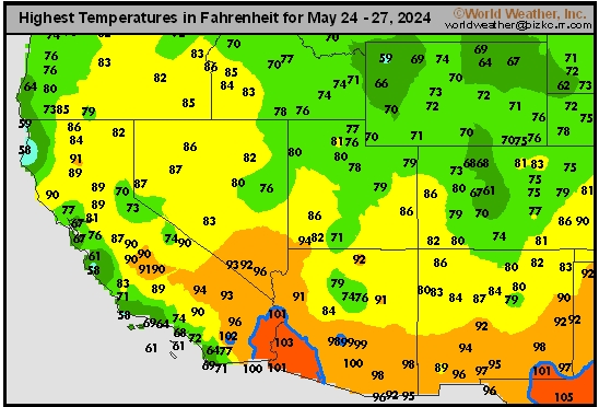
This content is for members only
Northwest Tmax
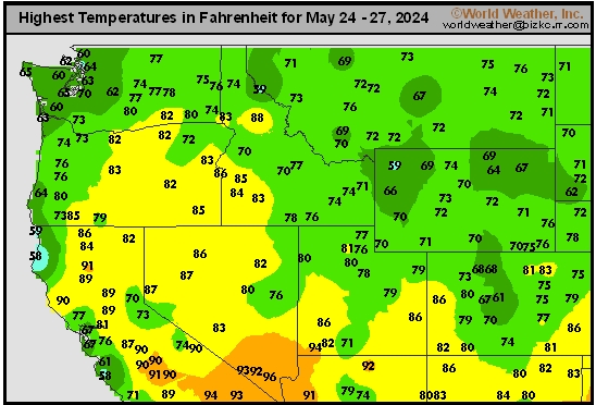
This content is for members only
South Plains Tmax
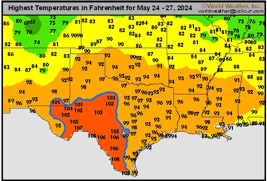
This content is for members only
Delta/SE U.S. Tmax
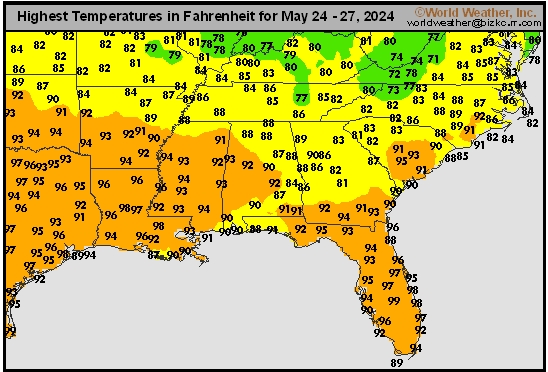
This content is for members only
Corn Belt Tmax
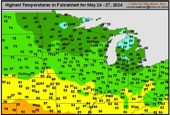
This content is for members only
North Plains Tmax
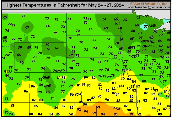
This content is for members only
US Max

This content is for members only
US Rain

This content is for members only
Northeast Daily Rain
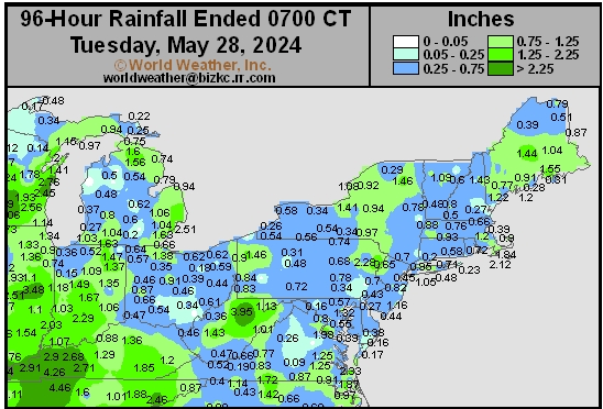
This content is for members only
Hard Red Wheat Daily Rain
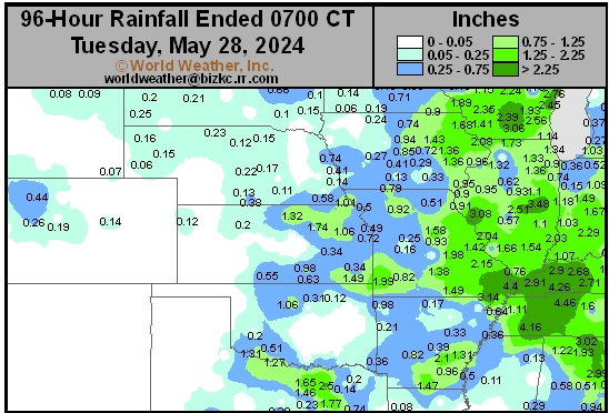
This content is for members only
Southwest Daily Rain
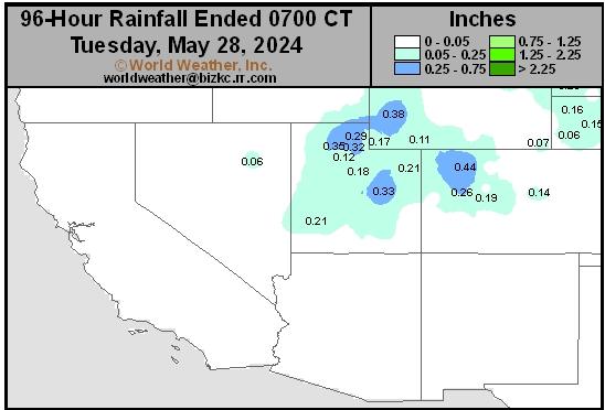
This content is for members only
Northwest Daily Rain
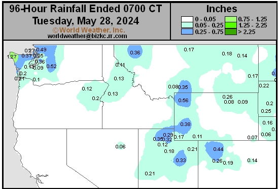
This content is for members only
South Plains Daily Rain
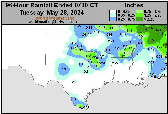
This content is for members only
Delta/SE U.S. Daily Rain
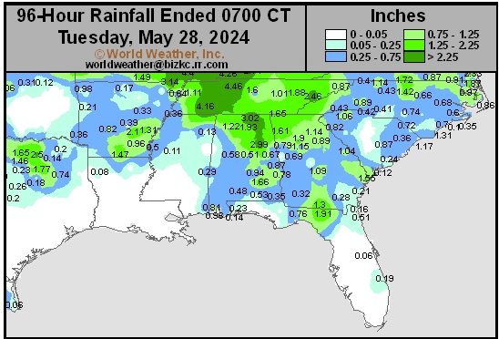
This content is for members only
Corn Belt Daily Rain
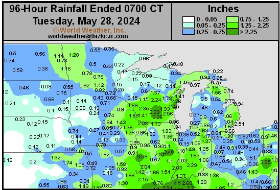
This content is for members only
North Plains Daily Rain
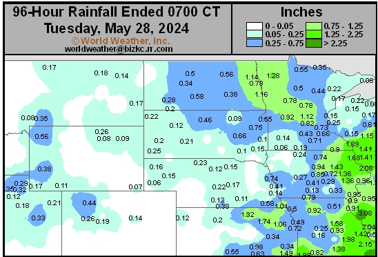
This content is for members only
Low Temperature
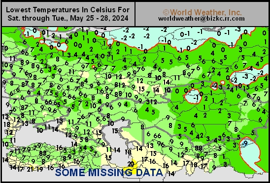
This content is for members only
High Temperature
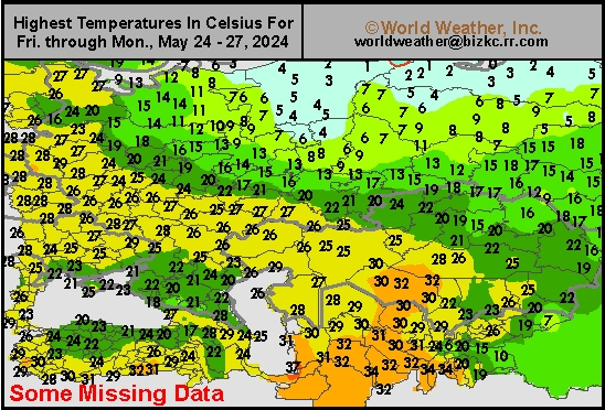
This content is for members only
CIS Rainfall
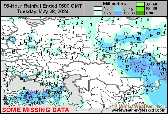
This content is for members only
Low Temperature
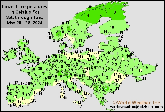
This content is for members only
High Temperature
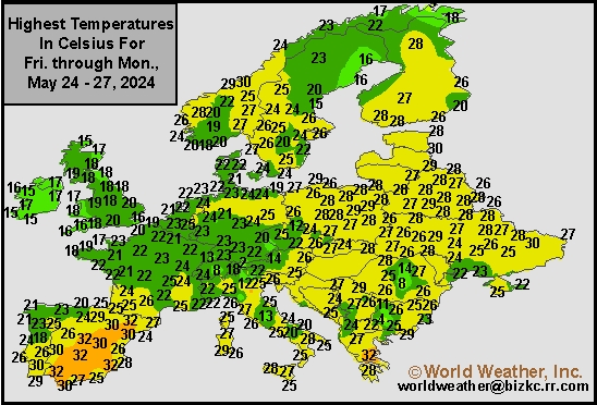
This content is for members only
Europe Rainfall
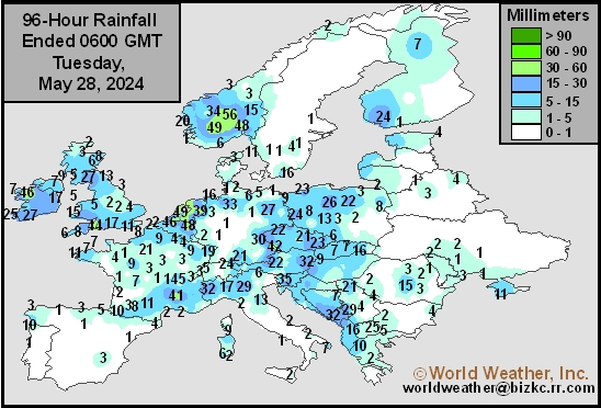
This content is for members only
Low Temperature
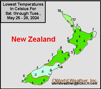
This content is for members only
High Temperature
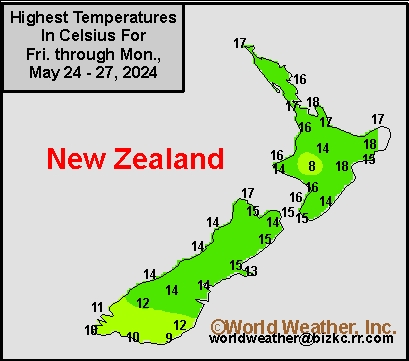
This content is for members only
New Zealand Rainfall
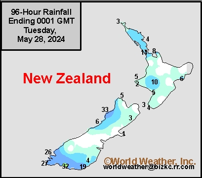
This content is for members only
Low Temperature
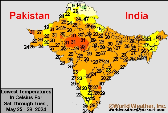
This content is for members only
High Temperature
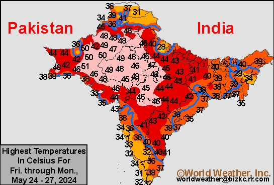
This content is for members only
India Rainfall
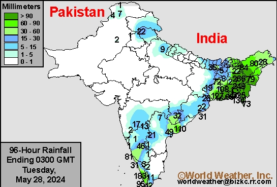
This content is for members only
Low Temperature
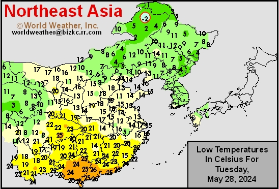
This content is for members only
Japan Rainfall
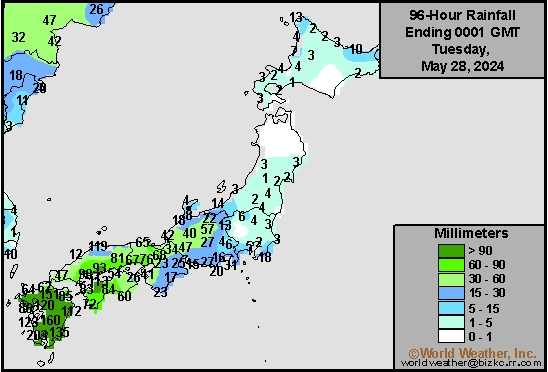
This content is for members only
Low Temperature
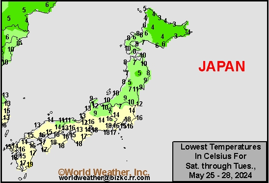
This content is for members only
High Temperature
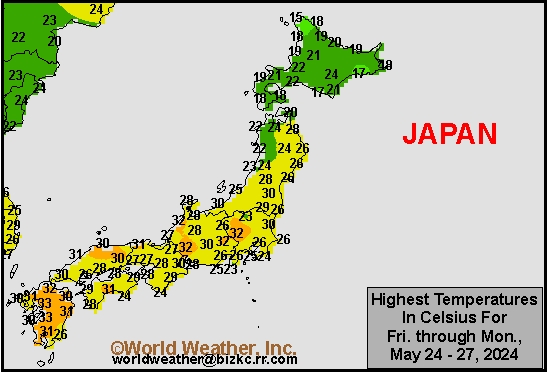
This content is for members only
High Temperature
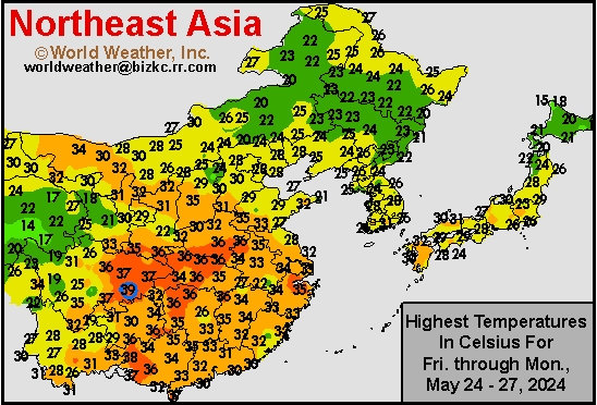
This content is for members only
China Rainfall
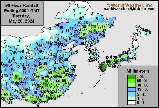
This content is for members only
Low Temperature
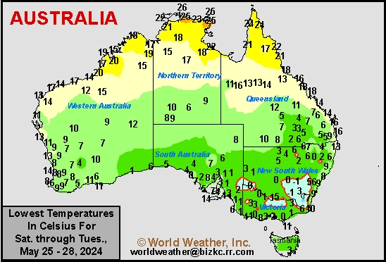
This content is for members only
High Temperature
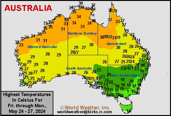
This content is for members only
Australia Rainfall
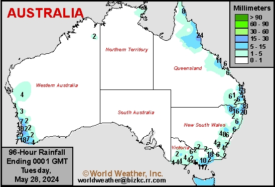
This content is for members only
Southwest U.S. Hard Red Wheat May Get Rain Too Late
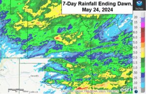
Kansas City, May 24 (World Weather Inc.) – Drought or abnormally dry conditions are ongoing in portions of the central and southern Plains despite some rain during the past week. Hard red winter wheat conditions are variable with some of the crop still rated poor to very poor. Irrigated yields will be high while some of the dryland production areas in the southwest yield poorly. Rain is expected to evolve more frequently beginning Tuesday night into the end of next week and through the following weekend in the high Plains region and that will moisten the soil for summer crops, but many of the dryland winter crops have advanced too far for a serious boost in production because of rain. Some improvement is possible, but much of the rain will have come a little too late for the best plant response. Other wheat production areas in Nebraska, central Kansas and northeastern Colorado will benefit greatly from additional rain.
Tropical Disturbance Aiming For Eastern India, Bangladesh
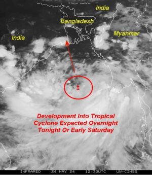
Kansas City, May 24 (World Weather Inc.) – A tropical disturbance over the Bay of Bengal will likely intensify into an organized tropical cyclone overnight tonight into early Saturday. The disturbance will enter West Bengal Sunday and meander around eastern India and Bangladesh early next week before dissipating. Torrential rain will spread across West Bengal, Bangladesh, and neighboring areas in the Eastern States, Odisha, Jharkhand, and Telangana Sunday through Tuesday. Significant flooding, combined with damaging wind speeds will promote damage to rice, personal property and infrastructure. Some disruption to shipping and at least some threat to port facilities is likely as well.
Venezuela/Colombia Min Temps
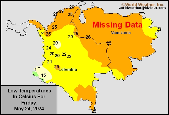
This content is for members only
Venezuela/Colombia Max Temps
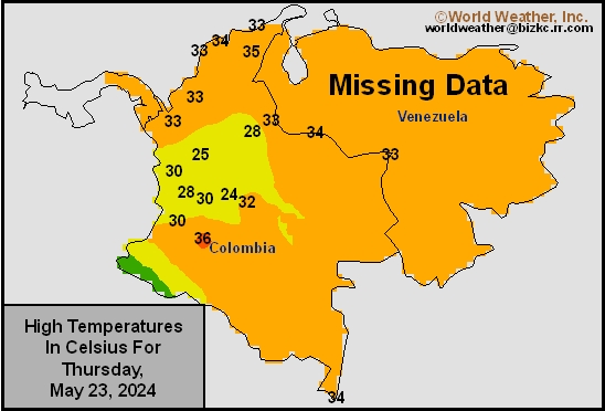
This content is for members only
SE Canada Min
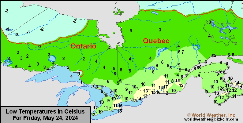
This content is for members only
SE Canada Max
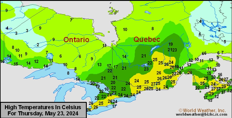
This content is for members only
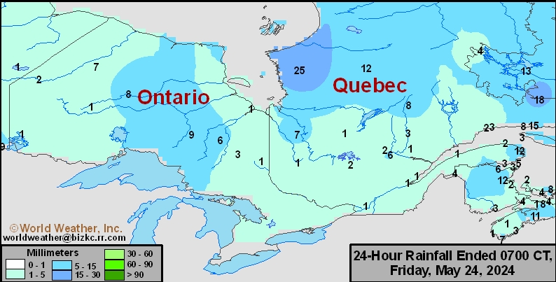
SE Canada Rainfall
This content is for members only
Prairies Rainfall

This content is for members only
Prairies Max Temperature

This content is for members only
Prairies Min Temperature

This content is for members only
Canada Rainfall

This content is for members only
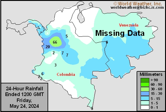
Venezuela Rainfall
This content is for members only
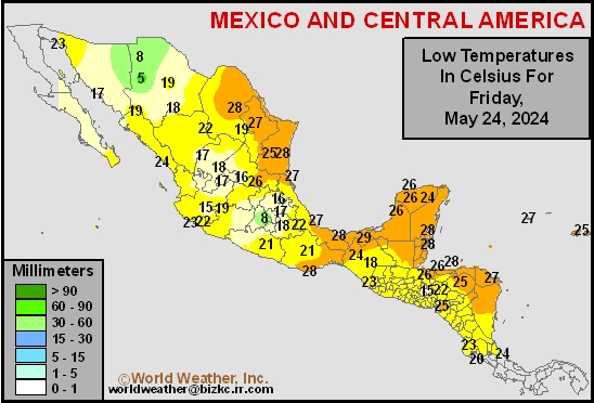
Mexico Min Temperature
This content is for members only
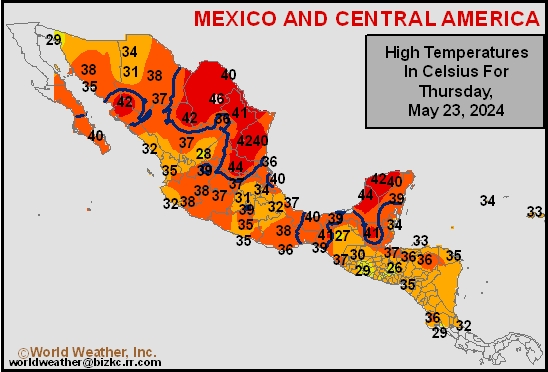
Mexico Max Temperature
This content is for members only
Mexico Rainfall
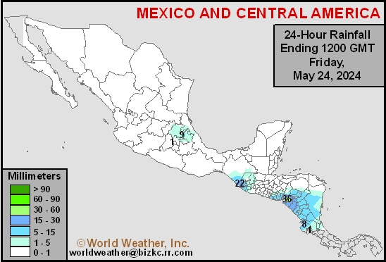
This content is for members only
Argentina Min Temperature
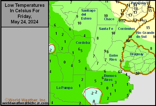
This content is for members only
Argentina Max Temperature
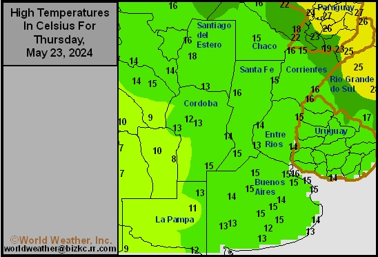
This content is for members only
Argentina Rainfall
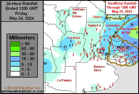
This content is for members only
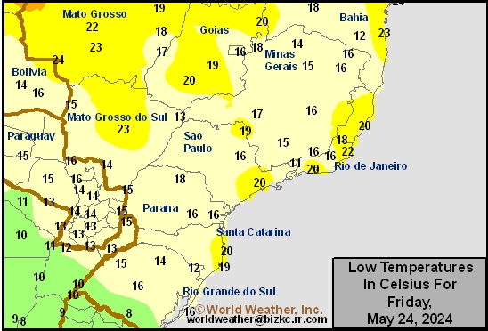
Brazil Min Temperature
This content is for members only
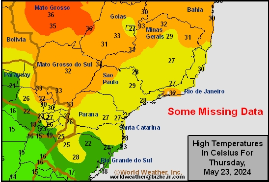
Brazil Max Temperature
This content is for members only
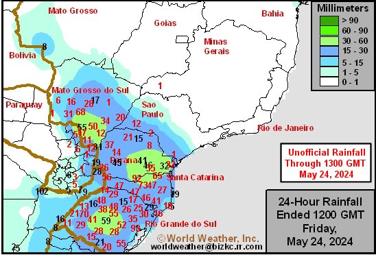
Brazil Rainfall
This content is for members only
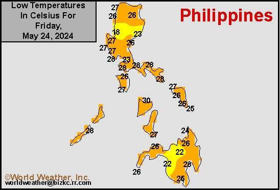
Philippines Min
This content is for members only
Philippines Max
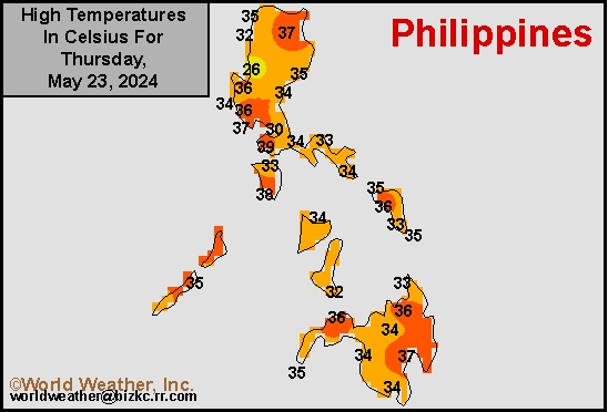
This content is for members only
Philippines Rain
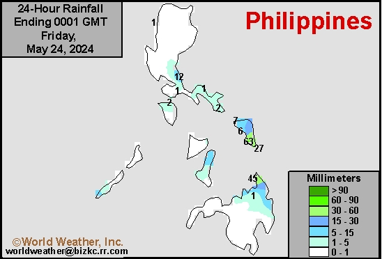
This content is for members only
Southeast North Rain
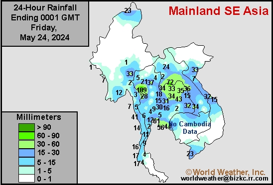
This content is for members only
Southeast North Min
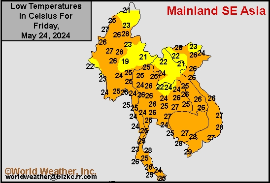
This content is for members only
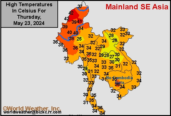
Southeast North Max
This content is for members only