
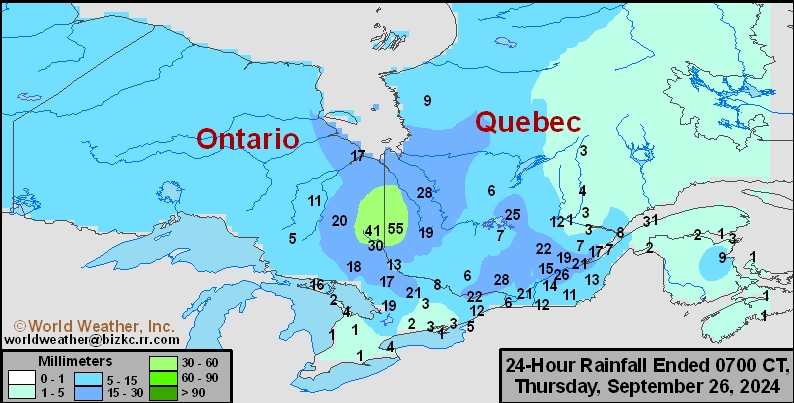
SE Canada Rainfall
This content is for members only
Prairies Rainfall

This content is for members only
Prairies Max Temperature

This content is for members only
Prairies Min Temperature

This content is for members only
Canada Rainfall

This content is for members only
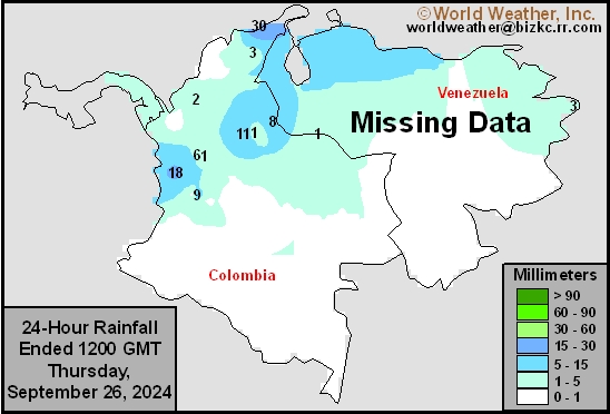
Venezuela Rainfall
This content is for members only
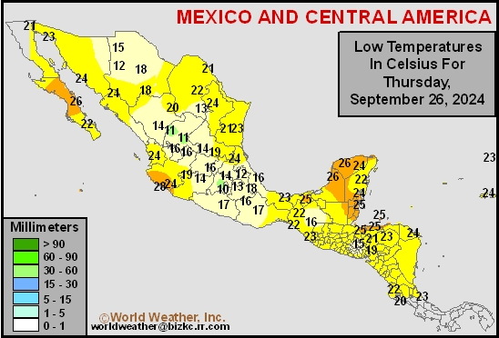
Mexico Min Temperature
This content is for members only
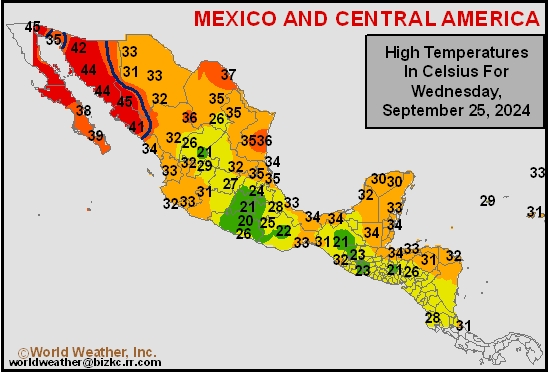
Mexico Max Temperature
This content is for members only
Mexico Rainfall
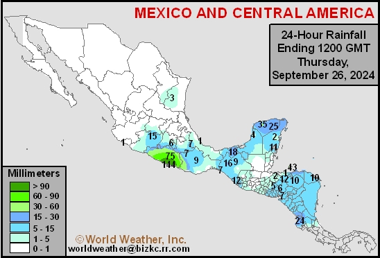
This content is for members only
Argentina Min Temperature
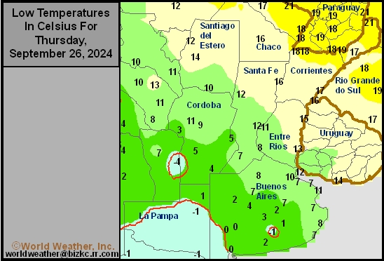
This content is for members only
Argentina Max Temperature
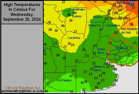
This content is for members only
Argentina Rainfall
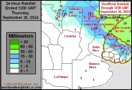
This content is for members only
Brazil Min Temperature
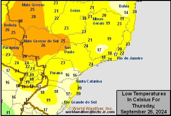
This content is for members only
Brazil Max Temperature
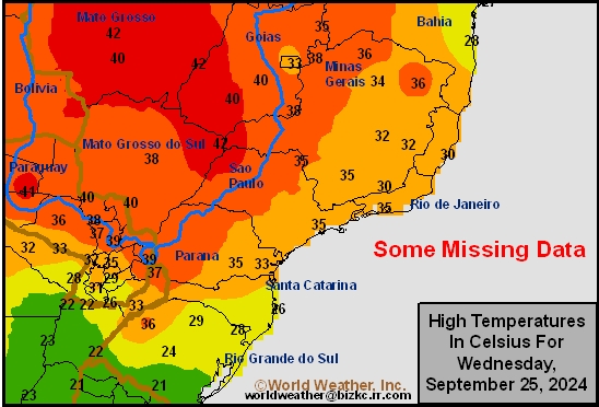
This content is for members only
Brazil Rainfall
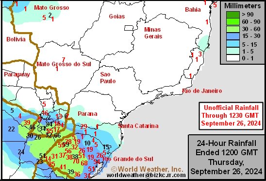
This content is for members only
Philippines Min
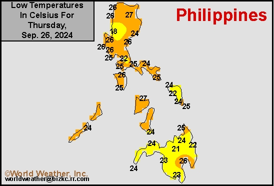
This content is for members only
Philippines Max
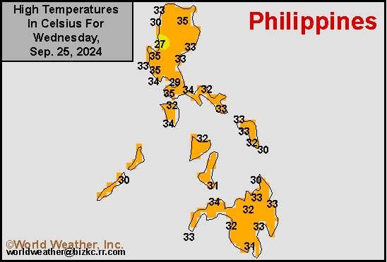
This content is for members only
Philippines Rain
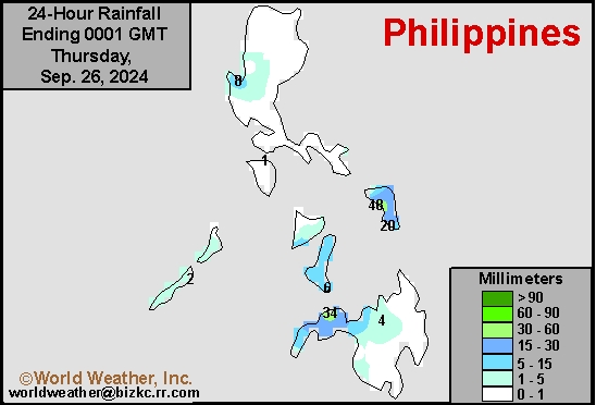
This content is for members only
Southeast North Rain
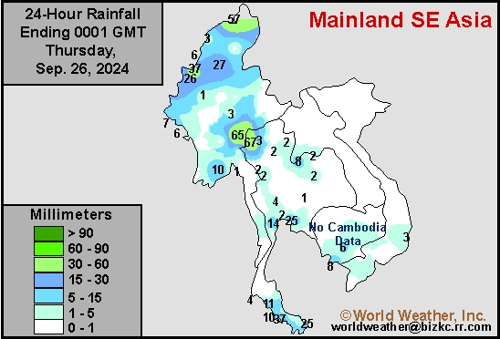
This content is for members only
Southeast North Min
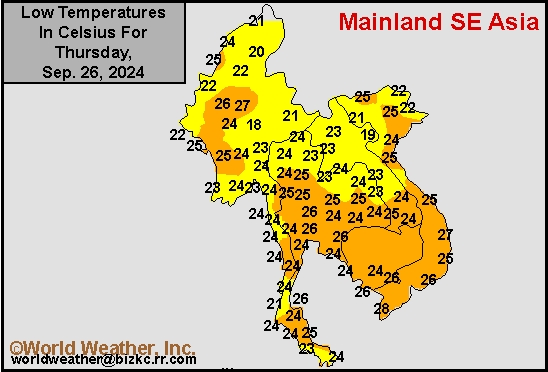
This content is for members only
Southeast North Max
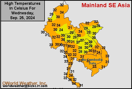
This content is for members only
Southeast Min
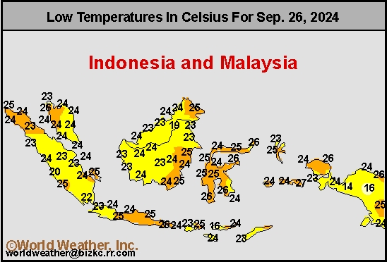
This content is for members only
Southeast Max
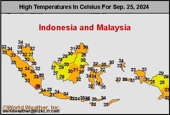
This content is for members only
Southeast Rain
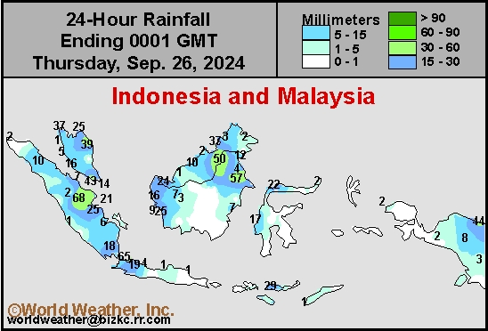
This content is for members only
West Africa Rain
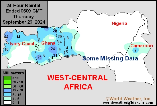
This content is for members only
Max Temperature
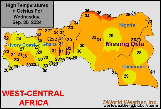
This content is for members only
Min Temperature
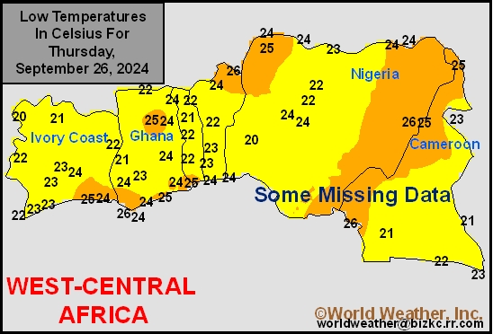
This content is for members only
North Africa Rain
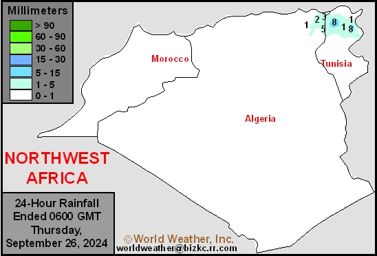
This content is for members only
Max Temperature
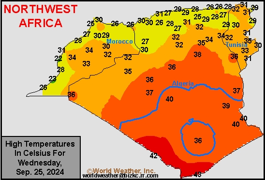
This content is for members only
Min Temperature
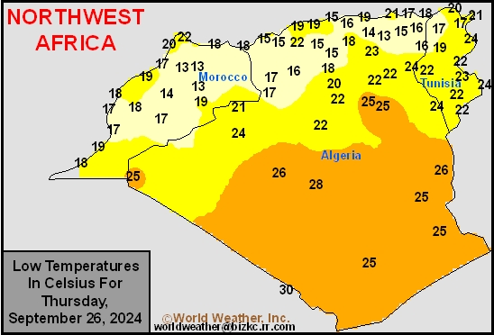
This content is for members only
Min Temperature
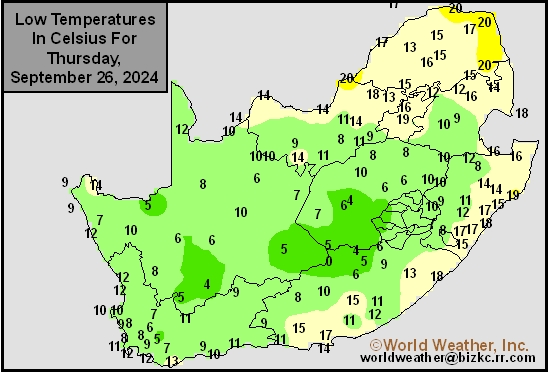
This content is for members only
Max Temperature
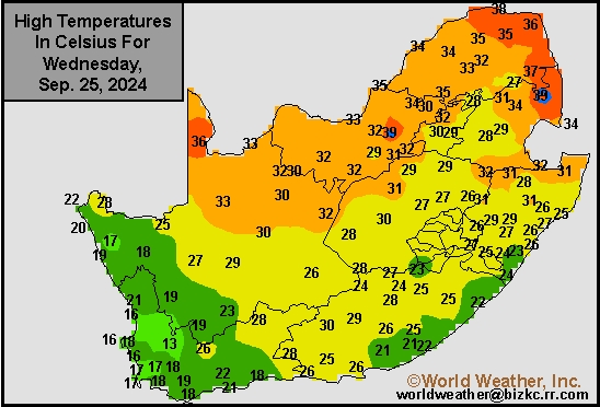
This content is for members only
South Africa Rain
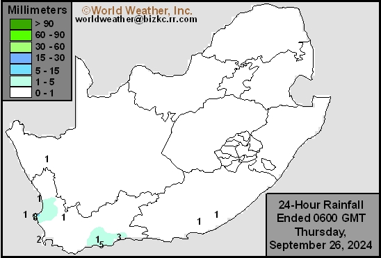
This content is for members only
Hard Red Wheat Tmin
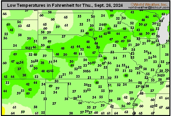
This content is for members only
Northeast Tmin
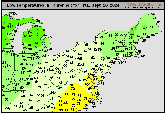
This content is for members only
Southwest Tmin
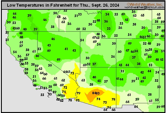
This content is for members only
Northwest Tmin
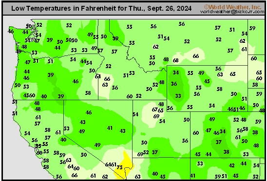
This content is for members only
South Plains Tmin
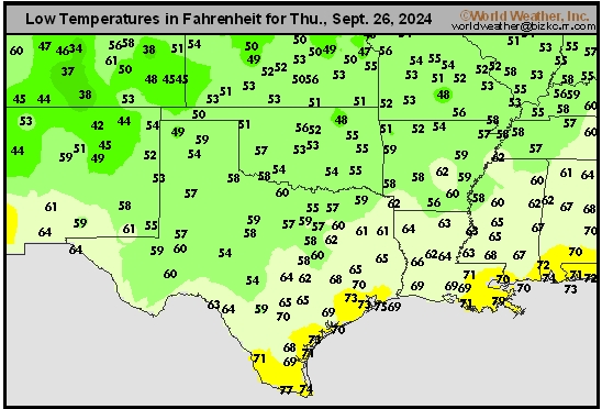
This content is for members only
Delta/SE U.S. Tmin
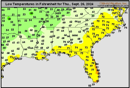
This content is for members only
Corn Belt Tmin
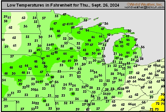
This content is for members only
US Min

This content is for members only
North Plains Tmin
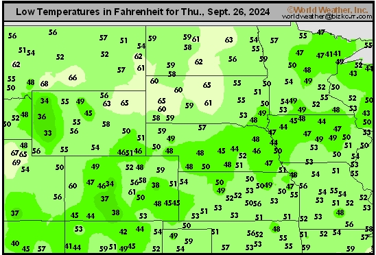
This content is for members only
Hard Red Wheat Tmax
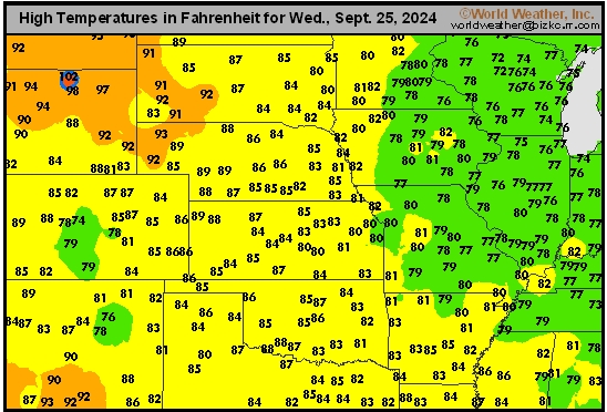
This content is for members only
Northeast Tmax
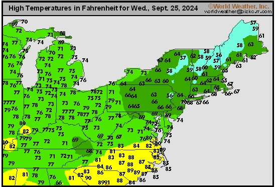
This content is for members only
Southwest Tmax
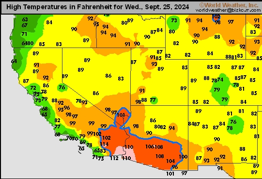
This content is for members only
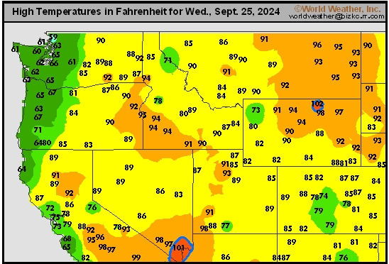
Northwest Tmax
This content is for members only
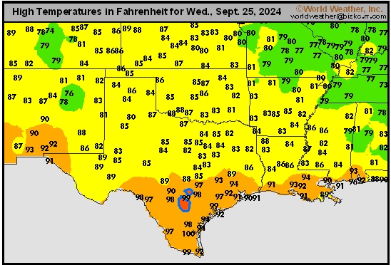
South Plains Tmax
This content is for members only
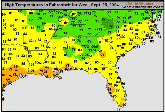
Delta/SE U.S. Tmax
This content is for members only
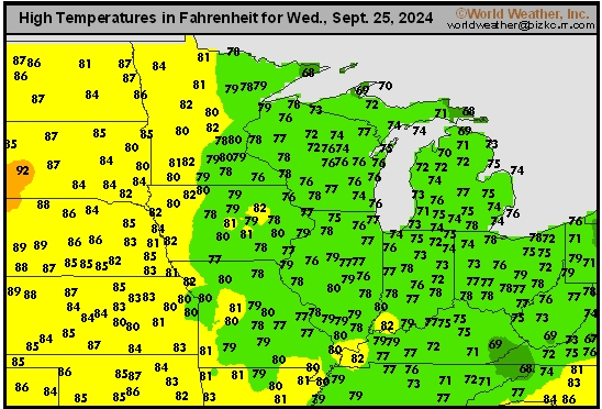
Corn Belt Tmax
This content is for members only
North Plains Tmax
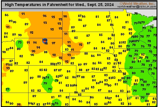
This content is for members only
US Max

This content is for members only
US Rain

This content is for members only
Northeast Daily Rain
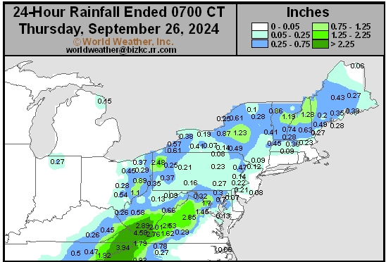
This content is for members only
Hard Red Wheat Daily Rain
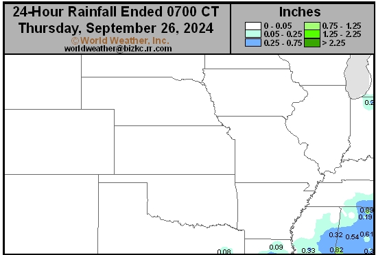
This content is for members only
Southwest Daily Rain
This content is for members only
Northwest Daily Rain
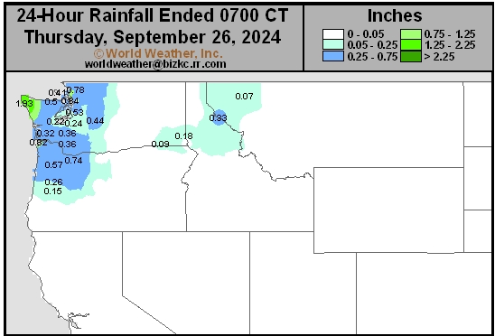
This content is for members only
South Plains Daily Rain
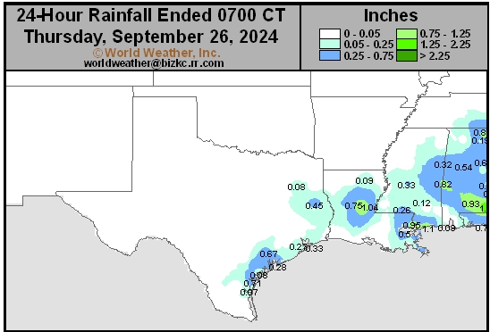
This content is for members only
Delta/SE U.S. Daily Rain
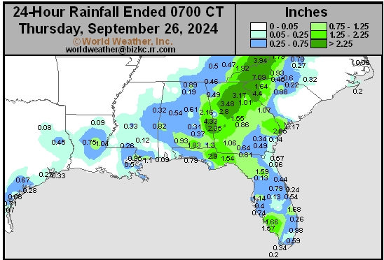
This content is for members only
Corn Belt Daily Rain
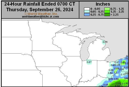
This content is for members only
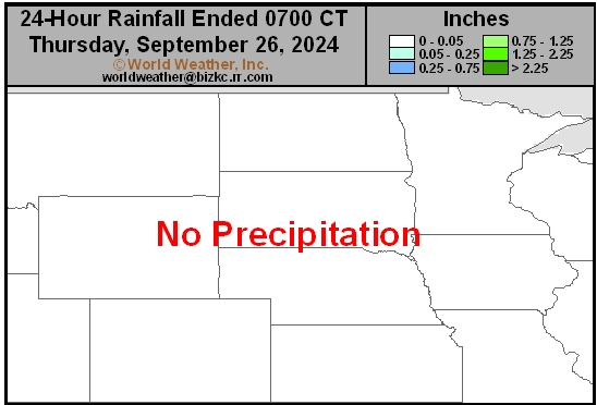
North Plains Daily Rain
This content is for members only
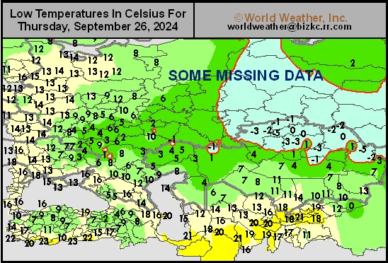
Low Temperature
This content is for members only
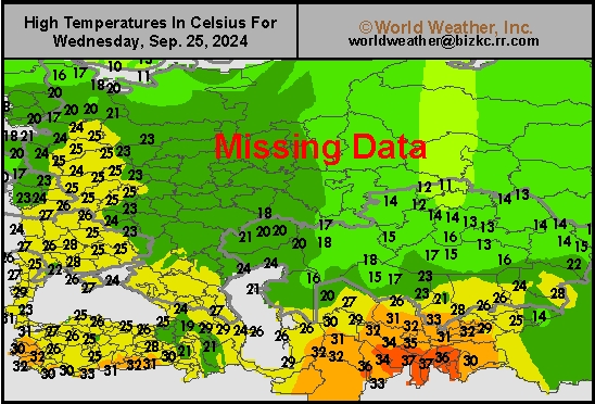
High Temperature
This content is for members only
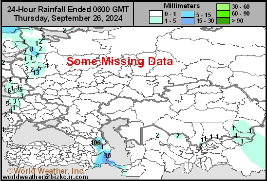
CIS Rainfall
This content is for members only
Low Temperature
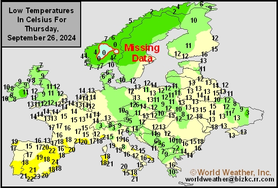
This content is for members only
High Temperature
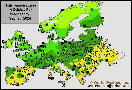
This content is for members only
Europe Rainfall
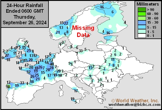
This content is for members only
Low Temperature
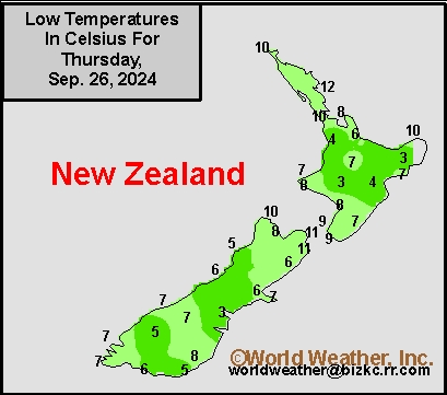
This content is for members only
High Temperature
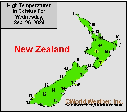
This content is for members only
New Zealand Rainfall
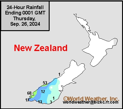
This content is for members only
Low Temperature
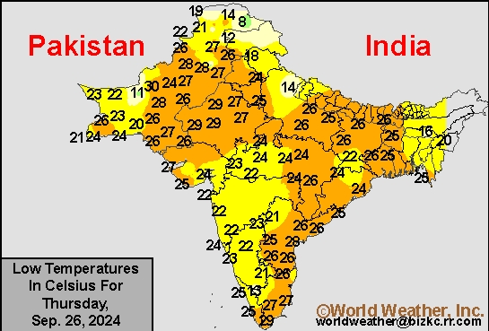
This content is for members only
High Temperature
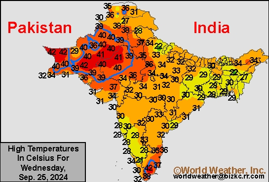
This content is for members only
India Rainfall
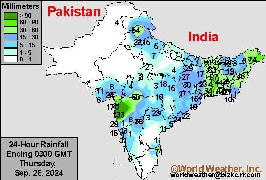
This content is for members only
Low Temperature
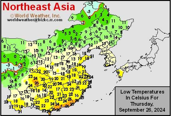
This content is for members only
Japan Rainfall
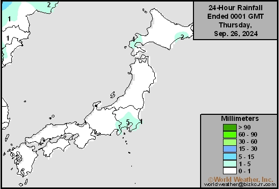
This content is for members only
Low Temperature
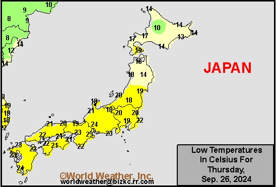
This content is for members only
High Temperature
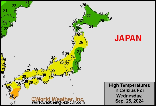
This content is for members only
High Temperature
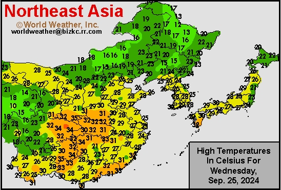
This content is for members only
China Rainfall
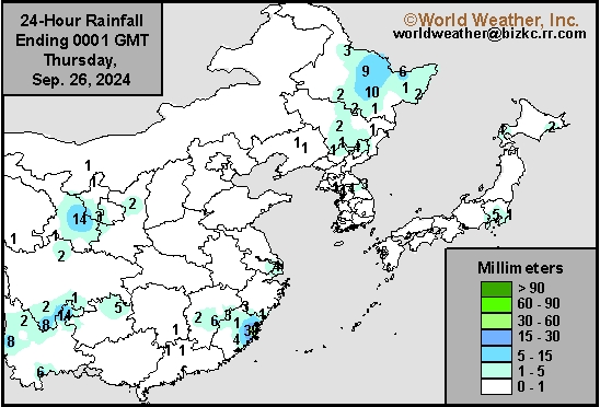
This content is for members only
Low Temperature
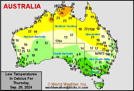
This content is for members only
High Temperature
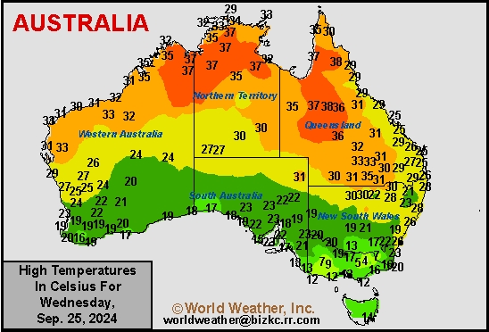
This content is for members only
Austrailia Rainfall
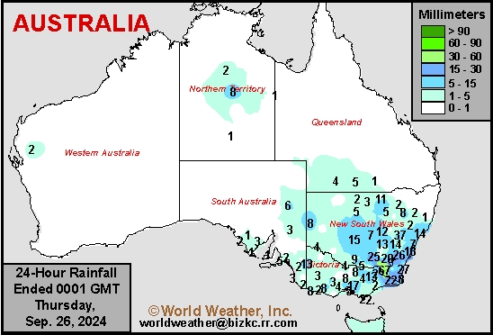
This content is for members only
Southeast U.S. Rainfall From Helene Through 10am CDT
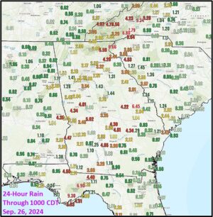
Kansas City, September 26 (World Weather Inc.) – Hurricane Helene was still 255 miles from Tampa Florida and 290 miles south of Apalachicola at 10am CDT today, but rain has already been falling since Wednesday from Florida to the southern Appalachian Mountains. Flood warnings are already in effect and the situation is expected to get worse as the storm comes ashore tonight and reaches into Tennessee Friday.
Tropical Storm Isaac In Atlantic Ocean Poses No Land Threat
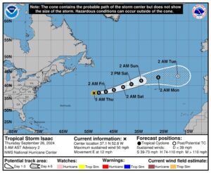
Kansas City, September 26 (World Weather Inc.) – Tropical Storm Isaac evolved in the central Atlantic Ocean overnight, but was expected to move east northeasterly during the next few days. The system will move away from North America and will become a hurricane briefly this weekend. The system will then weaken as it moves toward Western Europe with some gradual translation into a mid-latitude storm system over time.
Hurricane Helene’s Impact May Be Like That of Michael In 2018
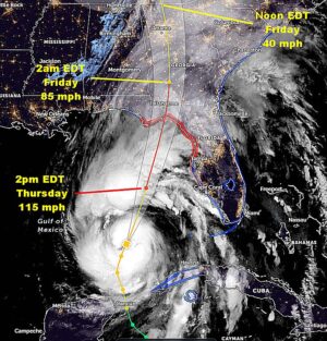
Kansas City, September 26 (World Weather Inc.) – Hurricane Helene will be barreling its way toward the southeastern United States today with landfall this evening in the northern Apalachee Bay south of Tallahassee, Florida. Landfall will occur as a Category Three storm with devastating impacts from the entire Apalachee Bay area northward into southern Georgia. Crop and property damage will likely be similar to that of Hurricane Michael that impacted much of the same region in early October 2018. Catastrophic damage will occur within 120 miles of the storm center, although the worst conditions will extend about 80 miles northeast of where the storm center reaches land.
Center-West, Center-South Brazil To Remain Drier Biased
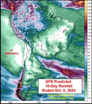
Kansas City, September 25 (World Weather Inc.) – Mato Grosso do Sul and portions of Sao Paulo and southern Minas Gerais received some rain during the past week that marginally bolster soil moisture. However, much of center-west, center-south, and northeastern Brazil remain too dry to support ideal early-season planting. These areas will again experience drier and warmer than normal weather through the middle of next week that will likely further delay aggressive planting. Pre-monsoonal showers and thunderstorms may begin during the second week of the outlook and “may” stimulate “some” early-season planting in pockets. Southern Brazil, otherwise, received varying amounts of rain during the past week with more on the way through the middle of next week. Planting and general fieldwork in the south will advance around the periods of rain.
India Monsoon Season To End Well; Flood Potential Rises In East
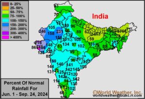
Kansas City, September 25 (World Weather Inc.) – India’s monsoon season will be winding down soon, but as it does there will be some last minute bolstering of soil moisture and water supply in both the far south and some eastern portions of the nation where summer rainfall was a little lighter than usual at times. Overall, the nation has experienced a very good monsoon season and crop production is expected to be highly favorable because of timely rain in most areas. Dryness remains an issue in the far south of the nation, although rain will fall significantly in the next ten days in that region. Similarly a part of eastern India will get hit with waves of heavy rain in the next two weeks resulting in some potential for flooding. Some of the long term moisture deficits in the lower Ganges River Basin may be reduced by the end of October’s first week of weather.
Argentina Spring Planting Must Have Better Rain Soon
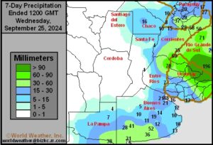
Kansas City, September 25 (World Weather Inc.) – With planting season approaching for much of Argentina, the need for rain is increasing. Severe moisture shortages persist in western and central Argentina and abundant rain will be needed to fix the dryness. Buenos Aires, Entre Rios, and Corrientes received some rain in recent weeks that slowly improved the moisture profile. However, more rain is also needed in these areas to support ideal planting and establishment. Northern Argentina will see a good mix of rain and sunshine through the middle of next week. The main Pampas production region will otherwise trend drier than normal. Rainfall may again be limited for much of crop country during the second week of the outlook as well. Planting conditions will remain less than favorable to poor for much of Argentina in the coming weeks outside the areas in northern Argentina that receive the greatest amount of rain.
Venezuela/Colombia Min Temps
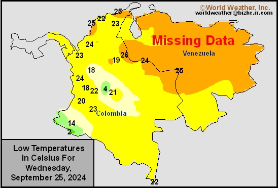
This content is for members only
Venezuela/Colombia Max Temps
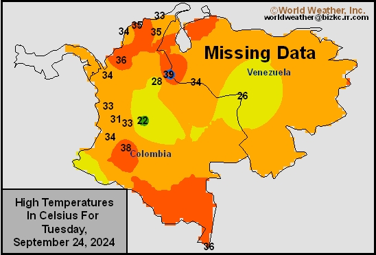
This content is for members only
SE Canada Min
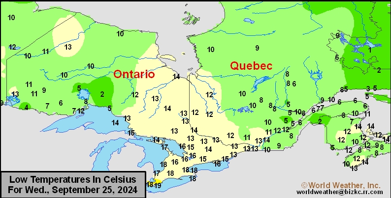
This content is for members only
SE Canada Max
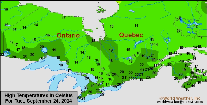
This content is for members only
SE Canada Rainfall
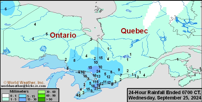
This content is for members only
Prairies Rainfall

This content is for members only
Prairies Max Temperature

This content is for members only
Prairies Min Temperature

This content is for members only
Canada Rainfall

This content is for members only
Venezuela Rainfall
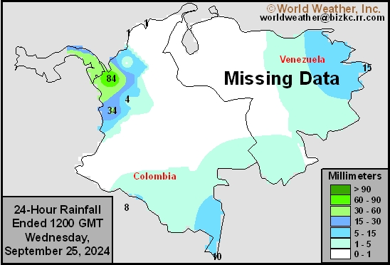
This content is for members only
Mexico Min Temperature
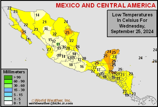
This content is for members only
Mexico Max Temperature
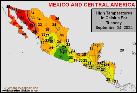
This content is for members only
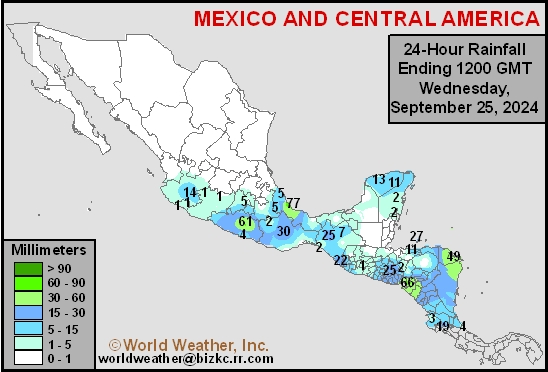
Mexico Rainfall
This content is for members only