
Europe Rainfall
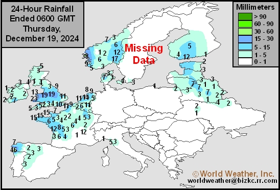
This content is for members only
Low Temperature
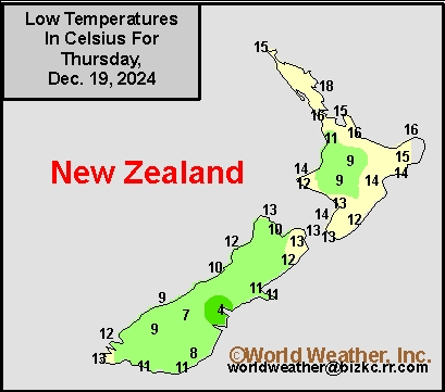
This content is for members only
High Temperature
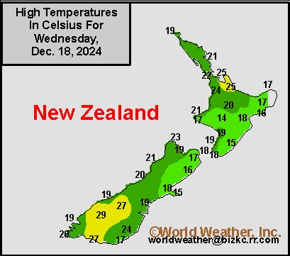
This content is for members only
New Zealand Rainfall
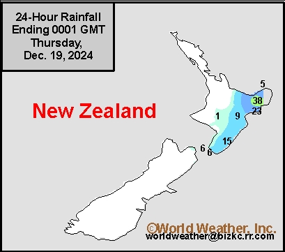
This content is for members only
Low Temperature
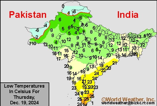
This content is for members only
High Temperature
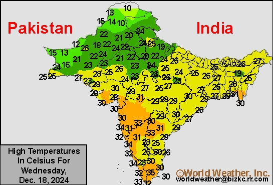
This content is for members only
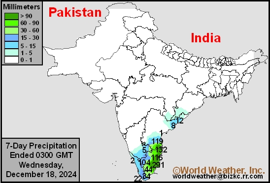
India Rainfall
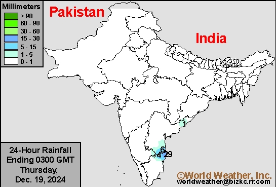
This content is for members only
Low Temperature
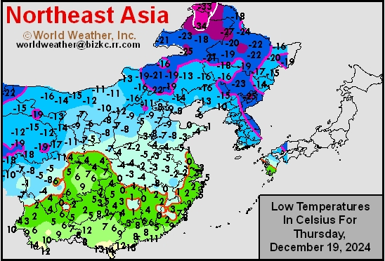
This content is for members only
Japan Rainfall
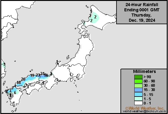
This content is for members only
Low Temperature
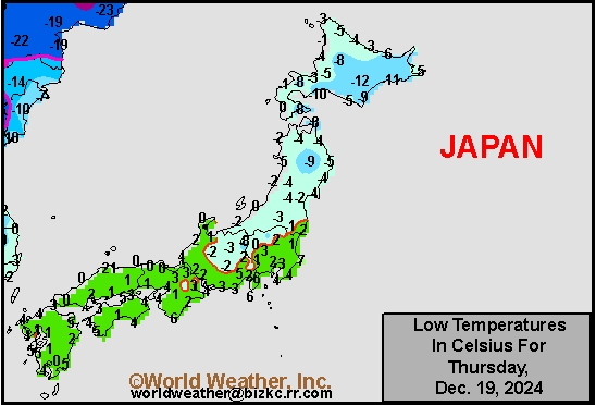
This content is for members only
High Temperature
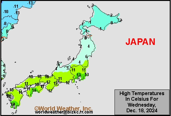
This content is for members only
High Temperature
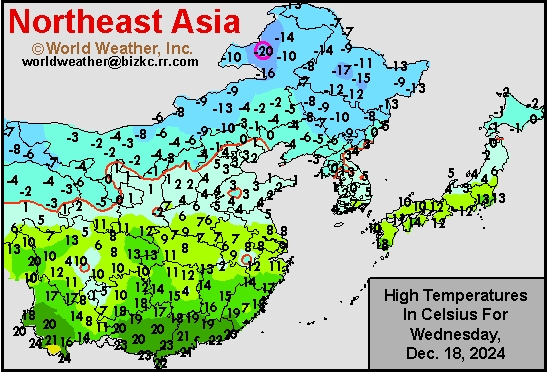
This content is for members only
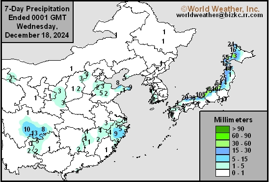
China Rainfall
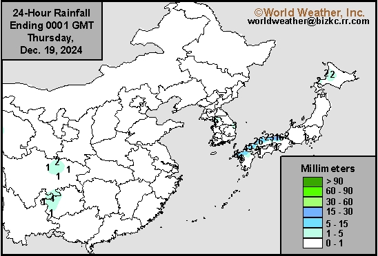
This content is for members only
Low Temperature
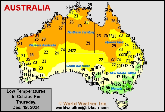
This content is for members only
High Temperature
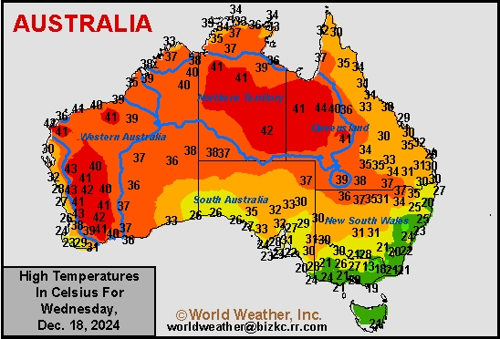
This content is for members only
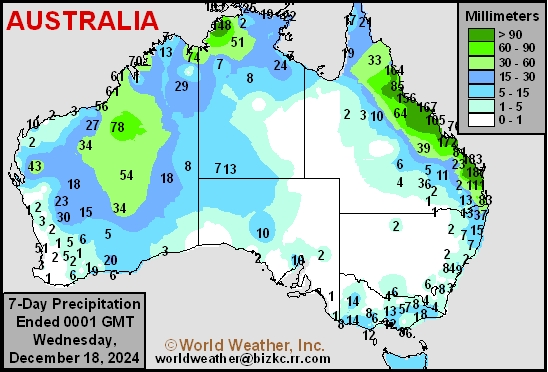
Austrailia Rainfall
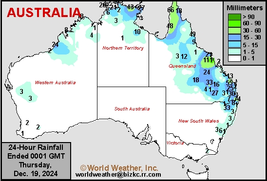
This content is for members only
U.S. Pacific Northwest, British Columbia Rain To Slow Shipping
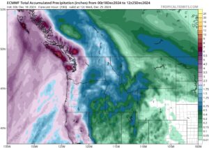
Kansas City, December 18 (World Weather Inc.) – A succession of disturbances will generate waves of precipitation for the U.S. Pacific Northwest, southwestern British Columbia, and neighboring locations for at least the next seven to ten days. The frequent precipitation may slow port activities in and around the Puget Sound and neighboring areas of British Columbia. Mountain snowpack will also increase significantly for portions of the Cascades and northern Rocky Mountains. Precipitation will also reach the main production areas of the Pacific Northwest, though precipitation totals will be much lower compared to areas closer to the coastline. The combination of precipitation and increased mountain snowpack will support a better outlook for the winter grains.
India’s Dryland Winter Crops Need Rain Soon
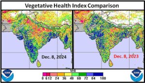
Kansas City, December 18 (World Weather Inc.) – Excessive heat across India’s central and northern crop areas during October was particularly brutal and most of November continued warmer than usual as well. The heat followed a favorable summer monsoon that had improved water supply for many areas; however, dryland winter crop areas quickly dried out after weeks of temperatures in the 90s to well over 100 degrees Fahrenheit in October and in the 80s and 90s in early November. The heat and resulting dryness delayed winter crop planting and led to some poor emergence and establishment in unirrigated fields. The Vegetative Health Index reveals this situation quite clearly. That does not mean winter crop production is doomed to be well below normal, but it does suggest that timely rainfall “must” occur sooner rather than later to get dryland crops in better shape prior to reproduction. Irrigated fields should perform well as long as February is not too hot.
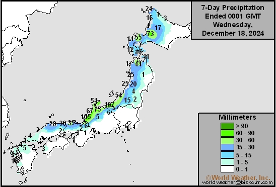
7-Day Rainfall
This content is for members only
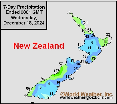
7-Day Rainfall
This content is for members only
7-Day Rainfall
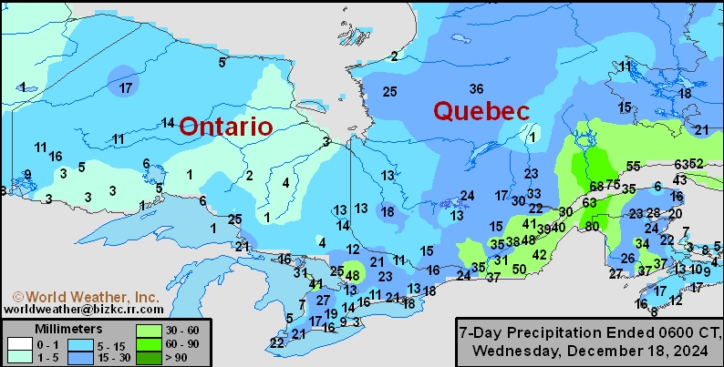
This content is for members only
7-Day Rainfall

This content is for members only
7-Day Rainfall

This content is for members only
7-Day Rainfall
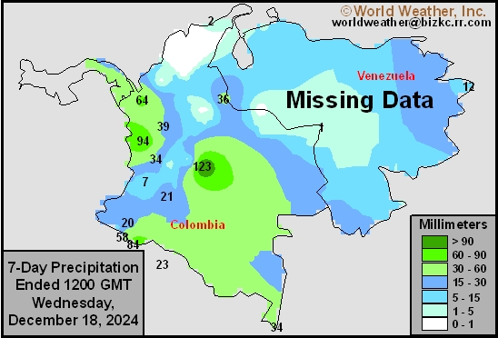
This content is for members only
7-Day Rainfall
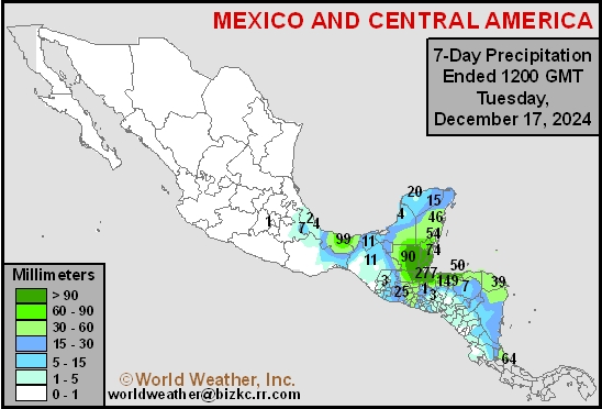
This content is for members only
Hard Red Wheat 7-Day Rain
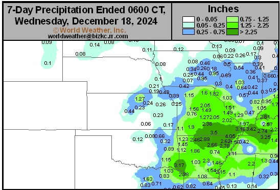
This content is for members only
Northeast 7-Day Rain
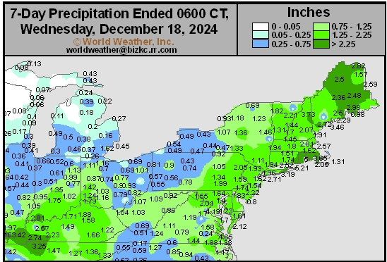
This content is for members only
Southwest 7-Day Rain
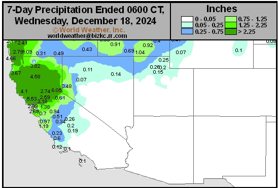
This content is for members only
Northwest 7-Day Rain
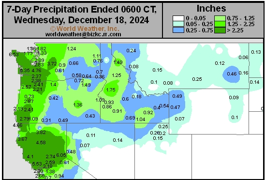
This content is for members only
South Plains 7-Day Rain
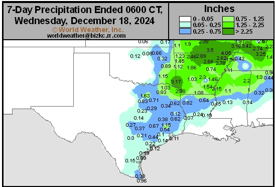
This content is for members only
Delta/SE U.S. 7-Day Rain
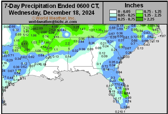
This content is for members only
Corn Belt 7-Day Rain
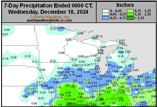
This content is for members only
North Plains 7-Day Rain
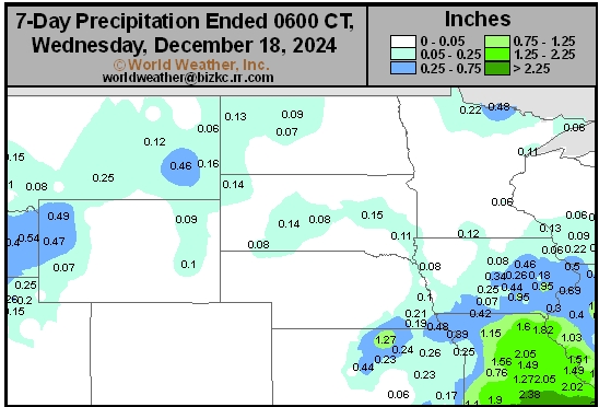
This content is for members only
7-Day Rainfall

This content is for members only
7-Day Rainfall
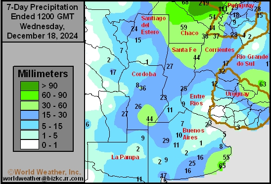
This content is for members only
7-Day Rainfall
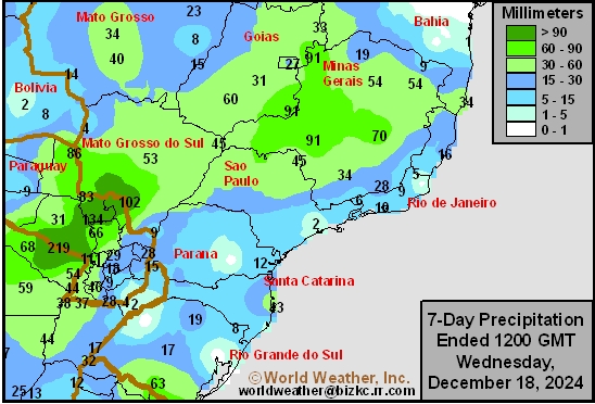
This content is for members only
7-Day Rainfall
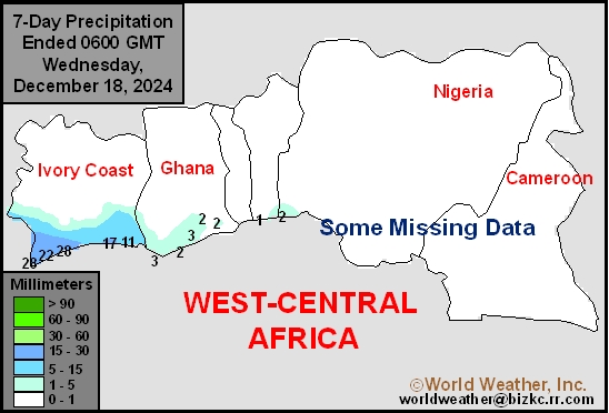
This content is for members only
7-Day Rainfall
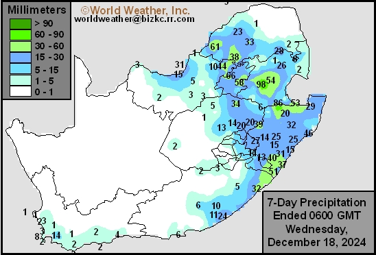
This content is for members only
7-Day Rainfall
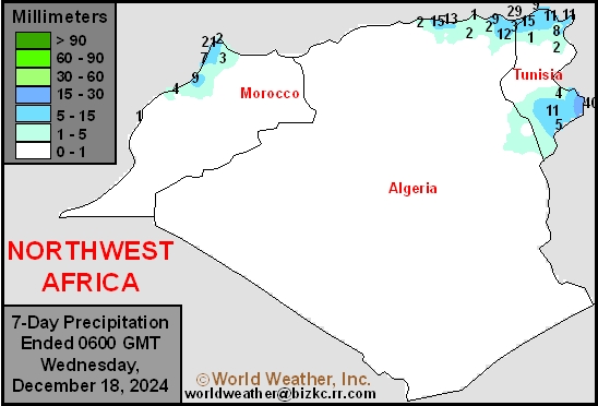
This content is for members only
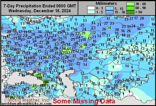
7-Day Rainfall
This content is for members only
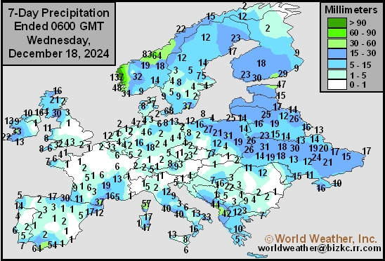
7-Day Rainfall
This content is for members only
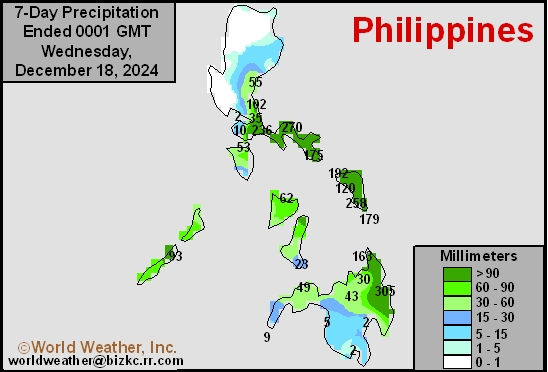
7-Day Rainfall
This content is for members only
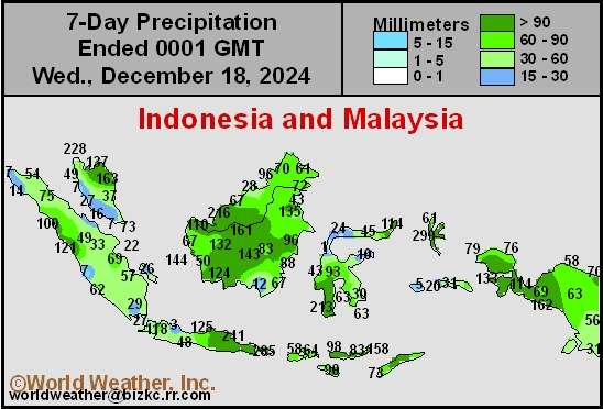
7-Day Rainfall
This content is for members only
7-Day Rainfall
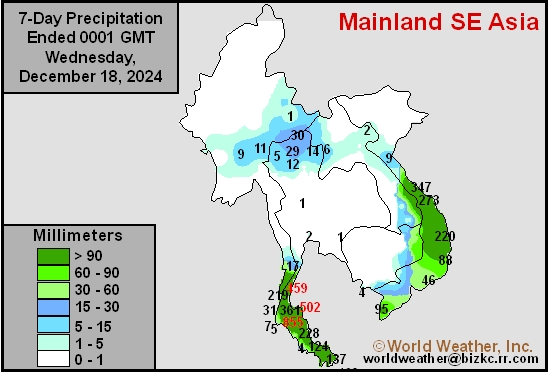
This content is for members only
7-Day Rainfall
This content is for members only
7-Day Rainfall
This content is for members only
7-Day Rainfall
This content is for members only
Venezuela/Colombia Min Temps
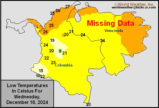
This content is for members only
Venezuela/Colombia Max Temps
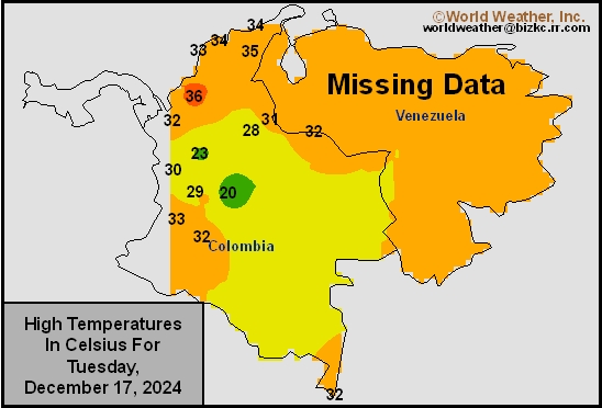
This content is for members only
SE Canada Min
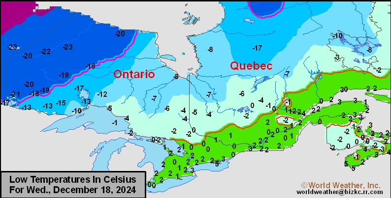
This content is for members only
SE Canada Max
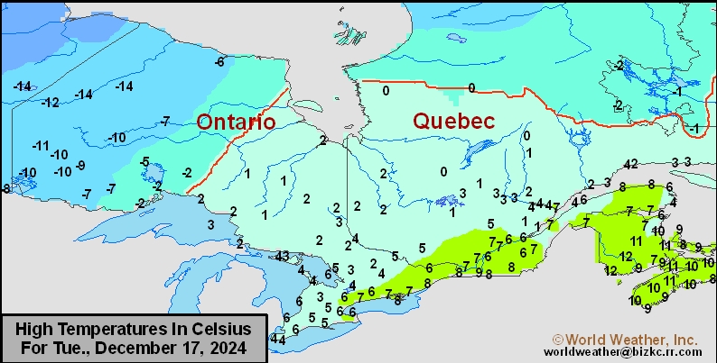
This content is for members only
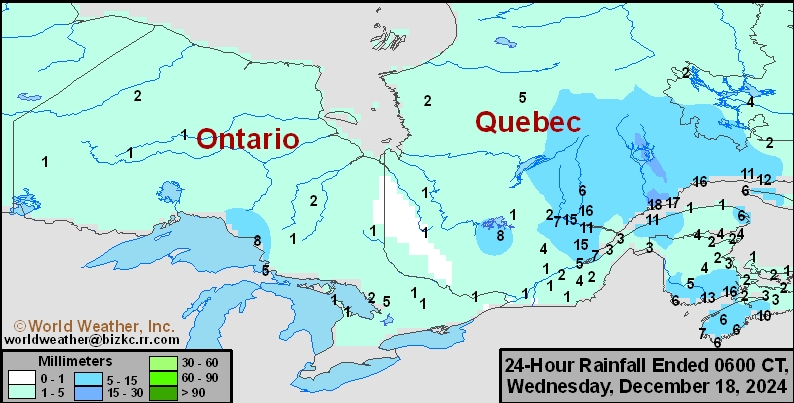
SE Canada Rainfall
This content is for members only
Prairies Rainfall

This content is for members only
Prairies Max Temperature

This content is for members only
Prairies Min Temperature

This content is for members only
Canada Rainfall

This content is for members only
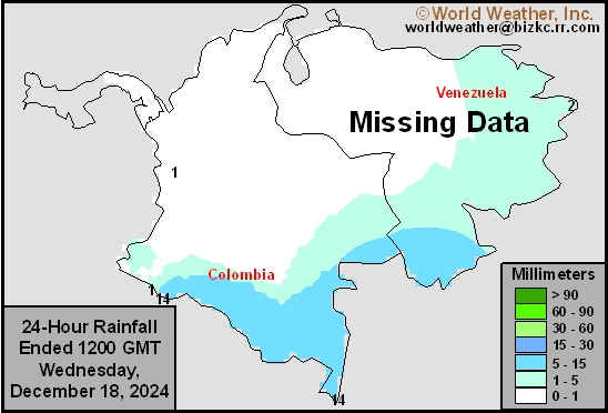
Venezuela Rainfall
This content is for members only
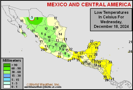
Mexico Min Temperature
This content is for members only
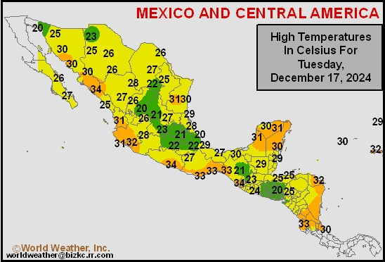
Mexico Max Temperature
This content is for members only
Mexico Rainfall
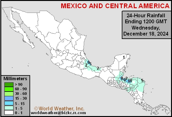
This content is for members only
Argentina Min Temperature
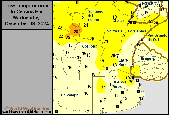
This content is for members only
Argentina Max Temperature
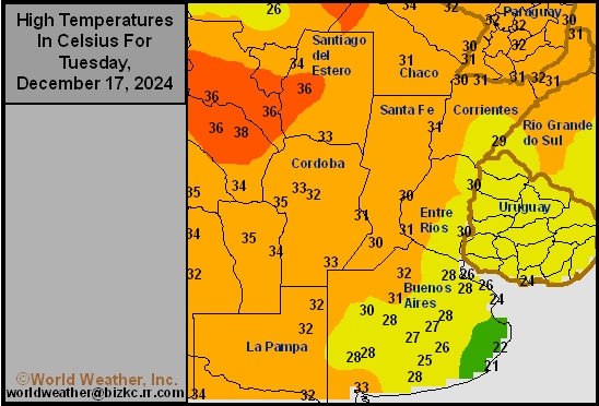
This content is for members only
Argentina Rainfall
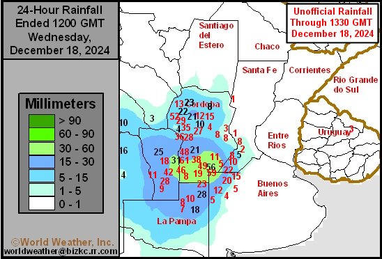
This content is for members only
Brazil Min Temperature
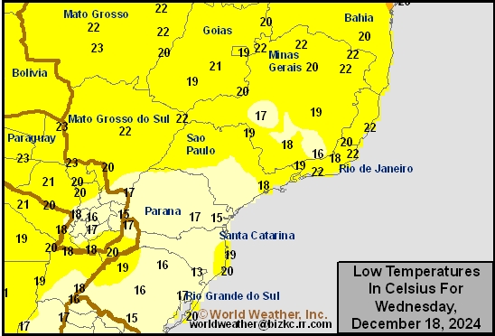
This content is for members only
Brazil Max Temperature
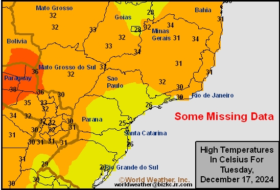
This content is for members only
Brazil Rainfall
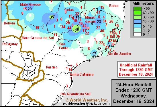
This content is for members only
Philippines Min
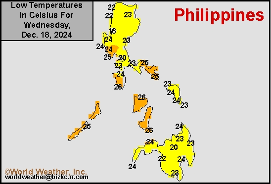
This content is for members only
Philippines Max
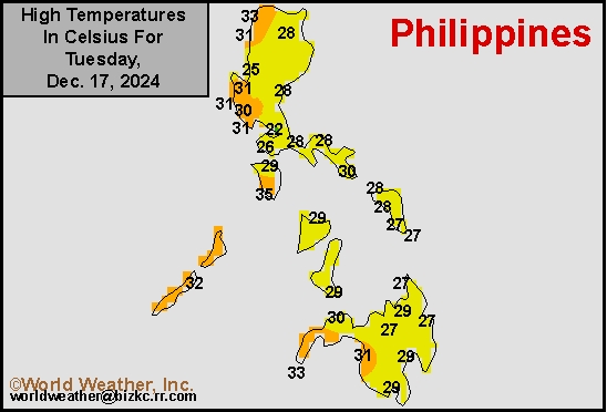
This content is for members only
Philippines Rain
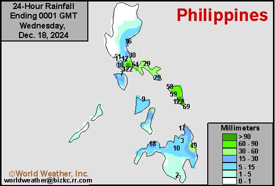
This content is for members only
Southeast North Rain
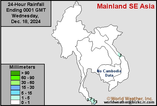
This content is for members only
Southeast North Min
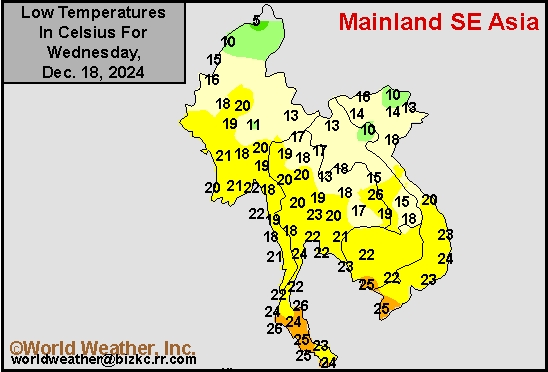
This content is for members only
Southeast North Max
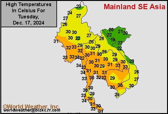
This content is for members only
Southeast Min
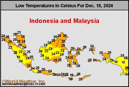
This content is for members only
Southeast Max
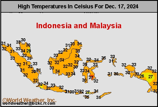
This content is for members only
Southeast Rain
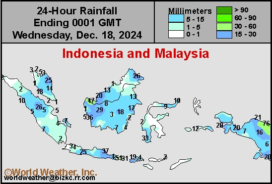
This content is for members only
West Africa Rain
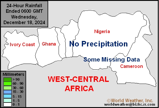
This content is for members only
Max Temperature
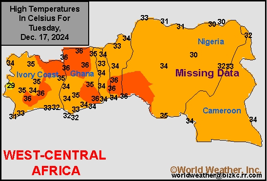
This content is for members only
Min Temperature
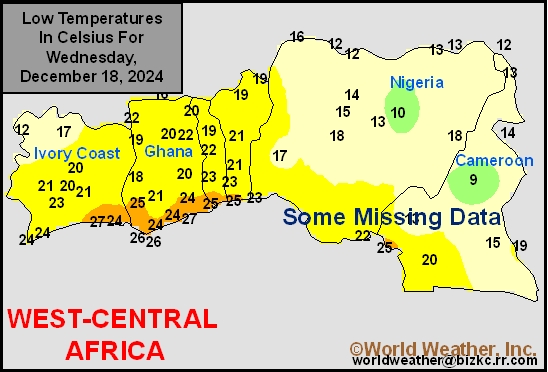
This content is for members only
North Africa Rain
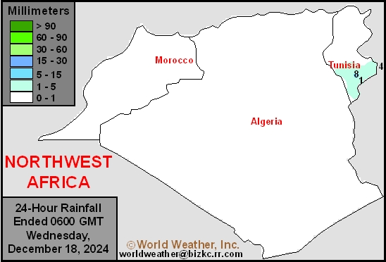
This content is for members only
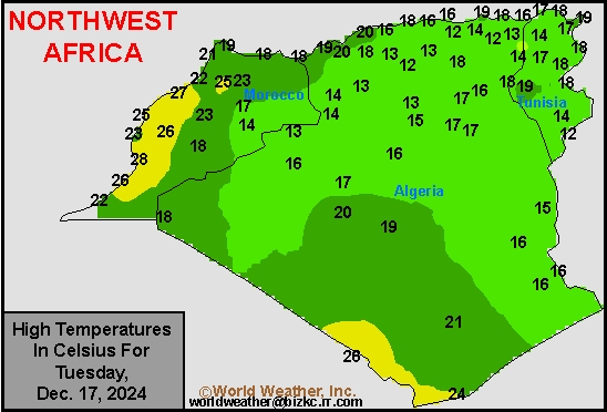
Max Temperature
This content is for members only
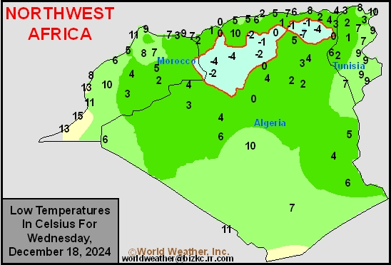
Min Temperature
This content is for members only
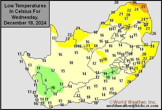
Min Temperature
This content is for members only
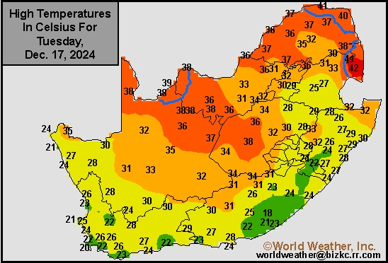
Max Temperature
This content is for members only
South Africa Rain
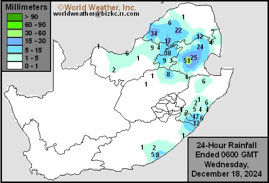
This content is for members only
Hard Red Wheat Tmin
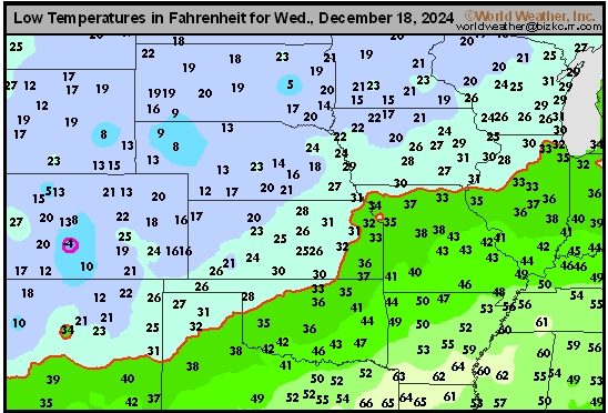
This content is for members only
Northeast Tmin
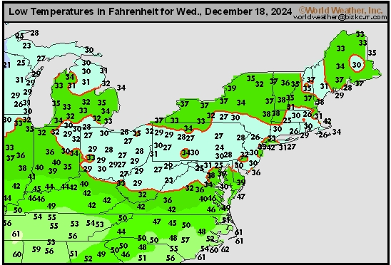
This content is for members only
Southwest Tmin
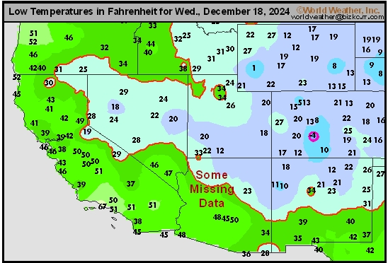
This content is for members only
Northwest Tmin
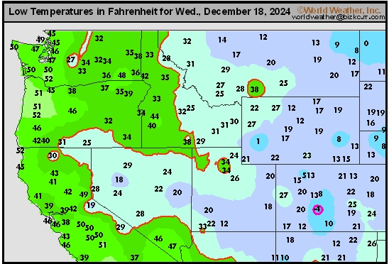
This content is for members only
South Plains Tmin
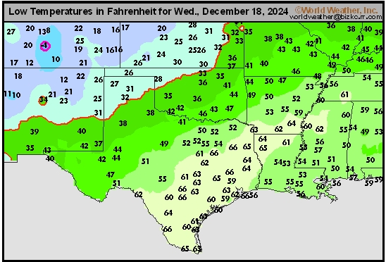
This content is for members only
Delta/SE U.S. Tmin
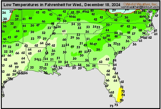
This content is for members only
Corn Belt Tmin
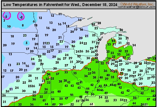
This content is for members only
US Min

This content is for members only
North Plains Tmin
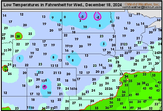
This content is for members only
Hard Red Wheat Tmax
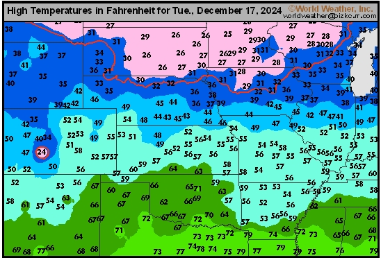
This content is for members only
Northeast Tmax
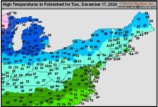
This content is for members only
Southwest Tmax
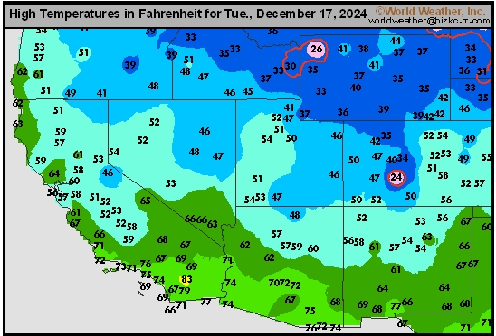
This content is for members only
Northwest Tmax
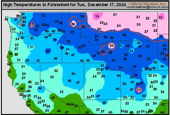
This content is for members only
South Plains Tmax
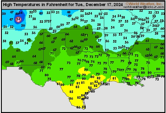
This content is for members only
Delta/SE U.S. Tmax
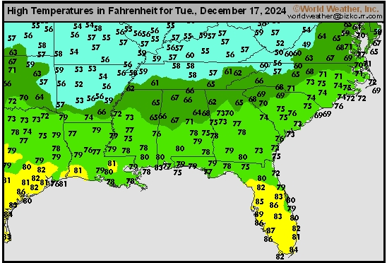
This content is for members only
Corn Belt Tmax
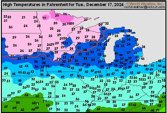
This content is for members only