
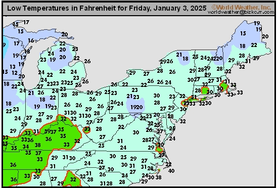
Northeast Tmin
This content is for members only
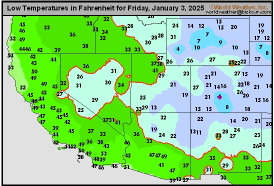
Southwest Tmin
This content is for members only
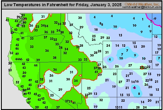
Northwest Tmin
This content is for members only
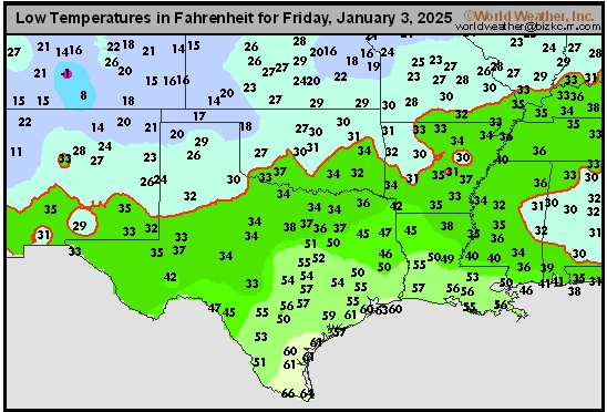
South Plains Tmin
This content is for members only
Delta/SE U.S. Tmin
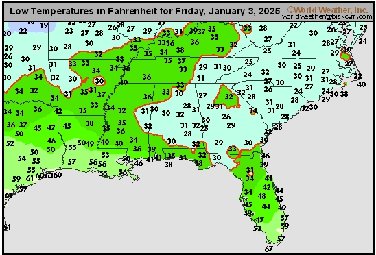
This content is for members only
Corn Belt Tmin
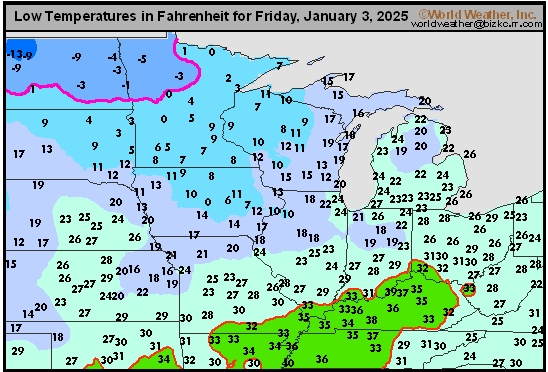
This content is for members only
US Min

This content is for members only
North Plains Tmin
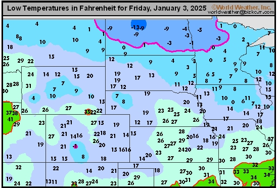
This content is for members only
Hard Red Wheat Tmax
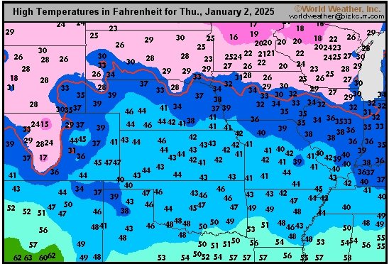
This content is for members only
Northeast Tmax
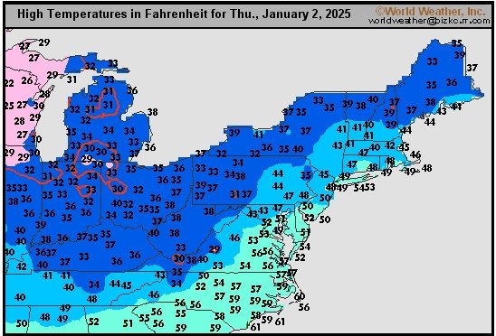
This content is for members only
Southwest Tmax
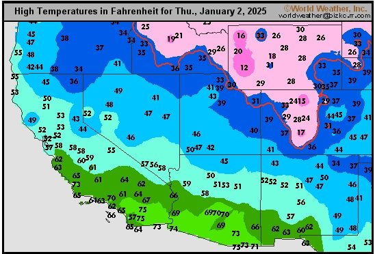
This content is for members only
Northwest Tmax
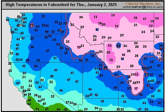
This content is for members only
South Plains Tmax
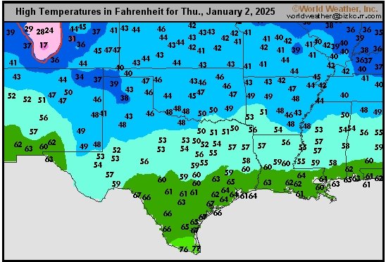
This content is for members only
Delta/SE U.S. Tmax
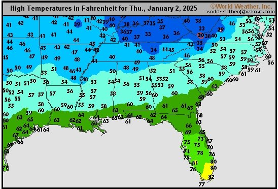
This content is for members only
Corn Belt Tmax
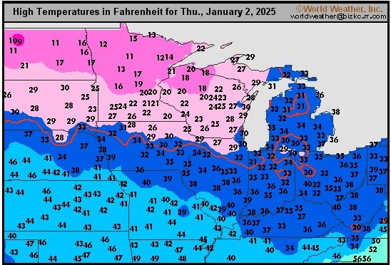
This content is for members only
North Plains Tmax
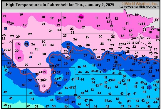
This content is for members only
US Max

This content is for members only
US Rain

This content is for members only
Northeast Daily Rain
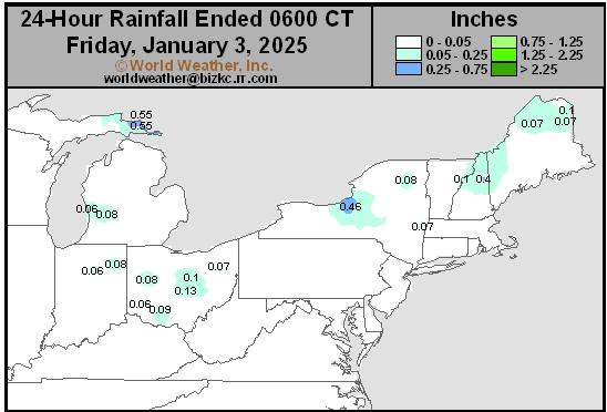
This content is for members only
Hard Red Wheat Daily Rain
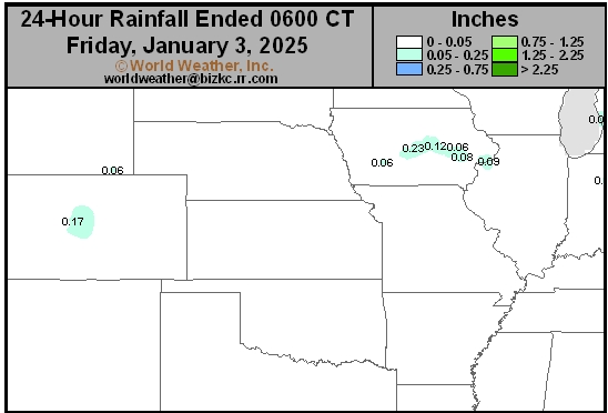
This content is for members only
Southwest Daily Rain
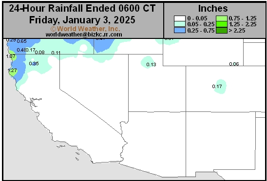
This content is for members only
Northwest Daily Rain
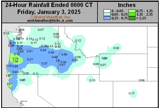
This content is for members only
South Plains Daily Rain
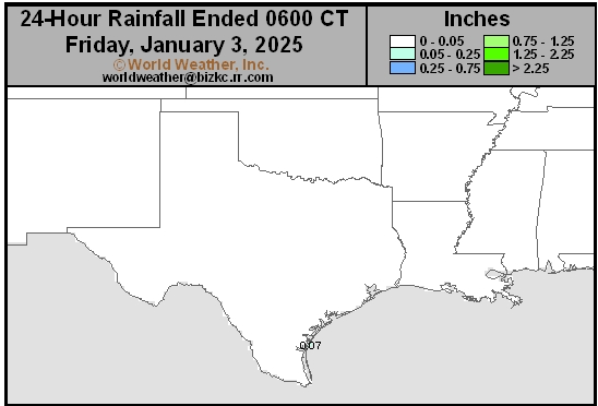
This content is for members only
Delta/SE U.S. Daily Rain
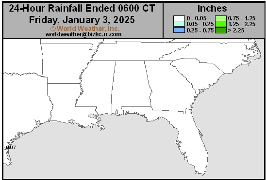
This content is for members only
Corn Belt Daily Rain
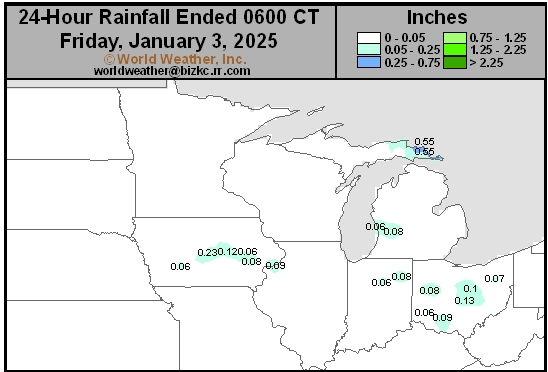
This content is for members only
North Plains Daily Rain
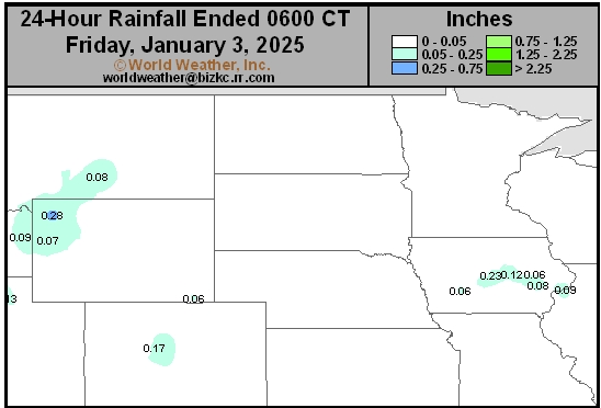
This content is for members only
Low Temperature
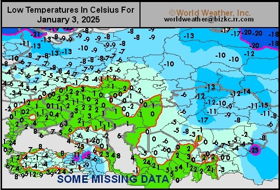
This content is for members only
High Temperature
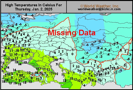
This content is for members only
CIS Rainfall
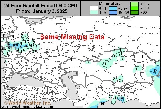
This content is for members only
Low Temperature
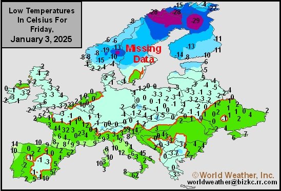
This content is for members only
High Temperature
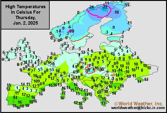
This content is for members only
Europe Rainfall
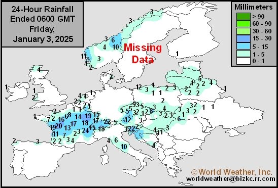
This content is for members only
Low Temperature
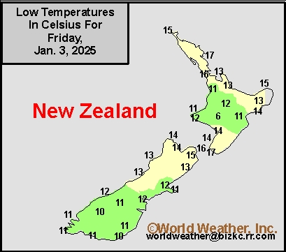
This content is for members only
High Temperature
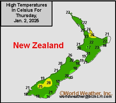
This content is for members only
New Zealand Rainfall
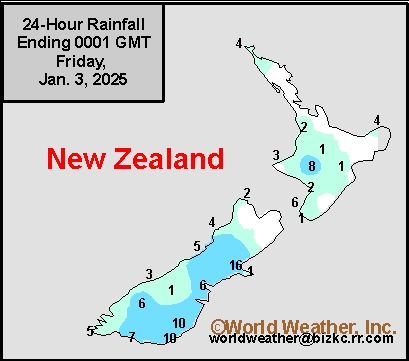
This content is for members only
Low Temperature
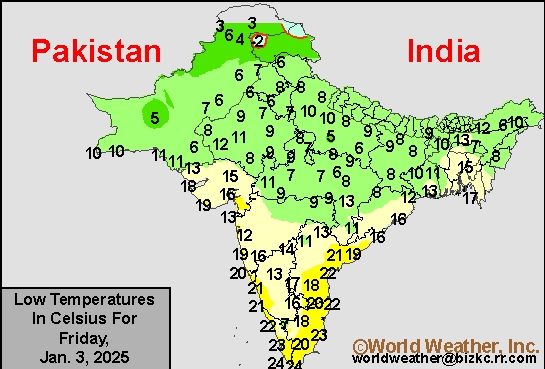
This content is for members only
High Temperature
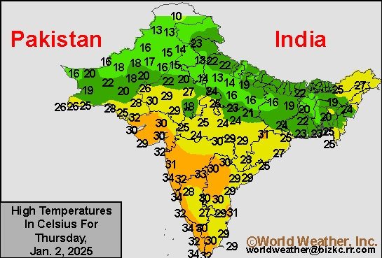
This content is for members only
India Rainfall
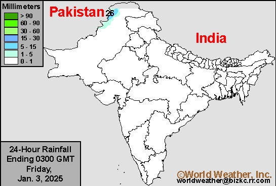
This content is for members only
Low Temperature
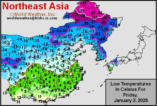
This content is for members only
Japan Rainfall
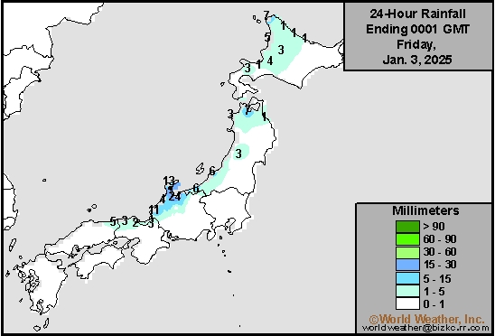
This content is for members only
Low Temperature
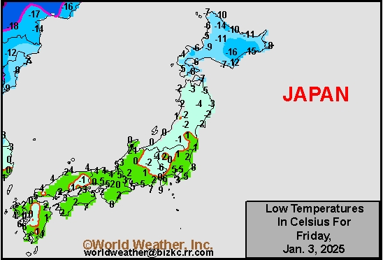
This content is for members only
High Temperature
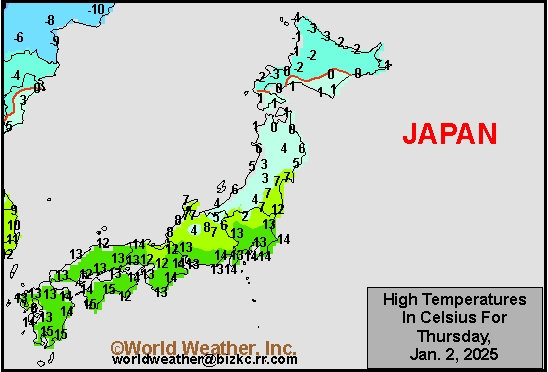
This content is for members only
High Temperature
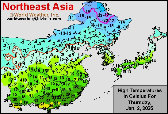
This content is for members only
China Rainfall
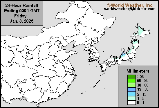
This content is for members only
Low Temperature
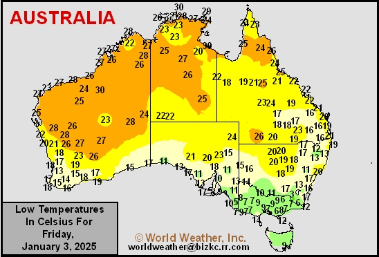
This content is for members only
High Temperature
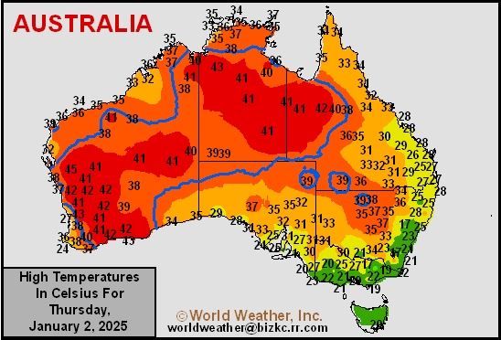
This content is for members only
Austrailia Rainfall
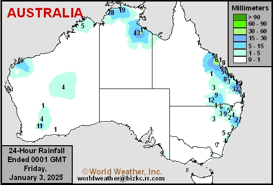
This content is for members only
U.S. Midwest Storm Promises Power Outages, Road Closures
Kansas City, January 3 (World Weather Inc.) – The first major winter storm of the season in the lower Midwest will evolve this weekend. The lack of big storms in the Midwest so far this season has kept commerce flowing freely and holiday travel advanced with very few issues except in the northeastern corner of the nation. An aggressive low pressure center expected to form Saturday in the southwestern U.S. Plains will bring copious amounts of sleet, freezing rain and snow from Kansas and southern Nebraska to Ohio, Virginia and Kentucky. The storm will disrupt electrical power, close some roads and airports and stress livestock. Bitter cold conditions will follow the storm and blizzard conditions may briefly develop as the storm is abating from the region.
Eastern Australia Dryland Summer Crops Need Moisture Boost
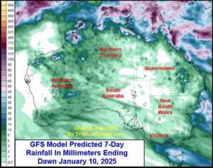
Kansas City, January 2 (World Weather Inc.) – Dryland summer crops in Queensland and New South Wales, Australia are experiencing a growing need for greater precipitation. Some locally heavy rain fell in portions of southeastern Queensland during this past week, but a large portion of the state’s unirrigated summer crops and those in New South Wales are in need of significant rain to fix long term moisture deficits and ease crop stress. Periods of hot weather were also noted, which accelerated drying between rain events. Summer grains, oilseeds, cotton, and other crops may have been stressed during the warmest periods. The need for rain is high in order to improve development conditions. Drier and warmer than normal weather will persist for the next seven days in several areas and the environment will further deteriorate for some summer crops. Meanwhile, late-season harvesting of winter grains in southern Australia will continue with few disruptions.
South Africa Rain Will Persist During Coming Week
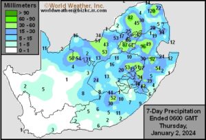
Kansas City, January 2 (World Weather Inc.) – An active weather pattern was noted in the main production areas of South Africa during the past week. Rainfall was enough to bolster soil moisture and support a better environment for crop developments, though many areas in Free State and North West need additional rain to completely fix the moisture deficits. Scattered showers and thunderstorms will continue on a frequent basis during the coming week. Localized flooding will be a growing concern in Natal and neighboring locations, though crop and structural damage will be minimal. The environment will otherwise improve or remain favorable for aggressive establishment and growth for the summer grains, oilseeds, cotton, and other crops.
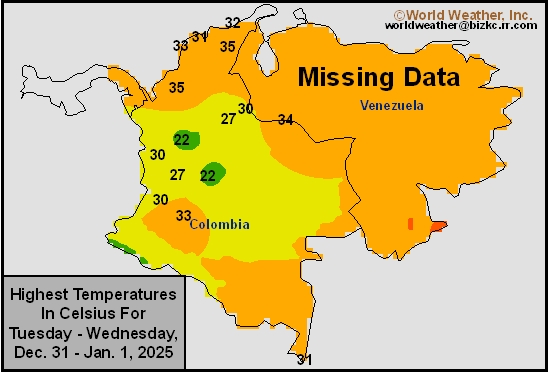
Venezuela/Colombia Max Temps
This content is for members only
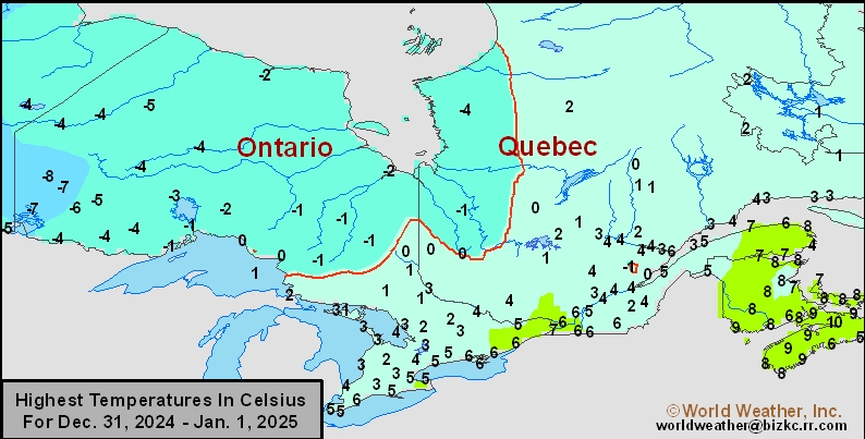
SE Canada Max
This content is for members only
SE Canada Rainfall
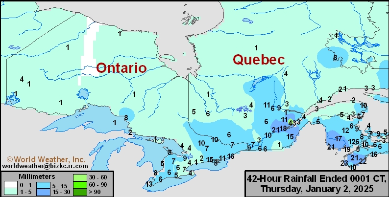
This content is for members only
Prairies Rainfall

This content is for members only
Prairies Max Temperature

This content is for members only
Prairies Min Temperature

This content is for members only
Canada Rainfall

This content is for members only
Venezuela Rainfall
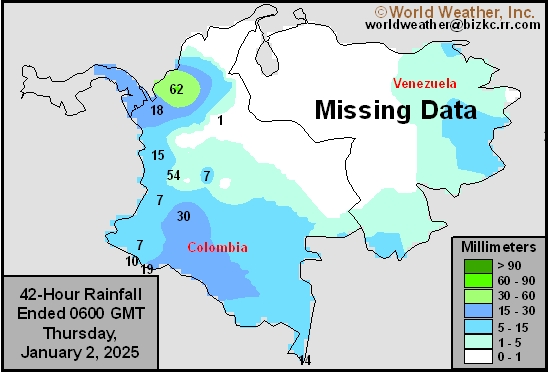
This content is for members only
Mexico Min Temperature
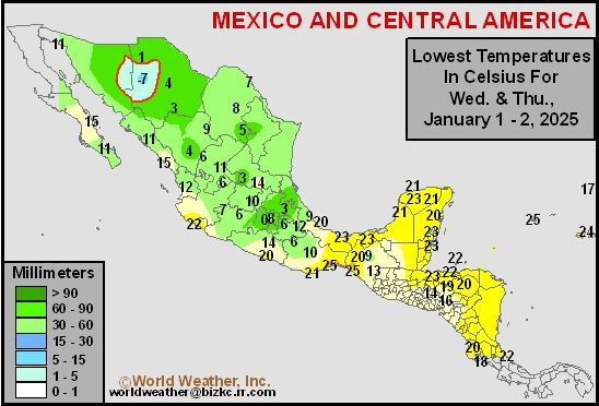
This content is for members only
Mexico Max Temperature
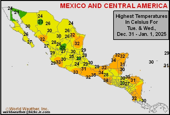
This content is for members only
Mexico Rainfall
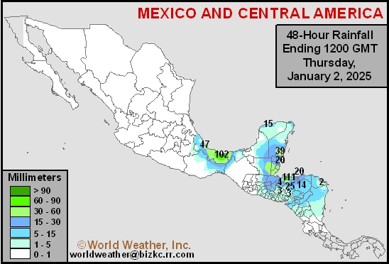
This content is for members only
Argentina Max Temperature
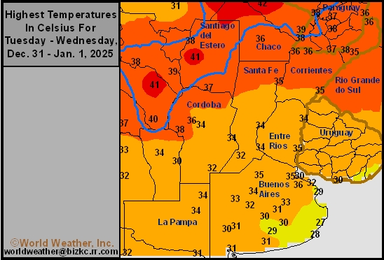
This content is for members only
Argentina Rainfall
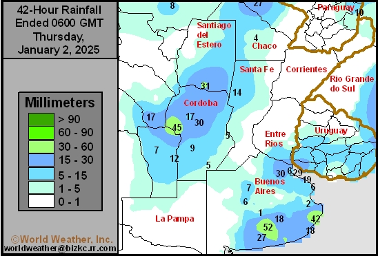
This content is for members only
Brazil Min Temperature
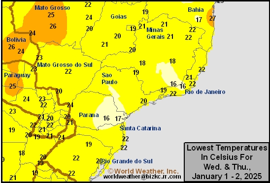
This content is for members only
Brazil Max Temperature
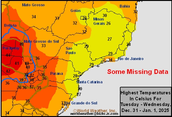
This content is for members only
Brazil Rainfall
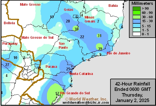
This content is for members only
Philippines Min
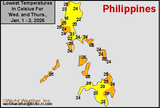
This content is for members only
Philippines Max
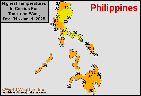
This content is for members only
Philippines Rain
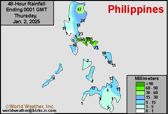
This content is for members only
Southeast North Rain
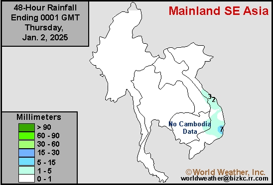
This content is for members only
Southeast North Min
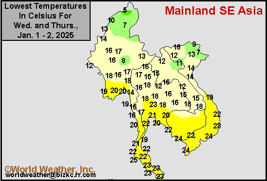
This content is for members only
Southeast North Max
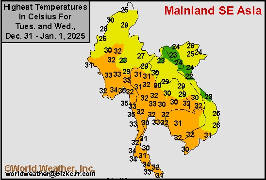
This content is for members only
Southeast Min
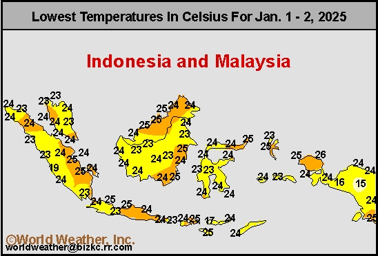
This content is for members only
Southeast Max
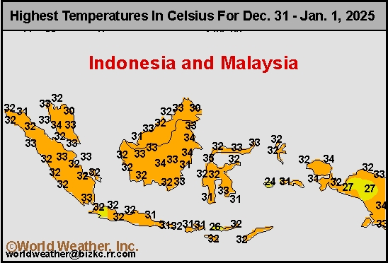
This content is for members only
Southeast Rain
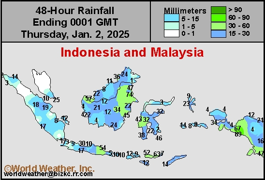
This content is for members only
West Africa Rain
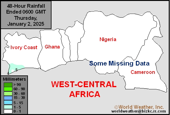
This content is for members only
Max Temperature
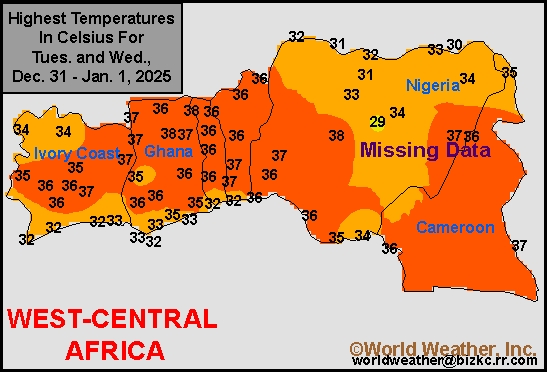
This content is for members only
Min Temperature
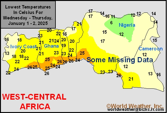
This content is for members only
North Africa Rain
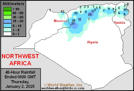
This content is for members only
Max Temperature
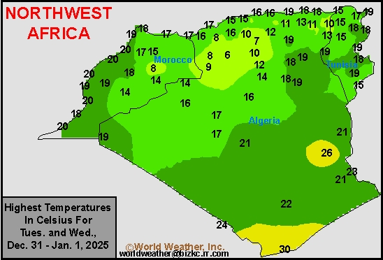
This content is for members only
Min Temperature
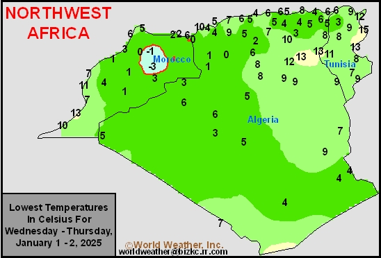
This content is for members only
Min Temperature
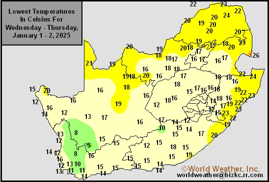
This content is for members only
Max Temperature
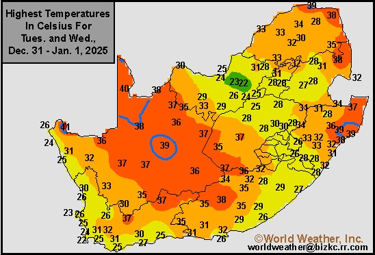
This content is for members only
South Africa Rain
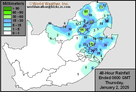
This content is for members only
Hard Red Wheat Tmax
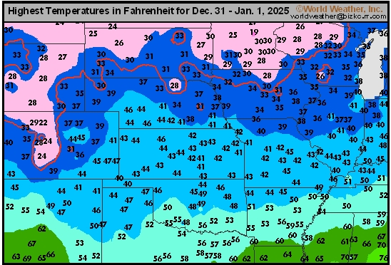
This content is for members only
Northeast Tmax
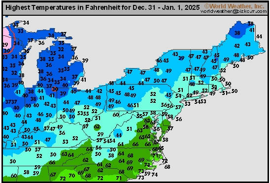
This content is for members only
Southwest Tmax
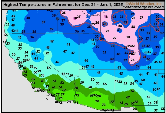
This content is for members only
Northwest Tmax
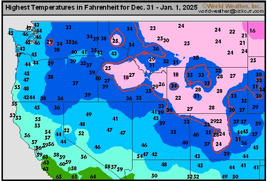
This content is for members only
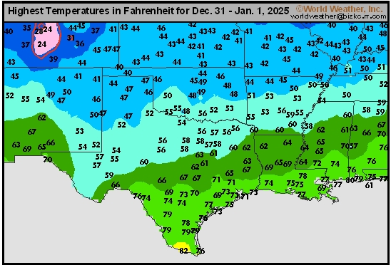
South Plains Tmax
This content is for members only
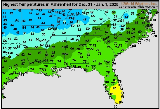
Delta/SE U.S. Tmax
This content is for members only
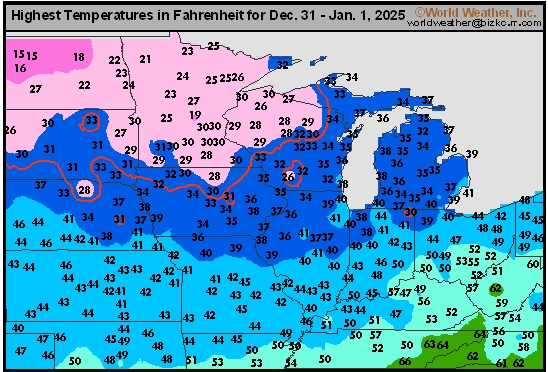
Corn Belt Tmax
This content is for members only
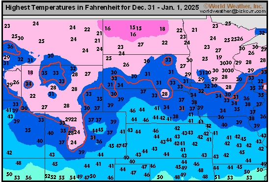
North Plains Tmax
This content is for members only
US Max

This content is for members only
US Rain

This content is for members only
Northeast Daily Rain
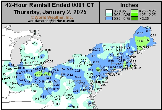
This content is for members only
Hard Red Wheat Daily Rain
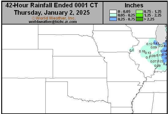
This content is for members only
Southwest Daily Rain
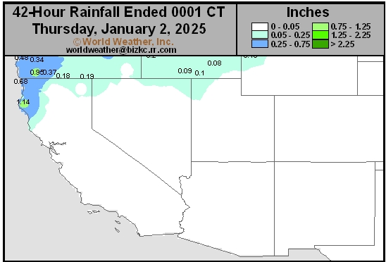
This content is for members only
Northwest Daily Rain
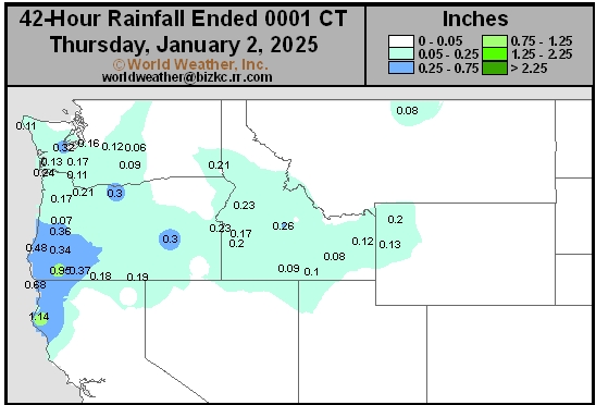
This content is for members only
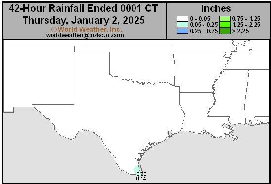
South Plains Daily Rain
This content is for members only
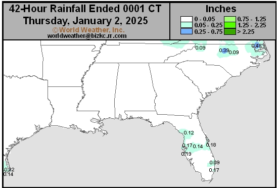
Delta/SE U.S. Daily Rain
This content is for members only