
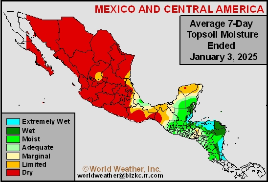
Topsoil Moisture
This content is for members only
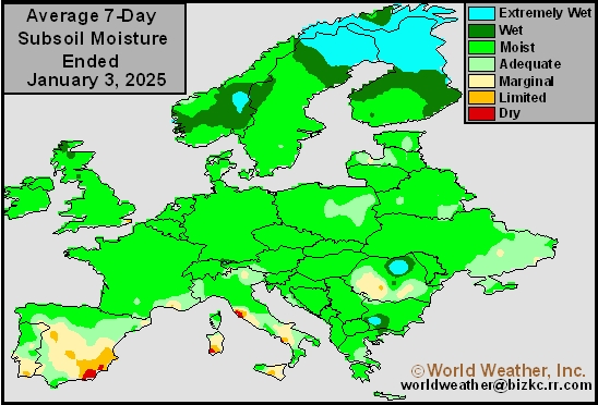
Subsoil Moisture
This content is for members only
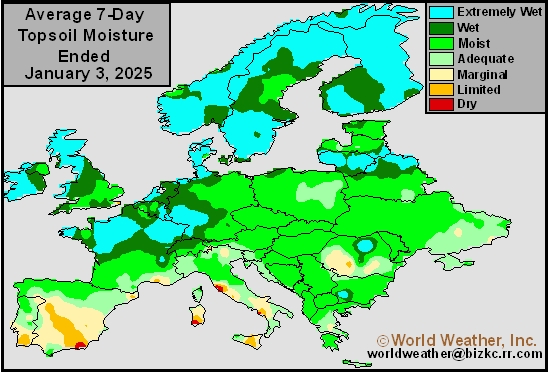
Topsoil Moisture
This content is for members only
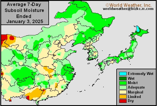
Subsoil Moisture
This content is for members only
Topsoil Moisture
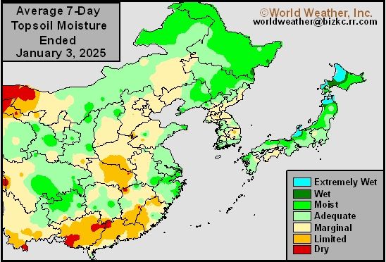
This content is for members only
Subsoil Moisture
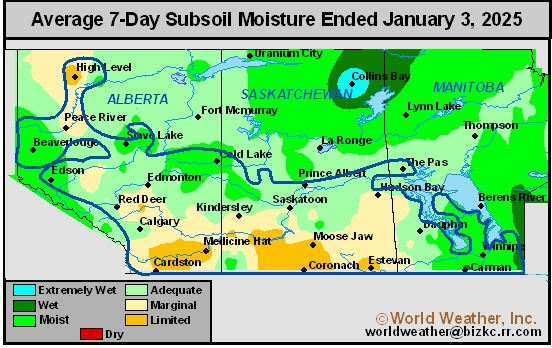
This content is for members only
Topsoil Moisture
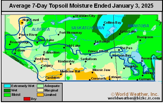
This content is for members only
Subsoil Moisture

This content is for members only
Topsoil Moisture

This content is for members only
Subsoil Moisture
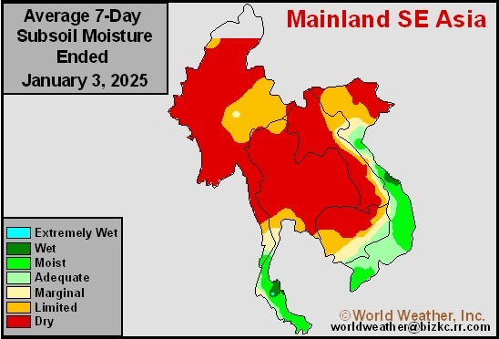
This content is for members only
Topsoil Moisture
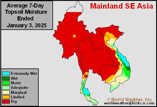
This content is for members only
Subsoil Moisture
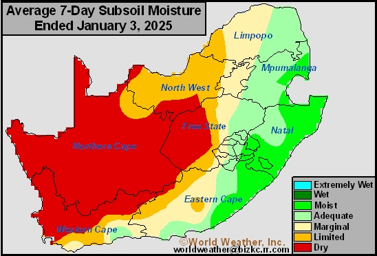
This content is for members only
Topsoil Moisture
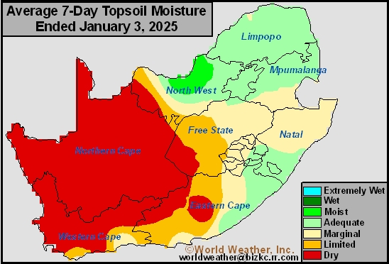
This content is for members only
Subsoil Moisture
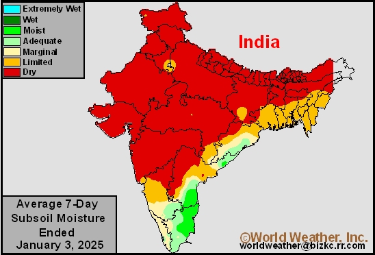
This content is for members only
Topsoil Moisture
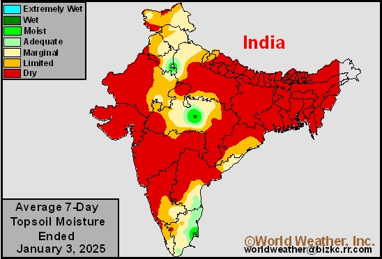
This content is for members only
Subsoil Moisture
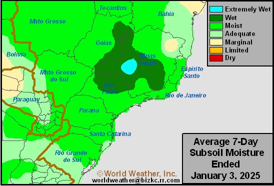
This content is for members only
Topsoil Moisture
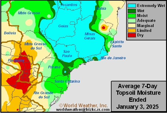
This content is for members only
Subsoil Moisture
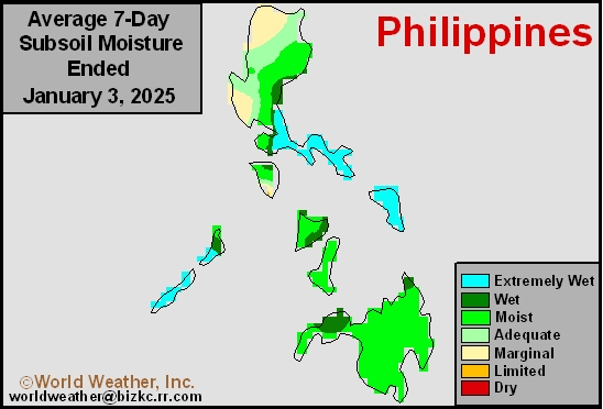
This content is for members only
Topsoil Moisture
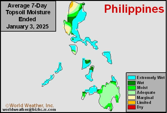
This content is for members only
Subsoil Moisture
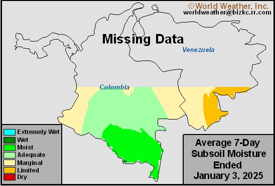
This content is for members only
Topsoil Moisture
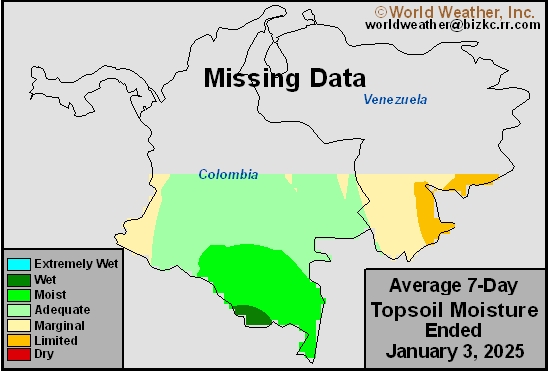
This content is for members only
Subsoil Moisture
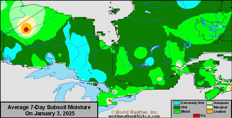
This content is for members only
Topsoil Moisture
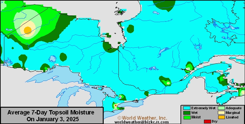
This content is for members only
Subsoil Moisture
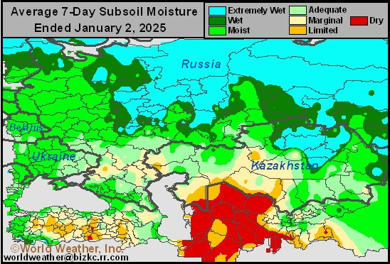
This content is for members only
Topsoil Moisture
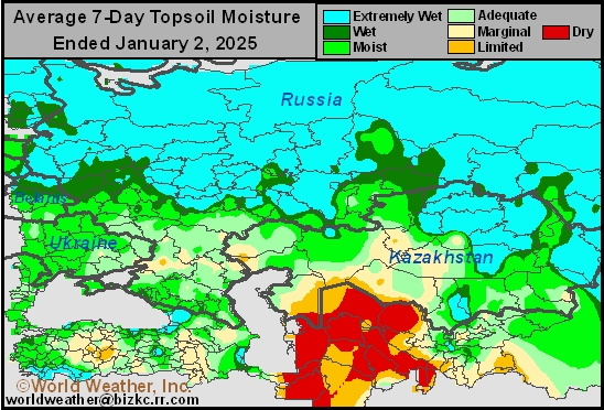
This content is for members only
Subsoil Moisture

This content is for members only
Topsoil Moisture

This content is for members only
Topsoil Moisture
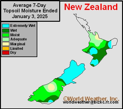
This content is for members only
Subsoil Moisture
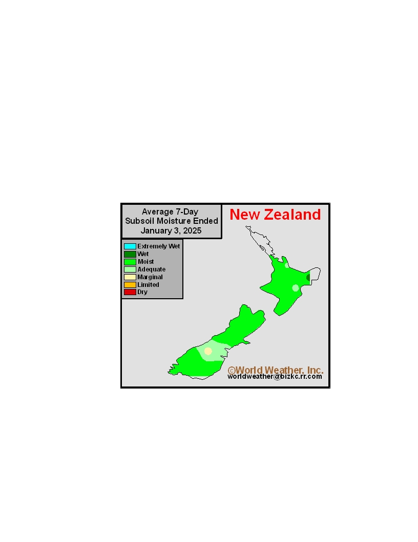
This content is for members only
Subsoil Moisture
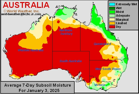
This content is for members only
Topsoil Moisture
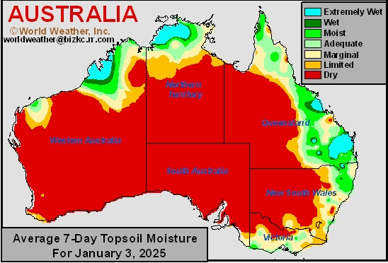
This content is for members only
U.S. Will Be Impacted By Active Weather Pattern
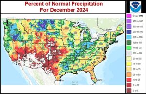
Kansas City, January 3 (World Weather Inc.) – Drought or abnormally dry conditions persist from portions of the U.S. Plains into the Upper Midwest and southeastern states. The most extreme drought was noted in portions of the northern Plains despite several locations receiving above normal precipitation during the past month. An active weather pattern is slated for the U.S. in the coming week, most notably a strong winter storm that will impact portions of the central Plains and Midwest later this weekend and early next week. Major travel delays and animal stress are expected, though the moisture will eventually be welcome when melting and reaching the soil. The Delta and southeastern states will also receive enough precipitation to marginally improve the moisture profile as will Montana while precipitation is limited elsewhere in the northern Plains.
Southeast Europe Received Timely Precipitation In December
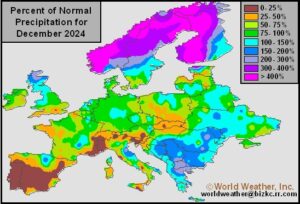
Kansas City, January 3 (World Weather Inc.) – Several locations in Europe’s Balkan region were struggling with dryness heading into December. Winter grain and oilseeds likely established unevenly in the driest locations and the need for timely winter precipitation was high. December provided some of that needed moisture and winter crop prospects improved. Other locations outside portions of the Iberian Peninsula still have adequate soil moisture. Precipitation through the end of next week will favor Western Europe, though several locations in Eastern Europe will receive some precipitation as well. Overall production potentials for Europe’s winter grains and oilseeds will remain favorable. There is potential for local flooding in France during this coming week.
7-Day Rainfall
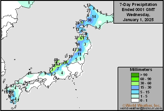
This content is for members only
7-Day Rainfall
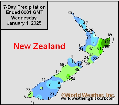
This content is for members only
7-Day Rainfall
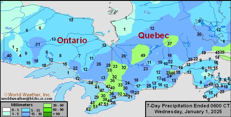
This content is for members only
7-Day Rainfall

This content is for members only
7-Day Rainfall

This content is for members only
7-Day Rainfall
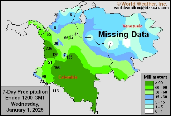
This content is for members only
7-Day Rainfall
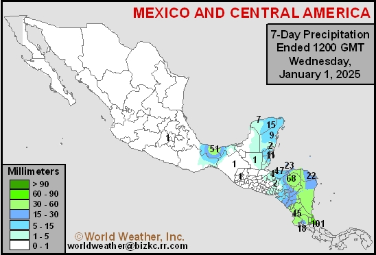
This content is for members only
Hard Red Wheat 7-Day Rain
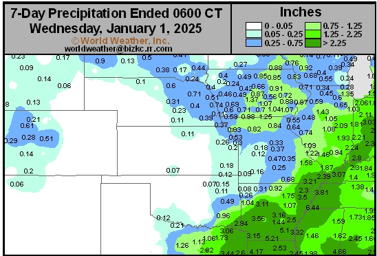
This content is for members only
Northeast 7-Day Rain
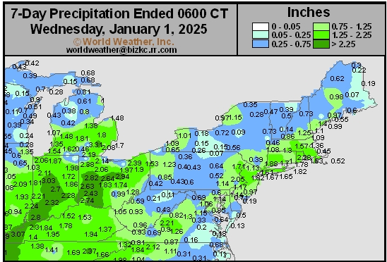
This content is for members only
Southwest 7-Day Rain
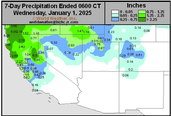
This content is for members only
Northwest 7-Day Rain
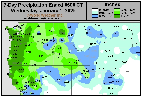
This content is for members only
South Plains 7-Day Rain
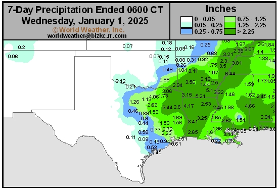
This content is for members only
Delta/SE U.S. 7-Day Rain
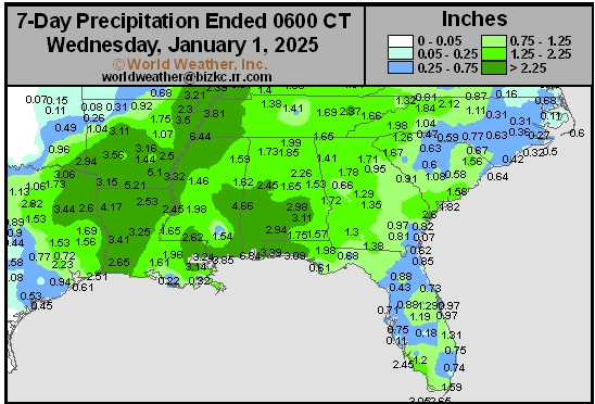
This content is for members only
Corn Belt 7-Day Rain
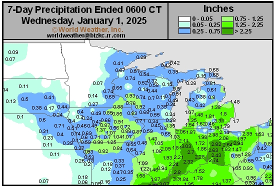
This content is for members only
North Plains 7-Day Rain
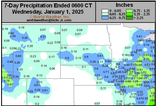
This content is for members only
7-Day Rainfall

This content is for members only
7-Day Rainfall
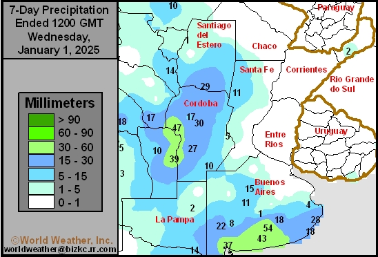
This content is for members only
7-Day Rainfall
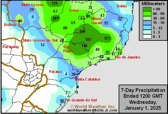
This content is for members only
7-Day Rainfall
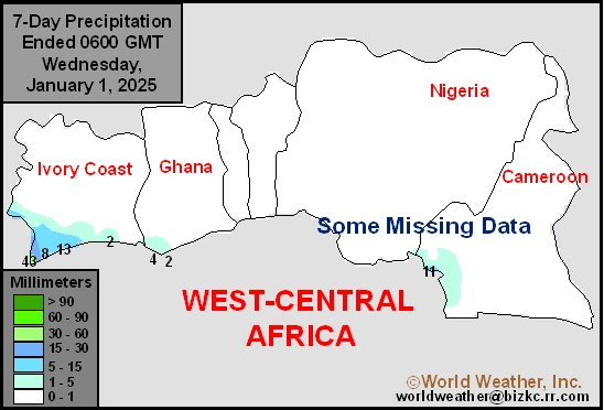
This content is for members only
7-Day Rainfall
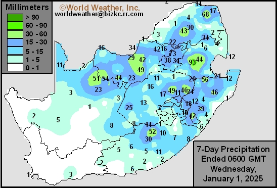
This content is for members only
7-Day Rainfall
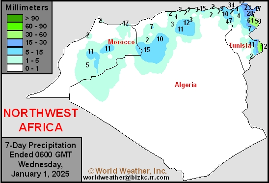
This content is for members only
7-Day Rainfall
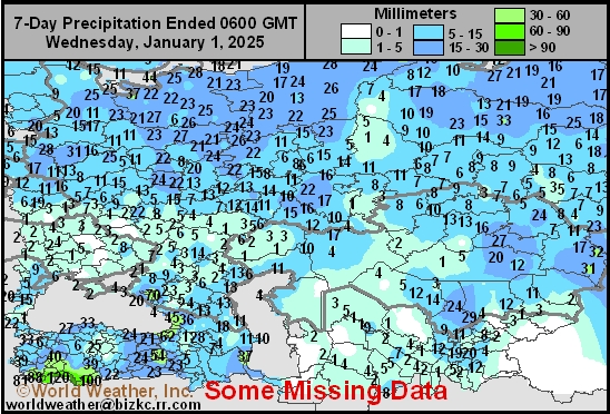
This content is for members only
7-Day Rainfall
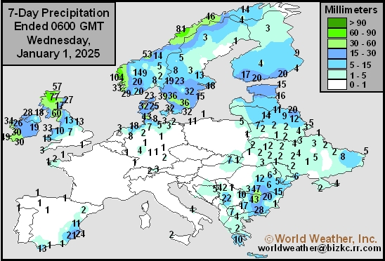
This content is for members only
7-Day Rainfall
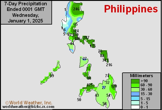
This content is for members only
7-Day Rainfall
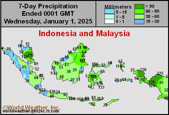
This content is for members only
7-Day Rainfall
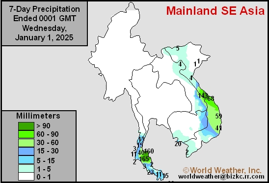
This content is for members only
7-Day Rainfall
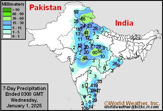
This content is for members only
7-Day Rainfall
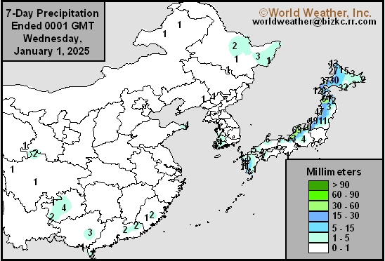
This content is for members only
7-Day Rainfall
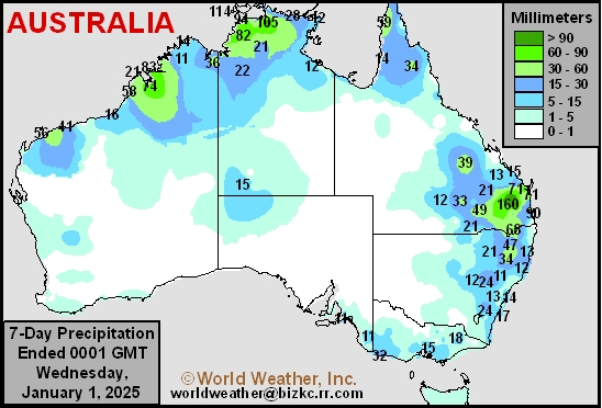
This content is for members only
Venezuela/Colombia Min Temps
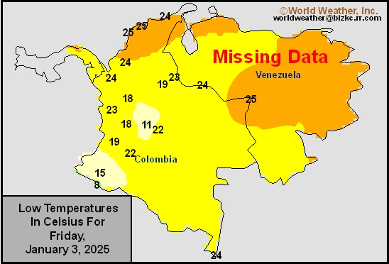
This content is for members only
Venezuela/Colombia Max Temps
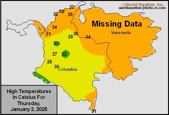
This content is for members only
SE Canada Min
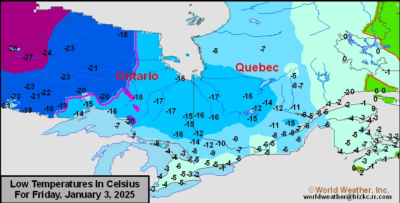
This content is for members only
SE Canada Max
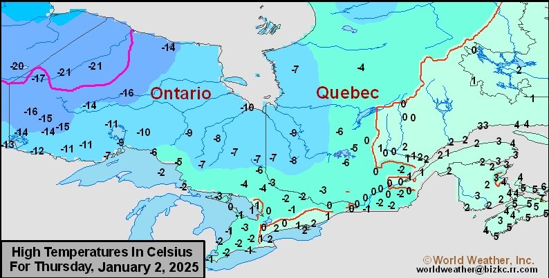
This content is for members only
SE Canada Rainfall
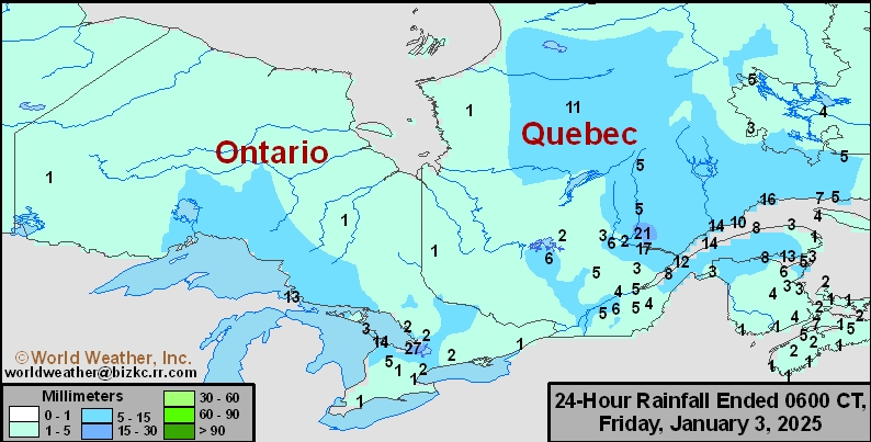
This content is for members only
Prairies Rainfall

This content is for members only
Prairies Max Temperature

This content is for members only
Prairies Min Temperature

This content is for members only
Canada Rainfall

This content is for members only
Venezuela Rainfall
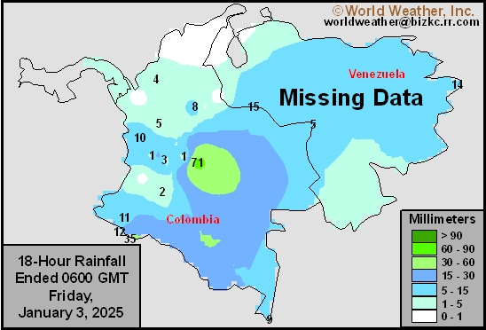
This content is for members only
Mexico Min Temperature
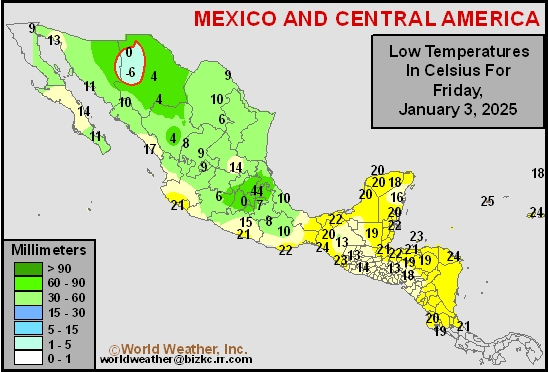
This content is for members only
Mexico Max Temperature
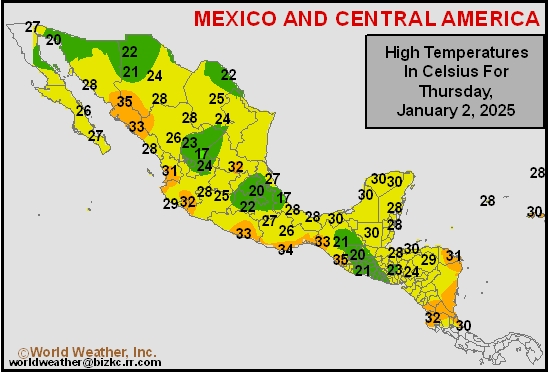
This content is for members only
Mexico Rainfall
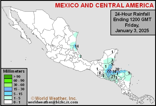
This content is for members only
Argentina Min Temperature
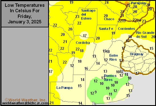
This content is for members only
Argentina Max Temperature
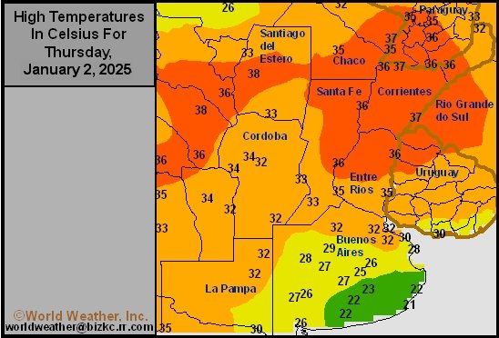
This content is for members only
Argentina Rainfall
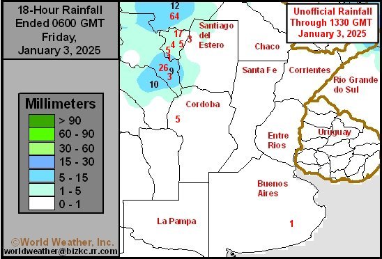
This content is for members only
Brazil Min Temperature
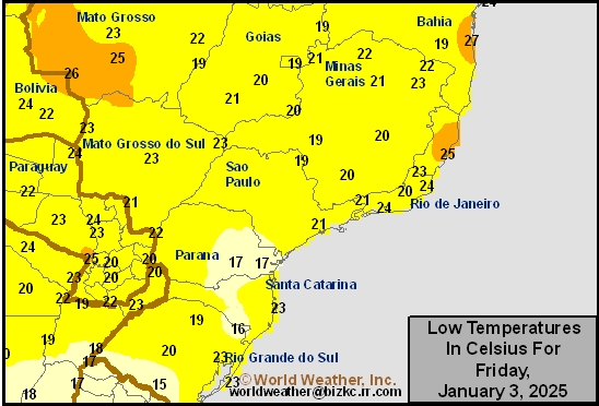
This content is for members only
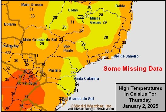
Brazil Max Temperature
This content is for members only
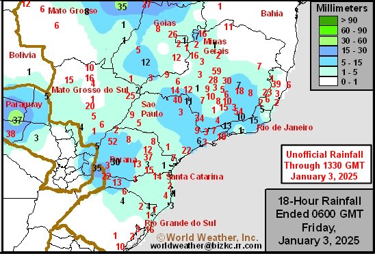
Brazil Rainfall
This content is for members only
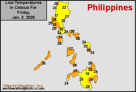
Philippines Min
This content is for members only
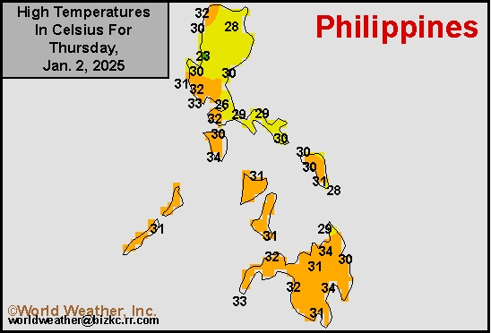
Philippines Max
This content is for members only
Philippines Rain
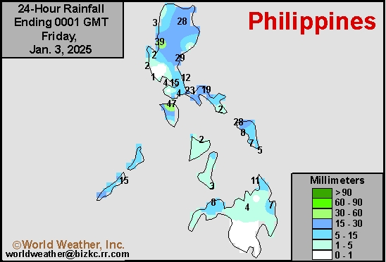
This content is for members only
Southeast North Rain
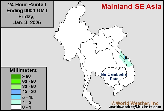
This content is for members only
Southeast North Min
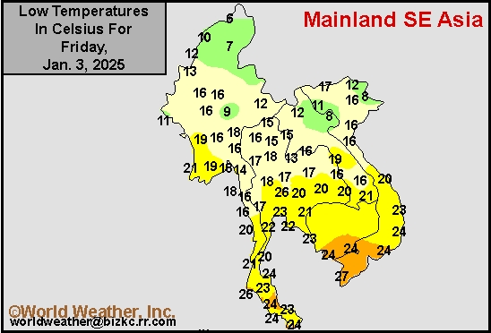
This content is for members only
Southeast North Max
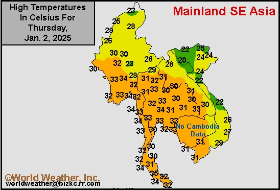
This content is for members only
Southeast Min
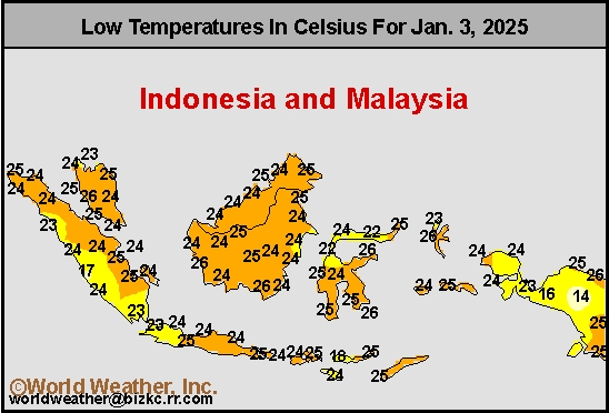
This content is for members only
Southeast Max
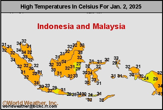
This content is for members only
Southeast Rain
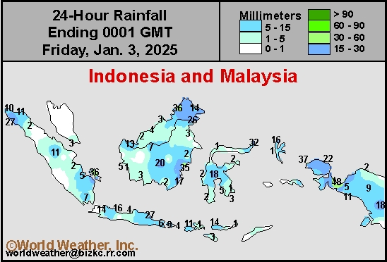
This content is for members only
West Africa Rain
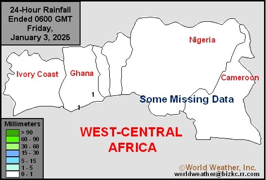
This content is for members only
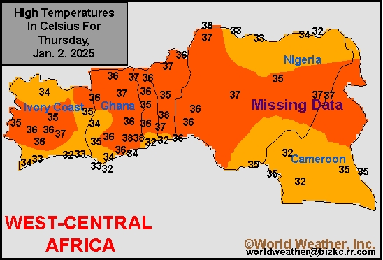
Max Temperature
This content is for members only
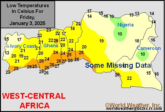
Min Temperature
This content is for members only
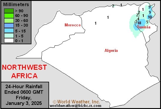
North Africa Rain
This content is for members only
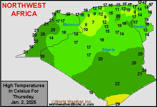
Max Temperature
This content is for members only
Min Temperature
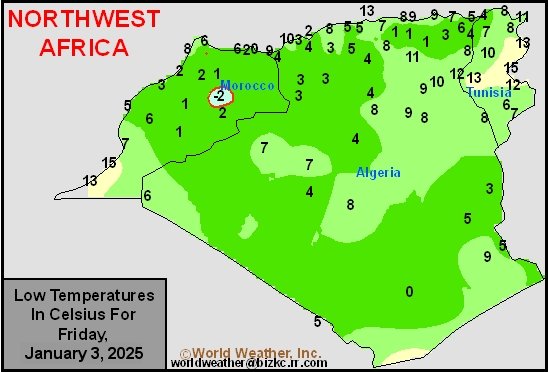
This content is for members only
Min Temperature
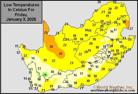
This content is for members only
Max Temperature
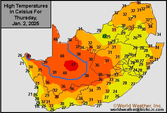
This content is for members only
South Africa Rain
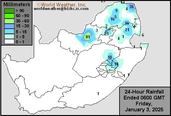
This content is for members only
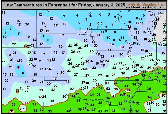
Hard Red Wheat Tmin
This content is for members only