
Min Temperature
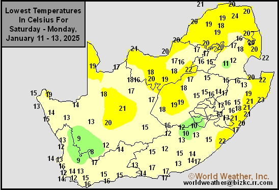
This content is for members only
Max Temperature
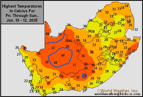
This content is for members only
South Africa Rain
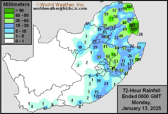
This content is for members only
Hard Red Wheat Tmin
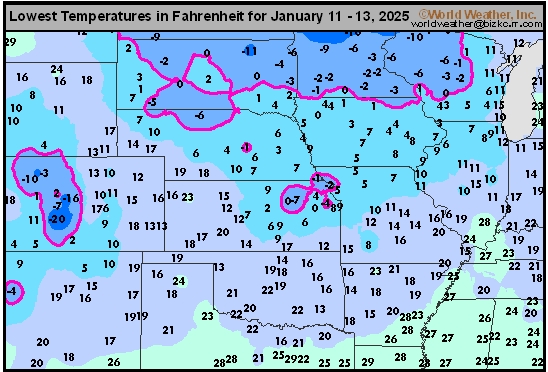
This content is for members only
Northeast Tmin
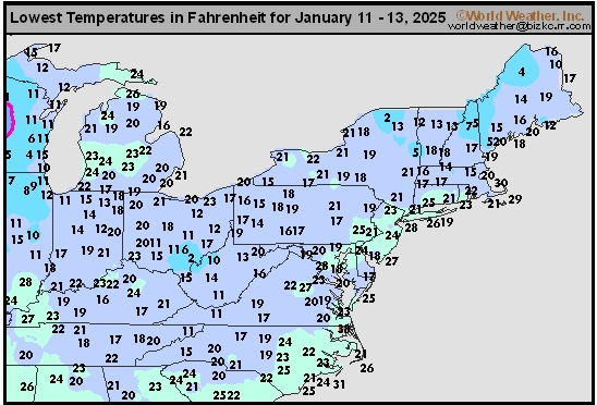
This content is for members only
Southwest Tmin
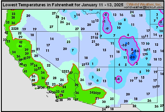
This content is for members only
Northwest Tmin
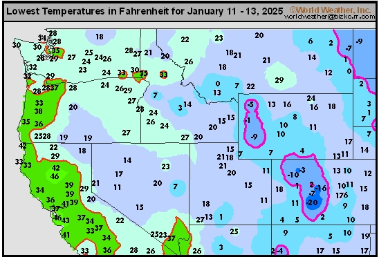
This content is for members only
South Plains Tmin
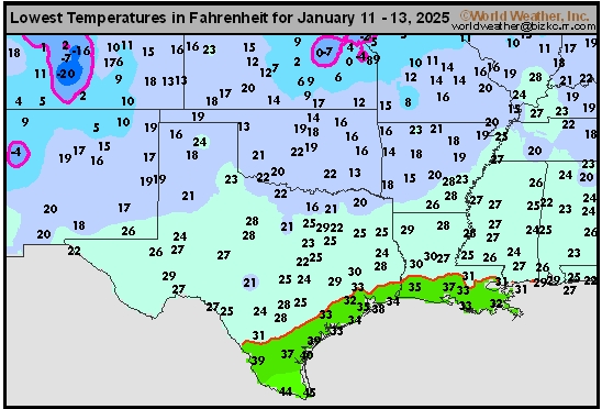
This content is for members only
Delta/SE U.S. Tmin
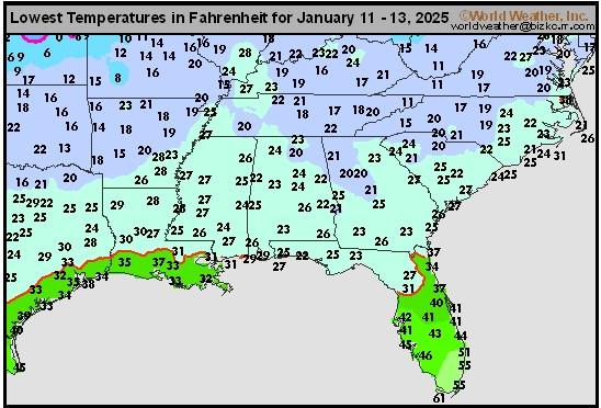
This content is for members only
Corn Belt Tmin
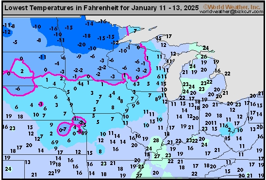
This content is for members only
US Min

This content is for members only
North Plains Tmin
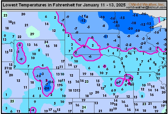
This content is for members only
Hard Red Wheat Tmax
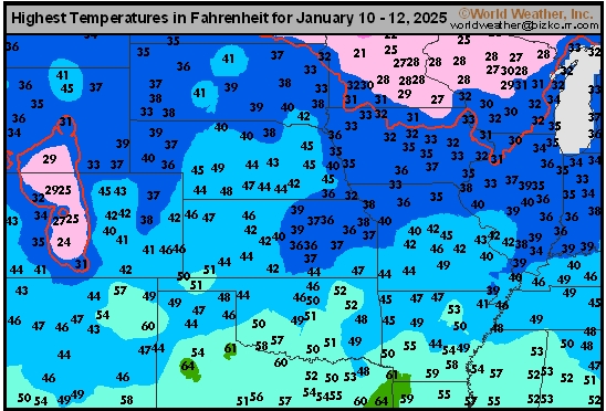
This content is for members only
Northeast Tmax
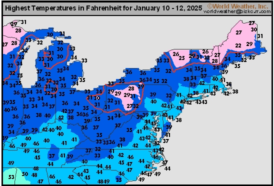
This content is for members only
Southwest Tmax
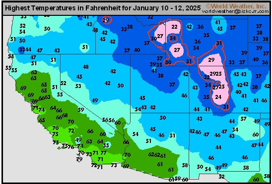
This content is for members only
Northwest Tmax
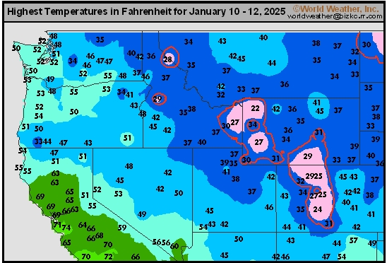
This content is for members only
South Plains Tmax
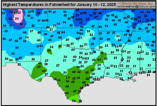
This content is for members only
Delta/SE U.S. Tmax
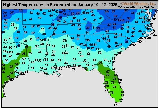
This content is for members only
Corn Belt Tmax
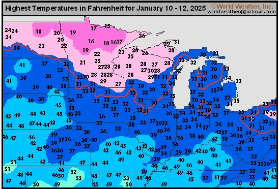
This content is for members only
North Plains Tmax
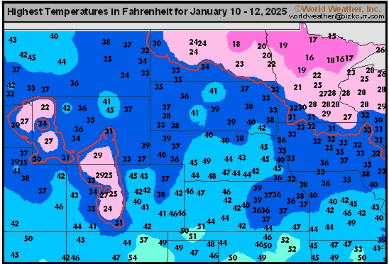
This content is for members only
US Max

This content is for members only
US Rain

This content is for members only
Northeast Daily Rain
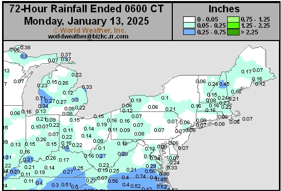
This content is for members only
Hard Red Wheat Daily Rain
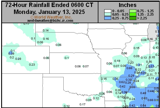
This content is for members only
Southwest Daily Rain
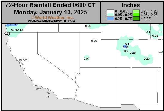
This content is for members only
Northwest Daily Rain
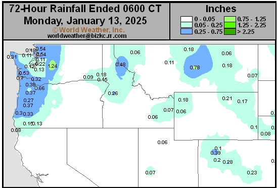
This content is for members only
South Plains Daily Rain
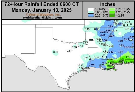
This content is for members only
Delta/SE U.S. Daily Rain
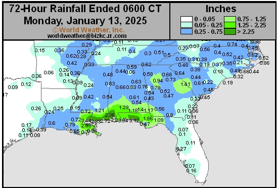
This content is for members only
Corn Belt Daily Rain
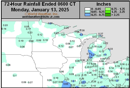
This content is for members only
North Plains Daily Rain
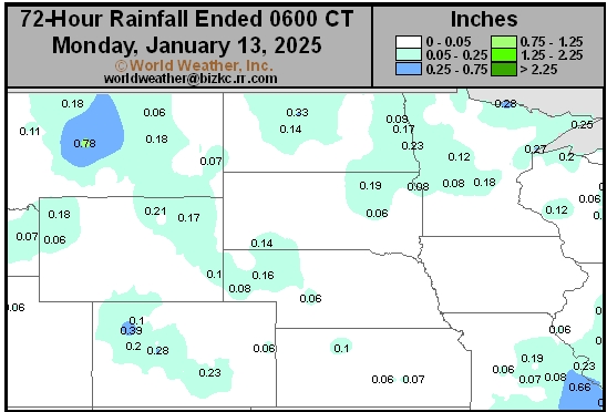
This content is for members only
Low Temperature
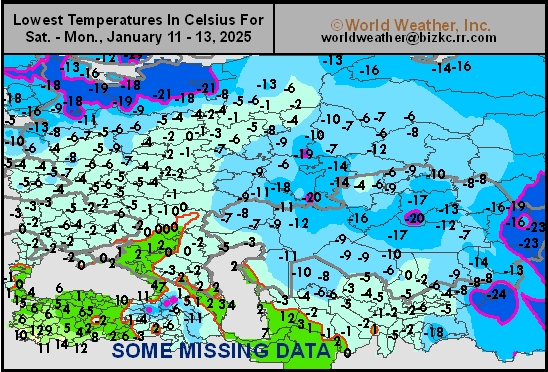
This content is for members only
High Temperature
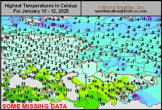
This content is for members only
CIS Rainfall
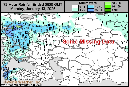
This content is for members only
Low Temperature
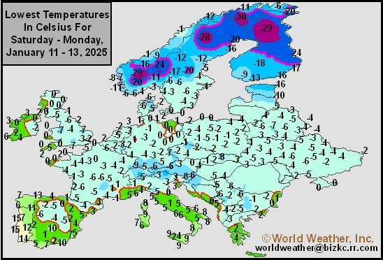
This content is for members only
High Temperature
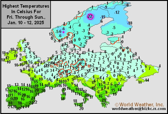
This content is for members only
Europe Rainfall
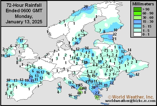
This content is for members only
Low Temperature
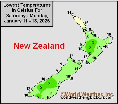
This content is for members only
High Temperature
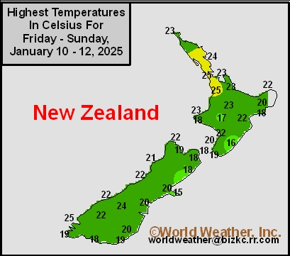
This content is for members only
New Zealand Rainfall
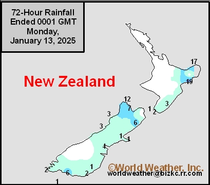
This content is for members only
Low Temperature
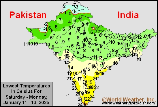
This content is for members only
High Temperature
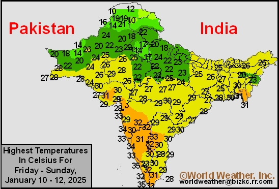
This content is for members only
India Rainfall
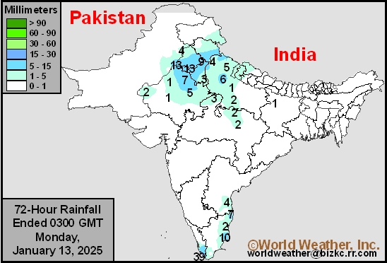
This content is for members only
Low Temperature
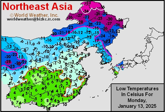
This content is for members only
Japan Rainfall
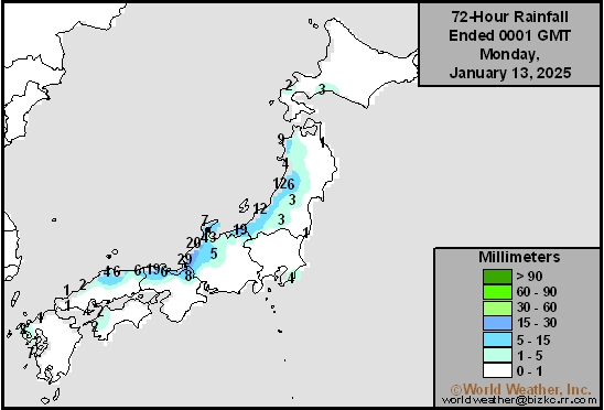
This content is for members only
Low Temperature
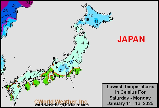
This content is for members only
High Temperature
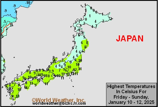
This content is for members only
High Temperature
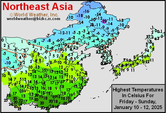
This content is for members only
China Rainfall
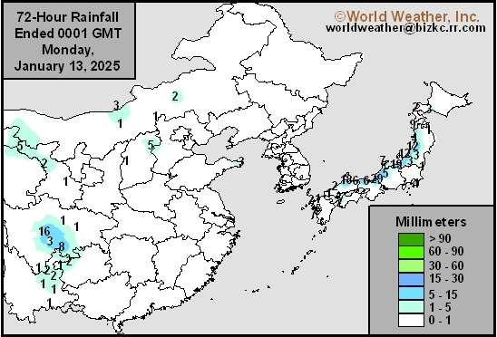
This content is for members only
Low Temperature
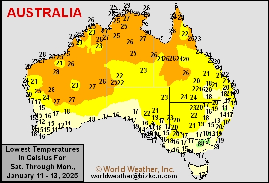
This content is for members only
High Temperature
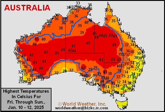
This content is for members only
Austrailia Rainfall
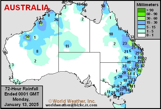
This content is for members only
Soil Temperature

This content is for members only
Soil Temperature
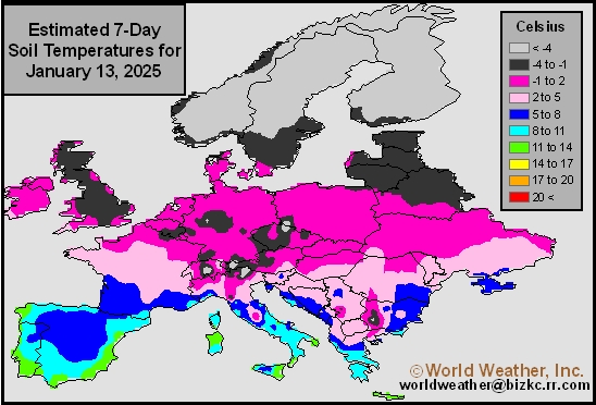
This content is for members only
Soil Temperature
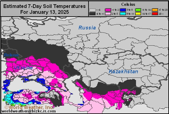
This content is for members only
Soil Temperature
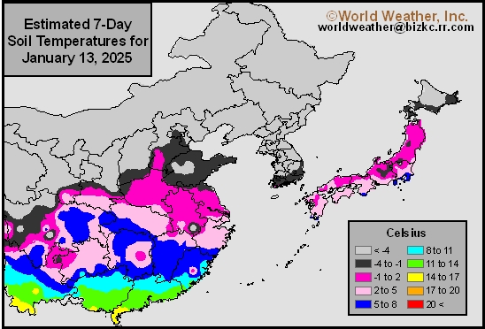
This content is for members only
Soil Temperature

This content is for members only
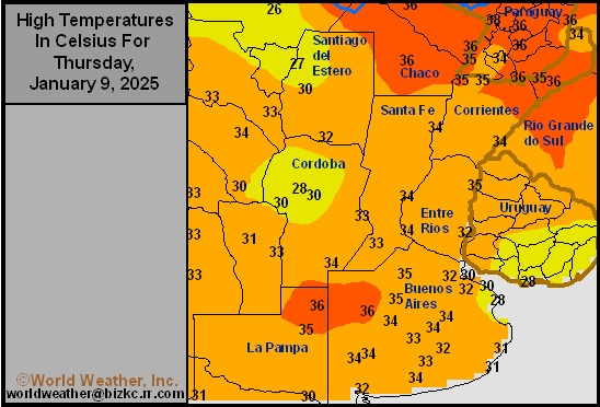
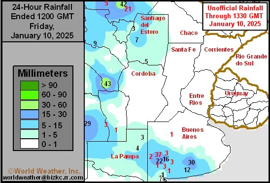
Argentina Dryness Relief Will Be Temporary, Welcome
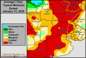
Kansas City, January 13 (World Weather Inc.) – Drier and warmer weather continued for much of Argentina during the past week. A few locations in western and southern Argentina saw periods of erratic rain, though resulting amounts were too light to impact long-term soil conditions. Temperatures slowly turned warmer leading to faster drying rates and the depletion of topsoil moisture from many areas. The need for rain is high, especially for recently-planted crops that are establishing or in the early stages of development. Topsoil moisture is short or very short and may be impacting development rates. A disturbance will bring variable rainfall to the country late this week and weekend. Resulting rainfall will only offer temporary relief from dryness and not all areas will be treated equally. Much more rain will be needed to return ideal crop conditions.
U.S. Northern Plains Will Not See Much Relief From Drought
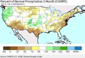
Kansas City, January 10 (World Weather Inc.) – A large section of the U.S. northern Plains trended drier than normal during the past three months. Drought or abnormally dry conditions evolved as a result of the drier biased environment and the need for timely precipitation is high across the region. Much of the region is covered in snow. Some of the snow will eventually seep down into the soil once seasonal warming begins this spring, though current snow totals are too light to offer much relief from the dryness. The region will have a few opportunities for precipitation in the coming days that will bolster snowpack. However, resulting precipitation will remain too light to significantly improve long-term conditions for the moisture profile. The need for significant precipitation will remain high later this winter and early this spring to improve planting prospects for the region.
U.S. Winter Storm Shifting Into Southeastern States
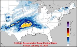
Kansas City, January 10 (World Weather Inc.) – The latest winter storm to impact the U.S. promoted significant snowfall from portions of Texas, Oklahoma, and southern Kansas through the northern Delta to northern Alabama and Tennessee overnight and earlier today. Travel has been and will likely be impacted for the next couple of days with a stressful environment for livestock also possible. Several areas in hard red winter wheat country received enough precipitation to eventually lift topsoil moisture. The winter storm will shift farther east through tonight and end Saturday with impacts from the Delta to the southeastern states, lower Ohio River Valley, and neighboring locations. Tennessee, northern sections of Georgia, Alabama, and Mississippi, and neighboring locations will receive the greatest amount of snow that will likely slow or delay travel. The moisture will otherwise be welcome are several locations are in a drought or abnormally dry.
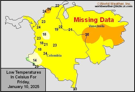
Venezuela/Colombia Min Temps
This content is for members only
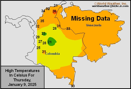
Venezuela/Colombia Max Temps
This content is for members only
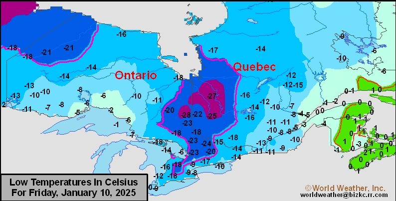
SE Canada Min
This content is for members only
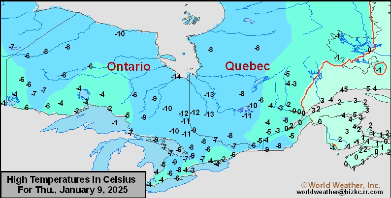
SE Canada Max
This content is for members only
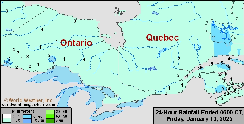
SE Canada Rainfall
This content is for members only
Prairies Rainfall

This content is for members only
Prairies Max Temperature

This content is for members only
Prairies Min Temperature

This content is for members only
Canada Rainfall

This content is for members only
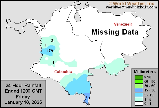
Venezuela Rainfall
This content is for members only
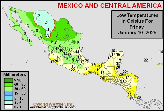
Mexico Min Temperature
This content is for members only
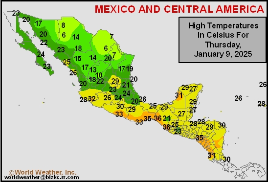
Mexico Max Temperature
This content is for members only
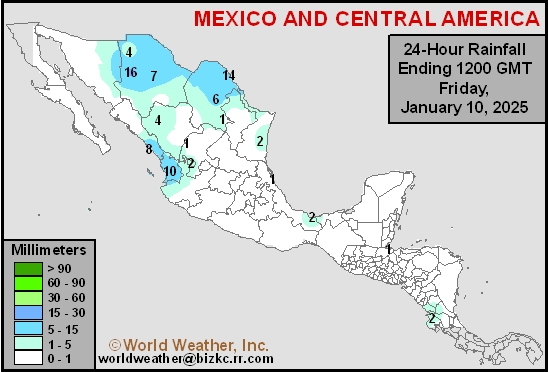
Mexico Rainfall
This content is for members only
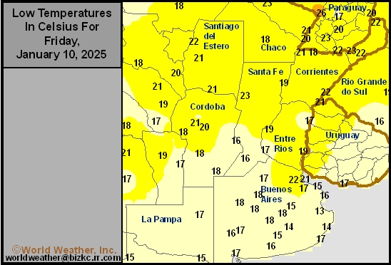
Argentina Min Temperature
This content is for members only
Argentina Max Temperature
This content is for members only
Argentina Rainfall
This content is for members only
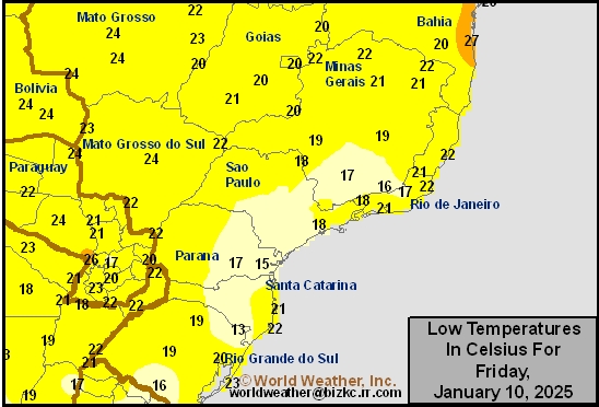
Brazil Min Temperature
This content is for members only
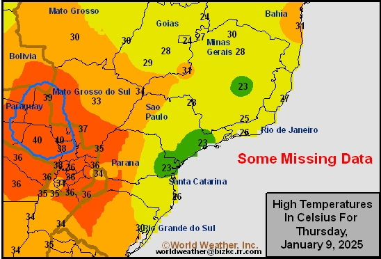
Brazil Max Temperature
This content is for members only
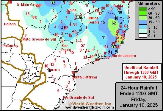
Brazil Rainfall
This content is for members only
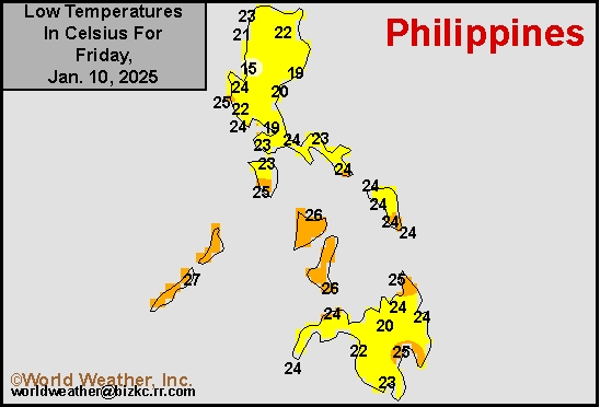
Philippines Min
This content is for members only
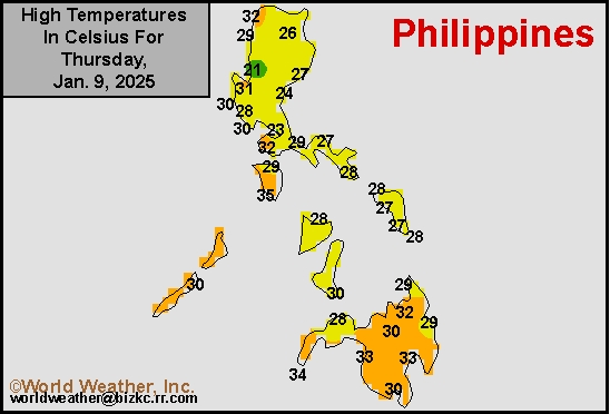
Philippines Max
This content is for members only
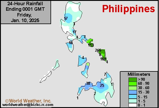
Philippines Rain
This content is for members only
Southeast North Rain
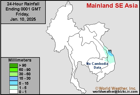
This content is for members only
Southeast North Min
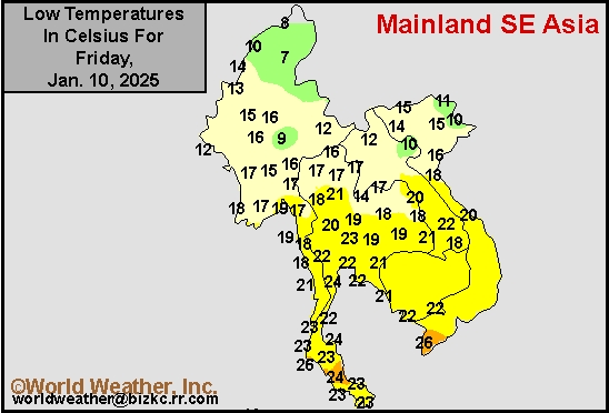
This content is for members only
Southeast North Max
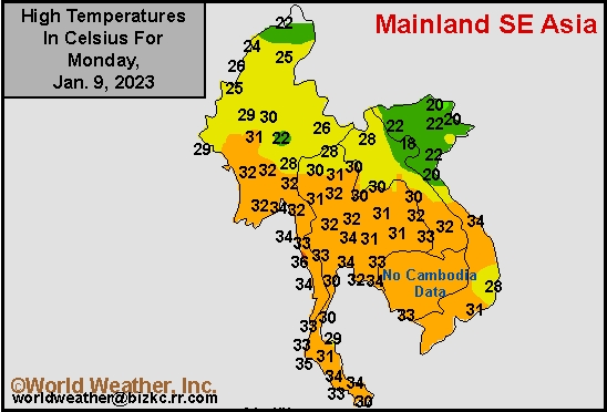
This content is for members only
Southeast Min
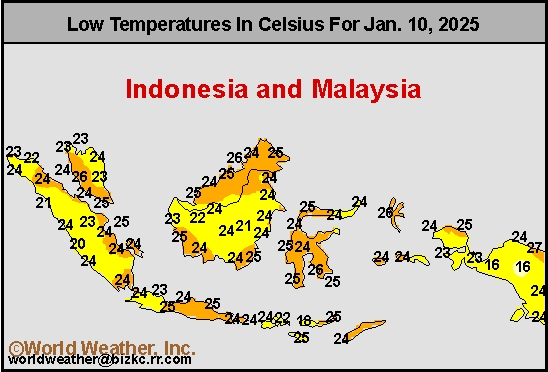
This content is for members only
Southeast Max
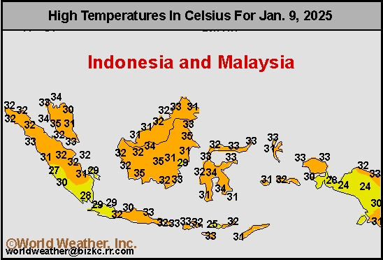
This content is for members only
Southeast Rain
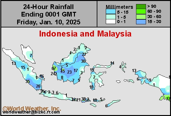
This content is for members only
West Africa Rain
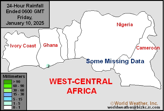
This content is for members only
Max Temperature
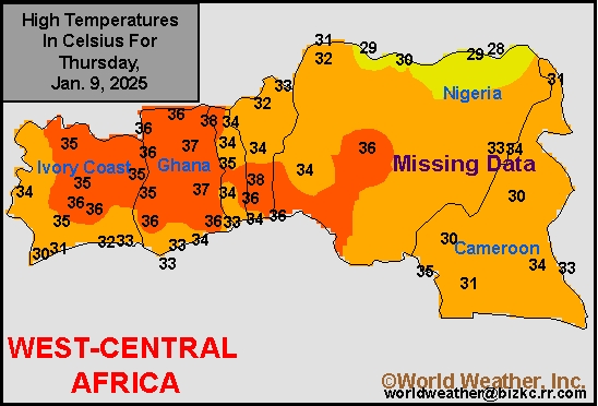
This content is for members only
Min Temperature
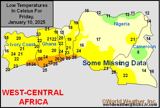
This content is for members only
North Africa Rain
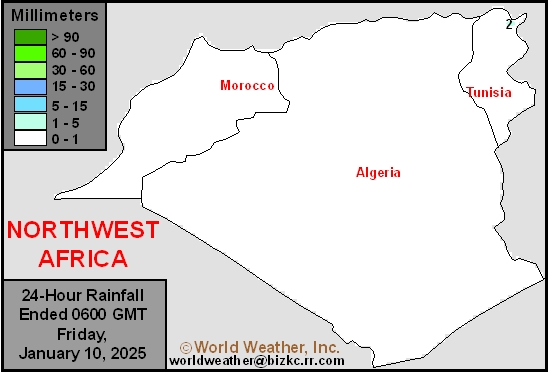
This content is for members only
Max Temperature
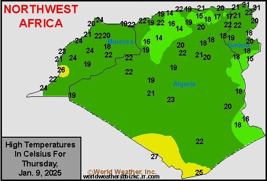
This content is for members only
Min Temperature
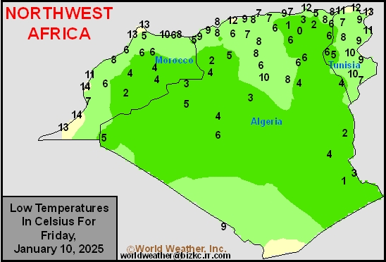
This content is for members only
Min Temperature
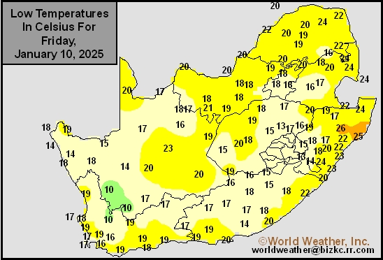
This content is for members only
Max Temperature
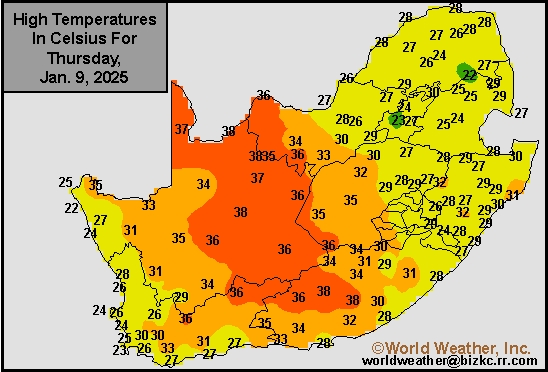
This content is for members only
South Africa Rain
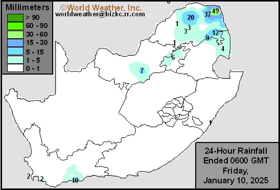
This content is for members only
Hard Red Wheat Tmin
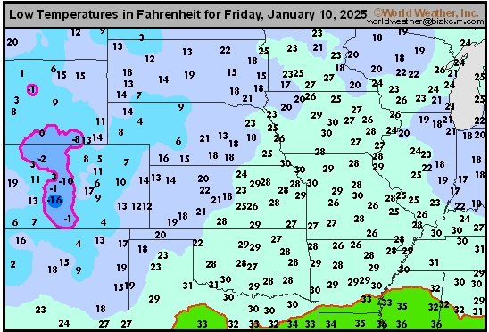
This content is for members only
Northeast Tmin
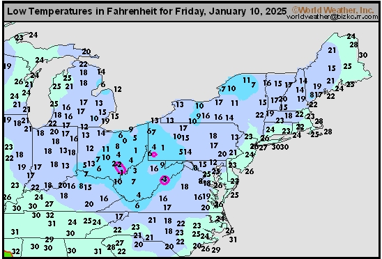
This content is for members only
Southwest Tmin
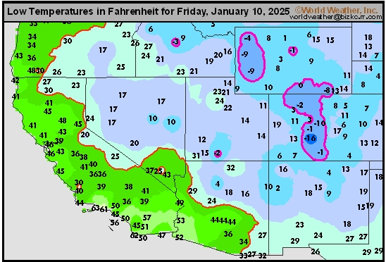
This content is for members only
Northwest Tmin
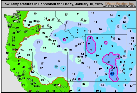
This content is for members only