
Min Temperature
This content is for members only
Max Temperature
This content is for members only
South Africa Rain
This content is for members only
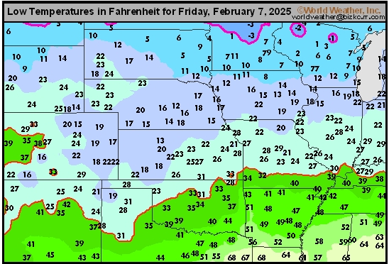
Hard Red Wheat Tmin
This content is for members only
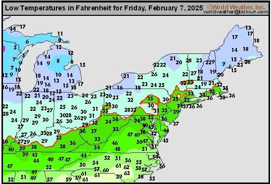
Northeast Tmin
This content is for members only
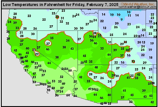
Southwest Tmin
This content is for members only
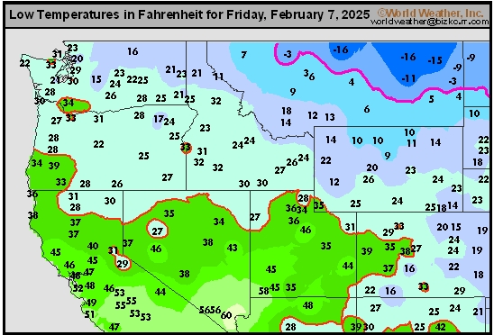
Northwest Tmin
This content is for members only
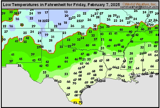
South Plains Tmin
This content is for members only
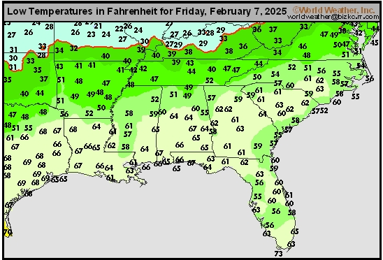
Delta/SE U.S. Tmin
This content is for members only
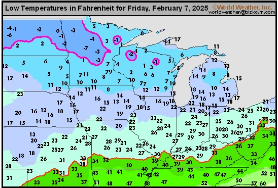
Corn Belt Tmin
This content is for members only
US Min

This content is for members only
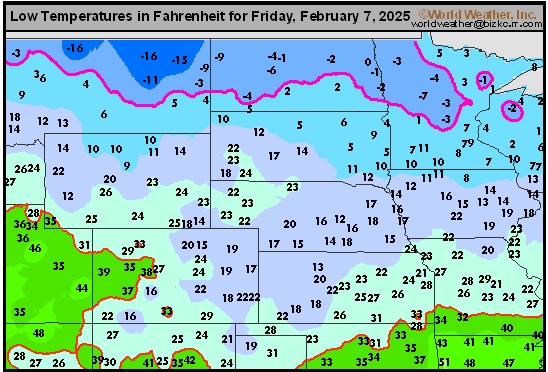
North Plains Tmin
This content is for members only
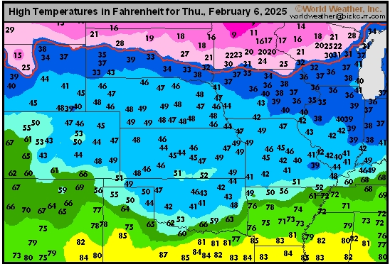
Hard Red Wheat Tmax
This content is for members only
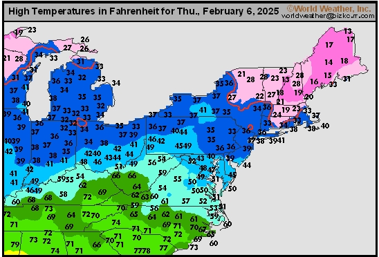
Northeast Tmax
This content is for members only
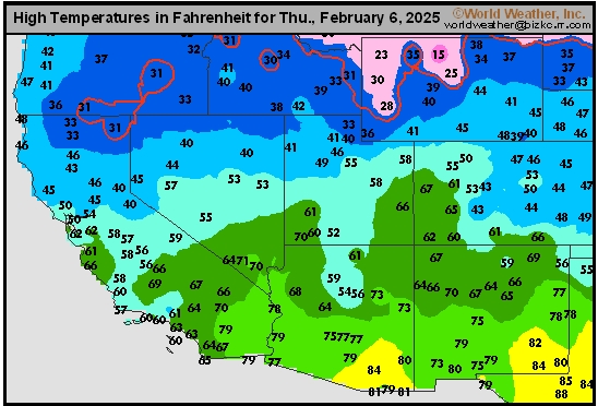
Southwest Tmax
This content is for members only
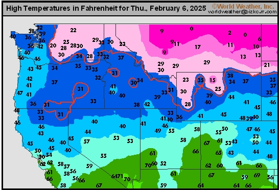
Northwest Tmax
This content is for members only
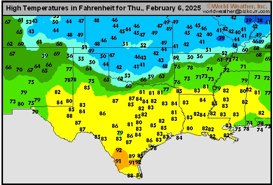
South Plains Tmax
This content is for members only
Delta/SE U.S. Tmax
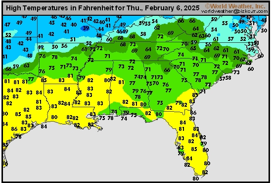
This content is for members only
Corn Belt Tmax
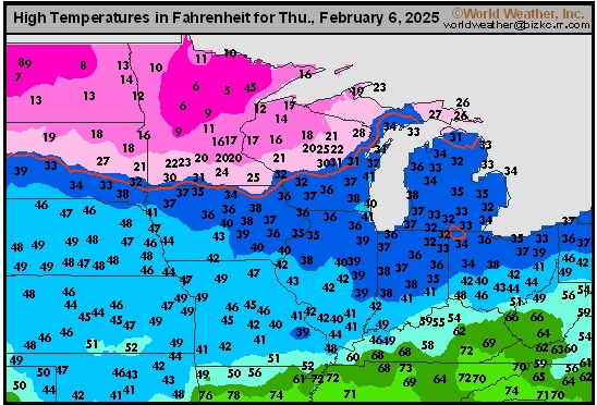
This content is for members only
North Plains Tmax
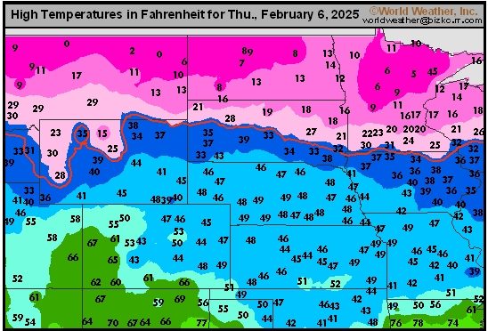
This content is for members only
US Max

This content is for members only
US Rain

This content is for members only
Northeast Daily Rain
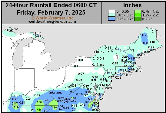
This content is for members only
Hard Red Wheat Daily Rain
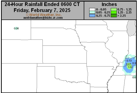
This content is for members only
Southwest Daily Rain
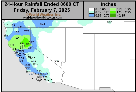
This content is for members only
Northwest Daily Rain
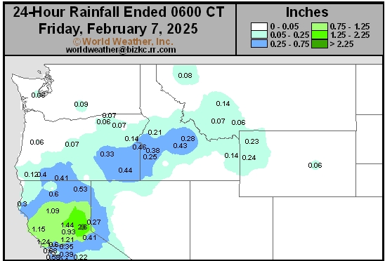
This content is for members only
South Plains Daily Rain
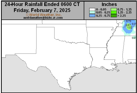
This content is for members only
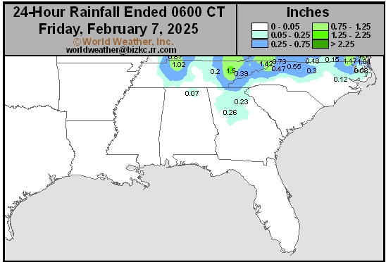
Delta/SE U.S. Daily Rain
This content is for members only
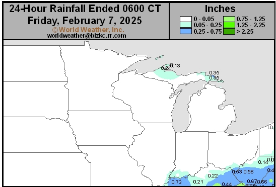
Corn Belt Daily Rain
This content is for members only
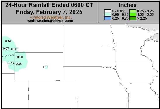
North Plains Daily Rain
This content is for members only
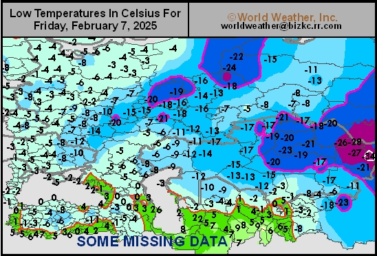
Low Temperature
This content is for members only
High Temperature
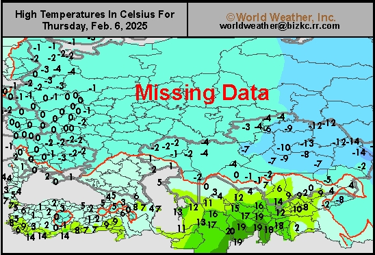
This content is for members only
CIS Rainfall
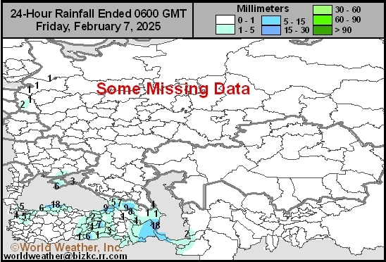
This content is for members only
Low Temperature
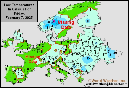
This content is for members only
High Temperature
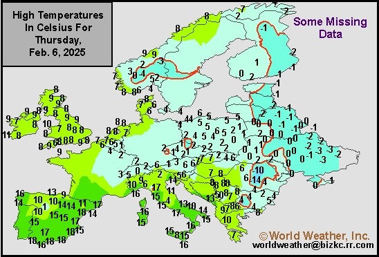
This content is for members only
Europe Rainfall
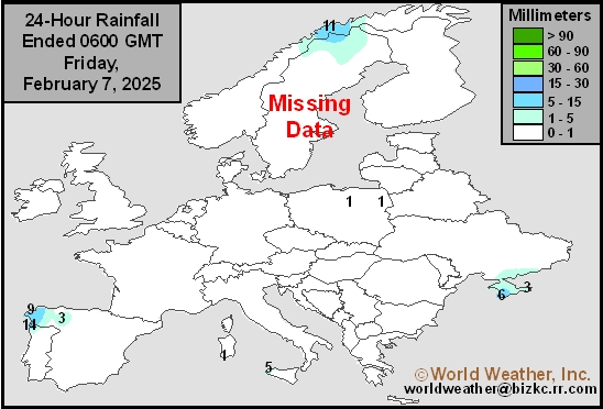
This content is for members only
Low Temperature
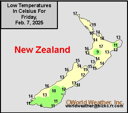
This content is for members only
High Temperature
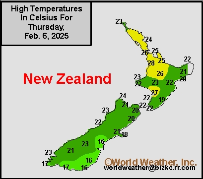
This content is for members only
New Zealand Rainfall
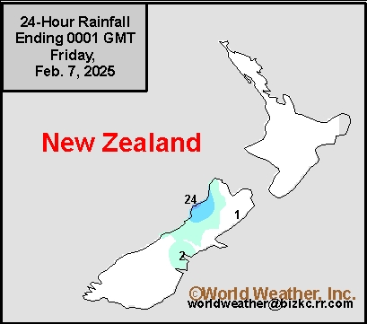
This content is for members only
Low Temperature
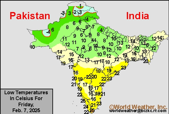
This content is for members only
High Temperature
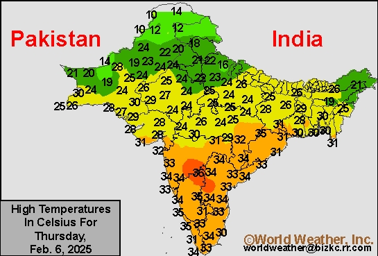
This content is for members only
India Rainfall
This content is for members only
Low Temperature
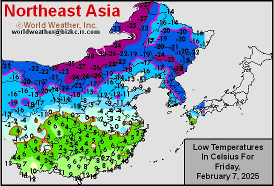
This content is for members only
Japan Rainfall
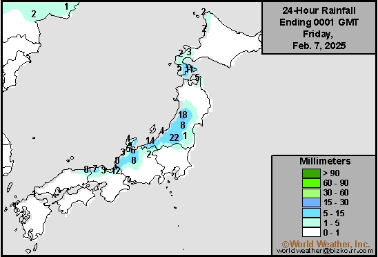
This content is for members only
Low Temperature
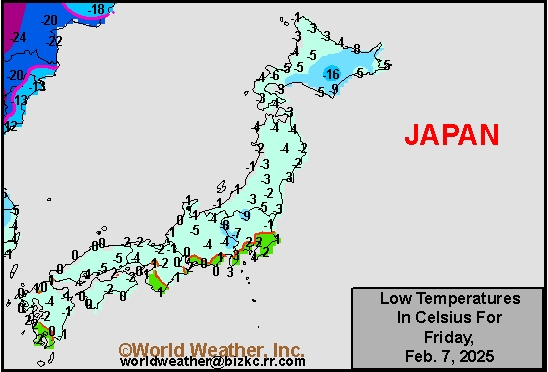
This content is for members only
High Temperature
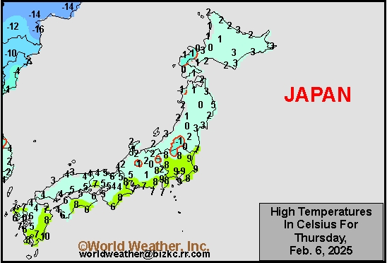
This content is for members only
High Temperature
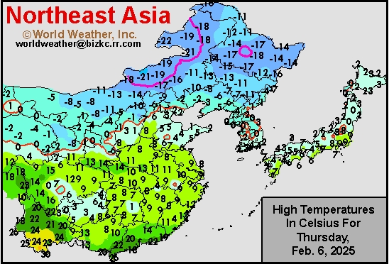
This content is for members only
China Rainfall
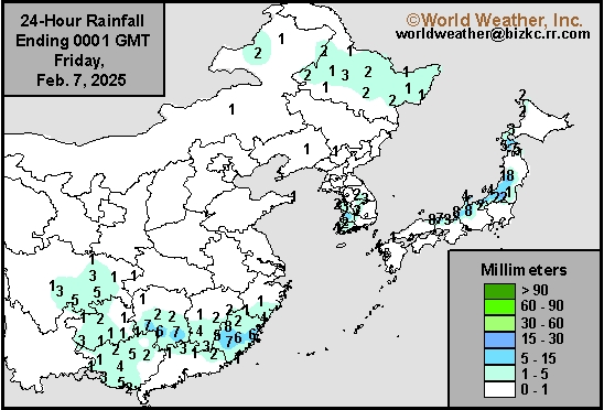
This content is for members only
Low Temperature
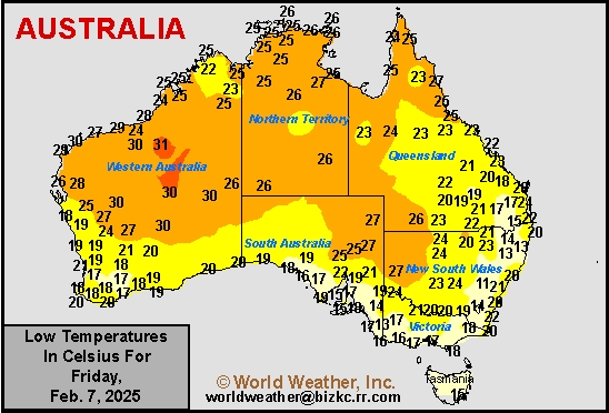
This content is for members only
High Temperature
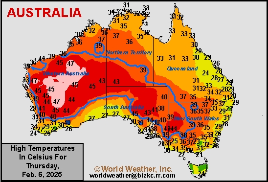
This content is for members only
Austrailia Rainfall
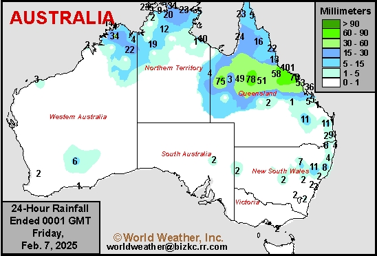
This content is for members only
Central U.S., Midwest Snow Next Week To Protect Wheat
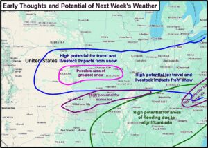
Kansas City, February 7 (World Weather Inc.) – A weather pattern setting up for next week will lead to multiple rounds of rain, snow, sleet and some freezing rain from the central Great Plains into the Midwest and in some more northern areas this weekend into early next week. The precipitation will begin in the eastern Midwest this weekend with some significant snowfall across the Great Lakes region and especially in the northeastern states. Follow up waves of snow and rain will begin in the central Plains Monday into Tuesday and shift east through the lower Midwest Tuesday and Wednesday with a second wave of snow, rain and freezing rain occurring in the same region Wednesday into Thursday. This latter storm system will also produce snow in the Great Lakes region and northeastern states. There is some potential for a third storm to impact parts of the same region in the following weekend. Travel delays and livestock stress are expected, although the snow will help protect winter wheat from threatening cold conditions
Soil Temperature

This content is for members only
Soil Temperature
This content is for members only
Soil Temperature
This content is for members only
Soil Temperature
This content is for members only
Soil Temperature

This content is for members only
Subsoil Moisture

This content is for members only
Topsoil Moisture

This content is for members only
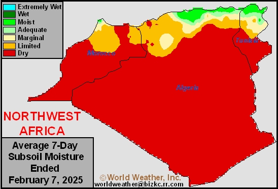
Subsoil Moisture
This content is for members only
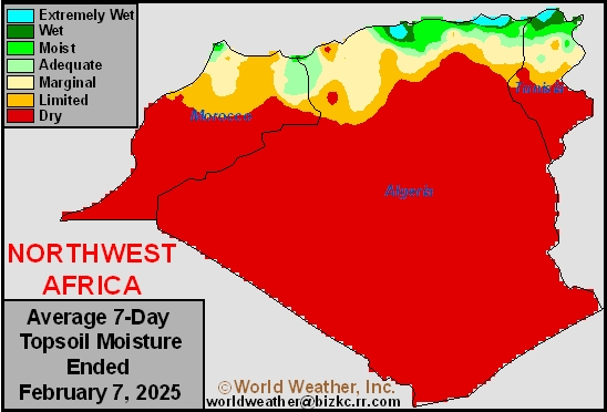
Topsoil Moisture
This content is for members only
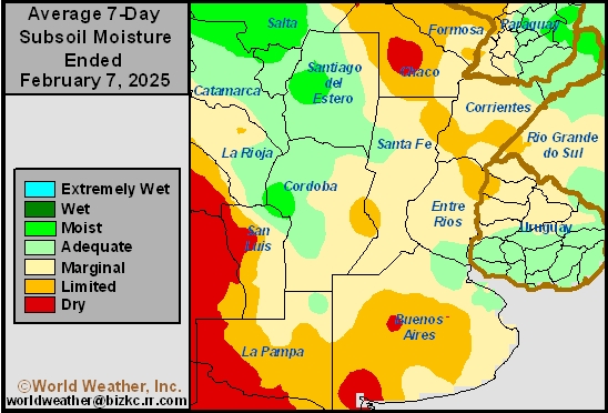
Subsoil Moisture
This content is for members only
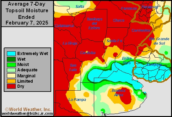
Topsoil Moisture
This content is for members only
Subsoil Moisture
This content is for members only
Topsoil Moisture
This content is for members only
Subsoil Moisture
This content is for members only
Topsoil Moisture
This content is for members only
Subsoil Moisture
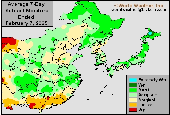
This content is for members only
Topsoil Moisture
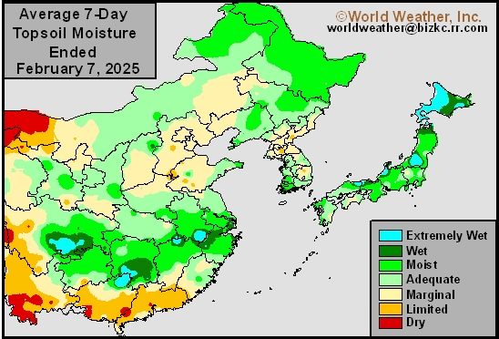
This content is for members only
Subsoil Moisture
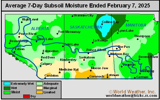
This content is for members only
Topsoil Moisture
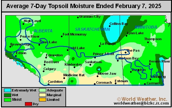
This content is for members only
Subsoil Moisture

This content is for members only
Topsoil Moisture

This content is for members only
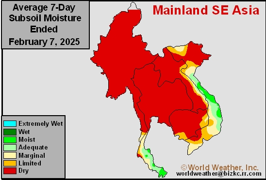
Subsoil Moisture
This content is for members only
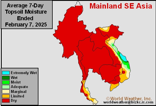
Topsoil Moisture
This content is for members only
Subsoil Moisture
This content is for members only
Topsoil Moisture
This content is for members only
Subsoil Moisture
This content is for members only
Topsoil Moisture
This content is for members only
Subsoil Moisture
This content is for members only
Topsoil Moisture
This content is for members only
Subsoil Moisture
This content is for members only
Topsoil Moisture
This content is for members only
Subsoil Moisture
This content is for members only
Topsoil Moisture
This content is for members only
Subsoil Moisture
This content is for members only
Topsoil Moisture
This content is for members only
Subsoil Moisture
This content is for members only
Topsoil Moisture
This content is for members only
Subsoil Moisture

This content is for members only
Topsoil Moisture

This content is for members only
Topsoil Moisture
This content is for members only
Subsoil Moisture
This content is for members only
Subsoil Moisture
This content is for members only
Topsoil Moisture
This content is for members only
Interior SE U.S. Rain Next Week To Bring Relief From Drying
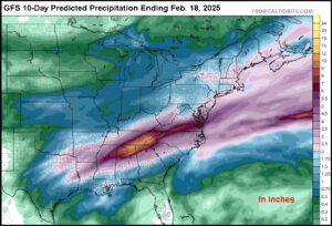
Kansas City, February 7 (World Weather Inc.) – Three and possibly a fourth wave of rain will move through the interior portions of the southeastern United States during the coming week to ten days. The precipitation will bring moderate to heavy rain over the same region repetitively resulting in the saturation of soil, significant runoff and possible flooding. The area to be impacted will be from southwestern Virgin through eastern Kentucky, far northern Georgia and northern Alabama to the northeastern corner of the Delta. Some of that region has been quite dry recently and (outside of the possible flooding) the event may prove to be beneficial for crops in the early spring.
2025 Weather Outlook Series: North America Spring
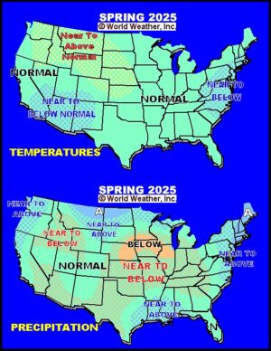
Kansas City, February 6 (World Weather Inc.) – As noted in part one of this 2025 Weather Outlook Series, there is good potential that weather coming into spring 2025 will be drier biased in a portion of the Great Plains, upper Midwest and southwestern desert region into northern Mexico. Canada’s Prairies will come into spring with some hope of improved weather after winter precipitation was favorable and some areas will have significant snow to melt as seasonal warming begins.
Arctic Air To Move Into U.S. Hard-Red Winter Wheat Region
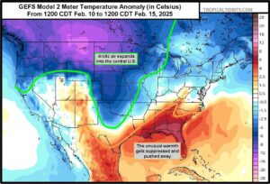
Kansas City, February 6 (World Weather Inc.) – A bitter cold airmass building up in Canada’s Prairies is getting ready to plunge southward and when it does there is likely to be some crop and livestock stress across much of the Great Plains and in a part of the western Midwest where temperatures will trend sharply colder once again after a period of milder weather this week. The change in air masses will also stimulate some significant snowfall, first in the northern Plains, Great Lakes region and northeastern United States Friday through the weekend and then farther to the south across the central Plains and lower Midwest next week. The snow will help protect winter crops, but livestock stress will be significant in some areas and travel delays should be expected as well.
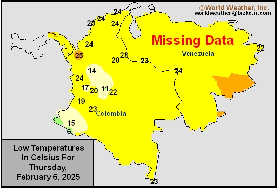
Venezuela/Colombia Min Temps
This content is for members only
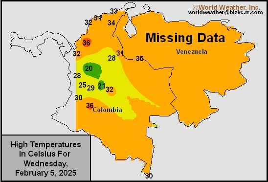
Venezuela/Colombia Max Temps
This content is for members only