
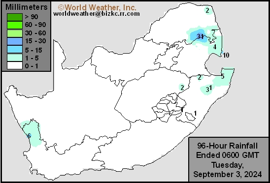
South Africa Rain
This content is for members only
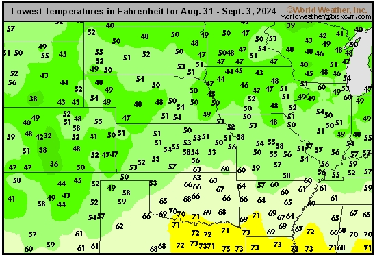
Hard Red Wheat Tmin
This content is for members only
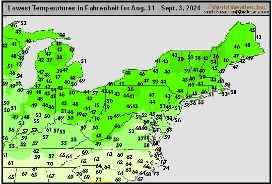
Northeast Tmin
This content is for members only
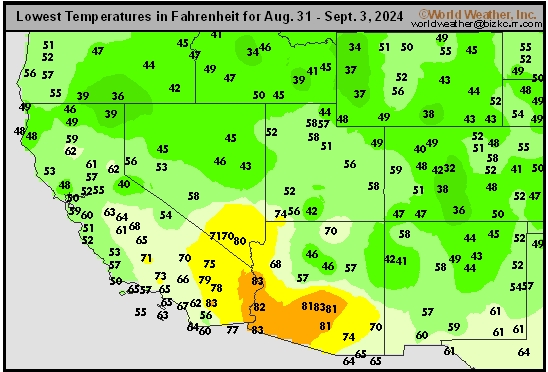
Southwest Tmin
This content is for members only
Northwest Tmin
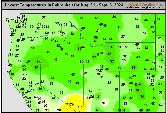
This content is for members only
South Plains Tmin
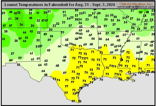
This content is for members only
Delta/SE U.S. Tmin
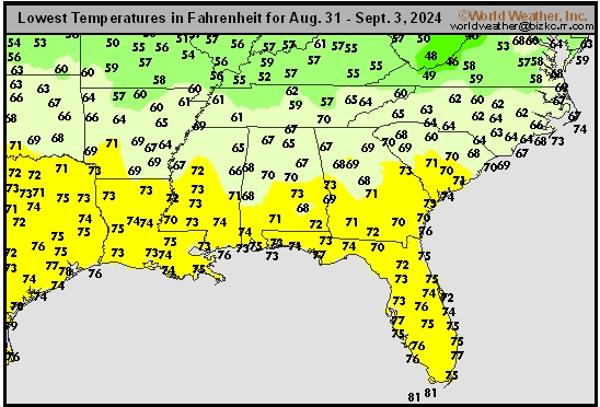
This content is for members only
Corn Belt Tmin
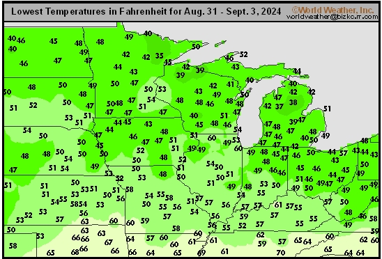
This content is for members only
US Min

This content is for members only
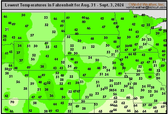
North Plains Tmin
This content is for members only
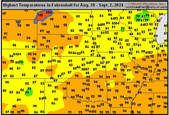
Hard Red Wheat Tmax
This content is for members only
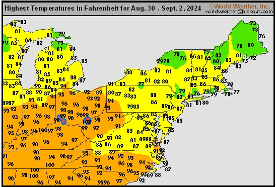
Northeast Tmax
This content is for members only
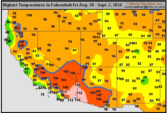
Southwest Tmax
This content is for members only
Northwest Tmax
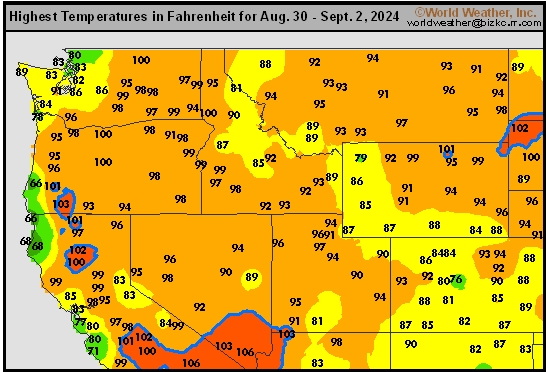
This content is for members only
South Plains Tmax
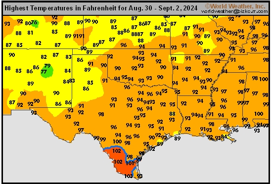
This content is for members only
Delta/SE U.S. Tmax
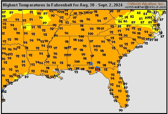
This content is for members only
Corn Belt Tmax
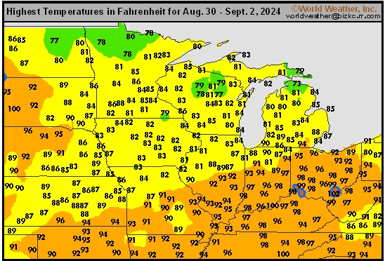
This content is for members only
North Plains Tmax
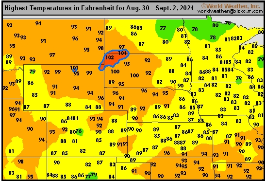
This content is for members only
US Max

This content is for members only
US Rain

This content is for members only
Northeast Daily Rain
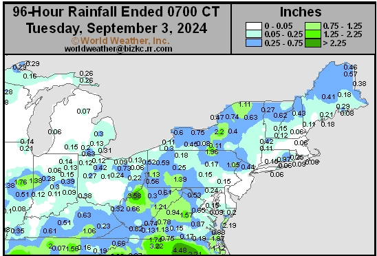
This content is for members only
Hard Red Wheat Daily Rain
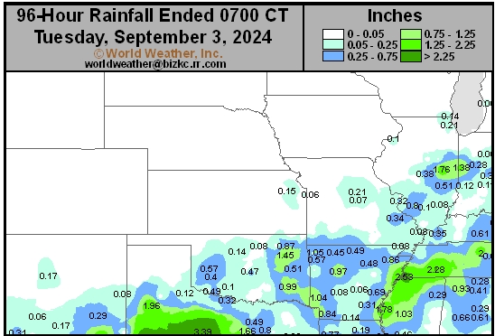
This content is for members only
Southwest Daily Rain
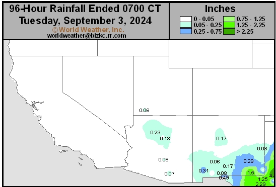
This content is for members only
Northwest Daily Rain
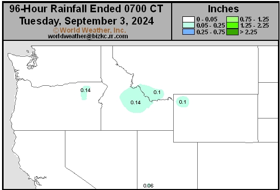
This content is for members only
South Plains Daily Rain
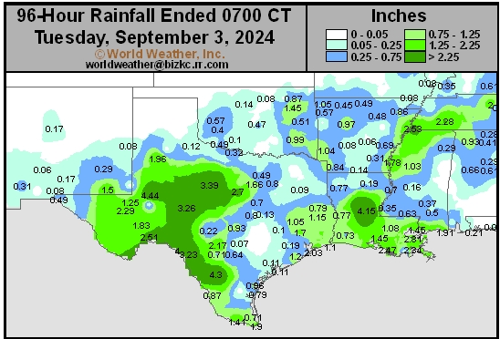
This content is for members only
Delta/SE U.S. Daily Rain
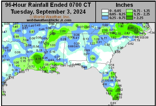
This content is for members only
Corn Belt Daily Rain
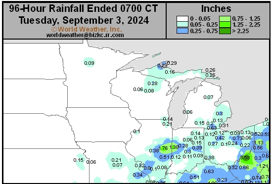
This content is for members only
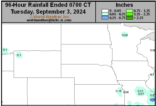
North Plains Daily Rain
This content is for members only
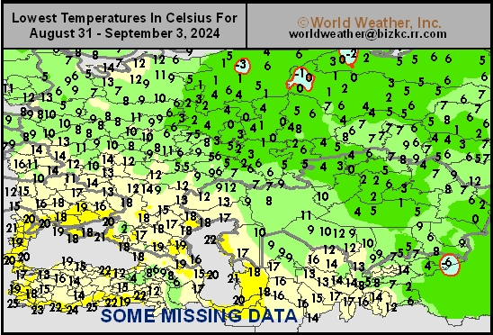
Low Temperature
This content is for members only
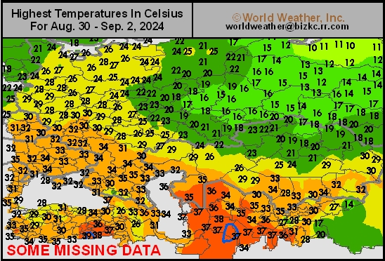
High Temperature
This content is for members only
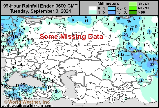
CIS Rainfall
This content is for members only
Low Temperature
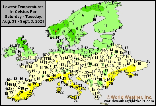
This content is for members only
High Temperature
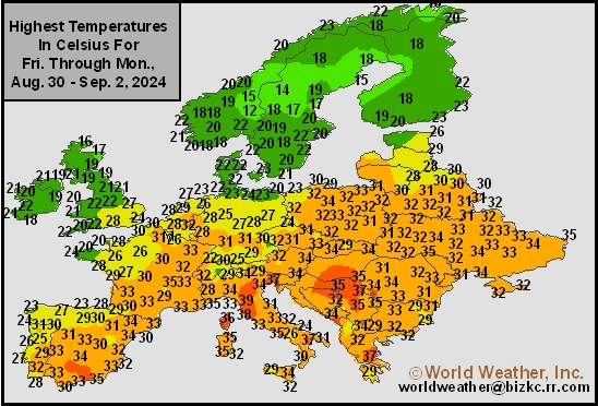
This content is for members only
Europe Rainfall
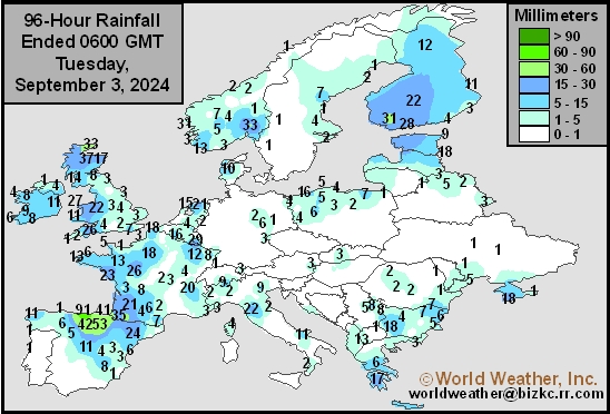
This content is for members only
Low Temperature
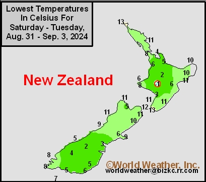
This content is for members only
High Temperature
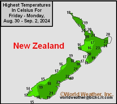
This content is for members only
New Zealand Rainfall
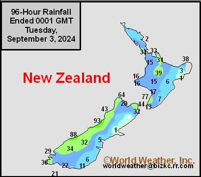
This content is for members only
Low Temperature
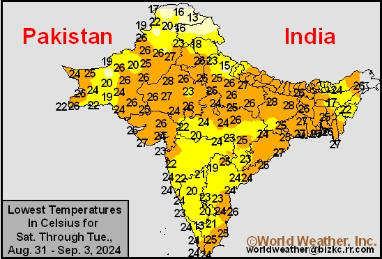
This content is for members only
High Temperature
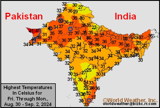
This content is for members only
India Rainfall
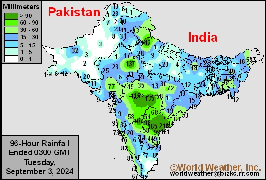
This content is for members only
Low Temperature
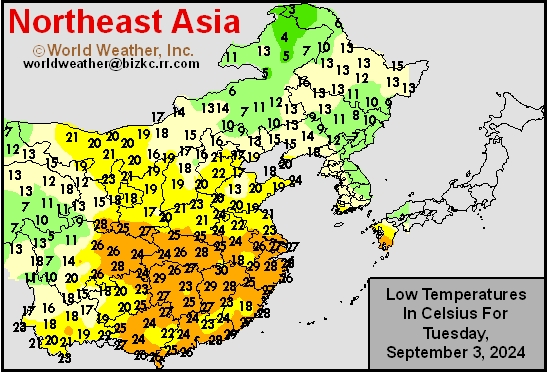
This content is for members only
Japan Rainfall
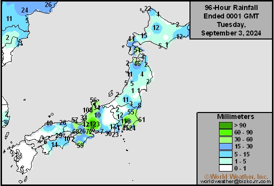
This content is for members only
Low Temperature
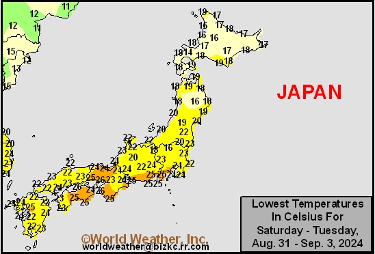
This content is for members only
High Temperature
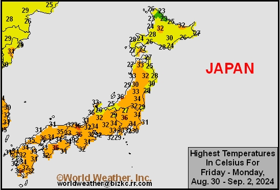
This content is for members only
High Temperature
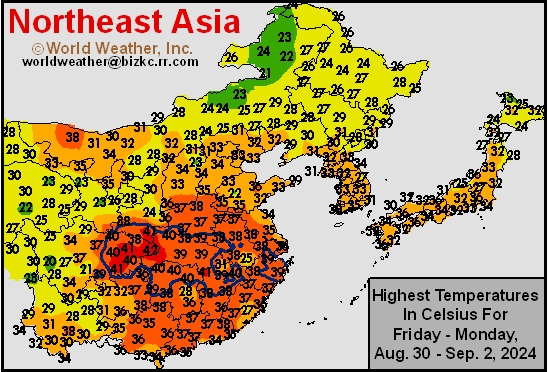
This content is for members only
China Rainfall
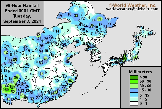
This content is for members only
Low Temperature
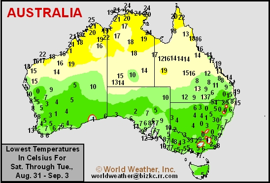
This content is for members only
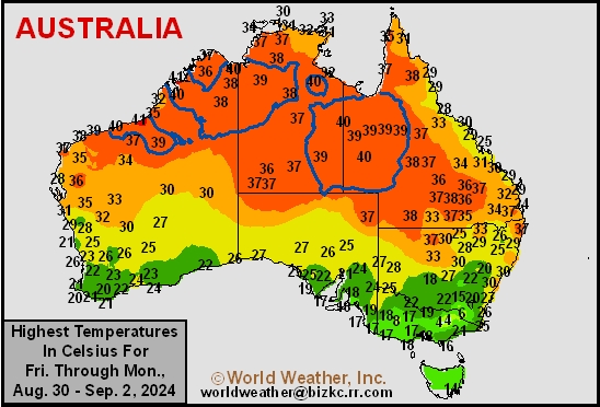
High Temperature
This content is for members only
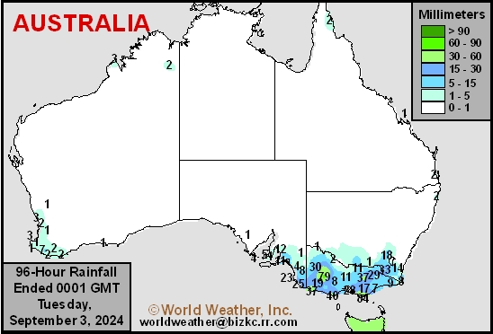
Austrailia Rainfall
This content is for members only
Brazil September Rain To Be Lighter Than Usual; October Better

Kansas City, September 3 (World Weather Inc.) – September weather in South America is not going to change as quickly as it normally does. As a result Brazil’s start to the rainy season will be a little delayed, but not like that of two years ago, and Argentina’s weather change toward a more active pattern will be held back to the second half of this month. The 90-day forecast period for September through November looks better because of improved October and November rainfall. Despite a slow start to season rainfall, the outlook in South America still looks good for 2024-25.
West Texas Rainfall Piles Up; Drier By Wednesday
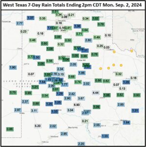
Kansas City, September 2 (World Weather Inc.) – Rain developed in West Texas as expected during the weekend. Some of the amounts were rather impressive, to say the least, with over 6.00 inches occurring at Fluvanna and 5.25 inches at Andrews through 1430 CDT today. Rainfall at Jayton reached 4.44 inches and there were a number of other areas from southern parts of West Texas into the Rolling Plains reporting 2.00 to more than 3.00 inches. To the northwest of this region, rainfall varied from 1.00 to 2.00 inches with a few areas getting 0.70 to 1.00 inch. Overall, it was the single greatest precipitation event seen in months. The moisture comes a little late in the summer to change production much, though.
Canada Prairies Agricultural Weather Prognosticator For September 1, 2024
Inside this edition of the Canada Prairies Weather Outlook there is an outlook for weather in the Prairies in September and October as well as comments about the potential for early season frost and freezes in the northern U.S. Midwest. A detailed assessment of weather in the Prairies over the past week and during the past month is also included in this issue along with soil moisture updates for various places around the world. There are special articles about Argentina, Australia, Europe and western Asia in this prognosticator as well.
Argentina Rain To Bring Restricted Relief To Some Dry Areas
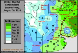
Kansas City, August 30 (World Weather Inc.) – A weather system moving through Argentina today has already been producing some welcome rain to parts of northeastern Buenos Aires, southern Santa Fe, Entre Rios and in a few eastern Cordoba locations. The precipitation will linger into Saturday and “some” relief from dryness is expected; however, a large part of western and northern Cordoba, northern and central Santa Fe and areas north to Formosa will likely continue to be drier than usual. The relief will benefit wheat and barley in the vegetative and tillering stages of development. More rain will be needed before aggressive spring growth begins later in September and October.
Canadian Prairies Harvest Will Advance With Few Disruptions
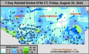
Kansas City, August 30 (World Weather Inc.) – Harvesting is underway for several locations in the Prairies despite some rain during the past week. Several crops in Alberta and Saskatchewan matured earlier than usual this season due to drier and warmer weather in recent weeks. Yields are highly variable across the Prairies with many areas in Alberta and Saskatchewan seeing lower than usual yields due to July and early August heat and dryness. Precipitation will be limited for the next week to ten days as high-pressure ridge often settles over western North America. The ridge will be strong enough to promote drier than normal weather, though a few frontal boundaries will generate mostly light rain. Maturation and harvesting will advance swiftly around the periods of spotty rain. Yield potentials will remain mostly unchanged.
Russia’s New Lands Frost May Impact Spring Wheat, Sunseed

Kansas City, August 30 (World Weather Inc.) – Wheat, sunseed, and other spring and summer crop prospects remain favorable for Russia’s eastern New Lands and Ural Mountains region into northern Kazakhstan, although these areas have been wetter than normal during the past month. There has been some concern over crop conditions because of the wet bias, but production potential has not likely declined by much. A series of frontal boundaries will bring colder air to these areas in the coming days, raising the threat for frost and some freezes. While frost is not uncommon this time of year, there is concern that crops are a little behind in their development due to the wet weather in recent weeks. Some damage to immature crops will be possible if frost and freezes are severe enough. Most likely the crop will not be seriously harmed, but the situation warrants a close watch.
Much Needed Rain for Texas and U.S. Delta to Occur
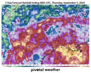
Kansas City, August 30 (World Weather Inc.) – The southern U.S. has struggled to receive adequate moisture in the past month as less than 25% of normal rain has occurred in much of Texas, Louisiana, and Mississippi. Temperatures have also been very warm to hot at times resulting in short to very short soil moisture and general crop and livestock stress. In the next 7-days however, between 1.00 and 2.60 inches of total rain is expected from a few waves of showers and thunderstorms. Locally heavier totals in excess of 3.00 inches are likely in some areas. These amounts will benefit sorghum that is continuing to develop in much of the region and late double cropped soybeans in the Delta, but less beneficial to corn as the crop is largely mature. Some quality reduction or damage to cotton is possible in portions of Louisiana and Mississippi where bolls continue to open.
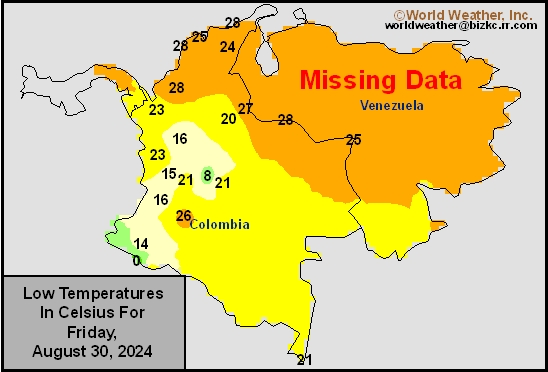
Venezuela/Colombia Min Temps
This content is for members only
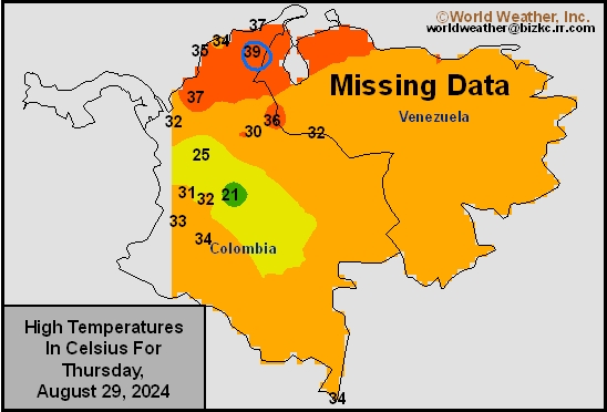
Venezuela/Colombia Max Temps
This content is for members only
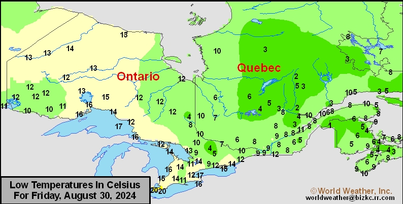
SE Canada Min
This content is for members only
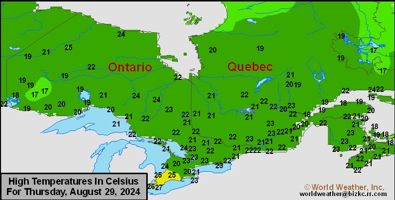
SE Canada Max
This content is for members only
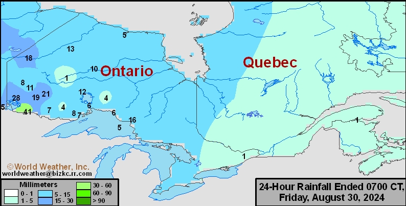
SE Canada Rainfall
This content is for members only
Prairies Rainfall

This content is for members only
Prairies Max Temperature

This content is for members only
Prairies Min Temperature

This content is for members only
Canada Rainfall

This content is for members only
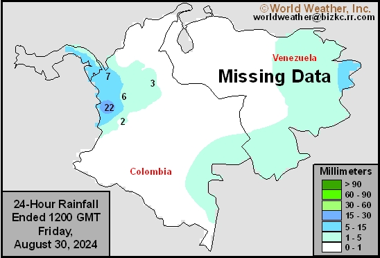
Venezuela Rainfall
This content is for members only
Mexico Min Temperature
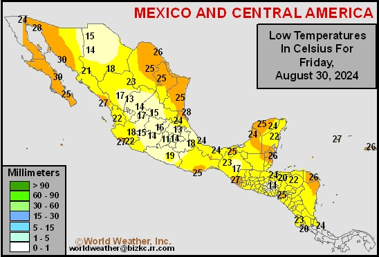
This content is for members only
Mexico Max Temperature
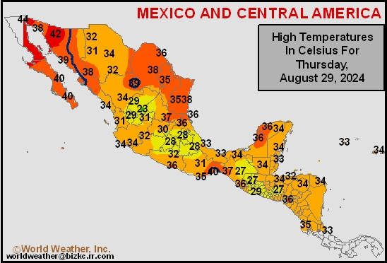
This content is for members only
Mexico Rainfall
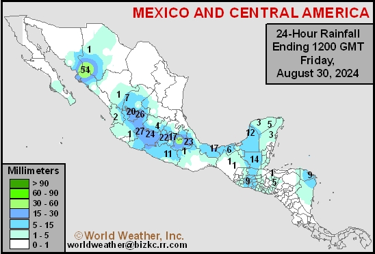
This content is for members only
Argentina Min Temperature
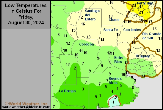
This content is for members only
Argentina Max Temperature
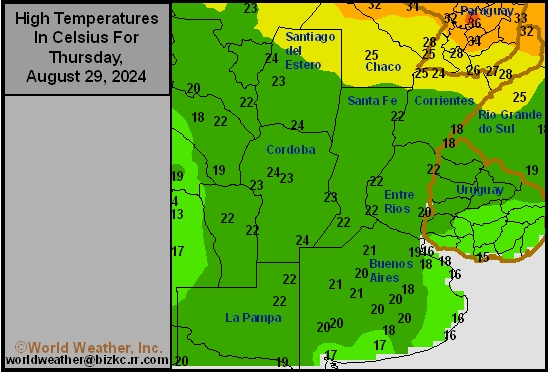
This content is for members only
Argentina Rainfall
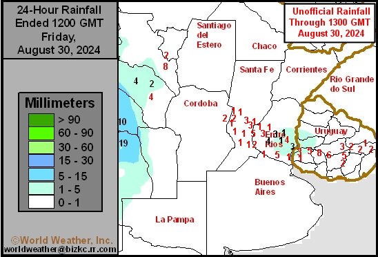
This content is for members only
Brazil Min Temperature
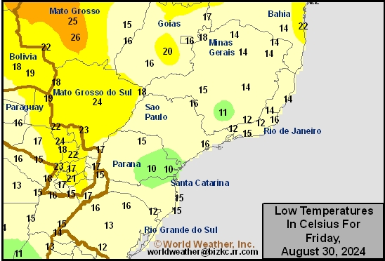
This content is for members only
Brazil Max Temperature
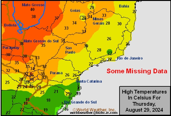
This content is for members only
Brazil Rainfall
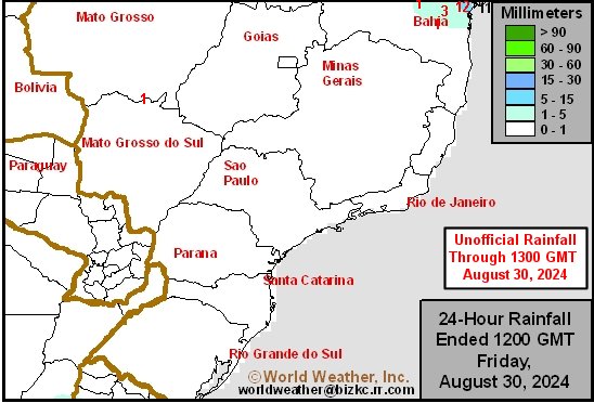
This content is for members only
Philippines Min
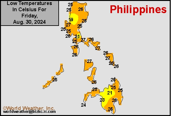
This content is for members only
Philippines Max
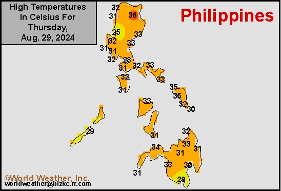
This content is for members only
Philippines Rain
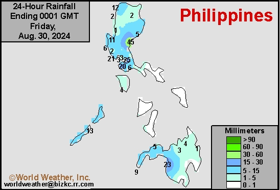
This content is for members only
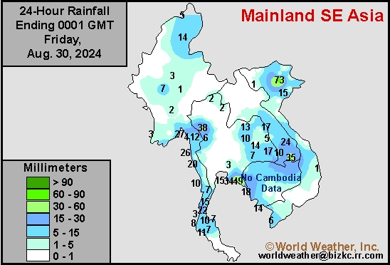
Southeast North Rain
This content is for members only
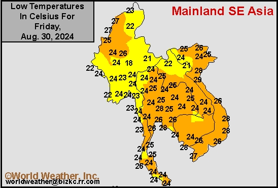
Southeast North Min
This content is for members only
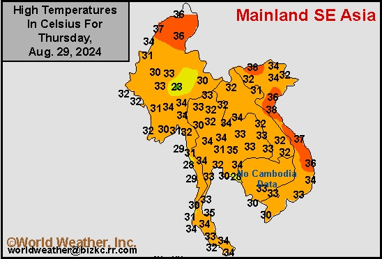
Southeast North Max
This content is for members only
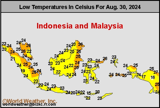
Southeast Min
This content is for members only
Southeast Max
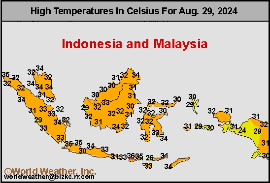
This content is for members only
Southeast Rain
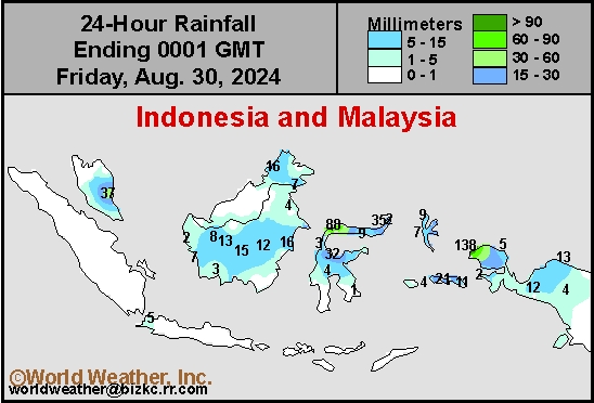
This content is for members only
West Africa Rain
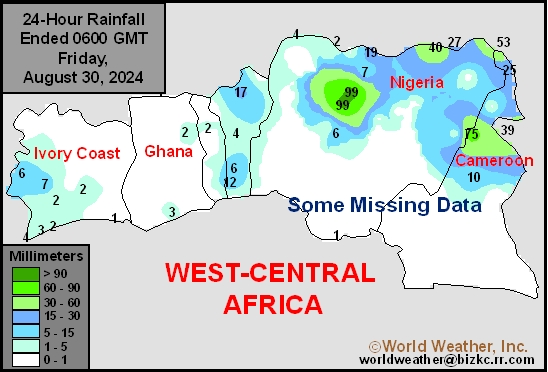
This content is for members only
Max Temperature
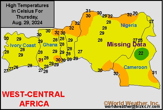
This content is for members only
Min Temperature
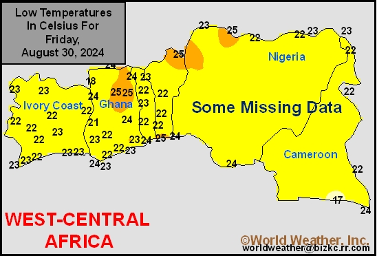
This content is for members only
North Africa Rain
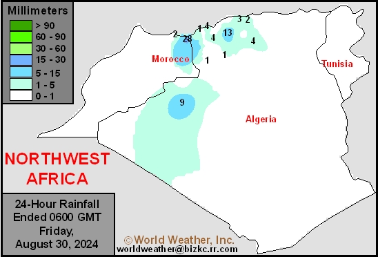
This content is for members only
Max Temperature
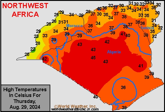
This content is for members only
Min Temperature
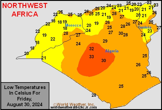
This content is for members only
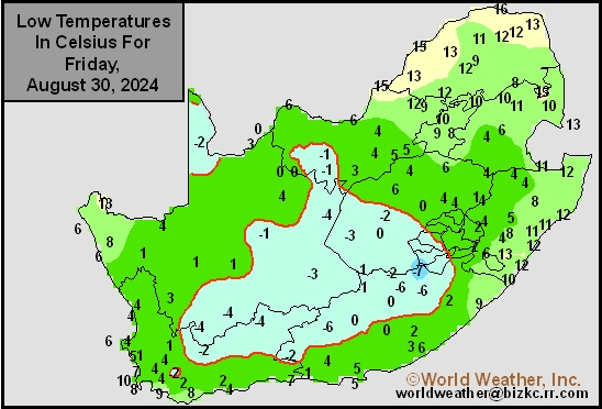
Min Temperature
This content is for members only
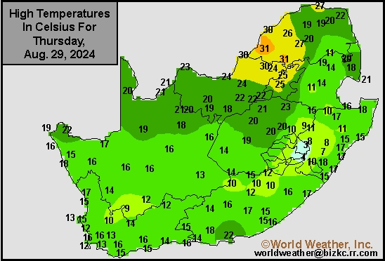
Max Temperature
This content is for members only
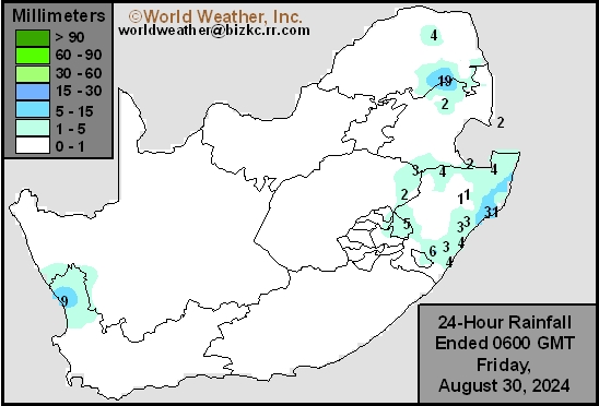
South Africa Rain
This content is for members only
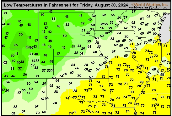
Hard Red Wheat Tmin
This content is for members only
Northeast Tmin
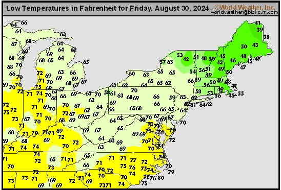
This content is for members only
Southwest Tmin
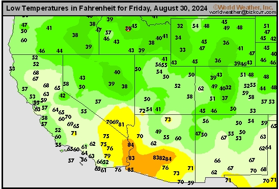
This content is for members only
Northwest Tmin
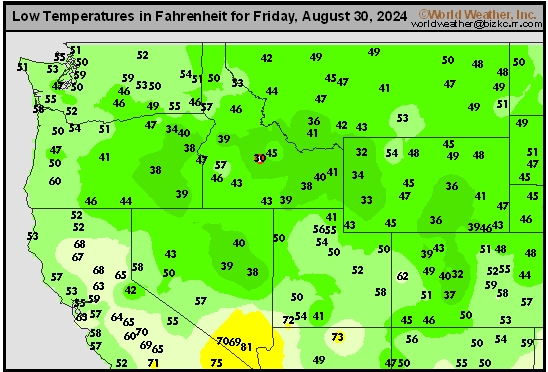
This content is for members only
South Plains Tmin
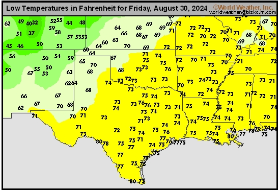
This content is for members only
Delta/SE U.S. Tmin
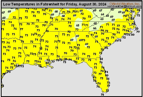
This content is for members only
Corn Belt Tmin
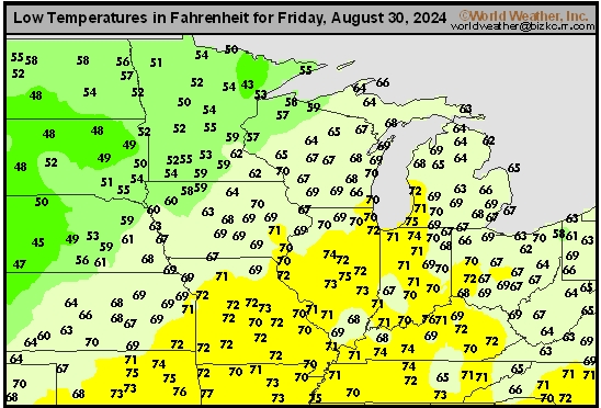
This content is for members only