
Subsoil Moisture

This content is for members only
Topsoil Moisture

This content is for members only
Topsoil Moisture
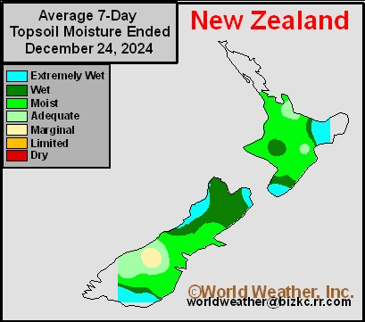
This content is for members only
Subsoil Moisture
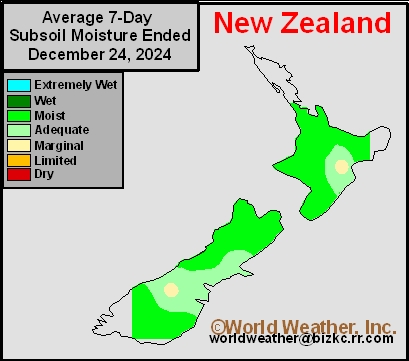
This content is for members only
Subsoil Moisture
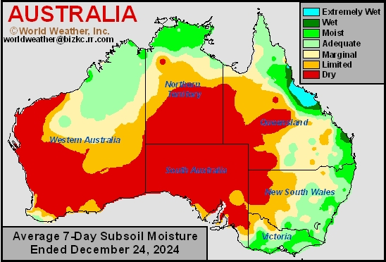
This content is for members only
Topsoil Moisture
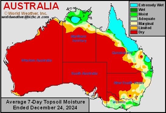
This content is for members only
Center-West, Center-South Brazil Flood Potentials To Increase
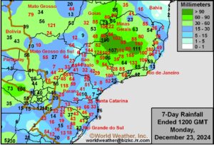
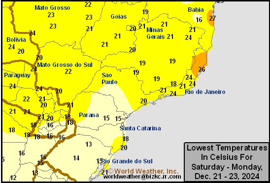
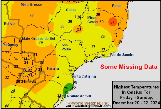
Kansas City, December 23 (World Weather Inc.) – Waves of rain are slated for much of center-west, center-south, and northeastern Brazil in the coming weeks as a La Nina-like weather pattern evolves for the country. These areas are already saturated and will receive several more inches of rain this week. The threat for flooding will increase and may damage some crops. Wet weather diseases will be a growing concern, as will the need for replanting if severe flooding occurs. Overall, production potentials will remain relatively favorable, though the need for drier weather will increase toward mid-January. Southern Brazil will otherwise trend drier than normal this week. The region will have ample moisture to maintain aggressive growth despite the lack of rain.
Argentina To Slowly Dry Down; Rain Will Be Needed In January
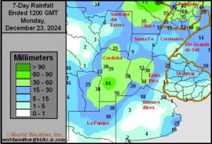
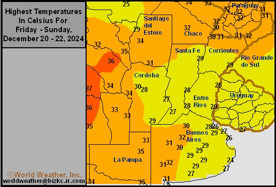
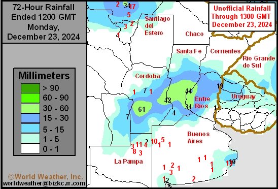
Kansas City, December 23 (World Weather Inc.) – Northern and central Argentina received much-needed rain during the past week while several areas in southern Argentina were dry. Short-term establishment and development conditions remain favorable across the country as planting enters the final stretch. With La Nina still looming, the weather pattern for Argentina will have a La Nina-like feel for the next week to ten days. Drier-than-normal weather is slated for much of crop country with temperatures gradually warming above normal. Although the environment will not immediately turn harsh for the country, continued dryness toward mid-January could start to impact development rates, especially if temperatures become well above normal.
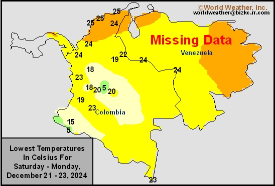
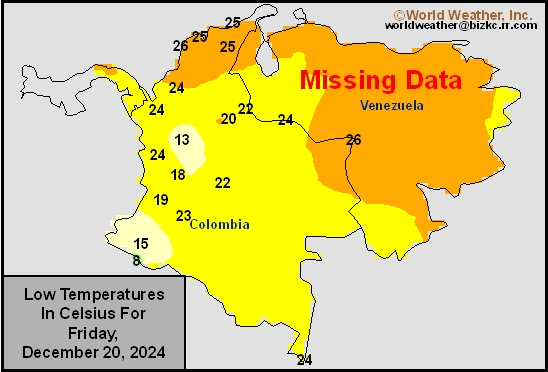
Venezuela/Colombia Min Temps
This content is for members only
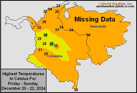
Venezuela/Colombia Max Temps
This content is for members only
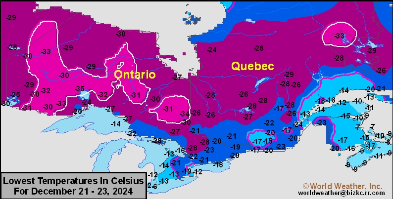
SE Canada Min
This content is for members only
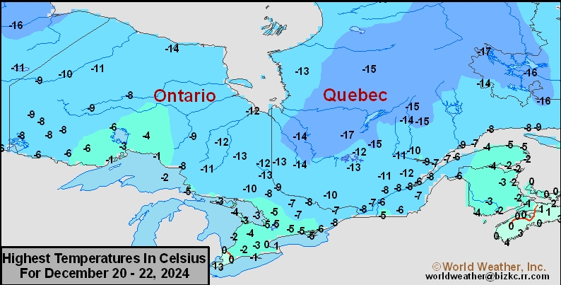
SE Canada Max
This content is for members only
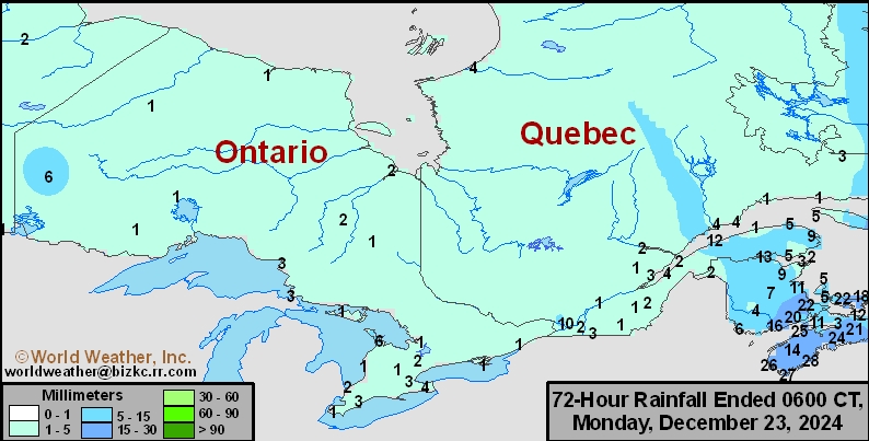
SE Canada Rainfall
This content is for members only
Prairies Rainfall

This content is for members only
Prairies Max Temperature

This content is for members only
Prairies Min Temperature

This content is for members only
Canada Rainfall

This content is for members only
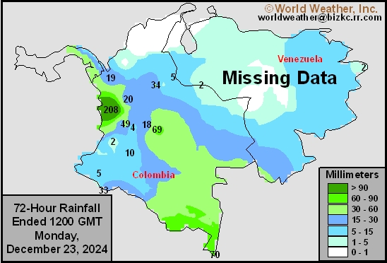
Venezuela Rainfall
This content is for members only
Mexico Min Temperature
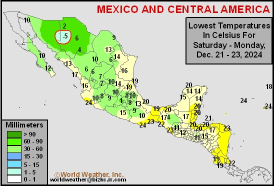
This content is for members only
Mexico Max Temperature
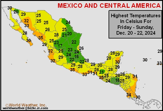
This content is for members only
Mexico Rainfall
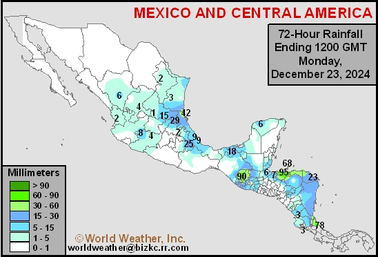
This content is for members only
Argentina Min Temperature
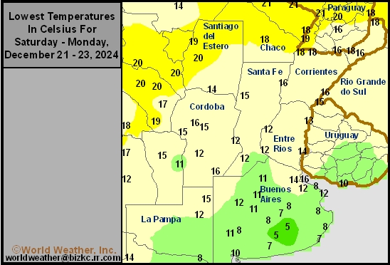
This content is for members only
Argentina Max Temperature
This content is for members only
Argentina Rainfall
This content is for members only
Brazil Min Temperature
This content is for members only
Brazil Max Temperature
This content is for members only
Brazil Rainfall
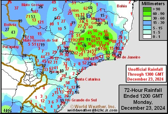
This content is for members only
Philippines Min
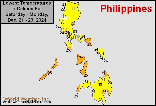
This content is for members only
Philippines Max
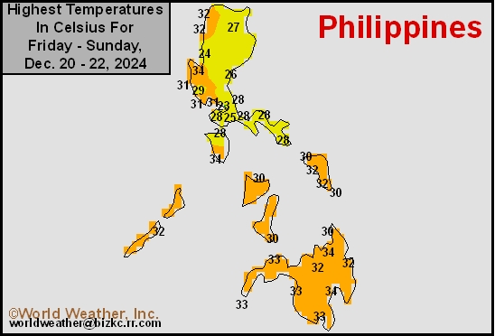
This content is for members only
Philippines Rain
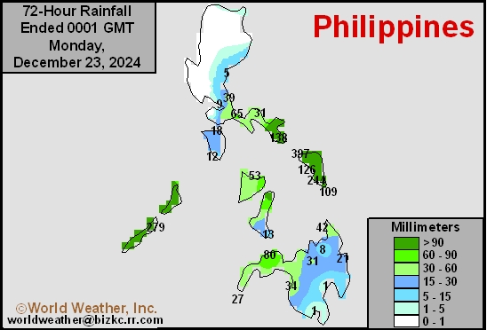
This content is for members only
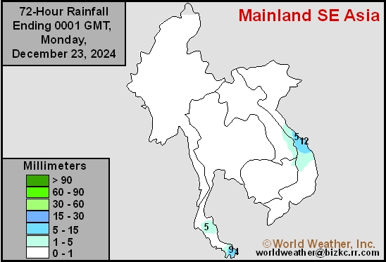
Southeast North Rain
This content is for members only
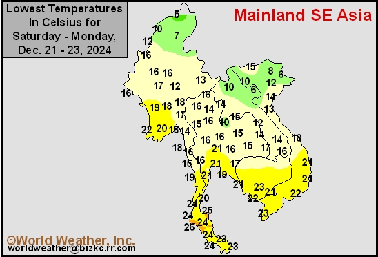
Southeast North Min
This content is for members only
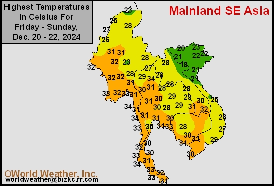
Southeast North Max
This content is for members only
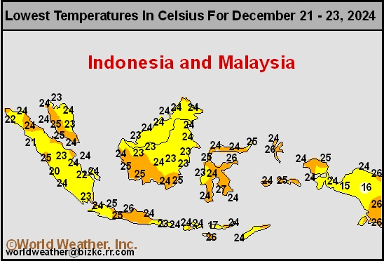
Southeast Min
This content is for members only
Southeast Max
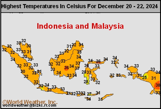
This content is for members only
Southeast Rain
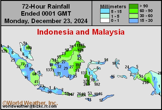
This content is for members only
West Africa Rain
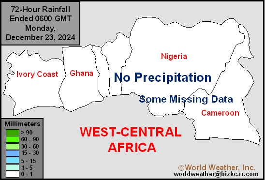
This content is for members only
Max Temperature
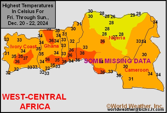
This content is for members only
Min Temperature
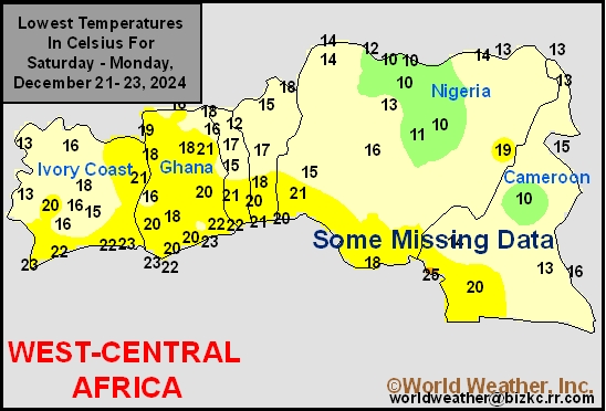
This content is for members only
North Africa Rain
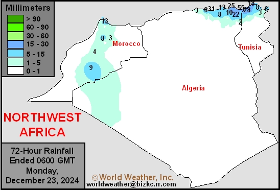
This content is for members only
Max Temperature
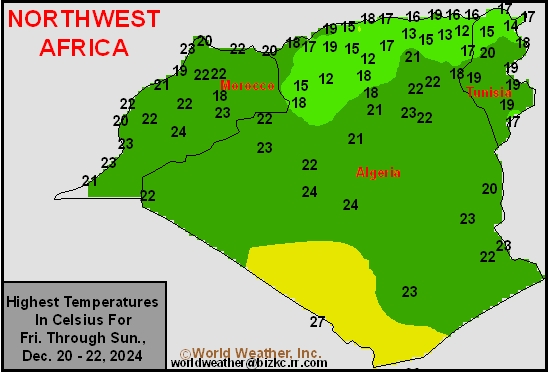
This content is for members only
Min Temperature
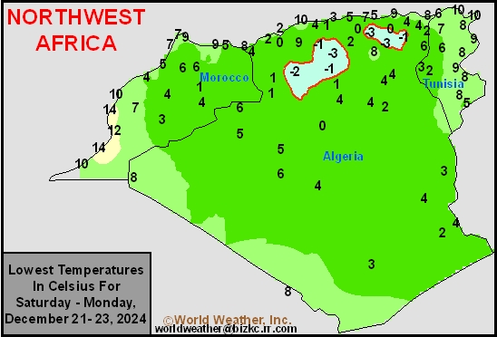
This content is for members only
Min Temperature
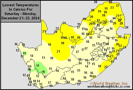
This content is for members only
Max Temperature
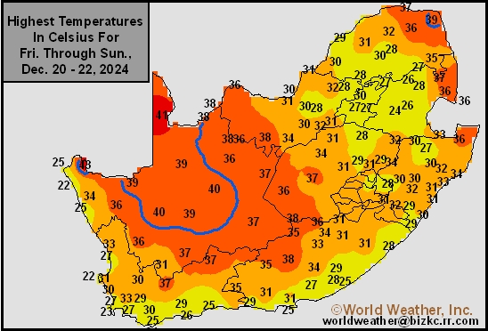
This content is for members only
South Africa Rain
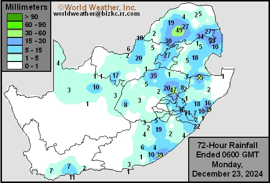
This content is for members only
Hard Red Wheat Tmin
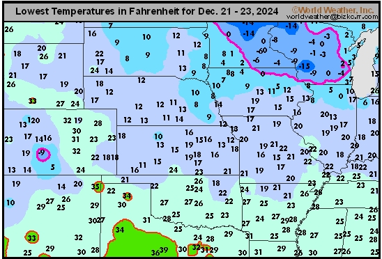
This content is for members only
Northeast Tmin
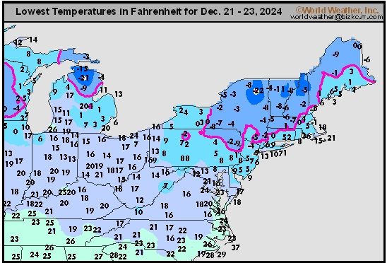
This content is for members only
Southwest Tmin
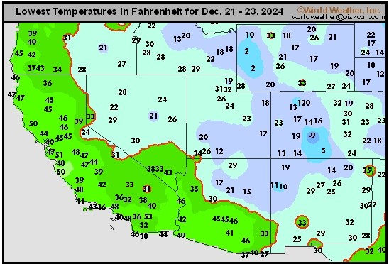
This content is for members only
Northwest Tmin
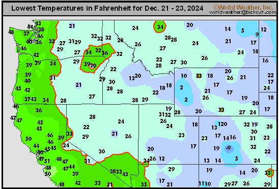
This content is for members only
South Plains Tmin
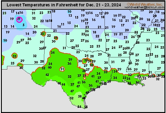
This content is for members only
Delta/SE U.S. Tmin
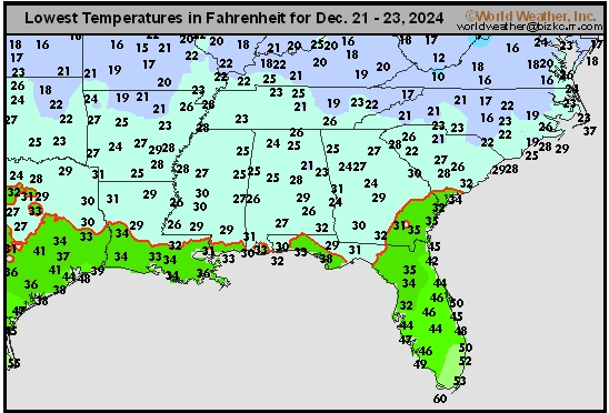
This content is for members only
Corn Belt Tmin
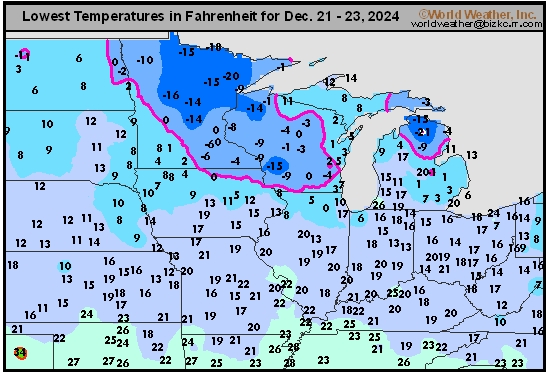
This content is for members only
US Min

This content is for members only
North Plains Tmin
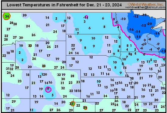
This content is for members only
Hard Red Wheat Tmax
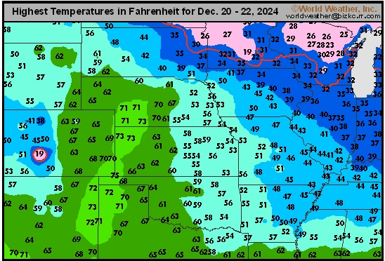
This content is for members only
Northeast Tmax
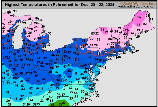
This content is for members only
Southwest Tmax
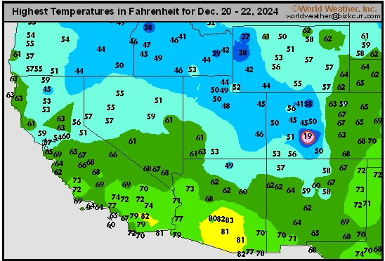
This content is for members only
Northwest Tmax
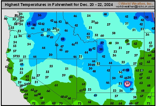
This content is for members only
South Plains Tmax
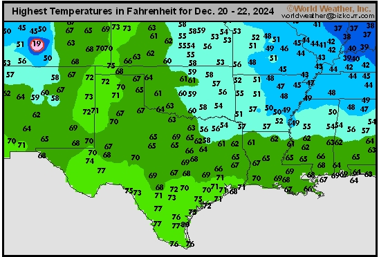
This content is for members only
Delta/SE U.S. Tmax
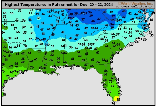
This content is for members only
Corn Belt Tmax
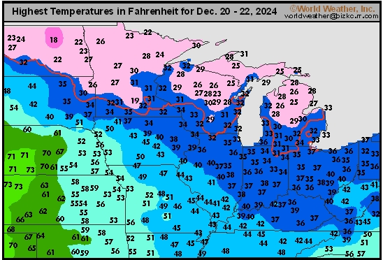
This content is for members only
North Plains Tmax
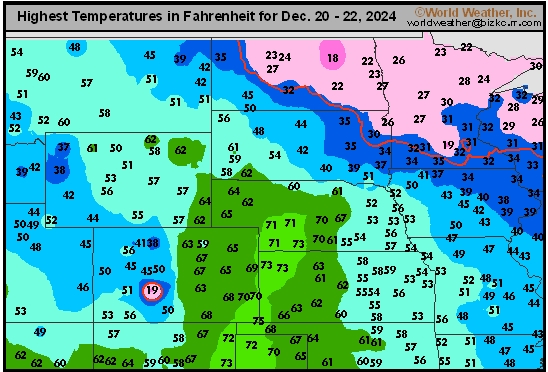
This content is for members only
US Max

This content is for members only
US Rain

This content is for members only
Northeast Daily Rain
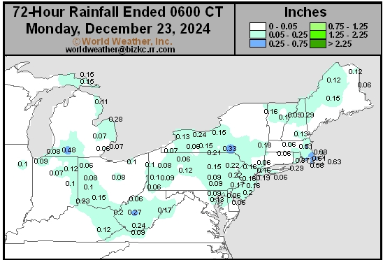
This content is for members only
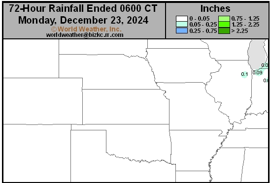
Hard Red Wheat Daily Rain
This content is for members only
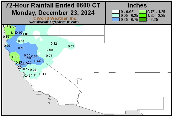
Southwest Daily Rain
This content is for members only
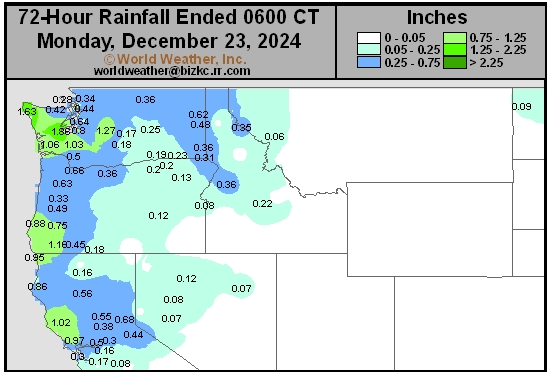
Northwest Daily Rain
This content is for members only
South Plains Daily Rain
This content is for members only
Delta/SE U.S. Daily Rain
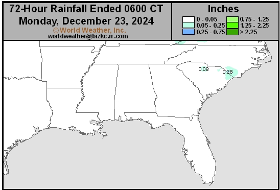
This content is for members only
Corn Belt Daily Rain
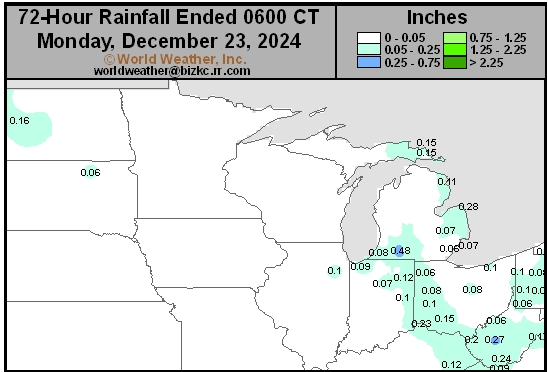
This content is for members only
North Plains Daily Rain
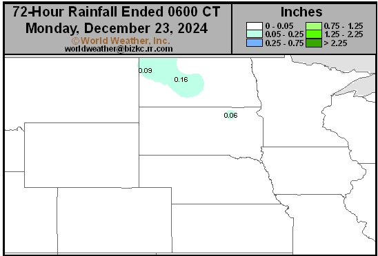
This content is for members only
Low Temperature
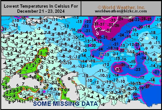
This content is for members only
High Temperature
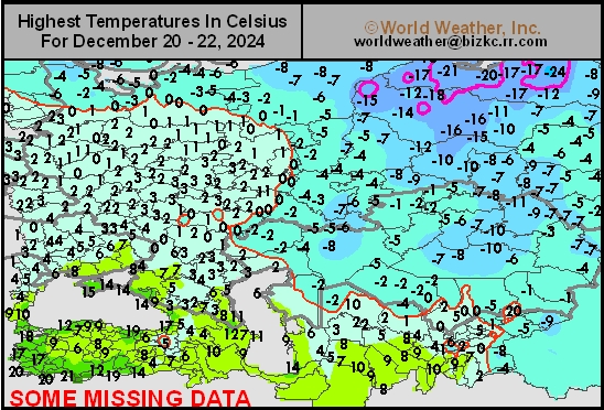
This content is for members only
CIS Rainfall
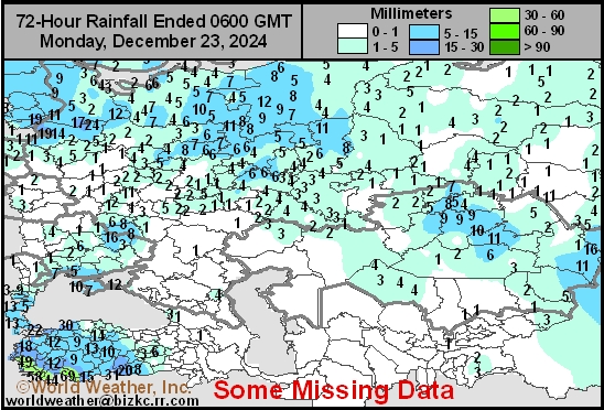
This content is for members only
Low Temperature
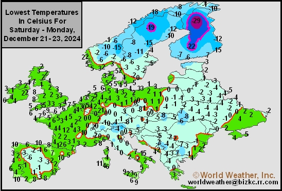
This content is for members only
High Temperature
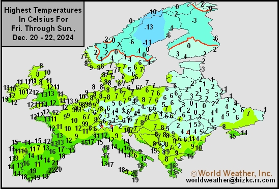
This content is for members only
Europe Rainfall
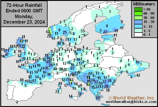
This content is for members only
Low Temperature
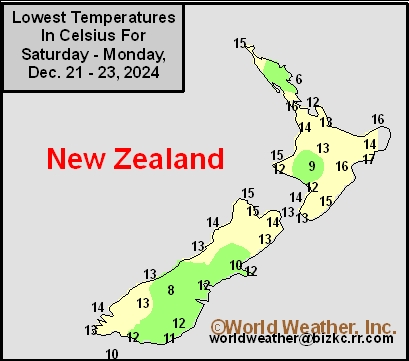
This content is for members only
High Temperature
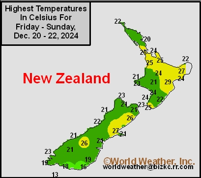
This content is for members only
New Zealand Rainfall
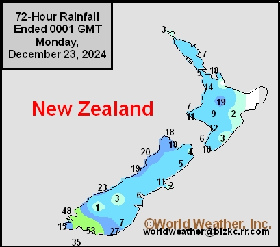
This content is for members only
Low Temperature
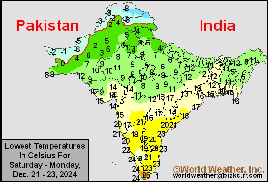
This content is for members only
High Temperature
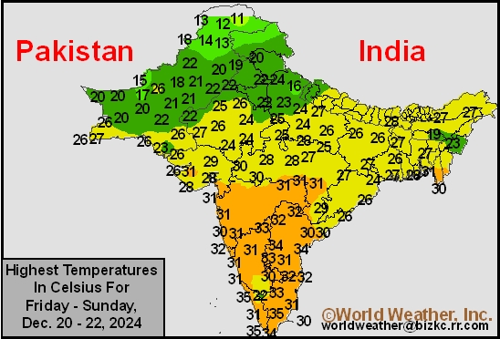
This content is for members only
India Rainfall
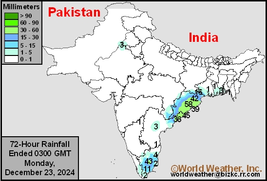
This content is for members only
Low Temperature
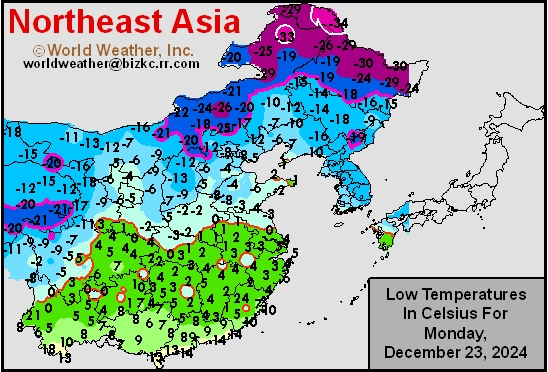
This content is for members only
Japan Rainfall
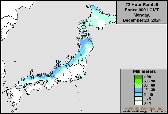
This content is for members only
Low Temperature
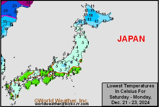
This content is for members only
High Temperature
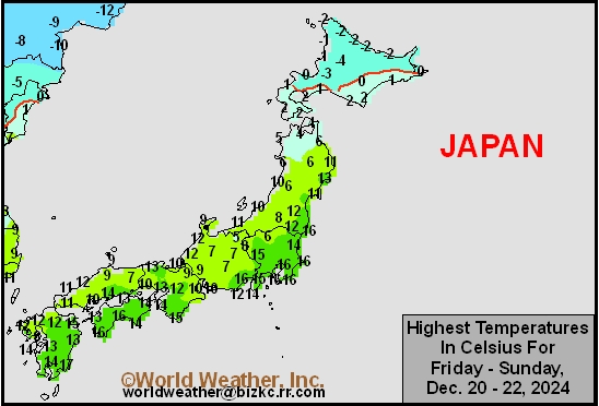
This content is for members only
High Temperature
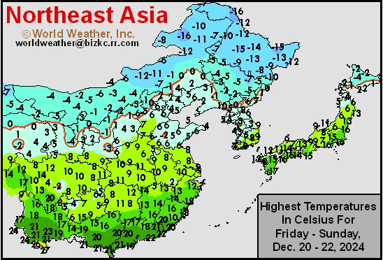
This content is for members only
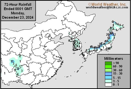
China Rainfall
This content is for members only
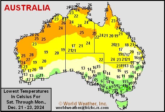
Low Temperature
This content is for members only
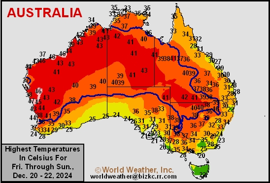
High Temperature
This content is for members only
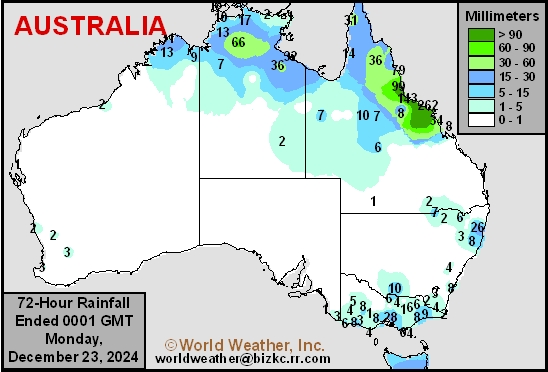
Austrailia Rainfall
This content is for members only
Soil Temperature

This content is for members only
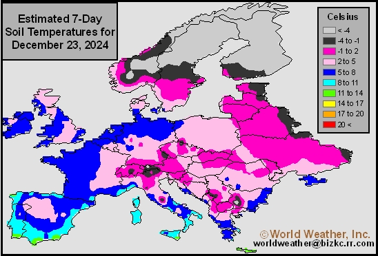
Soil Temperature
This content is for members only
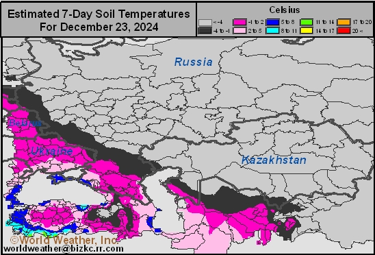
Soil Temperature
This content is for members only
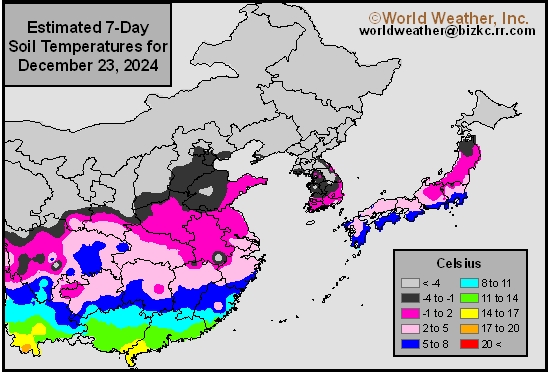
Soil Temperature
This content is for members only
Soil Temperature

This content is for members only
U.S. Pacific Northwest Mountain Snowpack To Increase
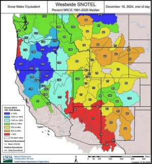
Kansas City, December 20 (World Weather Inc.) – The Cascade Mountains and a large section of the Rocky Mountains in the United States were generally drier than normal in the past few weeks. Mountain snowpack is still near or above normal in much of the Pacific Northwest despite the drier biased environment. Snow-water equivalents in the Rocky Mountains are otherwise near to below normal for this time of year. There is still plenty of time to improve mountain snowpack that will fill reservoirs next spring. A wet weather pattern is slated for the Pacific Northwest through the end of next week. Mountain snowpack will continue to increase in the Cascade Mountains and northern fringes of the Rockies. Other locations in the Rockies will remain drier biased through the end of next week. However, precipitation potentials could increase during the second week of the outlook that could promote significant snowfall in portions of the Rockies.
Venezuela/Colombia Min Temps
This content is for members only